Fish
Fish Fire
Fire Hike
Hike Bird
Bird

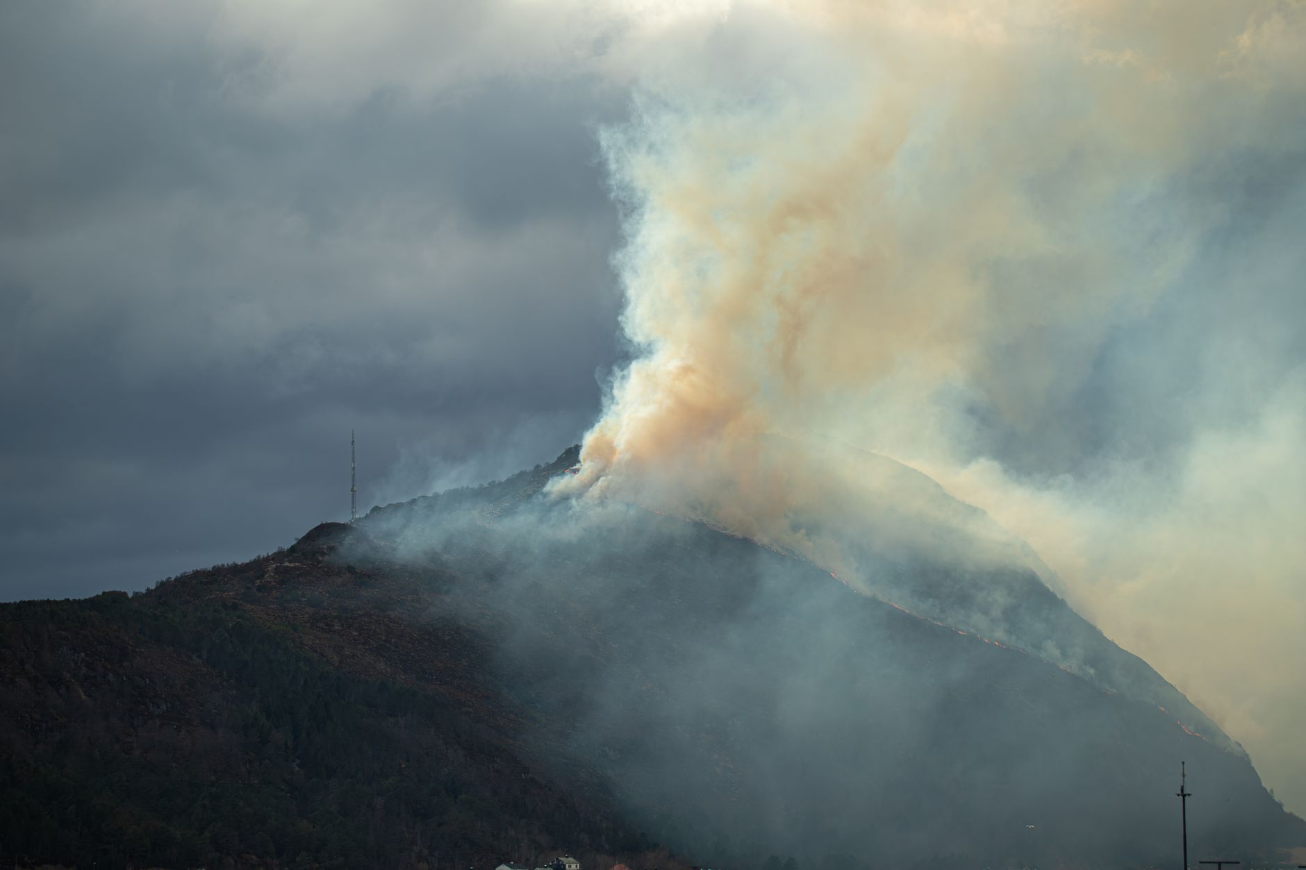

For a large part of the American West, smoke is now a hiking season rather than an event. August and September in Montana, Idaho, Oregon, Washington and California regularly bring stretches where the question is not what the weather is doing but what the air is.
And most hikers make that call badly, because they judge smoke by how it looks and smells rather than by what it is doing to them.
The one fact that changes everything
At rest, an adult moves roughly 6 liters of air per minute at about 12 to 15 breaths a minute. Under hard exercise that rises to somewhere between 60 and 100 liters per minute at 40 to 60 breaths. That is well over a tenfold increase in the volume of air, and therefore of particulate, passing through your lungs. You also shift toward mouth breathing, which bypasses the nose's filtering, and you draw air deeper into the lungs while doing it.
So an AQI that is a minor irritation to someone walking to their car is a materially different exposure to someone climbing 3,000 feet. Published air quality guidance is largely written for the general population going about a normal day, and hikers should read it as though it were one category worse.
What is in the smoke, and what the number measures
The figure that matters is PM2.5, meaning particulate matter under 2.5 micrometers across, and size is the whole problem. Particles under 10 micrometers get deep into the lungs, those under 2.5 penetrate to the alveoli and can cross into the bloodstream, and wildfire smoke is dominated by exactly this fraction. Short-term exposure is associated with airway inflammation, worsened asthma and COPD, higher rates of pneumonia and increased respiratory infections.
The AQI itself is worth understanding, because the scale is less intuitive than it looks. It is a converted index rather than a concentration, taking the measured concentration of a pollutant and mapping it onto a 0-500 scale designed so that 100 corresponds to the national ambient air quality standard for that pollutant. During smoke events the driving pollutant is almost always PM2.5, so in practice the AQI you see is a PM2.5 index.
Two consequences follow. The scale is not linear in the way you would assume, and the jump from 150 to 200 represents a much larger change in actual particulate concentration than the jump from 50 to 100, so bad air gets worse faster than the number suggests. And different countries and agencies convert differently, so a Canadian reading and a US reading of the same air will not produce the same number, while low-cost sensor networks apply their own corrections on top. If two sources disagree, that is usually why rather than one of them being broken. What matters for a hiker is the trend and the rough band rather than the second digit, so treat 148 and 155 as the same information.
Smoky Outside? Health Tips for Dealing with Wildfire SmokeThresholds worth using
Guidance varies, and anyone giving you a single hard number is oversimplifying. The consensus lands roughly here, adjusted for the exercise multiplier.
-
AQI 0 to 50, green. Normal, and you can hike whatever you like.
-
AQI 51 to 100, yellow. Fine for most people, though sensitive individuals may notice it on hard efforts.
-
AQI 101 to 150, orange. This is where it starts mattering for hikers, so reduce duration or intensity or both. A gentle valley walk is reasonable and a 4,000-foot climb is not the day for it. Sensitive groups should be off hard efforts entirely.
-
AQI 151 to 200, red. Most experts put the cutoff for vigorous outdoor exercise here. Do not do a hard hike, keep any outing short and low-effort, and honestly this is a good day to do something indoors.
-
AQI 201 and above, purple and beyond. Nobody should be exercising outside, healthy or not, and this is not a judgement call.
The practical shorthand is ideal below 50, easier trails above 100, treat 150 as the wall for anything strenuous, and cancel above 200.
Why the number where you live is not the number where you hike
This is where people go wrong most often. Smoke is spatially patchy, because plumes move with wind and terrain and conditions 30 miles away can be entirely different, so a monitor in town tells you about the town and nothing more.
Valleys trap smoke, since overnight inversions pool cold smoky air in valley bottoms and hold it there until the day heats up. In places like Missoula this is routine, and it produces the counterintuitive result that climbing can take you into cleaner air, with ridges above an inversion sometimes dramatically better than the trailhead. It works the other way too, and a pass can funnel a plume the valley never sees. All of it changes through the day as inversions break, winds shift and fire behavior responds to afternoon heating, which means a morning reading is not a forecast. Underneath that, official monitors are sparse, since large parts of the rural West have no regulatory monitor for a long way in any direction and interpolated maps are guesses in those gaps.
This is precisely the gap Guidepole Hike is built to close. It carries air quality against the trail itself rather than the nearest town, so you are checking the place you are going.
How to Find a Smoke Outlook and Protect Yourself from Smoke ImpactsReading the situation without a monitor
When you have no data you are not helpless. Visibility is a rough proxy, so if distant ridges that should be visible are washed out or gone entirely, the particulate load is significant, and very roughly, visibility under about five miles suggests unhealthy air. Color matters too, because thick smoke turns the sun orange or red and flattens the light, which is a lot of particulate doing that.
Smell is the unreliable one. You acclimatize to it within an hour or two, and smoke you can no longer smell is still smoke. What is reliable is your own body: a scratchy throat, stinging eyes, a cough that is not normal for you, a headache, or breathlessness disproportionate to the effort. Those are reasons to turn around rather than reasons to push through.
What helps, and what does not
Going lower and shorter helps, because both reduce your ventilation rate and the time you spend exposed. Going earlier is not always better, which surprises people: one commonly cited finding is that PM2.5 intake can be higher during morning activity, and valley inversions are typically at their worst overnight and early, so in smoke the midday window after the inversion breaks is sometimes cleaner. That is the opposite of normal hiking advice and it is worth holding loosely rather than as a rule.
N95 respirators work for particulate and are what public health bodies recommend for smoke, but they are difficult to exercise in, they get wet with exhaled moisture, and they increase breathing resistance, so realistically they are for getting to and from the car rather than for climbing. Bandanas, buffs and surgical masks do essentially nothing for PM2.5, because the particles are far too small. The underlying point is that nothing filters your way out of a hard effort in bad air, and the answer is to do less, lower, or elsewhere.
Who should be more careful
The thresholds above are for a healthy adult, and several groups should treat them as a category stricter again. People with asthma or COPD face a direct trigger, with symptoms that can appear hours after exposure ends rather than during it, so carry your reliever even on days you would not normally and treat orange as your red. Anyone with cardiovascular disease should note that PM2.5 crossing into the bloodstream is associated with cardiac events rather than only respiratory ones, and exertion compounds it.
Children breathe more air per unit of body weight than adults, their lungs are still developing, and they are less likely to report early symptoms. Pregnant women face risks to the developing fetus. And older adults start with lower lung function and cardiovascular reserve. If you are hiking in a mixed group, the plan should be set by the most susceptible person in it rather than the fittest, which is the opposite of how groups usually make decisions about pace and distance.
The gear
Hiking through a western smoke season is a decision problem more than an equipment problem, but a few things make the decisions better.
An air quality app with a map view rather than a single number. A city-wide AQI tells you almost nothing about a trailhead forty miles away at a different elevation in a different drainage, and the map is what shows you the gradient.
N95 respirators, with the honest caveat that they are for the drive and the trailhead rather than for the hike. A respirator that seals well enough to filter is a respirator you cannot breathe hard through, which is the whole problem with using one while climbing.
An asthma reliever inhaler if you have one prescribed, carried rather than left at home. Smoke season is when exercise-induced symptoms show up in people whose asthma is otherwise quiet.
Saline eye drops, which sound trivial and are the difference between an unpleasant day and a tolerable one.
Extra water, since smoke irritation and dry air both increase how much you need.
A low-elevation backup plan, because smoke frequently pools in valleys under an inversion and clears above it, and sometimes does exactly the reverse.
And an offline map covering a second region entirely, so that a bad forecast in one range turns into a different trip rather than a canceled one.
Living with a smoke season
If you hike in the West between July and October, the useful shift is from treating smoke as a disruption to treating it as a season with its own patterns.
-
Front-load the year. June and early July are increasingly the reliable window for big objectives in the northern Rockies and Cascades, and planning a September peak-bagging trip is planning around a coin flip.
-
Check air quality when you check the weather, because it is a separate forecast and it is not in your weather app's headline.
-
Keep a low-effort list, meaning short valley walks, forest trails and lakeshores, things worth doing that do not involve ninety minutes of hard breathing. Have one of these ready for every big objective.
-
Be willing to move regions, since smoke is patchy at a scale of hundreds of miles and the Olympics may be clear when the Bitterroots are not.
-
Watch for closures as well as air. Fire activity closes trails, roads and whole forests, sometimes with very little notice, and that is a separate question from air quality.
-
Treat multi-day trips more cautiously, because committing to three days in a drainage is committing to whatever the air does for three days and you cannot check a map from inside it.
-
Learn your local pattern, since every valley behaves differently and after a season or two you will know whether yours is worst in the morning or when the afternoon wind brings a plume in.
-
Watch the trend rather than the snapshot. A reading of 140 and falling is a different day from 140 and climbing.
The hardest part is not the physiology, it is having driven four hours. Deciding in advance what number turns you around makes the canceled trip easier than deciding at the trailhead with your boots already on.
The honest summary
Smoke is the one hiking hazard that is easy to ignore because it does not stop you. Ice makes you turn around. A river makes you turn around. Smoke lets you walk right up the hill while doing measurable damage, and the feedback is delayed by hours.
So use a number rather than a feeling. Below 100, hike. Between 100 and 150, go smaller. Above 150, do not do anything hard. Above 200, do not go. And remember the tenfold multiplier, which is the reason a number that sounds tolerable on a public health page is not the number for someone about to climb 3,000 feet.
Smoke shapes the season hardest in the northern Rockies: hiking Missoula covers a valley where the inversion means the ridges are often cleaner than the town. Oregon's Timberline Trail and Idaho's Sawtooths are both multi-day commitments where checking smoke before you start matters more than usual. And the underlying question of whether you can even be somewhere is covered in that trail might not be public.
What the numbers actually mean is in the air quality index explained, and the map reading is in how to read a wildfire smoke map. The training-specific version is in exercising in wildfire smoke, the mask question in N95 masks and wildfire smoke, and how long you will be planning around it in when will wildfire smoke clear. Regions where this is a routine part of the season are covered in hiking Missoula and Bend Oregon day hikes.