 Fish
 Fire
 Hike
 Bird


Public fishing access map (and more)
 Public fishing access map (and more)
Fish like a local
Where can I fish near me? Which banks and launches are public? What can I catch here? How are the conditions? Guidepole answers the questions that help you catch more fish.
Mapped and ready in OR · WA · ID · MT · CA · TN · HI.
Rolling out to all 50 states.
Coming soon to iPhone and Android
Join the waitlist
Be first to know when Guidepole Fish hits the App Store and Google Play.
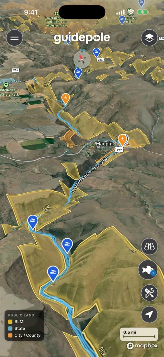
Try it live
Below is an interactive map sample. Full tool coming soon.
What Guidepole Fish does
HoverTap a feature to see it in the app.
Plan trips, track trolling routes, see emergency closures, find trail access, check out relevant regs, and more…
On-water tools
Built for the boat, too.
More than a map
It's not just data. It's a community.
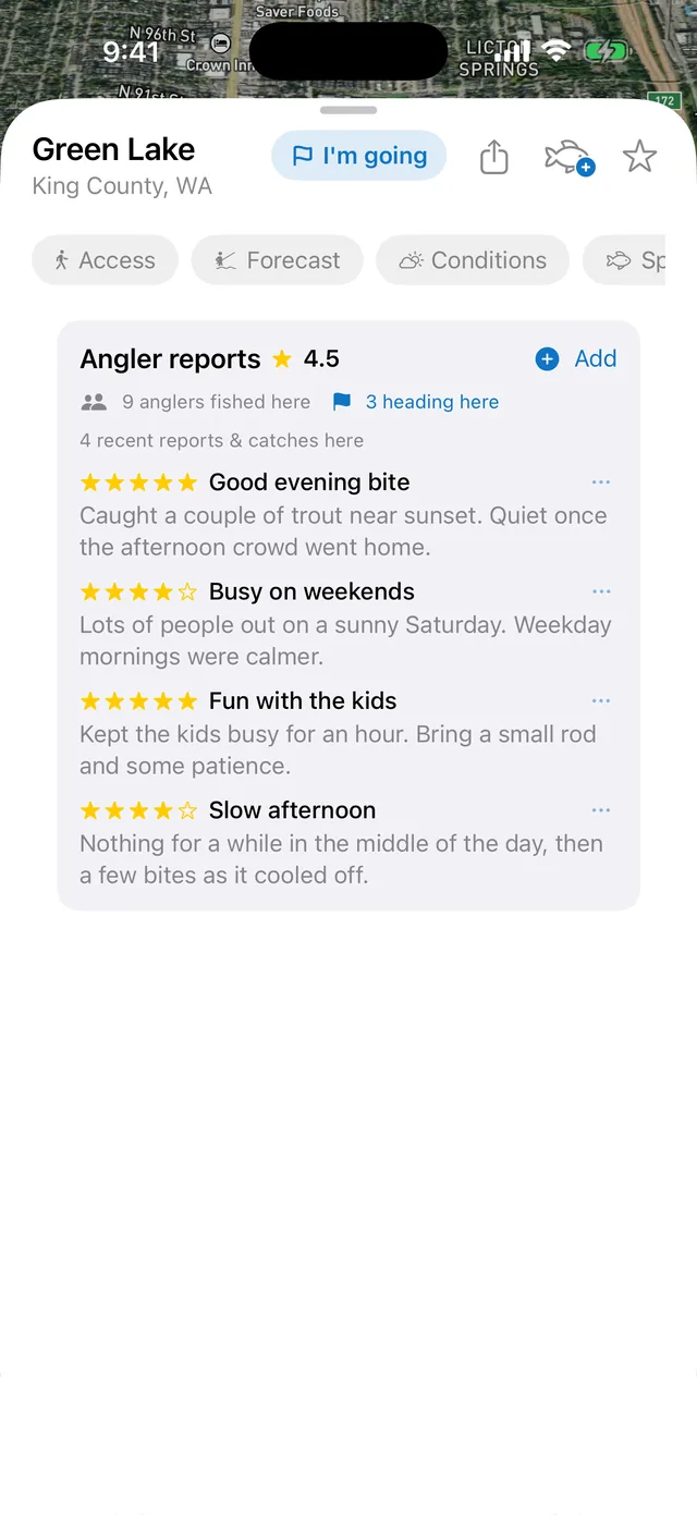
See where anglers are fishing, plan your next trip, and see who else is heading out. The stuff a map alone can't tell you.
- Reviews & check-insReal ratings and check-ins on every spot, so you know what other anglers found before you go.
- Plan a tripOne tap says you're going: tomorrow, this weekend, or any date you pick.
- See who's goingSee how many other anglers are heading to a spot, and meet up if you want.
- Your catches make it smarterEvery fish you log tells everyone what's really biting there. The more people log catches, the better the app knows what you can catch at each water.

Meet Gary
Your guide, built in.
Gary is the guide built into Guidepole Fish. Ask him anything in plain English, like “where can I fish near here?” or “is this bank public?” or “what’s the limit?” He reads the map for you, answers, and drops you right on the spot.
Pricing
One simple plan. Cancel anytime.
| Features | Free | Pro |
|---|---|---|
| Find every water body and what's around it | ||
| Access sites & boat launches | ||
| Regulations & seasons | ||
| Live fire, smoke & air quality | ||
| Save your spots | 1 | Unlimited |
| Can-you-fish-here access verdicts | - | |
| Land ownership & public tidelands | - | |
| Marine & lake depth, clarity & live conditions | - | |
| LiDAR relief basemap | - | |
| Fishing score, best times & 10-day forecast | - | |
| Species & your record catches | - | |
| On-water tools, offline maps & Gary | - |
Prices in USD. One subscription covers every U.S. state we support today, plus any we add later.