Smart access maps for the great outdoors
Know where
you can go.
- Whose land is that?
- Can I fish here?
- Is that smoke headed my way?
Guidepole turns the maze of maps, land records and government feeds into one plain answer — right where you're standing.
Everything you need before you go.
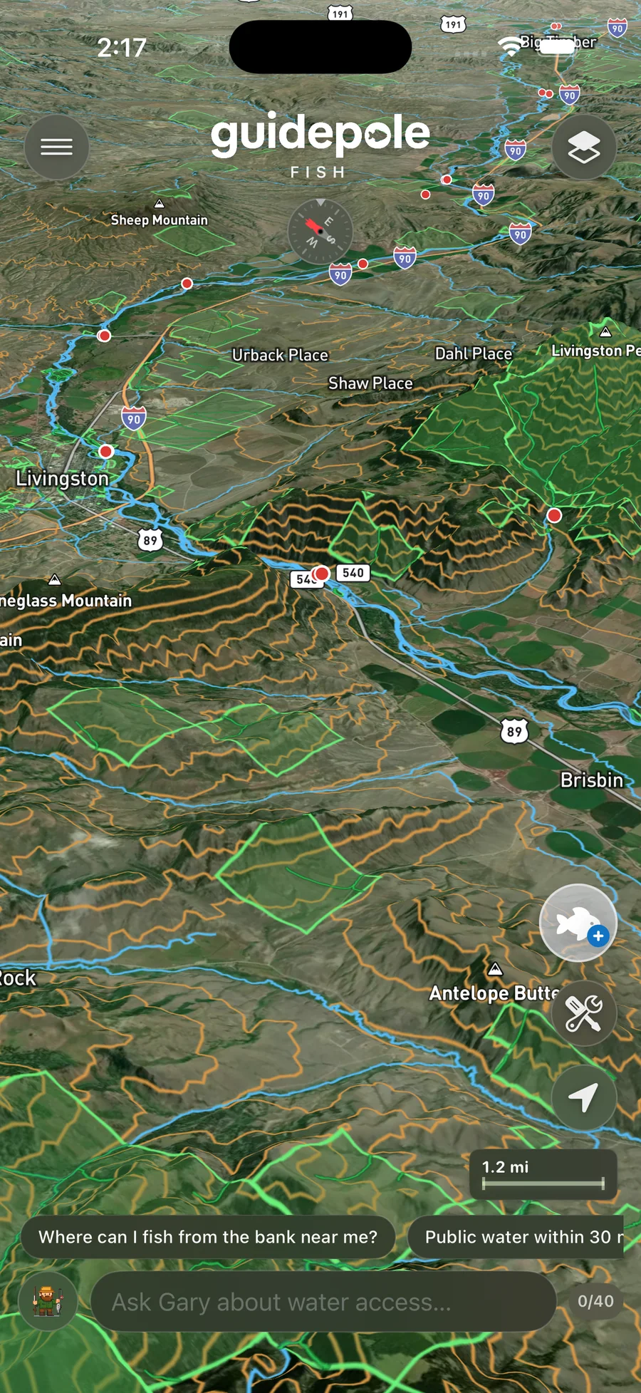
Land ownership and public access. Every lake, river, and trail. Live weather, wildfire, smoke, and air quality. Flip on the layers you need.

Water & access
Land & ownership
Depth & terrain
Fire, sky & weather
Can I fish here? Should I?
What can I keep?
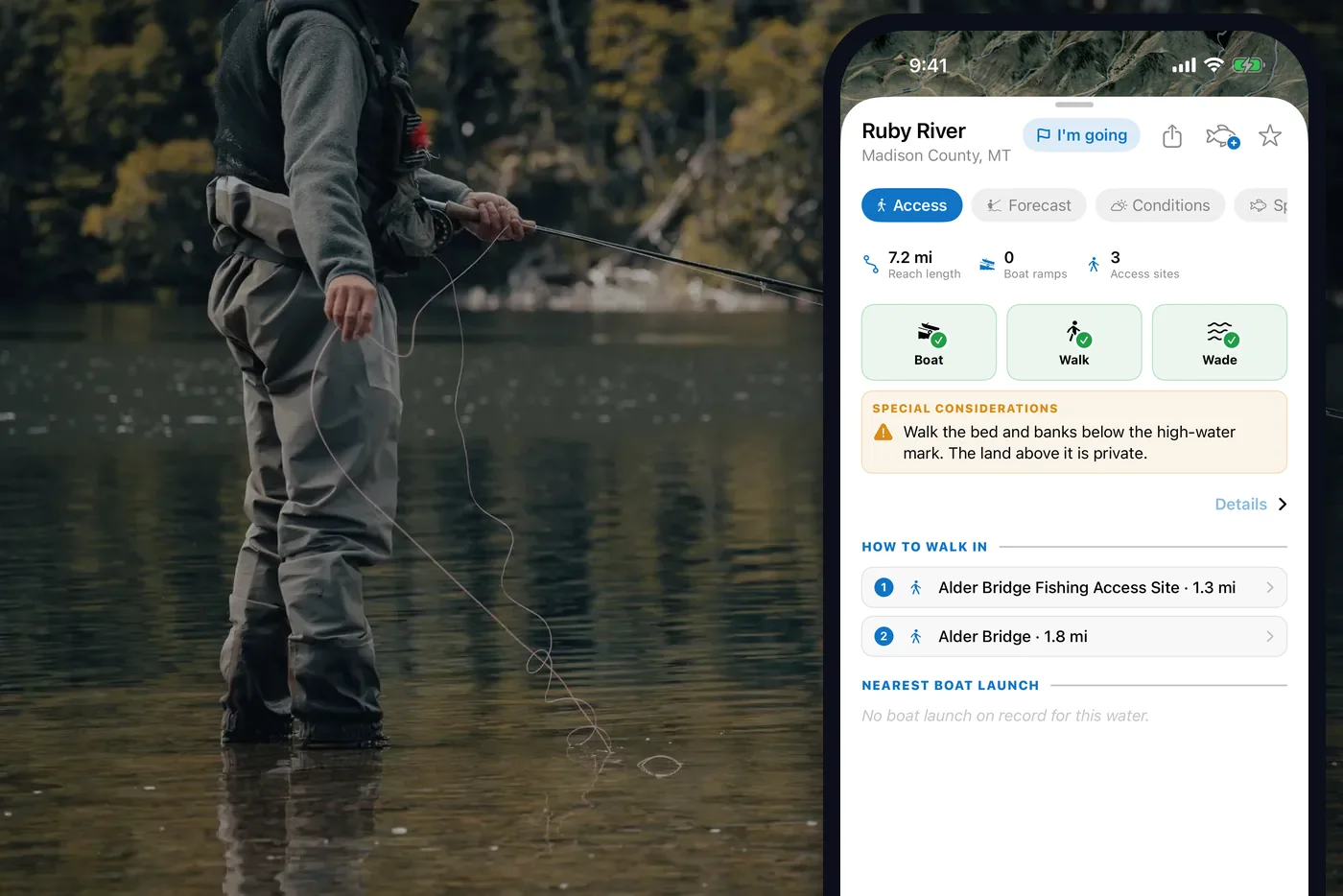
Tap any water and Guidepole shows the public banks, launches and access — not just where the water is — plus the current regulations, what's in season, and a straight read on whether the conditions are worth the drive today.
Download on theApp Store
Is that smoke headed
my way? When does it clear?
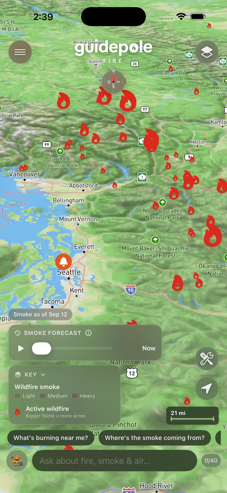
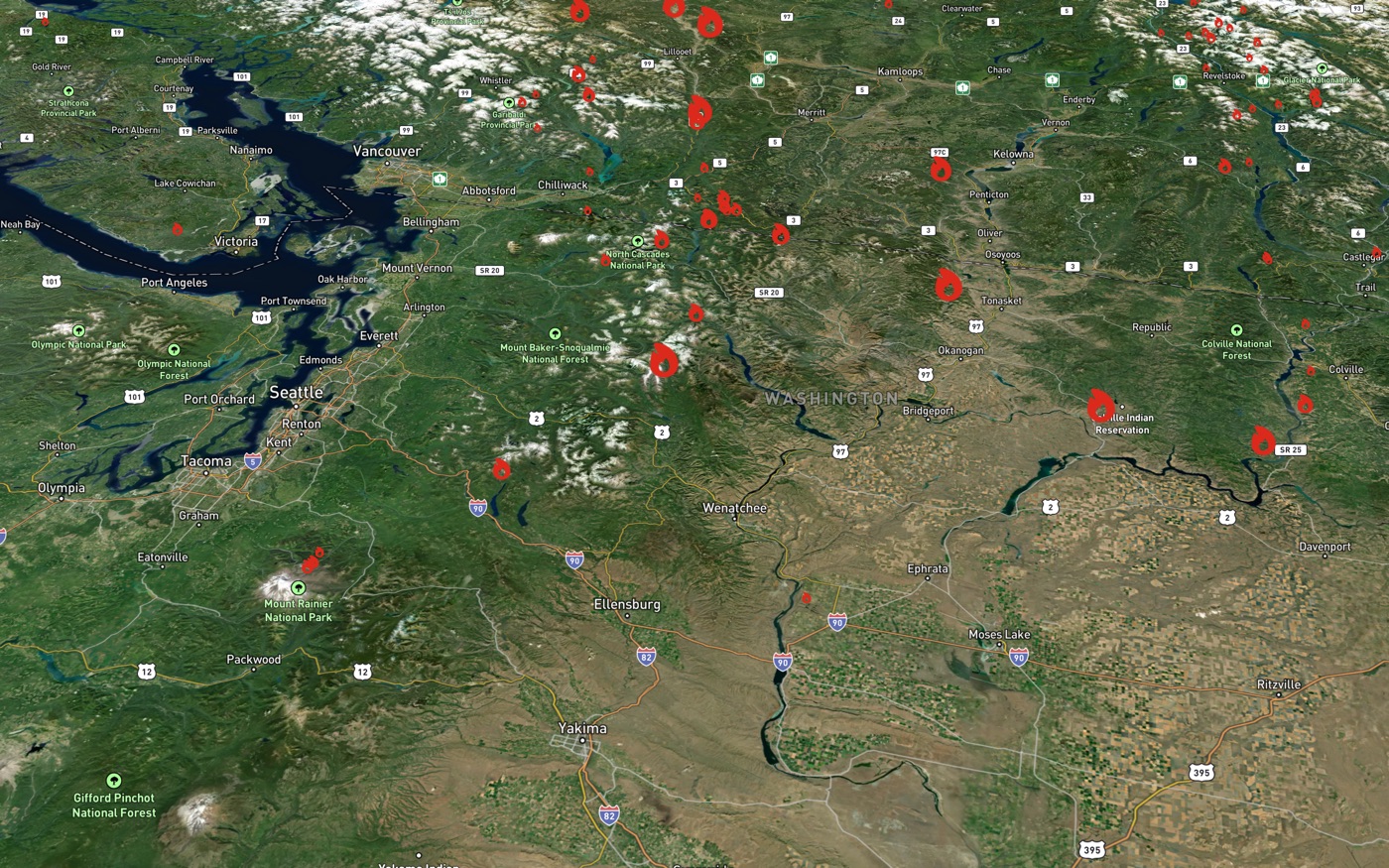
See the smoke plume overhead and the air you're actually breathing, every active fire across the US and Canada with its size and perimeter, and a 24-hour forecast you can scrub hour by hour — so you know whether to go out, close the windows, or leave.
Download on theApp Store


The map that actually answers you
Don't want to read a map?
Just ask Gary.
Gary is built into every Guidepole app. Ask a question in plain words and he answers from the same maps and live data you're looking at — then drops the spots straight onto your map.
In every app
More than a map.
Whatever you head out for, Guidepole comes with the tools to plan the day, read the conditions, and remember the spots that paid off.
Live conditions & forecast
Weather, water, wind, air and tides — right now and days ahead — wherever you tap, so you know before you drive whether today's the day.
Keep a field log
Log the day — a catch, a summit, a sighting — pinned to the map with an automatic weather and location snapshot. Your own record of what worked, and where.
Save spots, get alerts
Star the places you care about and Guidepole watches them for you — a fire moving in, the air turning, a season opening, a stocking truck rolling through.
Where Guidepole works.
Guidepole Fish brings you full access data — water, public land, launches, access, and regulations — in these states, with more rolling out:
- Montana
- Idaho
- Oregon
- Washington
- Hawaii
- California
- Alaska
- Tennessee
- Virginia
Guidepole Fire covers the entire US and Canada.
What's new
News & updates.
What's new in Guidepole Fire 1.2.1
A smoother, more reliable start — the map centers on you at launch, steadier satellite layers, and lower background battery use.
Guidepole comes to California
California is live — water, access, launches, marine protected areas, species, and CDFW freshwater and ocean regulations.
Guidepole comes to Tennessee
Tennessee is live — water, access, launches, trout stocking, advisories, species, and TWRA regulations across the state.