Fish
Fish Fire
Fire Hike
Hike Bird
Bird

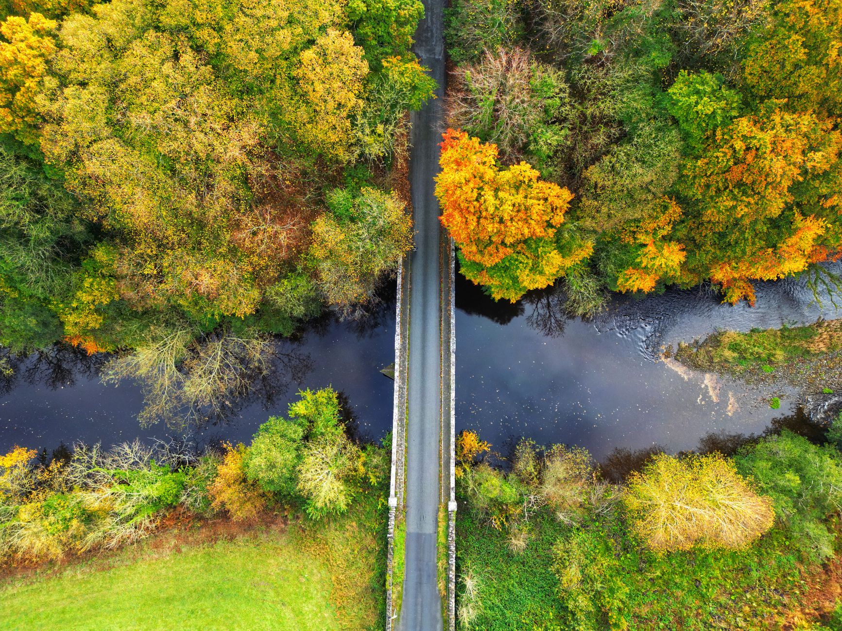

It is the most common access situation in American fishing and one of the least understood.
A county road crosses a creek. There is gravel to pull off on. There is a worn path down the bank that has clearly been used for years. There is no sign either way.
Can you park and walk down? The honest answer is it depends on three things, and two of them are invisible.
What a road right of way is
A public road is not owned by the public in the way a park is. In most cases the underlying land is still owned by the adjoining landowner, and the public holds an easement across it. Two consequences follow, and they pull in opposite directions.
The right of way is wider than the pavement. Typically it runs some distance either side of the roadway, frequently to a fence line, and commonly a total width of around sixty feet on a county road, though it varies enormously by jurisdiction and by the original grant, so the area between the edge of the asphalt and the fence is usually still within the right of way.
But the easement is for travel. It was granted for the purpose of a public road, not as a public park, and in most states that means it does not by itself authorize fishing, hunting, camping or leaving the corridor to reach the water. So you may be standing on public right of way and still not have a right to walk down to the river, because walking down to the river is not travel. This is the distinction that catches people out, and it is why the answer varies so much between states.
Wisconsin Trout Fishing Stream Access: How to Find Public AccessThe states that legislated it
A few states got tired of the ambiguity and wrote it down. Montana is the clearest, where the state's bridge access provisions establish that the public may access streams at public bridge crossings within the right of way and require that landowners not obstruct that access, with provision for gates or stiles where a fence crosses the right of way. Combined with Montana's stream access law, which permits use up to the ordinary high water mark, the bridge becomes a usable public entry point, and that arrangement is unusual enough to be the reason the state has such a reputation for accessible fishing.
Other states have narrower or no equivalent, and in many, access at a bridge is a matter of local practice, landowner tolerance or specific easements rather than a general right. Some states have section-line rights of way dating to territorial-era statutes, which create public corridors along survey section lines, and these exist in parts of the northern plains and are a genuine access tool where they apply, though they are far from universal and their status has been litigated.
The practical rule is to assume there is no general bridge access right unless your state has enacted one.
Prescriptive easements, and why the worn path matters less than you think
A well-worn path suggests long public use, and long public use can, in some circumstances, create a legal right. Prescriptive easements arise from open, notorious, continuous and adverse use over a statutory period, which varies by state and is typically measured in years or decades.
Three cautions apply. Establishing one is a court proceeding, not something an individual angler can rely on in the moment. Many states have modified or restricted the doctrine as it applies to public recreation, specifically to prevent access from ripening into a right against a tolerant landowner. And permission defeats it, because if use was permissive rather than adverse then no prescriptive right forms, which is why some landowners post signs specifically stating that use is by permission.
So the worn path is evidence that people go down there. It is not evidence that they may.
Road ends and public landings
A more reliable category, and worth looking for specifically. Where a public road ends at water there is frequently a public landing or access, particularly on rivers and lakes with a history of ferry crossings, log drives or commercial navigation, and many of these are old, unmarked and still legally public.
County and municipal records are where these are documented, and some states maintain published lists of public access sites. Old ferry landings are a particularly good category, because where a road runs to the water and stops, and a road on the far bank does the same, there was very likely a public crossing. Boat launches are the modern, signed version and the safe default.
What a posted sign does and does not mean
Signs are the most common source of confusion at an access point.
- A no-trespassing sign on private land is meaningful. In many states posting is what makes entry a criminal rather than civil matter, and in some states land need not be posted at all for trespass to apply.
- A sign placed on public right of way is not. Landowners sometimes post at the road edge rather than at the boundary, whether through misunderstanding or deliberately, and a sign does not move a boundary.
- A sign across a public access does not extinguish it. Where a genuine public access exists, a sign obstructing it may itself be unlawful, which is exactly what Montana's bridge access provisions address and what New Mexico's attorney general pursued on the Pecos.
- Purple paint means no trespassing in a number of states, which adopted paint marking as a legal equivalent to signage. If you fish in unfamiliar states, learn whether purple marks are used there.
- Absence of a sign proves nothing. In many states unposted private land is still private land and entry is still trespass.
The honest summary is that a sign is evidence of a claim, not proof of a boundary. Where the claim and your data disagree, the sensible move is not to argue on the spot but to leave, verify, and come back if you are right.
Parking, which causes more trouble than access
Almost every dispute at a bridge starts with a vehicle rather than an angler. Blocking a gate or a field entrance is the fastest way to generate a genuine complaint, and it is frequently what triggers a landowner to start posting and calling. Parking on the roadway is prohibited on many rural roads and is a real hazard where agricultural equipment uses the road.
Get entirely off the traveled way, all four wheels onto firm ground, off the pavement and out of the way of a wide load. Do not park on the bridge or its approaches, where sight lines are poor and it is usually specifically prohibited. And note that a wide shoulder is not a parking lot, because the right of way exists for travel and long-term occupation is a different use.
If the only place to leave a vehicle is somewhere that creates a problem, the honest answer is to fish somewhere else.
Public access easements, the underrated category
Beyond bridges and road ends there is a whole class of access that exists on paper and is largely unknown.
- Fishing access easements are purchased by state wildlife agencies from willing landowners, granting public entry and passage along a stretch of river. They are frequently signed but not always, and they seldom appear on general maps.
- Conservation easements sometimes, though not usually, include public access provisions. Most do not, which is a common misunderstanding: an easement protects land from development without necessarily opening it.
- Walk-in access programs, funded through state agencies and federal farm bill programs, pay landowners to allow public foot access during specified seasons. These cover very large acreages in some states and are underused because the enrolled parcels change year to year.
- Utility and pipeline corridors are private easements and do not confer public access, despite frequently looking like public paths.
- Railroad rights of way are private property. Walking a rail line is trespass and dangerous, and it is one of the most common inadvertent violations.
- Old public roads that have never been formally abandoned can remain public even when they are overgrown and impassable to vehicles, and county records are where that is established.
The practical point is that the access that exists is frequently better than the access that is obvious, and finding it is a records exercise rather than a driving exercise. That is the case for carrying the ownership layer rather than a road map: Guidepole shows parcel boundaries, the land manager, public access sites, boat launches and the public land that touches the river, which turns a bridge with a worn path into a specific question with a specific answer rather than a guess made from the shoulder with a rod already strung. It also gives you the landowner's name when the answer is that you need to ask.
The gear
Bridge access is a legal question rather than a physical one, so most of this list is information you carry rather than equipment.
A land-ownership map you trust is the first item and it does most of the work. The question at a bridge is who owns the ground between the pavement and the water, and that is a parcel question with a recorded answer. A mapping app that shows parcel boundaries and ownership over aerial imagery turns a guess into a check you can make from the driver's seat.
Your state's bridge access rule, read before the trip rather than at the pullout. A handful of states have legislated this explicitly and the rest have not, which means the default answer varies from clearly permitted to clearly not, and there is no way to work it out from what the bridge looks like.
A vehicle you can get fully off the road, which sounds trivial and is the most common cause of trouble. Most complaints about bridge anglers are parking complaints rather than trespass complaints, and a car with two wheels on the fog line generates a call to the sheriff regardless of whether the access itself was legal.
The landowner's contact details, if the parcel record gives them, because a phone call is a better first move than an assumption.
Boots you can walk a right of way in, since the legal route down is frequently not the convenient one.
Offline maps, because bridge crossings are exactly where cell coverage disappears.
And something to leave a note with. A note on the dash with your name, your phone number and where you have gone costs nothing and converts an unexplained parked vehicle into an explained one.
How Easements Really WorkAsking, and what to do if you are challenged
Where the right is unclear, the reliable route is permission, and asking works more often than people expect.
- Find the landowner before you turn up. Parcel data gives you a name, and a bit of searching usually gives you a way to contact them.
- Ask in advance and in person if you can. A phone call or a knock at a reasonable hour is considerably better received than a request shouted from a truck window.
- Be specific: where you want to go, when, how many of you, and how long.
- Accept no gracefully, because a polite refusal preserves the possibility of a yes next season.
- Follow up. Gates left as found, gates closed, nothing left behind and a thank you afterward. Landowners who have had one good experience are dramatically more likely to say yes again.
If you are challenged instead, be pleasant first, because a great many landowners believe the water and the bank are theirs and many have had bad experiences with people who left gates open and trash behind, so you are not the first person they have spoken to about this. Do not argue the law on the spot, since even if you are right a roadside legal debate with someone who is angry achieves nothing and occasionally escalates. Know what you relied on, because being able to say specifically why you believed you had access, whether a state bridge statute, a mapped public easement or a public land boundary, is far better than a general impression.
Offer to leave and verify, which costs you an afternoon and defuses almost everything, and if you were right, come back with the reference. Do not comply with a demand to hand over gear or licenses to a private individual, because landowners are not enforcement officers, and if enforcement arrives, be straightforwardly cooperative and factual. Report genuine obstruction of a lawful public access to the state agency responsible, since in states with bridge access laws obstructing access may itself be unlawful and agencies do act on it.
The long game matters. Access in this country is held open by a large number of people behaving well over a long period, and lost by a small number behaving badly in ways that are remembered for decades.
The short version
The right of way is usually wider than the pavement, so you may legally be standing further from the road than you think, but the easement is for travel, so being in the corridor does not necessarily authorize walking to the water. Montana has a specific bridge access law and most states do not, and a worn path proves habit rather than right.
Park entirely off the road and never block a gate. And when it is unclear, ask. It works, and it is how access stays open.
For more, the ordinary high water mark covers what happens once you reach the water, wading versus floating rights covers what you may do in it, and how to find public fishing access covers the wider search.
Whether you may then wade upstream from the bridge or must stay in the boat is a separate question entirely, and it is in wading versus floating rights. The boundary between public bed and private bank is in the ordinary high water mark, and the state-by-state summary is in fishing access laws by state. The other route onto landlocked public ground, now settled in the Tenth Circuit, is in corner crossing explained.