Fish
Fish Fire
Fire Hike
Hike Bird
Bird

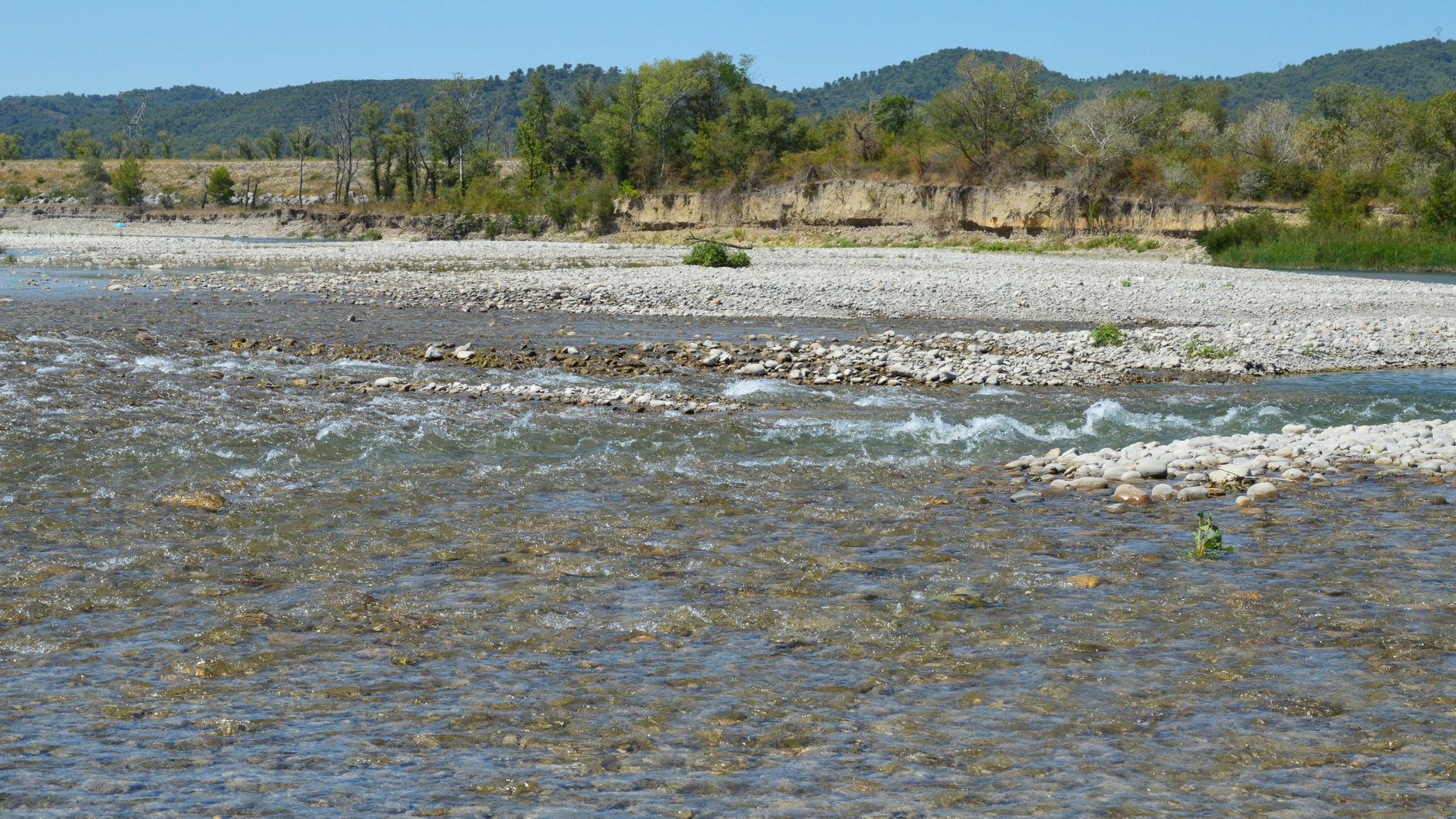

Two anglers stand on the same gravel bar. One is legally fishing on public ground. The other is trespassing.
The difference is a line neither of them can see, and on many American rivers it is the single most consequential fact about where you are standing.
What the ordinary high water mark is
The ordinary high water mark, usually shortened to OHWM, is the line on a bank where the presence and action of water has been so continuous as to leave a distinct physical mark. That is the important part: it is a physical feature, not a survey line. Nobody drew it. The river did, over decades, and you find it by reading the bank rather than by consulting a map.
The standard federal formulation describes it as the line indicated by physical characteristics such as a clear natural line impressed on the bank, shelving, changes in the character of the soil, destruction of terrestrial vegetation, and the presence of litter and debris. In plain terms, you are looking for the elevation the river reaches often enough that ordinary land plants cannot establish there.
Why it decides who owns the ground
The legal machinery behind this is worth understanding once, because it explains nearly every access argument in the country. Under the equal footing doctrine, when a state joined the Union it took title to the beds of navigable waters within its borders, holding them in trust for the public, and the federal government never conveyed those beds to private parties because it never owned them to convey.
The public trust doctrine is the principle that the state holds that land for public purposes, historically navigation, commerce and fishing, and cannot simply sell it out from under the public. So on a navigable river, the bed and banks up to the ordinary high water mark are typically public, even where the fields on both sides are private and posted. Above the mark, you are on private property.
The word navigable does three different jobs
This is where most confusion comes from, and it is worth being precise. Navigability for title determines who owns the riverbed, and the test is whether the waterway was susceptible to use as a highway for commerce in its ordinary and natural condition at the time of statehood.
Navigability for federal regulatory purposes, under the Clean Water Act and the Rivers and Harbors Act, is a much broader and entirely separate test, and a water can be regulated federally without the bed being public. Navigability or usability for state recreation purposes is a third thing again, defined by state law, and it is the one that most often governs whether you can fish.
A water can be non-navigable for title and still open to the public for recreation under state law. Montana is the clearest example.
Two cases worth knowing
The doctrine sounds abstract until you see it applied, and two decisions do most of the work.
PPL Montana v. Montana, decided in 2012, arose from a state claim that a power company owed rent for riverbeds under hydroelectric dams, where Montana argued the rivers were navigable at statehood and the beds therefore state-owned. The Supreme Court disagreed with the state's approach, holding that navigability for title must be determined segment by segment rather than for an entire river, and that portages around impassable stretches are evidence against navigability of those stretches rather than for it. The practical result is that a river can be title-navigable through the flat reaches and non-navigable through a canyon, with public ownership of the bed switching on and off along its length.
Mitchell Slough, decided by the Montana Supreme Court in 2008, tested whether a heavily modified side channel of the Bitterroot River was a natural water body subject to the state's stream access law, or a private ditch, as the landowners had argued. The court found it remained a natural water body and therefore subject to public access. That one matters because it addressed the obvious workaround: if a landowner reshapes a stream, does it stop being public? The answer, in Montana at least, was no.
The gear
Reading the ordinary high water mark is mostly a matter of looking carefully, so the list is short and two items on it are documents.
A land-ownership map you trust, showing parcels against aerial imagery, because the mark tells you where the bed ends and the map tells you who owns what is above it. Neither is much use without the other.
Your state's access rule, read before the trip. This is the item that changes the answer completely. In Montana the public may use the bed and banks up to the mark on any stream capable of recreational use; in Colorado the equivalent act may be trespass. The mark is a physical feature with a consistent definition and the rights attached to it are not consistent at all.
Wading boots you can walk distance in, since the legal route is frequently along the bed rather than the bank, and gravel is hard walking.
A wading staff, which is a safety item rather than a legal one, and which becomes a legal one the moment a slip puts you on the bank you were avoiding.
A phone with offline maps, because the parcel boundaries you need are in the app and the coverage is not in the canyon.
A camera for documentation. Photographing where you entered, where you were and the mark itself is what turns a disputed account into a documented one.
And a calm manner, which belongs on every access list in this library for the same reason: nearly every access dispute that becomes a legal problem became one after the conversation went badly rather than before.
Introduction to the Ordinary High Water MarkReading the mark on the ground
This is a learnable field skill and it is worth practicing deliberately.
- Find the vegetation line, the clearest indicator on most rivers. Below it, bare rock, gravel, sand or water-tolerant plants. Above it, grass, brush and trees. That transition is usually very close to the mark.
- Look for the debris line. Sticks, silt-stained grass and stranded wood collect at high flows and mark where the water has recently been.
- Look at the soil. Below the mark, scoured mineral soil, sorted gravel and sand. Above it, organic soil with duff and root mat.
- Look for shelving or a cut bank. Many rivers have a distinct step in the bank profile at the mark.
- Look at the trees. A line of mature trees usually sits above the mark, because seedlings below it get scoured out before they can establish.
What it is not: it is not the water's edge today, it is not the flood line from the biggest flood on record, and it is not the top of the bank. It is the ordinary high water, which on most rivers is well above summer flow and well below a hundred-year flood.
The National Ordinary High Water Mark ManualWhere states diverge
The same physical line produces very different rights depending on the state, and this is the part that catches traveling anglers.
- Montana has the broadest access in the country. Under the state's stream access law the public may use surface waters capable of recreational use up to the ordinary high water mark, regardless of who owns the streambed, on both navigable and non-navigable streams, so you may wade, fish and portage below the mark.
- Idaho recognizes public use below the mark on streams meeting the state's navigability standard.
- Washington, Oregon and California hold beds of title-navigable waters in trust, with public rights below the mark on those waters, and considerably less clarity on smaller streams.
- Colorado takes a much narrower view. Under long-standing case law, floating through is permitted, but touching the bed of a non-navigable stream can be trespass.
- Utah has litigated this repeatedly. The state supreme court concluded there is no constitutional easement giving the public a right to touch privately owned streambeds, and the legislature's Public Waters Access Act affirms a right to float, with incidental touching for safe passage, rather than a right to wade.
- New Mexico went the other way. In September 2022 the state supreme court held that the public right to recreate and fish in public water includes the right to touch the privately owned beds beneath, striking down a Game Commission regulation that had let landowners certify stretches as closed.
The practical rule is that the region tells you nothing. Check the state.
Lakes, reservoirs and tidewater
The mark is usually discussed for rivers and it applies more widely, with wrinkles. Natural lakes that are navigable for title have publicly owned beds up to the ordinary high water mark, on the same doctrine as rivers, and on a natural lake with a stable level the mark is often obvious and close to the waterline.
Reservoirs are the awkward case. An impoundment created by a dam frequently sits on land acquired by the dam operator, and the operative boundary may be a project boundary or a flowage easement rather than a natural high water mark. Federal reservoirs managed by the Army Corps of Engineers or the Bureau of Reclamation typically have a defined project boundary, and public access rules are set by the managing agency rather than by common law. A fluctuating reservoir also has an enormous exposed zone at low pool, and whether you may walk on it depends on the project rules rather than on a doctrine.
Tidewater uses a different line entirely, because on tidal waters the public trust generally runs to the mean high tide line, and a few states, notably Massachusetts and Maine, recognize private ownership down to low water subject to public rights of fishing, fowling and navigation. So for reservoirs, ask the managing agency; for tidewater, learn the state's tidal rule; and for natural rivers and lakes, read the bank.
When the river moves
Rivers do not stay put, and the law has doctrines for that which occasionally matter. Accretion is the gradual addition of land to a bank by deposition, and where it happens slowly the boundary generally moves with the bank, so the adjoining owner gains land. Erosion is the reverse, and the boundary generally moves the same way, so the owner loses land. Avulsion is a sudden change, such as a river cutting a new channel in a flood, and here the rule flips: the boundary generally stays where it was, in the old channel, even though the water has gone.
The practical consequence is real and occasionally startling, because after a major flood a stretch of public river bed can end up as a dry channel with the boundary still running through it, while the new channel runs across ground that is still privately owned. This is not a common problem, but it is why old maps of a braided river should be treated cautiously, and why a channel that clearly used to carry the river is worth thinking about before assuming its status.
What to do with all this
A short field protocol that keeps you out of trouble.
- Know the state rule before you travel. This is the single highest-value ten minutes of trip planning.
- Enter from public ground. A legal right to stand below the mark does not give you a right to cross private land to get there, and access points, bridges, public land and easements are how you arrive.
- Stay below the mark once you are there. Do not step up onto the bank to walk round an obstacle unless you know you may.
- Do not assume a fence means anything. Fences are built where they are convenient to build, frequently well inside a property line and sometimes across a stream, and a fence is not a legal boundary.
- Be polite if challenged. Most confrontations come from a landowner who believes the water is theirs, and a calm explanation beats an argument every time.
The second of those is where a map earns its keep, and it is worth being clear about what a map can and cannot do here. No map draws the ordinary high water mark, because that line is on the ground and you read it with your eyes. What Guidepole carries is the other half of the question: who owns each parcel along the bank, which agency manages what, where the public access points are, and whether there is a legal way to reach the water in the first place.
The short version
Below the mark, on a water where your state grants public use, you are generally fine. Above it you are on somebody's property.
Learn to see the line. Look at the vegetation, the debris and the soil, and after a season of paying attention you will read it without thinking about it. And get to the water legally, because that is the part that generates the citations.
For more, can you fish here covers the wider access framework, fishing access laws by state has the state-by-state detail, and wading versus floating rights covers what you may do once you are in the water.
What the mark permits you to actually do once you are standing on it varies more than the mark itself, and that is in wading versus floating rights and fishing access laws by state. Getting to the water in the first place is in bridge and road end river access, and the doctrine underneath all of it is in water access law explained. The saltwater version of the same question, which is unusually complicated in Washington, is in public tidelands and private beaches.