Fish
Fish Fire
Fire Hike
Hike Bird
Bird

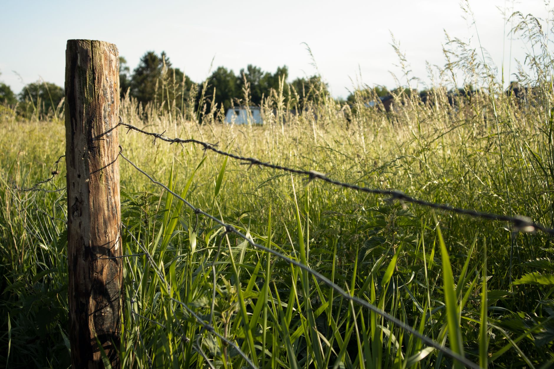

Picture four squares of land meeting at a single point, like a checkerboard. Two diagonal squares are public. Two are private.
You are standing on public land. You can see public land across the corner. To get there you must step over the exact point where all four meet, without touching either private square.
That is corner crossing, and for decades nobody could tell you with confidence whether it was legal. Now, in six states, they can.
Why the checkerboard exists, and where it is
The pattern is a nineteenth-century artifact and it explains the whole problem. To finance transcontinental railroad construction, Congress granted railroads alternating sections of land in wide corridors along the routes, so the railroad got the odd-numbered sections and the federal government kept the even ones, or the reverse depending on the grant. The result, across enormous areas of the interior west, is a checkerboard of private and public ownership in which public squares touch other public squares only at their corners. Much of the railroad land has since been sold to ranches and investors, and the public squares are still public.
Because a corner is a dimensionless point, reaching one public square from another has always required either crossing private ground or performing an awkward maneuver over a fence post. It helps to know where you are likely to encounter this, because it is not evenly distributed:
- Southern Wyoming has the most extensive checkerboard in the country, a broad corridor either side of the transcontinental route running roughly across the state, which is precisely where the Elk Mountain case arose.
- Northern Nevada and northern Utah carry the same corridor westward.
- Parts of Montana along the northern route have their own checkerboard, mostly from the Northern Pacific grant.
- Eastern Oregon and Washington have checkerboard sections associated with the Northern Pacific and other grants.
- New Mexico and Arizona have checkerboard areas from the Atlantic and Pacific grant.
- Colorado, Kansas and Nebraska have smaller checkerboard areas.
The corridors are typically twenty to forty miles wide either side of the historic route, and within them the alternating pattern is remarkably regular. If you are looking at a map and see a precise checkerboard of public and private squares rather than an irregular patchwork, you are almost certainly looking at a railroad grant corridor, and the corner-crossing question applies.
The case
The dispute that settled it began with four hunters from Missouri. In 2020 and 2021 they crossed a corner adjoining Elk Mountain Ranch in Wyoming, a property covering roughly fifty square miles owned by Iron Bar Holdings, a company of pharmaceutical executive Fred Eshelman, and to avoid touching the private ground they used a ladder placed across the corner. They were charged criminally and acquitted by a jury, after which Iron Bar Holdings sued them civilly for trespass, seeking substantial damages.
The federal district court ruled for the hunters. In March 2025 a three-judge panel of the Tenth Circuit Court of Appeals affirmed, holding that the lower court was correct that the hunters could corner-cross as long as they did not physically touch the private land, and the panel relied on the Unlawful Inclosures Act of 1885, a statute Congress passed to stop landowners from fencing off and obstructing access to public land.
Iron Bar Holdings petitioned the Supreme Court in July 2025. On October 20, 2025, the Court declined to hear the appeal, leaving the Tenth Circuit decision standing.
Corner Crossing Hunters Win as the Supreme Court Declines the AppealWhere it is settled, and where it is not
This is the part that matters practically and the part most coverage got imprecise. A federal appellate ruling binds the circuit that issued it, and the Tenth Circuit covers Wyoming, Colorado, Utah, New Mexico, Kansas and Oklahoma, so in those six states corner crossing without physically touching private land is now settled law.
It is not settled elsewhere. Montana, Idaho, Washington, Oregon, California, Nevada, Arizona, Alaska and Hawaii are in the Ninth Circuit, which has not ruled on the question, and the Tenth Circuit's reasoning is persuasive authority there rather than binding precedent. The Dakotas, Nebraska and Minnesota are in the Eighth Circuit, likewise unsettled.
So a Wyoming hunter and a Montana hunter, doing exactly the same thing on exactly the same kind of checkerboard, are currently in different legal positions. That is unsatisfying and it is accurate.
What the ruling permits
The scope is narrow and worth stating precisely.
- You may pass from public land to public land at a common corner.
- You may not touch the private land. The whole holding turns on this, and the hunters used a ladder for exactly that reason.
- Airspace above private land is a live question. The ruling addressed physical contact with the surface, and reaching over the private corner is the practical reality of any crossing, which is why a ladder or step device is used.
- It does not create a right to drive across. This is about foot passage.
- It does not open landlocked public land generally. A public parcel with no corner touching other public land remains unreachable without permission or an easement.
- It does not affect state trust land, tribal land or other categories with their own access rules.
- It does not change anything above the corner itself. Once you are on the public square, you are on public land with normal public land rules.
The scale of the landlocked problem
Corner-locked land is one part of a larger picture, and the distinction between its parts decides whether a trip is possible at all.
Landlocked public land is federal or state land with no public road, no public easement and no adjoining accessible public parcel, and analyses by conservation and mapping organizations have put the total across the American West in the millions of acres, with some assessments running well above ten million when state trust land is included alongside federal. Corner-locked land is the subset where the only connection to other public land is a shared corner, which is the category the Tenth Circuit ruling addresses, and coverage of the case put the acreage potentially opened at more than three million.
The rest remains inaccessible, because a public section entirely surrounded by private land with no shared corner is not helped by the ruling at all. The remedies there are slower: purchasing access easements from willing landowners, land exchanges that consolidate holdings, and negotiated agreements, and the federal programs that exist to fund exactly this are chronically oversubscribed.
The reason to know the distinction is that a map showing a promising green square does not tell you which category it falls into, and the difference between a corner-locked parcel in Wyoming and a fully landlocked one in Montana is the difference between a legal walk and no trip at all.
Why it took so long to settle
The question looks simple and was hard. Trespass law is state law, and most state trespass statutes were written without contemplating a person who touches nothing. Airspace is contested, since historic property doctrine held that ownership extended upward indefinitely, a principle substantially limited in the aviation era but never fully resolved at the scale of a fence post. And the Unlawful Inclosures Act was enacted in 1885 against cattle barons fencing off open range, so applying a statute about fencing to a question about stepping over a corner required work.
Beyond the doctrine, nobody wanted to be the test case. Corner crossing carried a real risk of criminal charges and a civil suit, which meant the practice continued quietly and the law stayed unsettled for generations. What broke the deadlock was that the stakes were finally large enough to fund litigation on both sides, because Iron Bar Holdings pursued the civil case through to a Supreme Court petition and advocacy organizations funded the defense, which is what produced a definitive appellate ruling rather than another quiet settlement.
The result is that a question left open since the railroad grants was resolved because four people from Missouri were willing to be sued over it.
The gear
Corner crossing is a precision exercise carried out in a place where being approximately right is not good enough, and the gear list reflects that.
Precise parcel and ownership data is the whole foundation. You need to know that the corner is a genuine four-way corner of the checkerboard rather than something that merely looks like one on a small-scale map, and you need to know which two diagonal parcels are public. A mapping app with current parcel data, downloaded for offline use, is the tool.
A GPS you trust, with a known accuracy figure. Consumer GPS is typically accurate to a few meters, corner monuments are points, and the honest position is that you are working inside your own error bars. Knowing that your device is showing plus or minus three meters is more useful than believing it is exact.
A lightweight step ladder or a purpose-built step device, which is what the Missouri hunters in the Wyoming case used and what made their crossing defensible. Going over rather than through means you never touch the private ground or the fence.
A camera, and use it. Photograph the corner, the monument if there is one, your device showing the position, and your route. The defense in the case that settled this rested substantially on the fact that the hunters had documented what they did.
Offline maps, since checkerboard country has no coverage.
A calm manner, because you may well be challenged and the confrontation is the part that goes wrong.
And nothing that could cut a fence. Wire cutters in a pack turn a legal crossing into a much harder conversation.
The Ruling in the Wyoming Corner Crossing CaseDoing it carefully
If you are in a Tenth Circuit state and intend to corner cross, the practical guidance is straightforward.
- Know exactly where the corner is. This is the entire risk, because GPS accuracy of a few meters is the difference between a legal crossing and a trespass, and section corners in the field are frequently unmarked or marked by a fence post that is not on the corner.
- Use good ownership data. Parcel boundaries, not a general shaded map.
- Do not touch private ground. Step, use a ladder, or use a step device, and do not climb a fence that sits on the private side.
- Do not cut, damage or move a fence. That is a separate offense entirely and it will lose you the argument regardless of the crossing.
- Expect to be challenged. Landowners in checkerboard country have been arguing this for a century and the Supreme Court's cert denial has not made everyone happy.
- Be polite and be certain. Being right is much easier to maintain calmly.
The first of those is the only one that is hard, and it is a data problem rather than a legal one. The legal question is now answered in six states, and what remains is entirely where the corner is and which two squares are public. Guidepole carries the parcel and ownership layer directly on the map, so public and private squares are distinguishable and the corner is locatable before you are standing in sagebrush trying to work out which side of an unmarked point you are on. On a checkerboard, that is not a convenience.
What might happen next
The question is settled in six states and the wider picture is still moving. A circuit split is the obvious route back to the Supreme Court, because if the Ninth or Eighth Circuit reaches a different conclusion on similar facts the Court would have a strong reason to take a case it just declined. State legislation could resolve it faster, since a state can define its own trespass law to permit or prohibit corner crossing explicitly and bills have been introduced in several western states in both directions. Federal legislation has been proposed at various points to clarify access to landlocked public land, without success so far.
Land exchanges and easement purchases are the quieter mechanism, and agencies and conservation groups have long bought access easements and consolidated checkerboard holdings, which solves the problem parcel by parcel rather than by doctrine. Mapping is doing some of the work too, because a large part of why this became a live issue at all is that consumer-grade parcel mapping made it possible for an ordinary person to know they were standing next to public land they could not reach. Before that, the checkerboard was effectively invisible.
What is unlikely to happen is that the argument ends. Corner crossing touches property rights, public land policy and a hundred and forty years of unresolved statutory language at the same time.
The short version
Corner crossing on foot, without touching private land, is lawful in the six states bound by the Tenth Circuit, Wyoming, Colorado, Utah, New Mexico, Kansas and Oklahoma, following its March 2025 ruling and the Supreme Court's refusal to review it in October 2025. This is an area of law that moved recently and may move again, including by state legislation, so check the current position for the state you are hunting or hiking in rather than treating this as settled. Elsewhere, it remains unsettled.
The underlying statute, the Unlawful Inclosures Act, has been on the books since 1885, which is a useful reminder that the question was never new. It just took a hundred and forty years and four hunters with a ladder to get an answer.
For the wider access picture, the ordinary high water mark covers the water version of the same problem, state trust lands covers another category of public land with its own rules, and how to find public fishing access covers the practical search.
The other way onto public water and public ground, which is legislated rather than litigated, is in bridge and road end river access. A great deal of the ground reachable by corner crossing is state trust land rather than federal, and that comes with its own permit rules, covered in state trust lands and access. If the destination is a river, the boundary that decides where you may stand is in the ordinary high water mark, and the summary by state is in fishing access laws by state.