Fish
Fish Fire
Fire Hike
Hike Bird
Bird


Bend sits at a geographic seam, and that is the whole reason its hiking works the way it does.
To the east is high desert: sagebrush, juniper and rimrock at around 3,600 feet, dry and open and sunny for something like 300 days a year. To the west, the Cascade crest rises to glaciated volcanoes above 10,000 feet, and one road, the Cascade Lakes Highway, runs from the edge of town straight into that alpine country.
Which means Bend offers something unusual: you choose your climate zone by deciding how far to drive. On a hot August afternoon you drive up. In a cold snowy March you stay low. The town is positioned so that something is always in season.
Tier one: from town
The Deschutes River Trail runs along the river through and beyond the city and is the local default. The stretch through the Old Mill District is paved and flat, while further out toward Meadow Camp and beyond it becomes proper trail through ponderosa forest and past rapids. It is walkable and runnable year-round, snow-free most winters, and it connects enough of the town that you can build a long day without a car.
Pilot Butte, an extinct cinder cone inside the city limits, climbs about 500 feet in a mile to a 360-degree view of the Cascades, taking in Bachelor, Broken Top, the Three Sisters, Jefferson and on a clear day Hood. It takes half an hour and it is the best orientation to the region available. Shevlin Park on the western edge has creekside trails through pine and aspen and makes a good hour when you do not want to drive.
Tier two: the Cascade Lakes Highway
This is what makes Bend special. The Cascade Lakes Scenic Byway climbs west from town past Mount Bachelor and into a string of alpine lakes, including Todd, Sparks, Devils, Elk, Hosmer, Lava and Cultus, sitting between 5,000 and 6,000 feet beneath the volcanoes. The road closes in winter beyond the ski area and typically reopens in late spring or early summer as the snow allows, which governs everything above it.
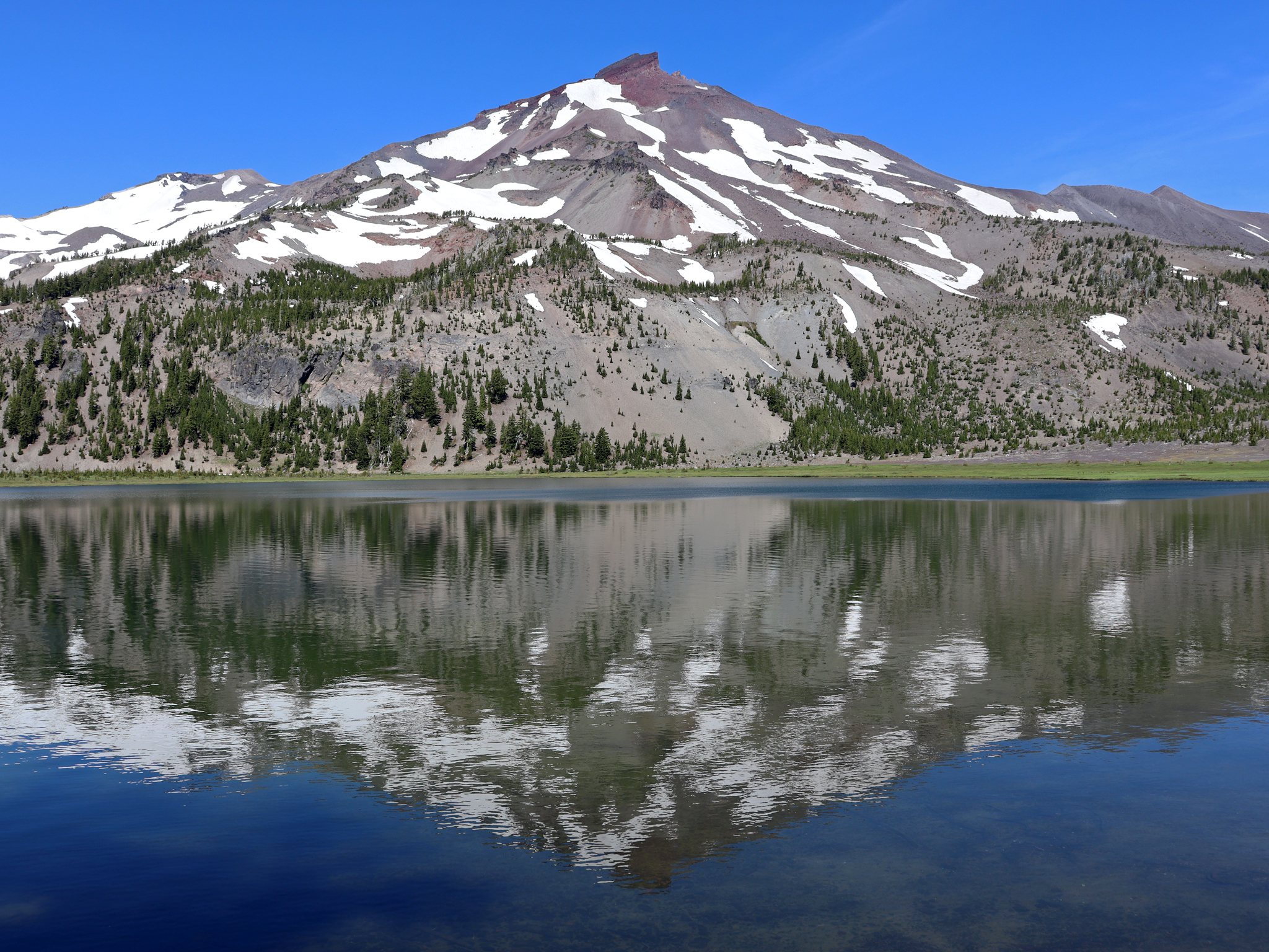
Green Lakes is the classic, a moderate few miles up a creek drainage to a basin of lakes sitting directly between South Sister and Broken Top. It is one of the finest day hikes in Oregon, it is busy for good reason, and limited-entry permits apply in season. Todd Lake is a short easy loop with a big view of Broken Top that works with almost anyone, and Sparks Lake has short trails through lava and meadow with the most photographed reflection in Central Oregon.
For more effort, Tumalo Mountain is a steep but short climb from the Dutchman Flat sno-park opposite Bachelor, with an outstanding summit panorama for what it costs. And South Sister itself is the big one, at 12.6 miles and roughly 4,900 feet to a 10,363-foot summit on a walk-up trail.
The permit that catches people out
The Central Cascades Wilderness Permit is required from June 15 through October 15 for the Three Sisters, Mount Jefferson and Mount Washington wilderness areas, which covers most of what is worth hiking off the Cascade Lakes Highway. Day-use permits at popular trailheads including Green Lakes and South Sister are limited and reservable through Recreation.gov, and while it is far less competitive than the famous lotteries it is not walk-up, so people arrive at the trailhead in July expecting to start walking.
Outside that window no wilderness permit is required, though a Northwest Forest Pass may still be needed for parking, and Smith Rock charges a state park day-use fee that is separate from both. Confirm with the Deschutes National Forest before you go.
Three different requirements across three agencies, plus a seasonal road closure that decides whether the trailhead exists at all, is a lot to hold in your head the night before. Guidepole Hike carries the managing agency, the permit or pass each trailhead requires, and current road status together, which around Bend answers most of the ways a day fails before it starts.
Five Best Hikes Thirty Minutes from Bend, OregonTumalo Falls and the waterfall corner
Tumalo Falls is a 97-foot drop reached by a short walk from a parking lot a dozen or so miles west of town, with a viewing platform almost immediately. The better move is to keep going, because the North Fork Trail climbs past a string of further waterfalls and the network up there connects into a long day if you want one.
The access road is unpaved for the last stretch and closes in winter, at which point the falls become a snowshoe or fat-bike objective from the gate, which is a very good winter outing in its own right.
Tumalo Falls and Double Falls: The Best Waterfall Hike Near BendTier three: the desert side
Do not overlook east of town, particularly in the months when the mountains are shut. Smith Rock State Park, about 30 minutes north near Terrebonne, is a world-class rock climbing destination and an excellent hiking one, and Misery Ridge is the signature: a steep, short, spectacular loop up and over the rimrock with Monkey Face, a 350-foot spire, and the Crooked River below. It is one of the best short hikes in Oregon.
The Badlands Wilderness east of town is old-growth juniper and lava, flat and quiet, and at its best in spring and autumn when the high country is unusable. Steelhead Falls and the Crooked River canyon offer more of the same character. The desert hikes are hot in summer and superb from October to May, which is exactly the inverse of the alpine season, and that complementarity is the point.
What you are looking at
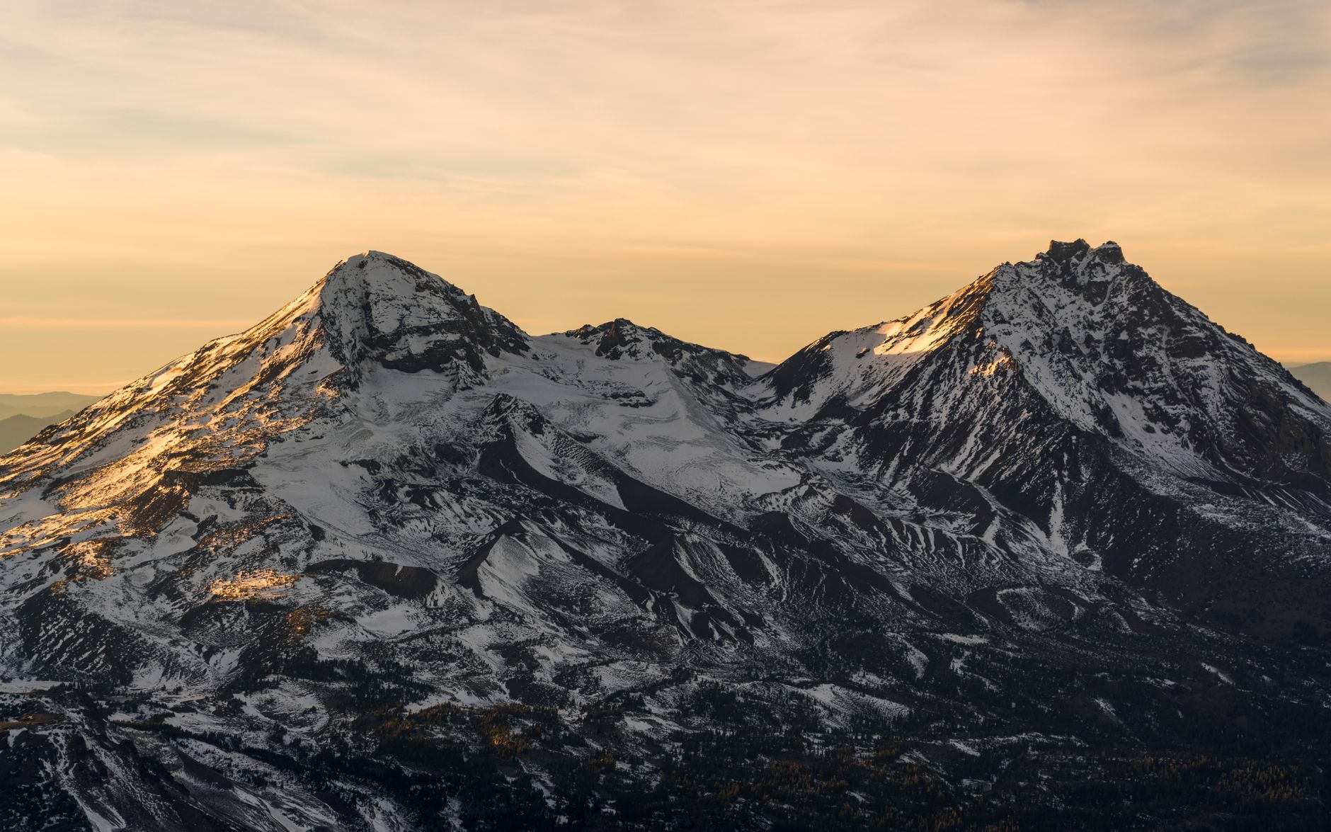
The skyline west of Bend is one of the most legible volcanic landscapes in the country, and knowing what the shapes mean makes the hiking better. The High Cascades here are a line of young volcanoes built on top of an older, worn-down range. South Sister at 10,363 feet is the tallest thing you can walk up without technical gear, and it is young enough, with its most recent eruptions a couple of thousand years old, that the summit crater holds a small lake and the flanks are still raw pumice. Middle and North Sister are older and heavily eroded, and North Sister in particular has been stripped back nearly to its plumbing and is a dangerous climb.
Broken Top is exactly what its name says, a stratovolcano cut open by glaciers, exposing colored layers of its own interior, while Mount Bachelor is a young simple cone, which is why it makes such good ski terrain.
Newberry Volcano, southeast of town, is the odd one out and the biggest: a shield volcano covering some 1,200 square miles, with a five-mile-wide caldera holding two lakes, the Big Obsidian Flow from an eruption about 1,300 years ago, and a summit road up Paulina Peak. The obsidian flow trail is a mile of walking on black volcanic glass and there is nothing else like it in Oregon. Lava Butte and Lava River Cave along Highway 97 are part of the same system, a cinder cone with a road to the rim and a mile-long lava tube you walk through with a lantern at a constant 42°F. The Deschutes itself cuts through all of it, and the canyon walls in town are the edges of old lava flows the river has sawn through.
The gear
Bend hiking spans desert and alpine within an hour, and the gear list has to cover both plus the two permits that catch visitors out.
A Northwest Forest Pass, for the Deschutes National Forest trailheads, which is most of them.
A Central Cascades Wilderness Permit, which is the item that ruins trips. Several of the best trails here, including South Sister and Green Lakes, sit inside a limited-entry area that requires a separate day-use permit booked on Recreation.gov in advance. It is not the Forest Pass, having one does not give you the other, and the popular days sell out.
Gaiters, because the volcanic ground here is pumice and cinder that pours into shoes on every descent, and Bend is one of the few places where gaiters on a day hike are ordinary rather than fussy.
High-SPF sunscreen and a sun hoody, since the high desert sits at three thousand five hundred feet with very little humidity and almost no shade east of town.
Three liters of water for the desert side, where there is none.
Microspikes or snowshoes depending on the month, since the Cascade Lakes Highway trailheads hold snow into July.
And an air quality app, which is a genuine planning tool here rather than a precaution. Regional wildfire smoke now routinely makes August and September unusable, and it changes day to day.
Smoke, and planning around it
This is Bend's one serious seasonal problem. August and September routinely bring wildfire smoke, either from local fires in the Deschutes and Willamette national forests or drifting in from California, Washington and the Oregon Cascades, and it can arrive overnight and sit for a week.
What it does to a hiking trip is straightforward: the views that are the entire point of the Cascade Lakes trails disappear, air quality can reach levels where hard exercise is inadvisable, and trailheads and roads close when fires are active.
The practical approach is to check air quality the morning of rather than the week before, and to keep the desert-side options in your pocket, because the Badlands and the Deschutes canyon trails are lower, shorter, and worth doing when the mountains are invisible. Early morning is often clearer than afternoon.
The ground itself
Bend's trails have a texture that surprises people from other mountain regions. Much of the Cascade high country here is pumice and volcanic ash, which drains instantly, holds no water, and walks like deep sand on the steeper sections. The South Sister climb is notorious for it, because the upper mountain is loose pumice where every step slides back, and the descent is faster and harder on the knees than the grade suggests.
Lower down, the lava flows are the other extreme: sharp, blocky basalt that will shred a hand or a knee in a fall and destroy soft-soled shoes, which is why the trails crossing them at Newberry and Lava Butte are built surfaces. And the ponderosa forest floor around town is soft, dry and pine-needled, a pleasant running and walking surface, which is why Bend has the trail-running culture it does.
The rest of the local character follows from the climate and the elevation. It is dry and sunny, with around 300 days of sun, low humidity, and dust rather than mud. The elevation swings are big, from town at 3,600 feet to trailheads at 6,000 and summits above 10,000, and nights at altitude are genuinely cold even in midsummer. There is no shade in the desert and thin shade in the pine, so sun protection matters more than the temperature suggests. Mountain bikes are everywhere, because Bend is a serious mountain biking town and many trails are shared, so read the signs. Dogs are widely allowed on leash on forest and state land, unlike the national parks elsewhere in Oregon. Signal drops off quickly west of town, and water is scarce on the desert side and abundant in the mountains.
Choosing by month
December to March is the desert and the river: Smith Rock, the Badlands, the Deschutes River Trail and Pilot Butte, with the Cascade Lakes Highway closed. April and May bring the desert at its best, waterfalls running hard, and the low forest trails opening up. June is transitional, because the highway opens but the high trails hold snow and the permit season begins on the 15th.
July to September is the alpine season, meaning Green Lakes, South Sister, Tumalo Mountain and everything up high, with the desert too hot to bother with. And October is arguably the best month of the year, with larches and aspen turning, the high country still open, the desert cooling, and the crowds gone.
Let the month choose the direction
Winter and spring, go east into the desert and along the river. Summer, drive west up the Cascade Lakes Highway and gain 2,500 feet of relief from the heat. October, do either, because both are at their best.
Book the Central Cascades permit if you are heading into the wilderness between mid-June and mid-October, because that is the single most common way a Bend hiking day fails before it starts. And climb Pilot Butte on your first evening, because half an hour of walking will lay out the whole geography you are about to spend a week in.
The region's marquee summit is covered in full at South Sister, the state's great multi-day loop is the Timberline Trail, and on the smoke that shapes August here: hiking in wildfire smoke.
The volcano that dominates the skyline and the permit that governs climbing it are in hiking South Sister. The wetter side of the Cascades, three hours north, is in the Multnomah and Wahkeena loop and hiking Portland. The coast is covered in Oregon coast hiking, and if the smoke does move in, the reasoning for what to do about it is in exercising in wildfire smoke and how to read a wildfire smoke map.