Fish
Fish Fire
Fire Hike
Hike Bird
Bird


Portland's hiking splits cleanly into two halves that could not be more different, and the mistake is treating either as sufficient.
Inside the city there is Forest Park, one of the largest urban forest reserves in the United States: just over 8 miles long, between one and two miles wide, and threaded by the 30.2-mile Wildwood Trail, a National Recreation Trail and part of the region's 40-Mile Loop system.
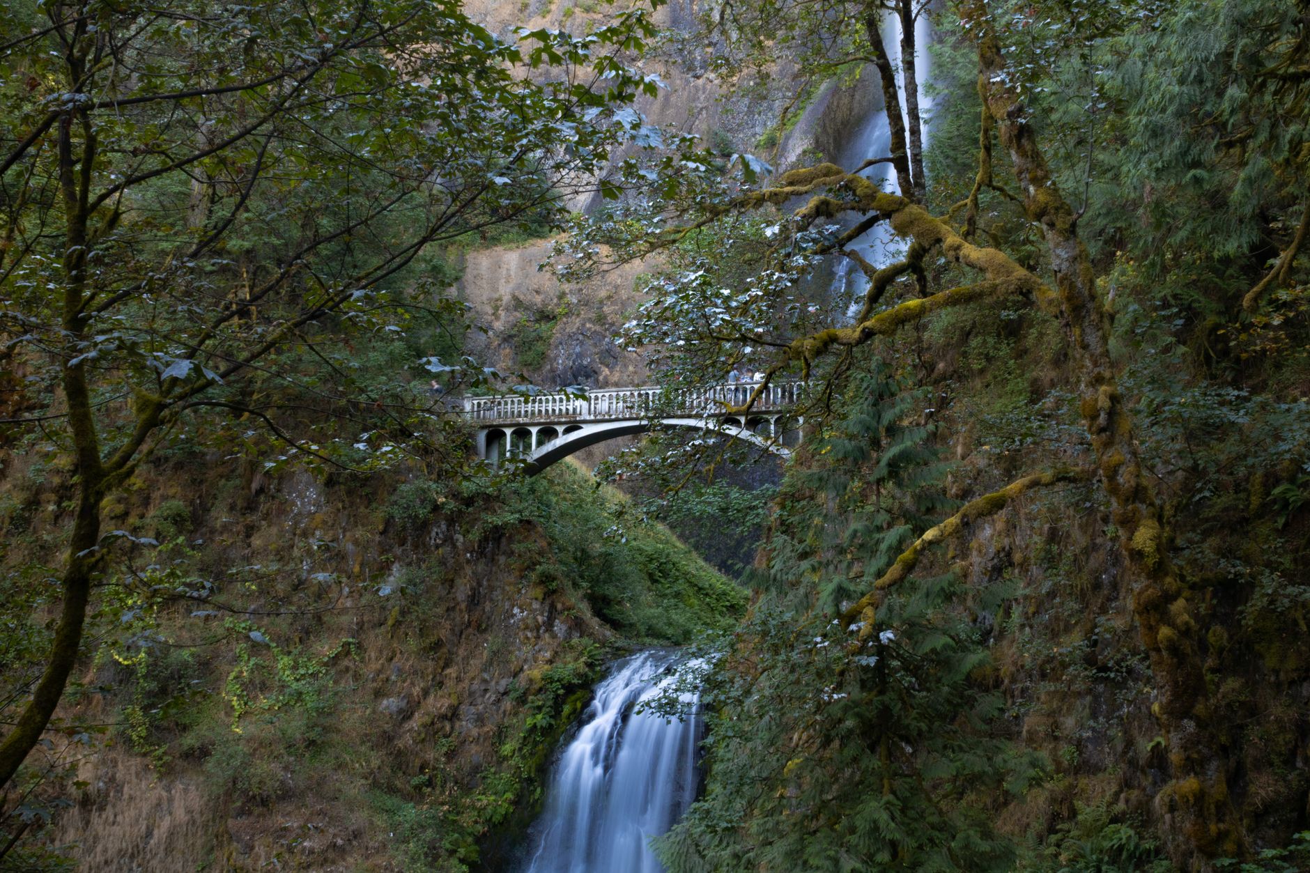
Forty minutes east there is the Columbia River Gorge, where a major river cuts through the Cascade Range and the walls on either side carry an extraordinary density of waterfalls.
One is your Tuesday evening. The other is your Saturday.
Forest Park
The scale is what surprises people. This is not a park with trails, it is a forest with a city beside it. The Wildwood Trail runs its full length at 30.2 miles with mileposts and forms the spine, and dozens of fire lanes and connector trails cross it, which means you can build a loop of almost any length, two miles or twenty, from most entry points.
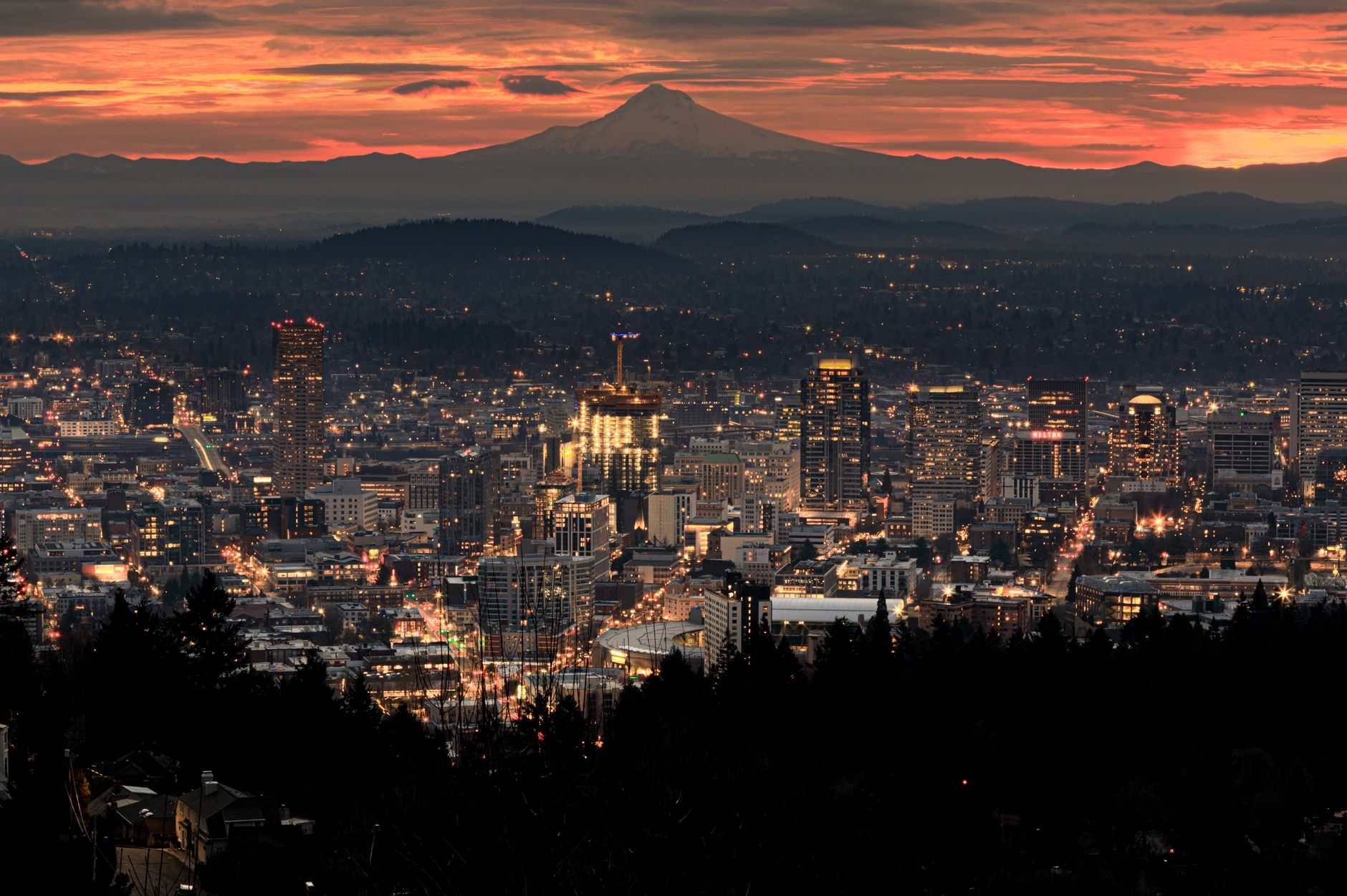
Three entries cover most of it. Lower Macleay Park in Northwest Portland follows Balch Creek up a ravine to the Stone House, a moss-covered 1930s stone shelter that looks like a ruin and is one of the city's best-loved landmarks, and from there you connect to Wildwood and can continue to Pittock Mansion for a view over the city with Mount Hood behind it. Washington Park is where Wildwood begins and also holds the Japanese Garden, the Rose Garden and the Hoyt Arboretum. And various fire lane trailheads off Northwest Skyline Boulevard serve the quieter northern end.
The forest is second-growth Douglas fir, western hemlock and red cedar, with sword fern and moss throughout. It is dark, damp and green nine months a year, and it goes quiet a surprisingly short distance in.
The Gorge
The Columbia River Gorge is the other half of Portland hiking and it is a completely different landscape: basalt cliffs, waterfalls, and steep trails climbing hard from near sea level.
Angel's Rest is the closest of the classics at 4.8 miles round trip with 1,500 feet of gain to an exposed rocky promontory with a view straight up and down the river, and it is one of the most popular hikes in the Gorge with parking that fills early. Beyond it lie Multnomah Falls, Wahkeena, Latourell, Horsetail, Oneonta Gorge and Eagle Creek, along with harder climbs like Dog Mountain and Table Mountain.
Two things need understanding before you drive out. The first is the 2017 Eagle Creek Fire, which burned a large part of the Oregon side of the Gorge, and recovery has been slow, with some trails still closed or altered years later and hazard trees and rockfall an ongoing concern. Check current trail status with the Forest Service, because a guidebook or an old blog post is not reliable here.
The second is that permits and passes are confusing. Angel's Rest parking requires the Oregon State Park Pass at $10 a day or $60 a year, while many other Gorge trailheads require a Northwest Forest Pass at $5 a day or $30 a year. Those are different agencies and different passes at trailheads a few miles apart, and some corridors have also operated timed-use permits in peak season. Parking fills fast in spring and summer, cars parked outside designated areas are cited and towed, and carpooling is recommended.
That combination, adjacent trailheads under different agencies plus closures that move year to year, is the case for checking a map rather than a memory. Guidepole Hike carries the managing agency, the pass it requires, and current closure status against each trailhead, which in this corridor answers both questions in one look.
Choosing between them
A rough rule works well here. Two hours, a weekday, or rain means Forest Park, because there is no drive, no parking problem, no pass, and the canopy makes rain pleasant rather than miserable. Half a day and reasonable weather means the Gorge, whether Angel's Rest or one of the waterfall trails. A full day means the Gorge's harder climbs, or Mount Hood. And wildflower season, roughly late April to early June, means the Gorge without question, because the eastern end in particular explodes.
The common error is driving to the Gorge on a wet Tuesday evening when Forest Park is fifteen minutes away and better in the rain.
The Wildwood Trail via Newberry Road in Portland's Forest ParkThe Wildwood Trail, end to end
This is worth treating as an objective in its own right rather than a corridor you happen to cross. The Wildwood runs 30.2 miles from the Vietnam Veterans Memorial in Washington Park at its southern end, north through Forest Park to Newberry Road, marked with mileposts every quarter mile, which makes it unusually easy to measure progress and plan sections.
People hike it in pieces, run it end to end in a day, or through-hike it using transit and rideshares at either end. Because the fire lanes cross it at intervals, almost any segment can be turned into a loop, which is the practical reason it sees so much use.
A good introduction is Washington Park to the Stone House, roughly five miles one way, taking in the Hoyt Arboretum, Pittock Mansion and the Balch Creek ravine, with transit at both ends so there is no car shuffle. The northern half is markedly quieter than the southern, because the southern end is where the attractions and the parking are.
How to Hike the Wildwood Trail in a Single DayEverything is ninety minutes away
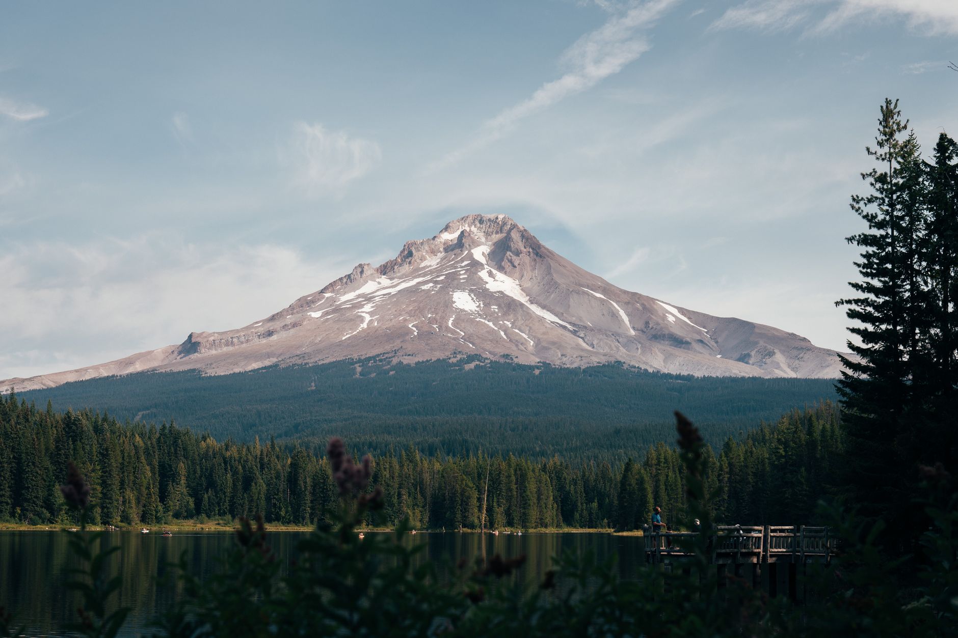
The two-halves framing undersells the city, because Portland sits within about ninety minutes of four distinct landscapes. The Gorge is forty minutes east, with its waterfalls and basalt. Mount Hood is about ninety minutes east and delivers alpine terrain, glaciers, the Timberline Trail's day-hikable sections, and the Mirror Lake and Tom Dick and Harry Mountain trails. The Oregon Coast is about ninety minutes west, giving headlands, tide pools and coastal forest at Ecola State Park and Oswald West. And the Coast Range is closer still, where Saddle Mountain rises abruptly out of forest for a short steep climb and a huge view.
Add the Willamette Valley to the south and the Mount St. Helens blast zone about two hours north, and the range of terrain reachable in a day from one mid-sized city is unusual in the United States.
Closer in, three more sit inside or near the city. Mount Tabor is an extinct volcanic cinder cone on the east side with a small network of trails, reservoirs and a good sunset view. Powell Butte is another in-city cinder cone with open meadows and Cascade views on a clear day. And Tryon Creek State Natural Area in the southwest is a ravine of second-growth forest and the only state park inside a major Oregon city.
The planning implication is that Portland rewards deciding what kind of landscape you want rather than which trail. Pick the direction first.
Forest Park's history, and why it is this big
A park of this scale inside a city does not happen by accident, and the reason here is partly that the land defeated everyone who tried to use it. The Tualatin Mountains, the West Hills that Forest Park occupies, are steep, unstable and prone to landslides. Nineteenth-century attempts to plat the hillside for housing and to build a scenic road along it failed repeatedly, tax-delinquent lots reverted to the city and county, and the terrain that made development impractical is what preserved the forest.
The park was formally dedicated in 1948 following decades of advocacy, on a plan influenced by the Olmsted Brothers' 1903 report on Portland's park system, which had recommended preserving the hillside forest. What you walk through today is largely second growth, since the area was logged and burned repeatedly, but it is old enough now to feel like forest rather than plantation and pockets of larger trees survive in the ravines.
It is also genuine habitat rather than ornamental green space. Elk have been recorded, the park is a significant corridor for birds, and the Balch Creek watershed supports a population of coastal cutthroat trout, which is an unusual thing to have running through a major city.
The gear
Portland hiking is wet forest close to town and a waterfall corridor an hour east, and the gear list is dominated by rain and by one plant.
Waterproof hiking shoes, because Forest Park is mud from October through May and the Gorge trails are wet year round from spray.
A rain shell, in a city with a nine-month wet season that is drizzle rather than downpour, which is exactly the condition that defeats a water-resistant jacket over three hours.
An Oregon State Park Pass or a Northwest Forest Pass depending on where you are going, since the Gorge trailheads are split between Forest Service, state park and Oregon Department of Transportation land and they want different things.
Trekking poles, for the Gorge, where every hike is a sustained climb up a basalt wall and a sustained descent back down it.
A headlamp, since Forest Park under a Douglas fir canopy in December is dark by four.
Poison oak awareness and a wash kit, which is the item people from wetter climates do not expect. Poison oak is common on the drier east end of the Gorge and on the sunny slopes, it is leafless and unrecognizable in winter, and a wash with a dedicated cleanser within a couple of hours does help.
And an air quality app, for the August and September smoke that now regularly closes the Gorge in.
What Portland hiking is like
It is wet. The rainy season runs roughly October to May and the trails are muddy for much of it, so waterproof footwear is not optional. It is also green year-round, because the conifer forest means winter hiking here does not feel dead the way deciduous forest does, which is the compensation for the mud.
The terrain is steep in the Gorge and gentle in Forest Park, and Gorge trails climb 1,500 to 3,000 feet from near sea level with little warning. The classics get crowded, with Multnomah Falls and Angel's Rest extremely busy on a sunny Saturday, and the quieter trails are usually two exits further along. Poison oak is present in the Gorge, particularly at the drier eastern end. Wildfire smoke affects the city in August and September in bad years, and the Gorge is a natural funnel for it. And I-84 is the Gorge's artery, with traffic worst on summer weekend afternoons heading back to the city.
Forest Park needs no pass or fee and is served by city transit at several points, while Gorge trailheads need a pass that depends on the agency. Dogs are allowed on leash in Forest Park and on most Gorge trails.
A car-free hiking day
Portland is one of the better American cities for hiking without a car, and it is worth spelling out. Washington Park has its own MAX light rail station, one of the deepest transit stations in North America, and it puts you directly at the southern terminus of the Wildwood Trail, the Hoyt Arboretum and the Japanese Garden. Lower Macleay is a short walk or bus ride from Northwest 23rd Avenue, and Mount Tabor and Powell Butte are both served by bus on the east side.
The Gorge is harder car-free, though seasonal shuttle services have operated in the corridor at times, so check what is running before assuming.
The Tuesday and the Saturday
Use Forest Park far more than you do, because it is 5,200 acres with a 30-mile trail through it and it asks nothing of you. Save the Gorge for weekends and good weather, check trail status because of the fire, and buy the right pass for the specific trailhead rather than the one you bought last time.
And on the wet gray Tuesday when you cannot face the drive, remember that Balch Creek to the Stone House in the rain is one of the better things about living here.
Oregon's marquee multi-day route circles the mountain you can see from the West Hills: the Timberline Trail. Its most accessible big summit is three hours south: South Sister. And on the August air: hiking in wildfire smoke.
The waterfall loop that most visitors do is in the Multnomah and Wahkeena loop. The volcano an hour east is in the Timberline Trail on Mount Hood, the drier half of the state is in Bend Oregon day hikes, and the coast is in Oregon coast hiking. The birding version of the same city is in birding Portland.
A last note on Forest Park's scale, since the claim gets stated loosely. It is frequently called the largest urban forest reserve in the country, and depending on how you define urban and reserve there are larger candidates, but the useful fact is not the ranking. It is that a continuous forested corridor runs more than seven miles along a ridge inside the city limits, holds elk sign and a resident population of pileated woodpeckers, and can be entered from a bus stop. Very few American cities have anything comparable, and it exists because the slope was too steep and too unstable to build on.