Fish
Fish Fire
Fire Hike
Hike Bird
Bird

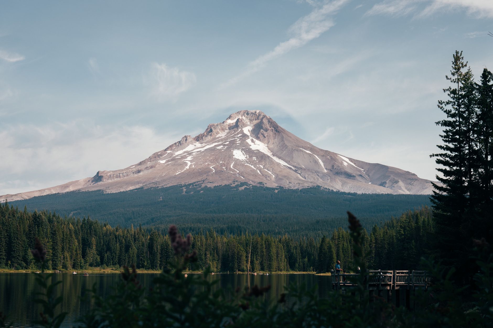

There are not many trails that go all the way around a mountain, and fewer still where the mountain is a glaciated stratovolcano and the loop is walkable in three or four days.
The Timberline Trail circles Mount Hood in 41.5 miles with roughly 10,000 feet of elevation gain and the same again in loss. It was built by the Civilian Conservation Corps in the 1930s, it starts and finishes at Timberline Lodge, and it is one of the great backpacking loops in the United States.
It is also, in one specific place, dangerous, and that place is not where people expect.
The Eliot Branch
Mount Hood is ringed by glaciers, and glaciers produce rivers. Those rivers cross the Timberline Trail. Most of them are manageable. One is not.
The Eliot Branch of the Middle Fork Hood River drains the Eliot Glacier on the mountain's north side, and in 2006 a large washout destroyed the established crossing. The trail was rerouted to cross downstream of the old point, a reroute the Forest Service completed in 2016, with the new crossing beginning around mile 23.8 at about 6,000 feet. There is no bridge and there has not been one for years, so you cross a glacial river on foot, in a steep-sided canyon, on unstable ground, and the character of that crossing changes with the season, the time of day and the year.
Glacial rivers differ from ordinary creeks in four ways that all matter here. They rise through the day, because melt increases as the sun works on the ice, so a crossing that is ankle-deep at 8am can be thigh-deep and pushy by mid-afternoon, which makes "cross glacial rivers in the morning" the single most useful sentence in this article. The water is opaque, since rock flour makes it impossible to see the bottom, so you cannot read depth or footing visually and must probe with a pole. It is painfully cold straight off the ice, which degrades balance and decision-making fast. And the banks move, because the canyon is actively eroding and the route down and up shifts year to year, so cairns and boot paths are not reliable.
Parties turn back here. That is a legitimate outcome rather than a failure, and it is why you should know about the Eliot before you commit rather than at mile 23.8.
How to Backpack the Timberline Trail Around Mount HoodThe other rivers
The Eliot gets the attention, but it is not the only ford, and treating it as the single obstacle is how people get caught out elsewhere. The loop crosses several glacier-fed streams and the list of which ones are difficult changes, because the Sandy River, the Muddy Fork, Coe Branch and Newton Creek have all been serious at various times depending on recent washouts, snowpack and where the channel has moved to. In a big melt year an ordinary crossing becomes a genuine one.
The general rules apply to all of them. Cross in the morning. Unbuckle your hip belt so you can shed the pack if you go in. Face upstream and shuffle rather than stepping over. Use poles as a third and fourth point of contact. And cross where the river is wide and shallow rather than narrow and fast, even if it means walking a few hundred yards to find it.
Read recent trip reports specifically for river conditions rather than trail conditions generally, because a report from three weeks ago about the Eliot is far more useful than a guidebook from three years ago.
The permit situation, which is refreshingly simple
After the Enchantments and Half Dome, this is a relief. Permits are free and self-issued at the trailheads, or a short way down the trail at the wilderness boundary, with no lottery, no advance reservation and no fee. You fill in a form and carry it.
What you may need is parking, since trailhead parking in this area generally requires a Northwest Forest Pass or equivalent and the rules differ by trailhead. Confirm with the Mount Hood National Forest before you go. The absence of a permit lottery for a trail this good is unusual and worth appreciating.
How long it takes, and doing it in one push
Most parties take three to four days. Strong backpackers do it in three, and taking four makes it a considerably more pleasant trip while leaving margin for weather or a river that needs waiting out. Two days is the awkward option, being one very long day and one merely long one, and the camps do not fall neatly at halfway.
The 10,000 feet of gain is the number people underestimate. The trail does not contour neatly around the mountain, it drops into every drainage and climbs back out of it repeatedly, so you are effectively doing a series of steep ascents and descents rather than a level circuit, and the cumulative effect on day three is significant.
A growing number of people run the whole thing in a day, and it is worth being clear what that involves: 41.5 miles with 10,000 feet of gain, at altitude, with multiple glacial fords and route-finding at the washouts. Fast parties finish inside a day, but it is a serious mountain ultra rather than a long run, and the fords are the part that does not scale with fitness, because a river you can rock-hop at 7am is a different problem at 4pm on the mountain's daily melt cycle. If you attempt it, plan your direction so the Eliot falls early, start before dawn, carry more layers than a road ultra would suggest, and have a bail-out for each quadrant, since the trail meets roads at several points.
Most people start and finish at Timberline Lodge, which has parking, water and the psychological benefit of ending somewhere with food. Clockwise versus counterclockwise is debated: going clockwise puts the Eliot Branch on day three, by which point you have the trail's rhythm but also tired legs, while counterclockwise gets the Eliot done earlier, which some people prefer for exactly the reason that it might turn them around and it is better to know on day one. The practical argument for counterclockwise is that you reach the Eliot in the morning of an earlier day, which is when you want to cross it.
The Timberline Trail: The Eliot Branch CrossingWhat you walk through
The loop passes through more distinct landscapes than 41 miles has any right to. The south side, out of Timberline, is open volcanic sand and scree with enormous views, hot and exposed in midsummer. The west side drops into forest and reaches Ramona Falls at about mile 9.5, a wide fan of water over columnar basalt that is one of the most photographed places in Oregon and a popular camp.
The north side is the wild half, holding Elk Cove, Cairn Basin and the wildflower meadows that make late July and early August the season people aim for, and it also contains the Eliot. The east side is drier, quieter, and has the fewest people.
Throughout, you are circling a mountain that is always there, changing angle as you go, which is the particular pleasure of a loop around a single peak.
What the mountain is
Understanding Hood makes the loop better, because you spend three days looking at it from every angle. It is a stratovolcano, the highest point in Oregon at about 11,240 feet, and it is potentially active, being the Oregon volcano most likely to erupt in the assessment of the geologists who watch it. Its last significant eruptive period was in the decades around 1800, and fumaroles near the summit still vent.
It carries around a dozen named glaciers, and those are what make the loop what it is. The glaciers grind rock into flour, the flour makes the rivers gray and opaque, the rivers cut the canyons you drop into and climb out of all the way around, and the moraines and washouts you scramble across are the debris. The Eliot Glacier on the north side is the largest, and the Eliot Branch that gives the loop its crux drains straight off it.
So the trail's defining features, meaning 10,000 feet of gain in and out of drainages, unbridged fords and shifting washouts, are all one phenomenon. You are walking around an active volcano across the debris its ice is currently producing.
That is also why the route itself is not a stable object. The Eliot crossing moved after the 2006 washout, others have moved before it, and others will move again, which means a map drawn three years ago can be wrong about where the trail goes rather than merely about conditions on it. Guidepole Hike carries current route and access status against the trail, which on a loop that reroutes itself every few washouts is a different kind of check from the usual one.
Season
Late July through September is the window. Earlier and you are dealing with snow on the traverses and higher, more dangerous river crossings from peak melt, while later you risk early-season storms at 6,000 feet. Early August is the sweet spot for wildflowers on the north side, and September is drier, cooler and quieter with lower rivers, so the Eliot is at its most manageable late in the season, though the days are shorter.
Snowfields persist on the traverses well into summer in a heavy year, and a snow slope above a drop is its own hazard, so check recent trip reports rather than a calendar.
What it asks of you
Route-finding comes first, because the trail is generally clear but the river crossings and washouts are not, and the Eliot in particular requires you to work out your own line. Water management is the next, since there is abundant water but much of it is glacial silt that clogs filters fast, so carry a backup purification method and let silty water settle before filtering. Real navigation matters too, because signal is patchy to absent, so carry a downloaded map and know how to use it.
Beyond that it wants fitness for repeated climbs, meaning ten thousand feet across three days in and out of drainages with a pack, and a willingness to turn around, whether at the Eliot, in bad weather, or on a snow traverse you do not like.
Practically: camping is dispersed along most of the route with established sites at the obvious places, so follow Leave No Trace and current fire restrictions, which are frequently in force in late summer. Timberline Lodge is a genuine landmark and worth an hour at either end. Water sources are plentiful but check which are silty before planning a long dry stretch. The trail crosses the Pacific Crest Trail in places and shares tread with it on the south side, so you will meet thru-hikers in season. And wildfire smoke is a real factor in August and September in Oregon and can make a three-day trip unpleasant or unwise, so check air quality as well as weather.
The gear
Forty-one miles around a volcano with a dozen glacial stream crossings is a specific problem, and the gear list is built around water in two senses.
Trekking poles, which are safety equipment here rather than comfort equipment. Every glacial crossing on this loop is done on foot in moving water over loose rock, poles are what keep you upright, and the Eliot Branch is the one people talk about for a reason.
A water filter plus a chemical backup, because glacial streams carry rock flour that clogs filters fast, and a blocked filter on day two of a three-day loop is a genuine problem.
Sturdy shoes you accept getting soaked, since there is no keeping feet dry on this route and changing footwear at every crossing costs hours.
A downloaded offline map, because the Eliot Branch crossing in particular is not where the official trail shows it, the route moves year to year as the channel shifts, and there is no coverage.
An insulating layer and rain shell, for a route that circles an eleven-thousand-foot volcano at treeline.
A Northwest Forest Pass for the trailhead.
And bear canister or hanging system per current rules, which are worth checking rather than assuming, since the Forest Service has tightened food storage requirements on Mount Hood in recent years.
Doing part of it instead
The full loop is a commitment, and several sections work extremely well as out-and-backs or shorter overnights that get you the best of the trail without the Eliot.
Timberline Lodge to Paradise Park and back is a superb day hike on the south side, with open volcanic terrain, big views and meadows. Ramona Falls as a standalone is one of Oregon's classic short hikes, reached from the Sandy River trailhead rather than by walking nine miles from Timberline. Elk Cove on the north side is reachable from the Vista Ridge trailhead and delivers the wildflower meadows that make the north half famous, as a long day or an easy overnight. And Cairn Basin and McNeil Point similarly give you the north side's best scenery without committing to the full circuit.
If the Eliot is the thing stopping you, these are not consolation prizes. They are the highlights, accessed differently.
Three days walking around a volcano
Go late July to September. Pick up the free permit at the trailhead. Plan four days rather than three. Cross the Eliot Branch in the morning, probe with a pole, and accept that turning around there is a reasonable outcome.
Then spend three days walking around a volcano, which is a strange and excellent way to spend a week off.
Oregon's other great volcano hike is a day rather than a loop: South Sister. If you are basing in Portland, hiking Portland covers what is close to the city. And on smoke, which decides more Oregon trips than weather does: hiking in wildfire smoke.
The other Oregon volcano, with a route up rather than around, is in hiking South Sister. The town at the base of the Cascades is in Bend Oregon day hikes, and the nearest city is in hiking Portland. The Columbia Gorge walk an hour away is in the Multnomah and Wahkeena loop, and the comparable multi-day loop in Washington is described in the Enchantments permit lottery.