Fish
Fish Fire
Fire Hike
Hike Bird
Bird

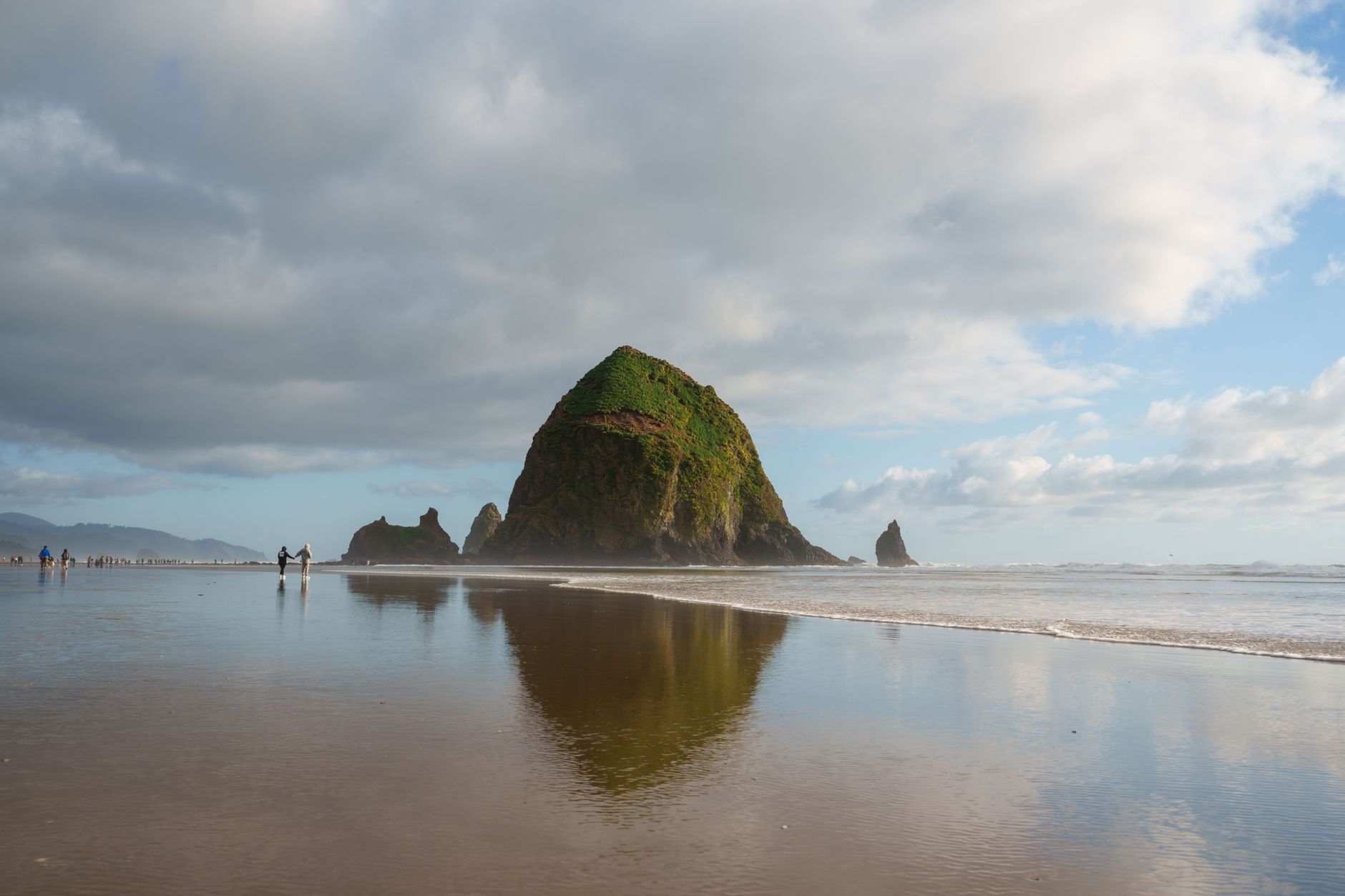

In 1967 Oregon passed what became known as the Beach Bill, establishing public ownership and access along the entire coastline. All 362 miles of it are public.
That single legal fact is why hiking here feels different from the coast of California or Washington. There is no private stretch to detour around, no gated community blocking the shore, no fifteen-mile section you cannot reach. You can walk the whole thing, and people do, because the Oregon Coast Trail runs the full length of the state.
What shapes a day out here is not access. It is the tide.
Every beach in Oregon is public
The history is worth knowing, because it was close. In 1913, Governor Oswald West had the entire Oregon shoreline declared a public highway, a legal maneuver that kept the beaches out of private hands at a moment when they could easily have gone the other way. In 1967, after a motel owner in Cannon Beach fenced off the dry sand in front of his property, the legislature passed the Beach Bill, which established a public recreational easement over the dry sand up to the vegetation line along the entire coast.
The result is that all 362 miles are open to you on foot. There is no private beach in Oregon, you can walk from the Columbia River to the California line without trespassing once, and the state park system maintains access points the length of it. That is why the Oregon Coast Trail exists at all, and why so much of it is beach.
It is also why the access question that dominates hiking almost everywhere else in the country, meaning who owns this and may I walk here, largely evaporates the moment your feet are on sand. Above the vegetation line it returns in full, because headland routes cross a mix of state park, county, federal and private timber land where the rules are entirely ordinary again. Guidepole Hike carries the ownership layer above the beach, which on this coast is a narrower question than usual and therefore an easier one to get wrong: the sand is always yours, and the trail climbing off it may not be.
The tide is not optional
This is what separates people who enjoy the Oregon coast from people who get into trouble on it. Headlands that are passable at low water become impassable at high, and the sea does not negotiate. Silver Point, Humbug Point and Hug Point can be rounded at low tide in summer and not otherwise, and creek outlets that are an ankle-deep ford at low water are a swim at high.
Check a tide table before you leave rather than when you arrive, because there is frequently no signal at the trailhead. Plan around lower tides, and understand that the window is measured in hours rather than across the whole day. And never let a rising tide be behind you on a beach section between headlands, because getting cut off on this coast means climbing loose crumbling cliff or waiting somewhere unpleasant, and people die doing the former.
The corollary is that a beach section is often best walked in a specific direction at a specific hour, which is a constraint hiking rarely imposes anywhere else.
Headlands and beaches, and why the coast alternates
Oregon's coast alternates between two completely different experiences, and knowing which you are choosing matters. Headland trails climb through Sitka spruce and salal onto basalt promontories jutting into the Pacific, with cliff-edge viewpoints hundreds of feet above the water, and these are proper hikes with elevation, forest and mud. Beach walking is flat, open, exposed and governed entirely by the tide, which makes it easier physically and more demanding to plan.
The pattern of long beaches separated by abrupt rocky headlands is not random. The headlands are mostly basalt, and the remarkable part is where much of it came from: between roughly 16 and 15 million years ago, enormous flood basalt eruptions in eastern Oregon and Washington sent lava flows traveling hundreds of miles down the ancestral Columbia River valley and out to the coast, where they spread along the shoreline and in places burrowed into wet sediment. Neahkahnie Mountain, Cape Lookout, Cape Meares, Tillamook Head and Haystack Rock are all built from that rock.
Because basalt resists erosion far better than the surrounding sandstone and mudstone, the flows stand out as capes while the softer rock between them has been cut back into bays and filled with sand. Cape Perpetua further south is a different and older volcanic assemblage, which is why its rock behaves differently, and the churns, spouting horns and tide pools at Devils Churn and Thor's Well are carved into fractured basalt at a scale you can stand next to.
The practical version is that the capes are where the climbing, the views and the old growth are, and the beaches between them are where the flat walking is. Most good days combine the two, and the Oregon Coast Trail itself alternates constantly.
The best of the north coast
The stretch between Cannon Beach and Tillamook holds most of the marquee hiking. Ecola State Park, just north of Cannon Beach, gives cliff-top forest trail with views south to Haystack Rock and north to Tillamook Head, and the Clatsop Loop climbs through spruce to a viewpoint over the Tillamook Rock Lighthouse, standing on a sea stack a mile offshore and abandoned since 1957.
Oswald West State Park is the highlight of the coast for many people, one of the largest state parks on the coast, and it contains three things worth the drive on their own. Cape Falcon is a moderate walk of a few miles out to a headland with an enormous view up and down the coast, roughly 2 miles along the Coast Trail from Short Sand Beach. Neahkahnie Mountain, at 1,680 feet the highest point on this section of coast, is reached by a steep climb with the Pacific spread out below. And Short Sand Beach is a sheltered cove reached by a short walk through old-growth spruce, popular with surfers.
An 8-mile loop links Short Sand Beach, Devils Cauldron and Neahkahnie Mountain, and it is one of the best coastal days in the state.
Eight Great Day Hikes on the Oregon CoastCape Lookout and the central coast
Cape Lookout is the archetypal Oregon headland walk: a 2.5-mile trail through Sitka spruce forest running out along a narrow promontory to its tip, with the ocean on both sides and drops of several hundred feet. From the end you look south to Cape Kiwanda and Cascade Head, and north to Cape Meares and Three Arch Rocks National Wildlife Refuge, and in spring and winter it is one of the better land-based whale watching spots on the coast as gray whales pass close on migration.
The trail is often muddy, because this is a rainforest headland, and the cliff edges are unfenced and undercut in places. Cascade Head further south is a rare coastal prairie with a trail climbing to open grassland above the Salmon River estuary, and sections close seasonally to protect a threatened butterfly, so check before going.
What to expect underfoot and overhead
Mud comes first, because the headland trails run through temperate rainforest and hold water for most of the year, which makes waterproof footwear a requirement rather than a preference. Wind is the next, since exposed headlands catch the full Pacific and it can be difficult to stand on an edge in a winter gale. Fog arrives frequently and fast.
Two hazards deserve more than a line. The cliffs are unfenced and frequently undercut and crumbling, because the basalt here erodes and the ground at the lip of a headland is not always as solid as it looks, so stay back from edges. And sneaker waves are what this coast is notorious for: an unexpectedly large wave arriving well up a beach that looked safe, capable of knocking people down and dragging them out. Never turn your back on the ocean, do not climb on driftwood at the water line, and keep well up the beach in high surf. These kill people on this coast every year.
Cape Lookout Hike Guide, Tillamook, OregonThe Oregon Coast Trail itself
This is worth knowing about even if you only day hike. The OCT runs roughly 400 miles from the Columbia River to the California border and it is a genuine long-distance trail, though an unusual one, because substantial sections are on the beach, some are on road, and several require tide timing or a boat to cross river mouths.
People thru-hike it, typically north to south with the prevailing wind at their back, over four to six weeks. For day hikers, the practical value is that the OCT connects almost everything, so most of the hikes above are sections of it, and the trail's own resources are the best source for tide-dependent crossings.
The gear
Coastal hiking in Oregon is a tide problem wrapped in a rain problem, and the first two items on this list are the ones that matter.
A tide table, printed or downloaded, corrected for the stretch you are walking. This is not optional equipment on this coast. Several of the classic beach sections and every headland traverse around a point are passable at low water and not at high, and people are caught by this every year.
Waterproof boots rather than trail runners, because the crossings are creeks and wet sand and the walking is long. Wet feet on a fifty-degree coast for six hours is a different proposition from wet feet in the Sierra.
A hardshell jacket, since this is the wettest coastline in the contiguous states and the rain arrives sideways.
Gaiters, for sand and for the wet salal on the headland trails, which soaks trousers to the knee within a hundred yards.
Binoculars, which belong on a coastal hiking list here as much as on a birding one. Gray whales pass close inshore twice a year, the offshore rocks hold seabird colonies, and the headlands are the vantage points.
An Oregon State Parks day-use pass, since most of the trailheads on this coast are state park.
And a dry bag, for the electronics, because the spray and the rain will find them.
Seasons
Summer is driest and busiest, with the most reliable beach walking and the least mud, and it is also when the coast is foggiest in the mornings. Autumn is excellent, bringing fewer people, dramatic skies, and trails not yet at their muddiest.
Winter is the storm-watching season and it is worth doing, with enormous surf, wild skies and empty trails, though it is also the wettest and windiest and the time when sneaker waves and cliff erosion are most dangerous. Spring brings wildflowers on the headlands, gray whale migration and improving weather. Whale watching itself peaks during the migrations in roughly December to January and March to April, with a resident population off the coast through summer.
Passes, dogs, and practical notes
Oregon's state parks along this coast are unusually good and unusually cheap, and several of the best headland trails start from day-use areas that charge nothing at all. Where a fee does apply, an annual Oregon State Parks pass pays for itself in about four visits and is valid at every park on the coast. Some coastal trailheads need a Northwest Forest Pass instead, and the two are not interchangeable, which is the usual trap.
Dogs are widely allowed on leash including on most beaches, which is an unusual freedom compared with the national parks. Highway 101 is the spine and everything comes off it. Fog and rain make navigation harder on headland trails than the distances suggest, and cell signal is patchy and absent on many headlands. Camping is plentiful in the state parks along the coast and it books up in summer.
Check the tide before the weather
Check a tide table before you check the forecast, because the tide decides which sections are walkable and the weather only decides how pleasant they will be. Pick a headland for a proper hike and a beach for a flat one, and combine them if the tide allows.
Go to Oswald West if you only have one day, because Cape Falcon and Neahkahnie between them cover everything this coast does well. Wear boots you do not mind soaking, stay back from unfenced edges, and never turn your back on the water.
And take a moment to appreciate that the whole 362 miles belongs to everyone, which is not true of any other coastline in the American West.
Portland is about ninety minutes east and its own hiking is covered in hiking Portland. Inland, Oregon's high country is a different world entirely: Bend's trail menu and South Sister.
The reason every beach here is legally yours to walk is worth understanding properly, and the general version of that argument is in public tidelands and private beaches and the ordinary high water mark. The tide arithmetic is the same one used in minus tides for clamming. The inland half of the state is in Bend Oregon day hikes, and the city nearest this coast is in hiking Portland.