Fish
Fish Fire
Fire Hike
Hike Bird
Bird

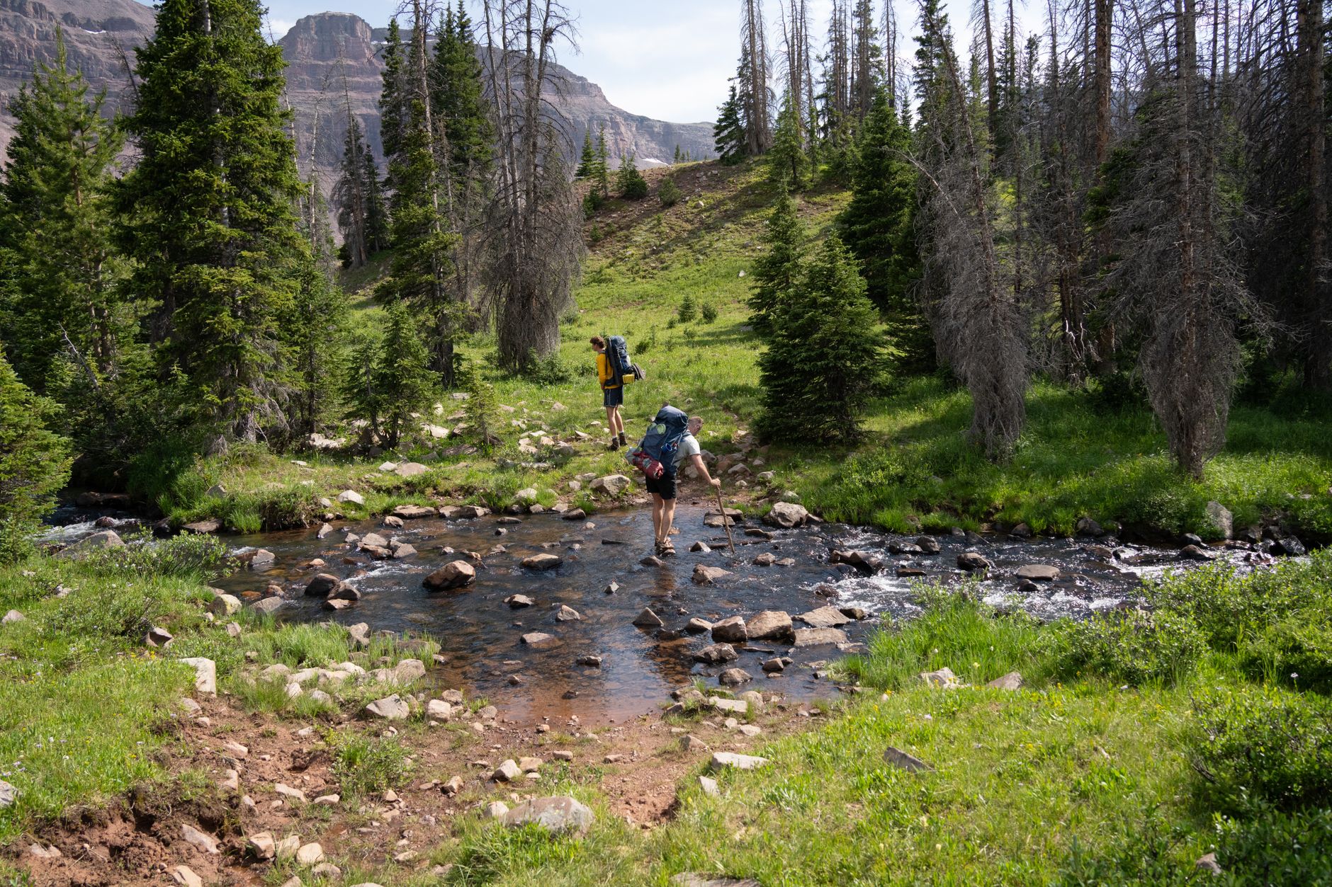

Hikers are cautious about heights and casual about water, and the risk runs the other way round.
A cliff edge announces itself. A creek looks like an inconvenience: you can see the far bank, it is obviously shallow, and the water is clear. Then you are standing in it, the force on your legs is far greater than expected, the rocks are moving under your feet, and you are three steps from the point where you cannot go back.
Drownings and swiftwater incidents are a consistent cause of death on American trails, and they overwhelmingly involve people who did not think they were doing anything dangerous.
Why moving water is stronger than it looks
The force water exerts scales with the square of its velocity, so double the speed and the force on your legs roughly quadruples. That is why depth is a poor guide on its own, and why knee-deep water moving quickly is more dangerous than waist-deep water barely moving. Most people judge a crossing by how far up their leg it comes, which is the wrong variable entirely.
A rough rule has served a long time: if the depth in feet multiplied by the speed in feet per second exceeds about ten, do not cross. Estimating speed is easier than it sounds, because you can throw a stick in and count how long it takes to travel a known distance.
The other thing people underestimate is cold. Snowmelt and glacial water sits a few degrees above freezing, so within a minute your feet are numb, within a few minutes your balance and decision-making are measurably degraded, and cold shock on immersion can take your breath entirely. None of that is visible from the bank.
Glacial rivers rise through the day
This is the single most useful piece of timing knowledge in mountain hiking and it is not obvious. A river fed by glacier or snowmelt is driven by the sun, so overnight the melt slows and the flow drops, then through the morning the sun works on the ice and the water rises, peaking in the late afternoon and evening. The same crossing can be ankle-deep at 8am and thigh-deep and pushy by 4pm.
The rule that follows is to cross glacial and snowmelt rivers in the morning. On the Timberline Trail around Mount Hood, on the Wonderland Trail, in the Sierra during the melt and anywhere in Alaska, this governs the shape of the day, so plan the route to put the serious crossing early rather than at the end of a long one when you are tired and the water is at its peak. It also means a crossing you made easily on the way out can be materially harder on the way back, which is a specific trap on out-and-back routes.
The places where this bites hardest are predictable. The Timberline Trail's Eliot Branch crossing turns back parties every season. The Sierra during the melt, roughly May to July, has creek crossings as the primary hazard on the John Muir Trail and its neighbors in a big snow year. The Wonderland Trail and Rainier's glacial drainages, Glacier and the Northern Rockies in early season, and Alaska generally, where glacial rivers are a routine part of travel rather than an event, all run on the same clock.
Choosing where to cross
Almost all the safety is in site selection, and it is worth walking a quarter mile to find a better one. Wide and shallow beats narrow and deep, because a river constricted between banks is moving faster and the narrow point that looks like an easy jump is usually the worst place to be in the water. Braided sections, where the flow splits into several channels, are the prize: crossing three easy channels is far better than one hard one.
The question that matters most is what lies downstream. If you are swept off your feet, where do you end up? A gravel bar and a slow pool is survivable, while a rapid, a logjam, a waterfall or a strainer is not, so never cross above a hazard. Beyond that, avoid the outside of bends where the current is fastest and the bank undercut, and treat log crossings with suspicion, because a wet log with no handline is a fall onto rock and people are injured on them regularly. Straddling and shuffling is undignified and far safer than walking.
One last check costs nothing. Look upstream and down for the trail's intended crossing, since trails usually cross where crossing is easiest, and if you are somewhere hard you may simply be off route.
Trail Smarts: Water CrossingsTechnique
-
Unbuckle your hip belt and sternum strap. This is non-negotiable, because if you go in the pack must come off instantly and a buckled pack full of water will hold you down. It is the single most important habit in this article.
-
Keep your boots on. Bare feet on unseen rock is how ankles break, and while wet boots are a nuisance, a broken ankle mid-river is an emergency. Carrying lightweight camp shoes or sandals to cross in is a reasonable compromise on a multi-day trip.
-
Face upstream and shuffle sideways, leaning slightly into the current. Do not cross facing downstream, and do not step over rocks, but slide your feet along the bottom so you always have two points of contact.
-
Use poles as a third and fourth leg. Plant firmly upstream, move one limb at a time, and keep three points of contact at all times. Poles are the difference between a manageable crossing and a swim.
-
Move steadily, because standing still in cold fast water while you deliberate is worse than committing to a line you have already chosen.
-
Cross one at a time unless you are using a group technique, so that a fall does not take the whole party.
Group techniques
For harder crossings, several people are stronger than one. The line abreast with arms linked, strongest person upstream breaking the current, is the standard approach, and everyone moves together on a count. The wedge or triangle, with one person upstream and two behind, works for three. What these share is a larger and more stable base than any individual presents, and what they require is coordination and communication over the noise of water, which needs agreeing before anyone steps in rather than shouted afterward.
Ropes are not a solution for people without swiftwater training. A rope across a river can drown someone by holding them in the current, and standard swiftwater training makes this point emphatically. If your plan involves a rope, you need the training that goes with it.
How to Cross a River SafelyWhen to walk away
-
You cannot see the bottom and cannot probe it. Opaque glacial water hides depth and footing entirely, which is why you probe with a pole.
-
The water is above mid-thigh and moving with any force.
-
You cannot hear someone shouting from the far bank, because if it is that loud it is moving fast.
-
There is a hazard downstream within swimming distance.
-
Anyone in the group is not confident. The weakest crossing is the one that defines the party.
-
It is late in the day on a snowmelt river. Camping and crossing at dawn is nearly always available and nearly always correct.
-
You would be crossing only to avoid backtracking. A long detour is cheap compared with the alternative.
Turning around at water is one of the more common good decisions in hiking and one of the least often taken, because the far bank is right there.
That last criterion deserves a practical note, since the detour is the thing you will actually be weighing on the bank. Whether a way round exists, and whether it is legal, depends on who owns the ground between you and the next bridge, and in the Northern Rockies and the Sierra foothills the parcel on the other side of a drainage is as likely to be private timberland or ranch as it is to be forest. Guidepole Hike carries the ownership layer under the terrain, which makes the alternative to a bad crossing something you can check rather than guess at.
What to do if you go in
Get the pack off if it is dragging you, which is the reason the buckles were undone. Then get on your back, feet downstream, toes up, which is the defensive swimming position: feet first means you hit obstacles with your legs rather than your head, and toes up keeps them from catching on the bottom, which is how foot entrapment happens.
Do not try to stand up in moving water. Standing is what causes foot entrapment and it drowns people in water they could have floated through. Swim aggressively for an eddy or the bank at an angle rather than directly across, and get warm immediately once out, because cold water incapacitates fast and someone who has been in a glacial river is on a clock even after they are on land.
The gear
Crossing moving water is mostly technique and judgment, but a few items change the odds meaningfully.
Trekking poles, which are the single most useful piece of equipment for this and function as two extra points of contact. Plant upstream, move one point at a time, and never have two feet and no pole in the water at once.
Lightweight camp shoes or sandals with a heel strap, because crossing barefoot is how people cut their feet on rock they cannot see, and crossing in boots means walking in wet boots afterward.
Dry bags for your sleeping bag and insulation, which is the difference between an unpleasant swim and a hypothermia problem. If your warm layers get wet in a fall, the crossing becomes the second problem.
Quick-dry trousers rather than anything cotton, since wet cotton in wind at elevation is a genuine hazard.
A spare warm layer kept dry and separate.
A watch, and a plan built around it, because glacial rivers run lowest in the early morning and highest in late afternoon. The same crossing at seven and at five is not the same crossing, and building the day around that is the most effective thing on this list.
And a satellite communicator, since the places where serious crossings happen are the places without coverage.
Snow bridges and the crossings you cannot see
This is a specific spring hazard worth separating out, because it does not look like a river crossing at all. In early season, creeks run under snow, the surface looks continuous and walkable, and the water beneath it is at peak melt flow. Punching through into moving water inside a snow tunnel is one of the worse situations available in mountain travel, since you are in cold fast water, under a lid, with limited options.
The signs are readable if you look for them: a depression or trough running down the slope, a change in snow color or texture along a line, the sound of water underfoot, and sagging or collapsed sections upstream and downstream of you. Handle it by crossing where the snow is thickest and the creek smallest, ideally where you can see solid ground on both banks, probing with a pole and spreading the party out so weight is not concentrated. Where the bridge is doubtful, look for a place to cross the creek itself instead, on rock or a log.
This is another argument for morning, because overnight refreeze strengthens bridges considerably and afternoon sun weakens them.
Desert washes and flash floods
A completely different version of the same hazard, and the one that surprises people most. In canyon and desert country a dry sandy wash can become a wall of moving water with no local warning at all, because the rain fell twenty or thirty miles upstream in a catchment you cannot see. Clear sky overhead is not information.
Check the regional forecast rather than the local one, and specifically look upstream of wherever you are walking. Avoid narrow slot canyons when rain is forecast anywhere in the drainage, since there is no high ground inside a slot, which is exactly what makes them lethal. Camp on benches above the wash and never in it, however convenient the flat sand looks. And if water rises, climb immediately, before working out whether it is necessary, because flash floods move faster than people expect and carry debris with them.
This is a rare hazard and a catastrophic one, and it is entirely avoidable with a forecast check.
Reading the water rather than the map
Judge speed rather than depth, and remember that force rises with the square of velocity. Cross glacial and snowmelt rivers in the morning, and plan the day so the hard one comes early. Walk to find a wide, braided site with nothing dangerous downstream. Then unbuckle everything, keep your boots on, face upstream, shuffle, and use poles as extra legs.
And be willing to walk away from a crossing you have hiked eight miles to reach, because the far bank being visible is not the same as it being reachable.
The route in this library where this is the defining problem is the Timberline Trail on Mount Hood, whose Eliot Branch crossing moves year to year. The season that produces the highest water is in shoulder season and snowline hiking. Finding a crossing you cannot see on a map is in navigation without signal, and the ranges where glacial rivers behave this way are covered in North Cascades day hikes and backpacking the Sawtooths.