Fish
Fish Fire
Fire Hike
Hike Bird
Bird


The North Cascades are the most alpine landscape in the lower 48 that almost nobody visits. The national park at their center is consistently among the least-visited in the country, and it sits three hours from a metro area of four million people.
The reason is not obscurity. It is a road.
Highway 20 is the whole story
The North Cascades Highway, State Route 20, is the only road through the heart of the range, and WSDOT closes it every winter. The closure typically runs from late November or early December through to a reopening by early May, though both ends move with the snowpack, and in the 2025 season it closed at 6:00 pm on Thursday, December 4.
When it is shut you cannot simply drive further and walk in. The gates go across well below the high country, and the trailheads at Rainy Pass and Washington Pass, which serve most of the hikes below, are on the wrong side of them, with the Rainy Lake and Heather-Maple Pass trailhead inaccessible for the duration.
So the practical North Cascades season for these hikes is roughly May through October, and the good season is shorter than that, because snow lingers on the high traverses well after the road opens. Late July through early October is the reliable window.
Check WSDOT's mountain pass reports before you commit to the drive, and note that forest roads run on their own separate closure timelines. The Cascade River Road that reaches the Cascade Pass trailhead opens and closes independently of Highway 20, so an open highway does not guarantee an open trailhead.
Heather-Maple Pass Loop
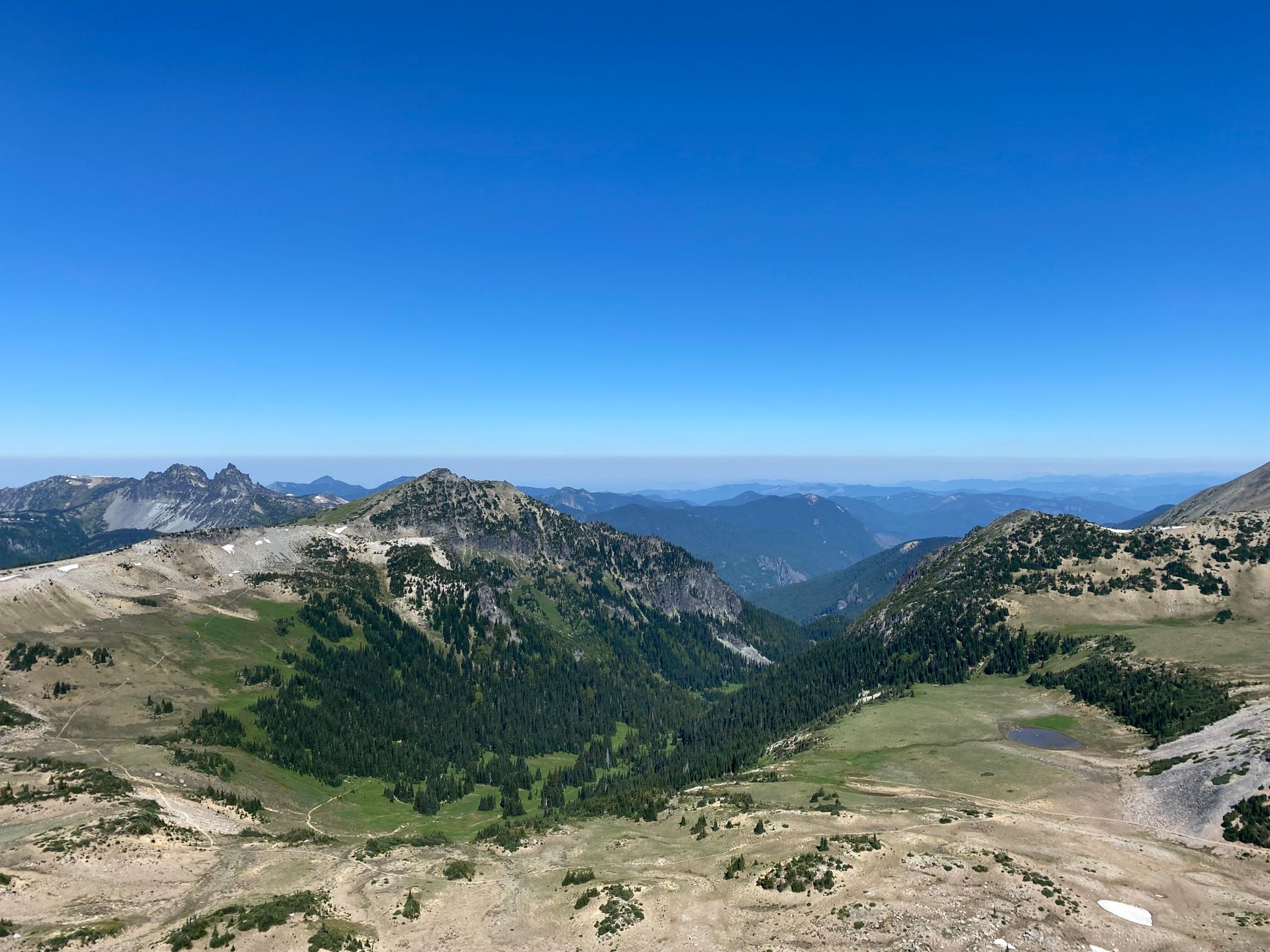
If you do one hike here, do this one. It is 7.2 miles round trip with 2,020 feet of gain, topping out at 6,650 feet, and it delivers more per mile than almost anything in Washington: a genuine loop rather than an out-and-back, a high ridge traverse with the range stacked up in every direction, and Lake Ann sitting in a cirque below you for most of the descent.
It is best walked counterclockwise, which gives you progressively bigger views of Black Peak and the national park as you climb rather than putting the best of it behind you.
In autumn it becomes something else again. The larches here turn gold in late September and early October, ringing the lakes, and the loop is one of the premier larch hikes in the state, which makes it extremely busy in that window. The trailhead is at Rainy Pass on Highway 20 and it needs a Northwest Forest Pass or an America the Beautiful pass.
Maple Pass Loop: Maybe the Best Day Hike in WashingtonBlue Lake
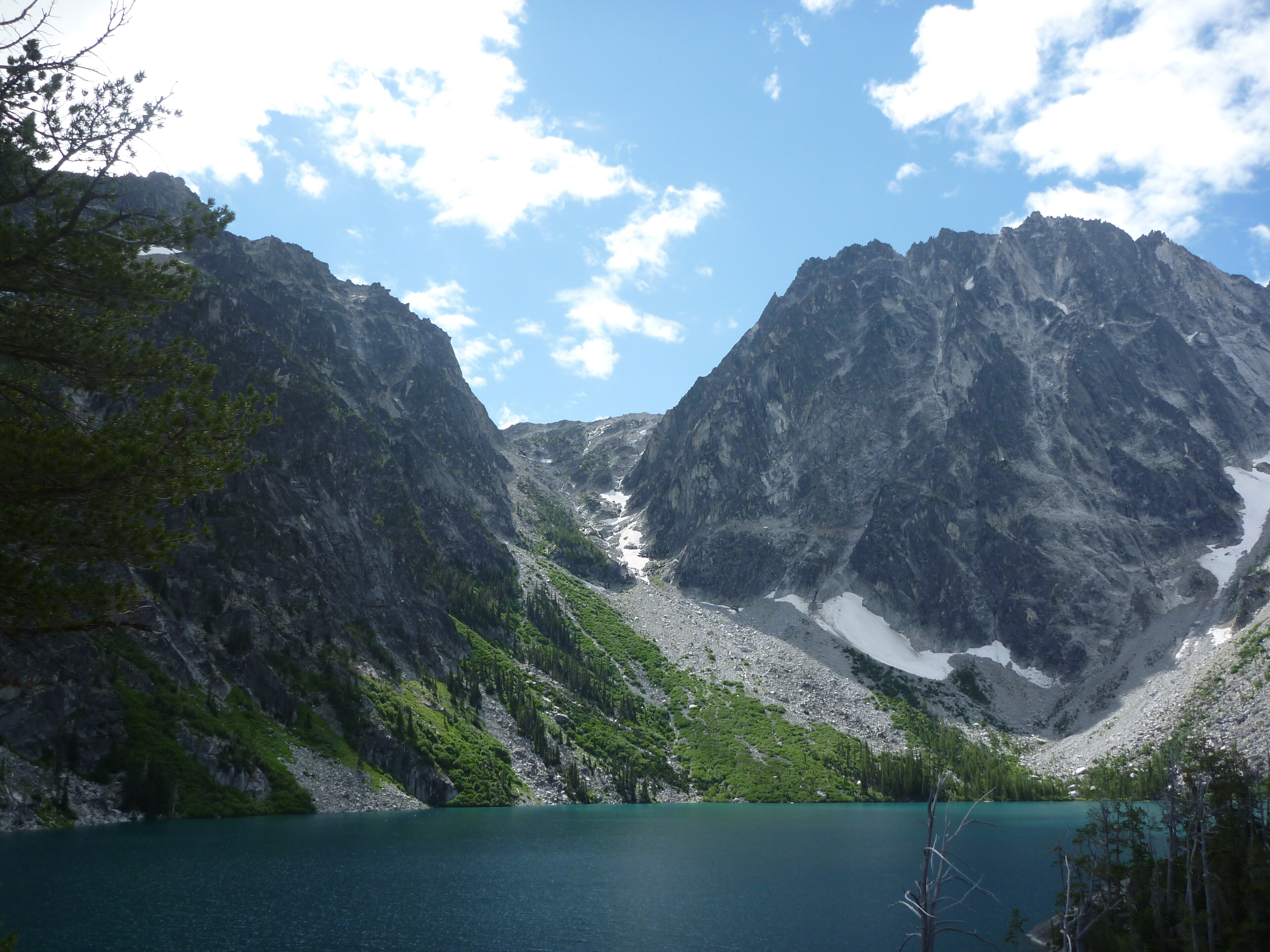
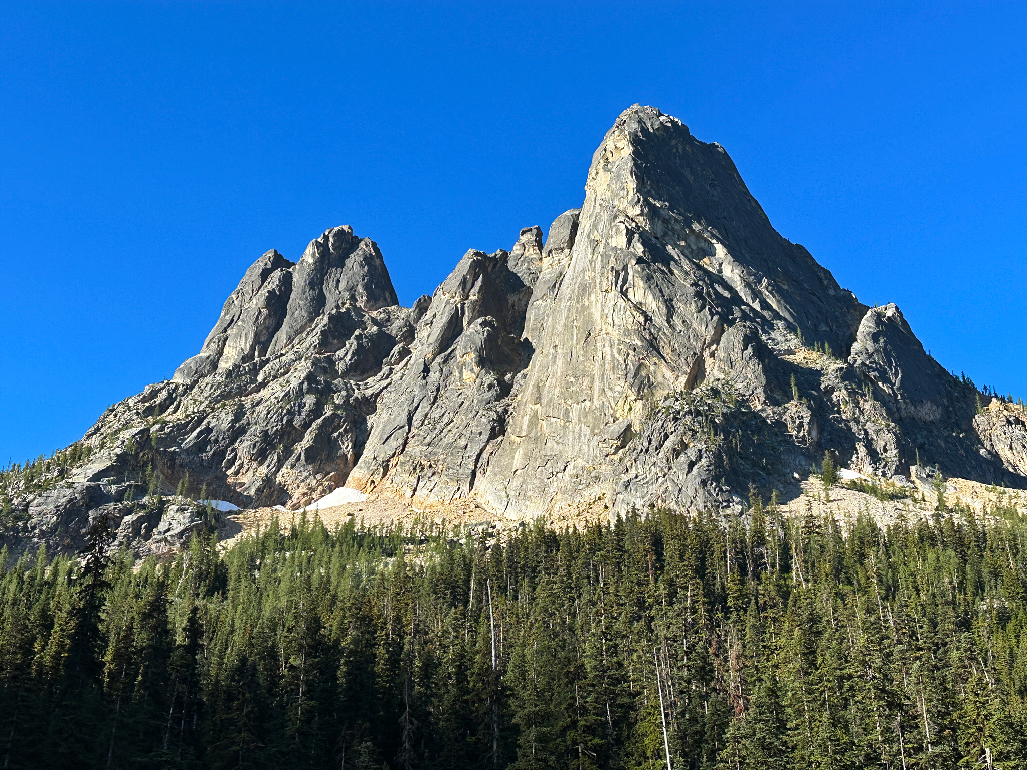
The short one, and a good use of a half day. Roughly 4.5 miles round trip with about 1,000 feet of gain to a green-blue lake sitting directly beneath the spires of Liberty Bell Mountain and Early Winters. It takes most people two and a half to three hours, which makes it the sensible option if you have driven up late, if the weather is marginal, or if you want a second hike after something bigger, and it holds larches in autumn too.
The trailhead is a couple of minutes from Washington Pass on Highway 20, and the Washington Pass Overlook a little further on is a two-minute walk from the car for one of the great roadside views in the state, with Liberty Bell rising straight out of the forest above the highway's hairpin.
Cascade Pass
The classic, and a different sort of day. Cascade Pass itself sits at 5,392 feet, reached by a well-graded switchbacking trail that climbs into a hanging valley ringed by glaciated peaks and hanging ice. What makes it distinctive is how quickly the landscape turns serious, because you are looking at active glaciers, avalanche paths and rock walls from a maintained trail without any scrambling. Strong parties continue up the Sahale Arm above the pass for a long, steep, exceptional extension into high terrain.
The complication is access. Cascade Pass is reached by the Cascade River Road out of Marblemount rather than from Highway 20 directly, and that road is long, rough in places, and on its own seasonal schedule. Check its status with North Cascades National Park before driving out, because it closes independently of the highway and has been shut for extended periods for repair.
The other trailheads on the highway
Maple Pass, Blue Lake and Cascade Pass get the attention, but Highway 20 is lined with options and the overflow matters on a busy weekend.
Rainy Lake shares the Maple Pass trailhead and is a paved, wheelchair-accessible mile to a lake beneath a waterfall. It is the rare North Cascades destination that asks almost nothing of you, and it is a good answer with small children, with someone who cannot manage 2,000 feet of climbing, or as a leg-stretch after the drive.
Hidden Lake Lookout is the serious one, a hard climb to a fire lookout perched on rock with a view across the park's core, reached by a rough forest road rather than the highway, so it carries the same access caveat as Cascade Pass. And Easy Pass is misleadingly named, being a steep sustained climb to a high saddle, which is why it is quieter than Maple Pass.
Park, forest, or wilderness: it changes the rules
One thing trips people up here: the land you are on switches repeatedly along Highway 20, and the rules switch with it. The corridor threads together North Cascades National Park, the Ross Lake National Recreation Area, the Okanogan-Wenatchee and Mount Baker-Snoqualmie National Forests, and several designated wilderness areas. Maple Pass and Blue Lake are national forest. Cascade Pass is national park. They look identical from the trail.
What changes is substantial. Dogs are generally allowed on leash on national forest trails and prohibited on most national park trails, backcountry camping permits work differently between the two, and the parking pass a trailhead wants depends on which agency runs it. A dog that is welcome at Blue Lake is not welcome at Cascade Pass, and nothing on the ground tells you where that line falls.
This is what Guidepole Hike is for on a corridor like this one: the managing agency, the pass it requires and its dog rules sit under each trailhead, so the question is answered before you have driven three hours to discover it.
North Cascades Short Hikes for a Half DayDiablo Lake and the western approach
Even if the high passes are shut, the western half of Highway 20 stays open year-round as far as Diablo, and it is worth knowing what that buys you.
Diablo Lake Overlook is a roadside stop with the most photographed view in the range, a reservoir of startling turquoise water ringed by steep forested peaks. The color is glacial flour, fine rock ground by ice and held in suspension, and it is at its most intense in mid to late summer when melt is at its peak.
Around it, Thunder Knob and the Diablo Lake Trail give genuine hiking at low elevation, snow-free far longer than anything at the passes. Thunder Knob in particular is a short forested climb to a viewpoint over the reservoir, and in November, when Maple Pass is unreachable and Rainy Pass is behind a gate, this stretch is still walkable.
The town of Newhalem, a company town built by Seattle City Light for the Skagit hydroelectric project, sits along here with short interpretive trails and a suspension bridge. It is a strange, tidy, functional place in the middle of enormous wilderness, and it is the last services heading east.
The gear
Highway 20 hiking means high trailheads, a short season, and a range that holds snow far later than the calendar suggests.
An annual Northwest Forest Pass, because almost every trailhead on the highway is Forest Service rather than national park and they are signed and checked. The annual pass costs about the same as four day passes and you will use it more than four times.
Kahtoola MICROspikes, which is the item that decides whether an early-season or late-season trip works. Maple Pass and Cascade Pass both hold hard snow across steep traverses into July and again from October, and a firm snow slope above a runout is where the accidents on these trails happen.
A hardshell rain jacket rather than a resistant one. The west side of this range receives enormous precipitation and the weather divide at Rainy Pass is abrupt: it can be raining hard at Diablo and clear at Washington Pass twenty minutes later, or the reverse.
Offline maps downloaded before you leave, since there is no coverage anywhere on the highway east of Marblemount.
A satellite communicator, which is a reasonable thing to carry here rather than an overreaction. This is a large wild range with no coverage and long response times.
Bear-aware food storage, because black bears work these basins hard in huckleberry season.
And trekking poles, for the sustained descent off Maple Pass, which is where knees fail.
Making the drive work, and the weather divide
From Seattle you are looking at roughly two and a half to three hours to the Rainy Pass and Washington Pass trailheads, depending on where you start and how bad I-5 is. That is a lot of driving for a day hike and it is why so many people do this range as an overnight, with the realistic options being camping along Highway 20, staying in Winthrop or Mazama on the east side, which puts you twenty minutes from Washington Pass and in genuine sunshine far more reliably than the west, or basing in Marblemount on the west side for Cascade Pass.
If you are committed to a day trip, leave Seattle at 5:00 am. You will be hiking by eight, off the trail by three, and home for dinner, which is a long day and worth it two or three times a year.
The crest also splits the weather in a way that changes plans. The west side around Marblemount and the Skagit valley is wet, green, heavily forested Pacific Northwest, while the east side past Washington Pass toward Winthrop is drier, sunnier and warmer, with ponderosa pine instead of hemlock. The practical upshot is that when the forecast in Seattle is grim, the east-side trailheads are frequently fine, and Maple Pass and Blue Lake both sit close enough to the crest to benefit. On a marginal weekend, driving through the murk expecting to turn around and then emerging into sun at Rainy Pass is a common and delightful North Cascades experience.
What this range asks of you
These are not casual trails, even the short ones. Snow persists, and steep snow on a traverse is a genuine hazard that lingers on the Maple Pass ridge into July in a big year, so early in the season you carry traction and know when to turn around. Weather moves fast, and you are high, exposed and a long way from the car on the loop hikes, which is why a shell and a warm layer belong in the pack in August.
There is no signal, with large stretches of Highway 20 carrying no service at all let alone the trails, so download maps and tell someone your plan. Bears are common, black bears rather than grizzlies, but common enough that food storage and noise are ordinary practice. And larch season is a crowd event, because late September and early October at Maple Pass means a full trailhead by 7:00 am, so go midweek or go early.
Check the road first, always
Then pick by ambition. Maple Pass if you want the best day in the range, Blue Lake if you want three hours and a lake under spires, Cascade Pass if you want glaciers and can confirm the Cascade River Road is open.
Go late July through early October. Leave early. Buy the right pass. Expect the east side to be sunnier than the forecast suggests. And if you get one clear weekend in larch season, spend it here rather than anywhere else in Washington.
Two hours south, the other great larch destination runs a permit lottery instead of a highway gate, the Enchantments. And because the passes here differ trailhead by trailhead, it is worth knowing how to check what a trail requires before you drive three hours to find out.
One more thing worth knowing if you are already making the drive: Marblemount, the town you pass through for Cascade Pass, is also the access point for one of the most storied steelhead rivers in the Pacific Northwest. Fly fishing the Skagit explains why it is both famous and famously difficult, and fly fishing the North Cascades covers the turquoise backcountry lakes you will be looking down at from Maple Pass.
The one-day version of this trip, and how to sequence it, is in one day in the North Cascades. The nearest city to stage from is covered in hiking Seattle, and the permit lottery for the range's most famous basin is in the Enchantments permit lottery. Understanding which agency's rules apply on a given trail is in dog-friendly trail rules by agency, and if you would rather stay over than drive it in a day, booking a site is covered in state park camping reservations.