Fish
Fish Fire
Fire Hike
Hike Bird
Bird


North Cascades National Park has more glaciers than any other unit in the lower 48: several hundred of them, roughly a third of all the glaciers in the contiguous United States and the most of any place outside Alaska.
It also receives a startlingly small number of recreation visits, routinely among the very lowest of any American national park, in a year when Great Smoky Mountains takes around 12 million.
That gap is not because nobody has heard of it. It is because of how the park is built.
Why almost nobody goes
There is essentially one road, and it does not go into the park so much as through a corridor between its two units, because Highway 20, the North Cascades Highway, runs east to west and is the only vehicle access to the heart of the range.
The park itself has almost no development. There is no lodge, no big visitor complex in the middle, no loop road with pull-outs, since the park proper is largely designated wilderness and reaching most of it requires walking. And the classic trails sit outside the park boundary in adjacent national forest, which confuses people who go looking for hikes inside the park itself.
The upshot for a one-day visit is that you are visiting a corridor, and picking one thing to do along it.
The drive is a significant part of the day
From Seattle it is roughly two and a half to three hours to the good trailheads and longer to the eastern end, and the drive itself is part of the experience, following the Skagit River through a canyon, past three reservoirs, and up into high country with Liberty Bell and the Early Winters Spires rising straight out of the forest at Washington Pass. Budget time for stopping.
The constraint that governs everything is the winter closure. WSDOT shuts Highway 20 from roughly late November or early December until it reopens by early May, with the 2025 closure beginning at 6pm on December 4, which is five months in which the interior is unreachable by car. Reopening lands somewhere between late April and June depending on avalanche work.
The section west of Diablo stays open year-round, and that matters, because it holds Newhalem, Gorge Creek and Diablo Lake and is reachable in December when the passes are gated. East of Diablo the road climbs to Rainy Pass and Washington Pass and shuts, and when it does, the eastern towns are a long way round through Stevens Pass or the Columbia. Check the state highway status before committing to a crossing in either shoulder season, because nothing else in this article matters until that gate is open. Guidepole Hike carries current road and trailhead access status against the routes, which on a corridor with exactly one way through is the first question rather than the last.
North Cascades National Park: Things to Do, Hiking and CampingThe single best thing to do with one day
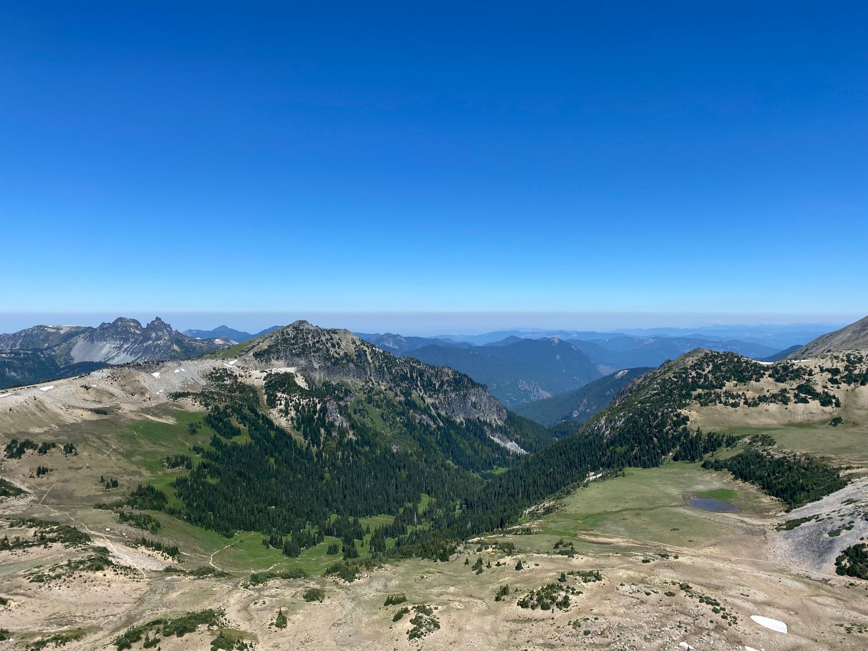
Maple Pass Loop, if the road is open. It is 7.2 miles round trip with 2,020 feet of gain, topping out at 6,650 feet, and it is a genuine loop rather than an out-and-back, climbing to a high ridge traverse with the range stacked up in every direction and Lake Ann sitting in a cirque below you for much of the descent.
Walk it counterclockwise, which gives progressively better views of Black Peak and the park as you climb rather than putting the best of it behind you. In late September and early October the larches turn gold and it becomes one of the premier hikes in Washington, and correspondingly one of the busiest. It leaves from Rainy Pass on Highway 20 and needs a Northwest Forest Pass or America the Beautiful pass.
The alternatives, by how much time you have
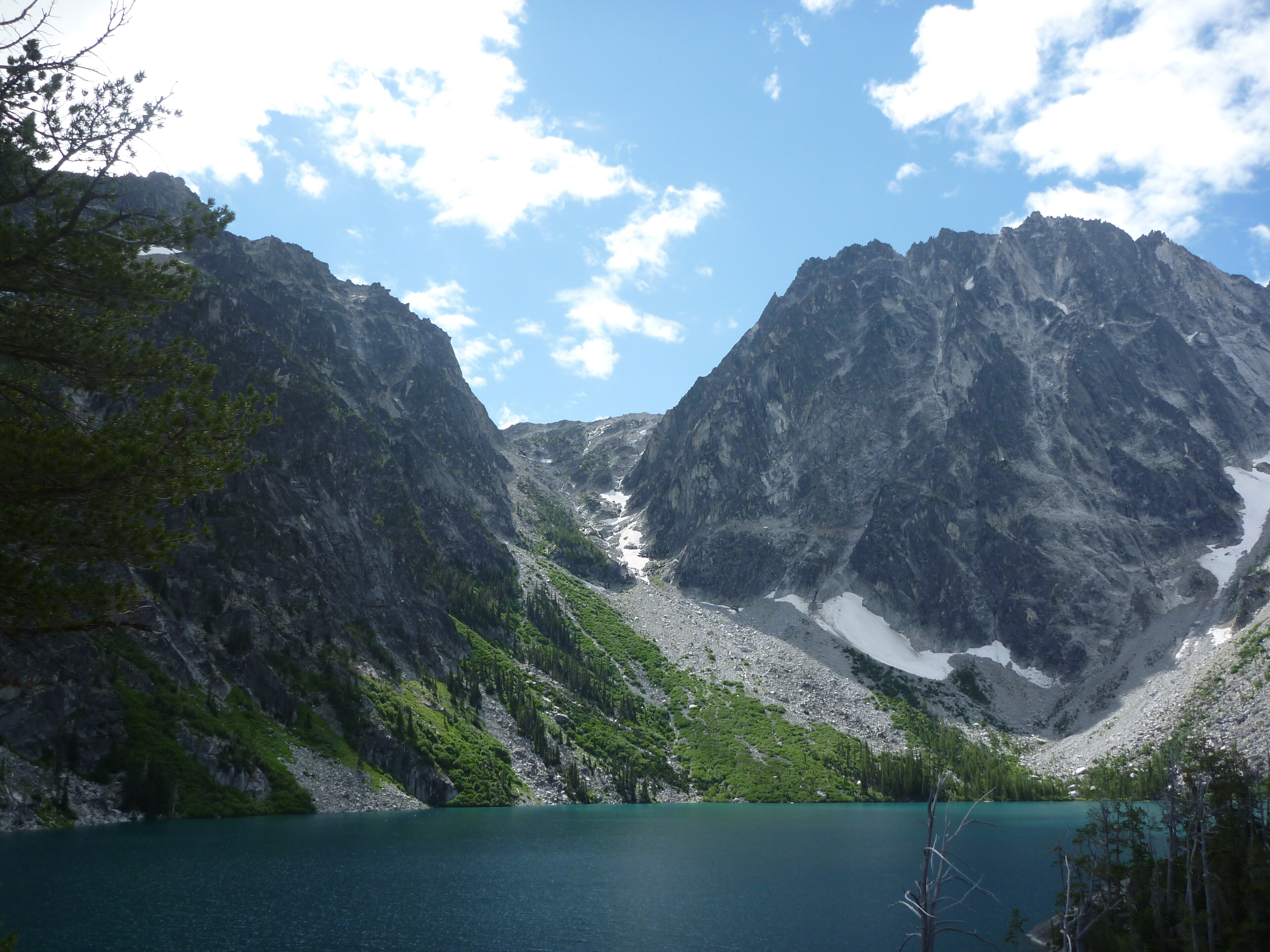
Two hours buys Rainy Lake, a paved wheelchair-accessible mile from the same trailhead as Maple Pass to a lake beneath a waterfall, and it is the rare North Cascades destination that asks nothing of you. Half a day buys Blue Lake, about 4.5 miles round trip and roughly 1,000 feet, two and a half to three hours, to a green-blue lake directly beneath the spires of Liberty Bell, minutes from Washington Pass. On the west side, half a day buys Thunder Knob instead, a short forested climb near Diablo Lake to a viewpoint over the reservoir, low enough to be open earlier and later in the season than anything at the passes and walkable in winter.
A full day buys Cascade Pass, the classic: a well-graded switchbacking climb to a 5,392-foot pass in a hanging valley ringed by glaciated peaks and hanging ice, with the steep Sahale Arm above it for strong parties. The catch is access, because it is reached by the Cascade River Road out of Marblemount, which is long, rough in places, and on its own seasonal schedule independent of Highway 20. Check its status with the park before driving out, since it has closed for extended periods for repair. A hard full day buys Hidden Lake Lookout, a steep climb to a fire lookout perched on rock with a view across the park's core, also via a rough forest road.
The ice is the point
The North Cascades hold something close to three hundred glaciers depending on how you count, roughly a third of all the glaciers in the lower 48 states and by far the greatest concentration outside Alaska. They are the reason the landscape looks the way it does, because the horns, the arêtes, the hanging valleys and the turquoise lakes all come from ice, and unlike most of the American West a great deal of that ice is still here and still working.
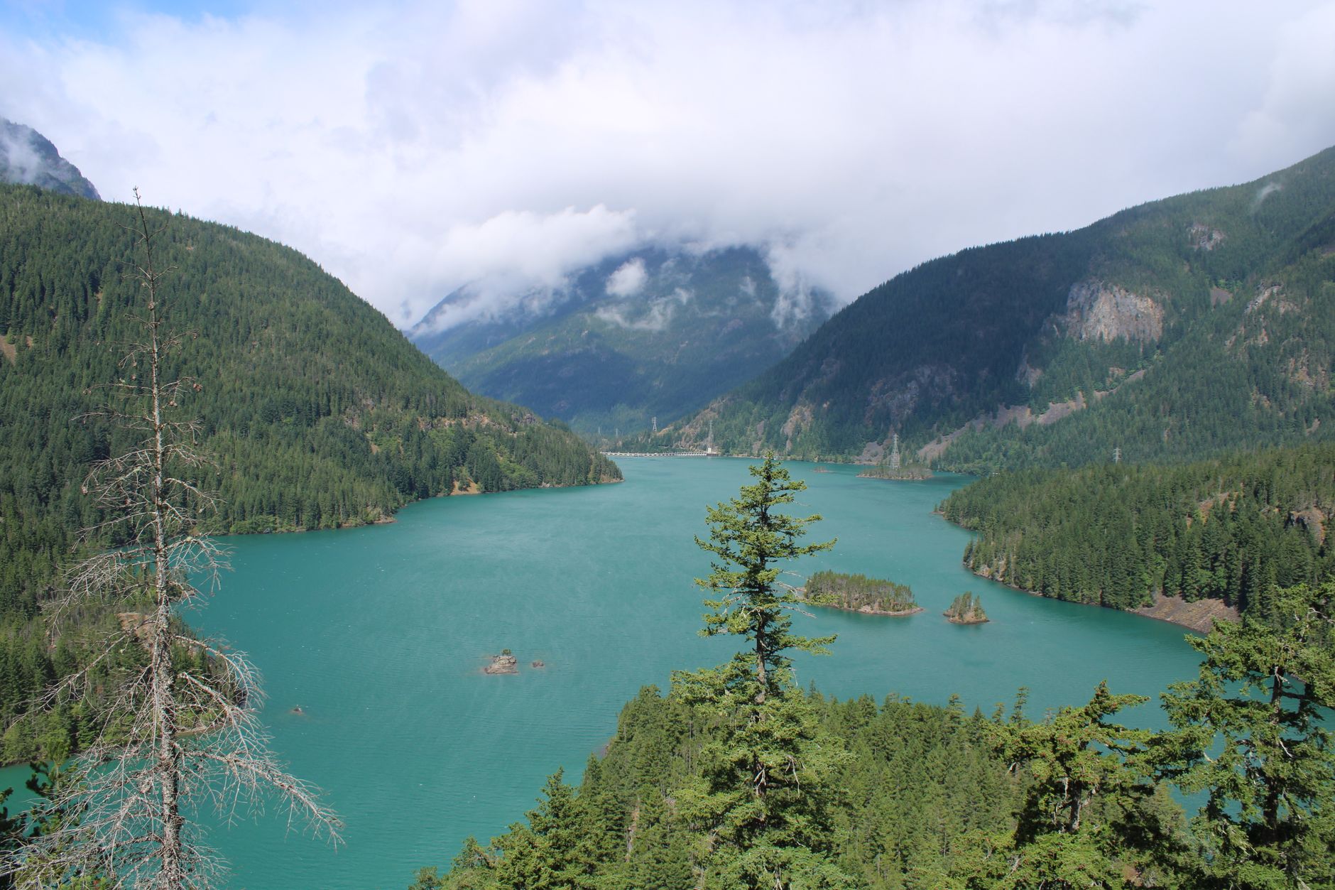
They are also the reason the water is that color, and if you do nothing else on Highway 20, stop at the Diablo Lake Overlook. The almost unreal turquoise is glacial flour, rock ground to powder beneath moving ice, carried down by meltwater and held in suspension so finely that it scatters light. It is at its most intense in late summer when melt is at its peak and it fades in winter, which makes the color a direct visual readout of what the glaciers above are doing. It is the most photographed view in the range and it costs you a parking lot. Washington Pass Overlook further east is the other one, a two-minute walk to Liberty Bell rising above the highway's hairpin.
The glaciers are retreating fast. The South Cascade Glacier has one of the longest continuous monitoring records of any glacier in North America, running since the 1950s, and the losses it documents are substantial, while several smaller glaciers in the range have disappeared entirely within living memory. Visitors comparing photographs at the overlooks with the view in front of them can see the difference without any instrumentation at all.
You will not walk on a glacier in a day hike here, because reaching them is mountaineering. But you will look at a lot of them, and the water you drink from every creek came off one.
Must-See Stops in North Cascades National ParkPark, forest, or wilderness: the rules change
This catches people out repeatedly. The corridor threads together North Cascades National Park, the Ross Lake National Recreation Area, the Okanogan-Wenatchee and Mount Baker-Snoqualmie National Forests, and several designated wilderness areas. Maple Pass and Blue Lake are national forest. Cascade Pass is national park. They look identical from the trail.
What changes is dogs, permits and money. Dogs are generally allowed on leash on national forest trails and prohibited on most national park trails, backcountry permits work differently between the agencies, and the parking pass a trailhead wants depends on which one runs it. The fee structure is the counterintuitive part: there is no entrance fee for North Cascades National Park itself, which is unusual and leads people to assume the whole corridor is free, while the forest trailheads, where most of the good hiking is, do require a pass. Check the managing agency for your specific trailhead rather than assuming the corridor is one jurisdiction.
The gear
The North Cascades is the least visited park in the contiguous states and the gear list reflects a place with almost no infrastructure in it.
A Northwest Forest Pass, because most of the trailheads on Highway 20 are Forest Service rather than park, and the distinction is invisible from the road but not from the windshield of a ranger's truck.
Kahtoola MICROspikes, since the high trailheads here hold snow later than anywhere else at this latitude and a firm snow traverse is the hazard on Maple Pass and Cascade Pass.
A hardshell rain jacket, for the west side, which is wet.
Offline maps, because there is no coverage on the highway east of Marblemount, which is most of the park.
Trekking poles, for the long descents.
Bear-aware food storage, since black bears work the huckleberry basins hard in late summer.
And a full tank of fuel, which is the item people do not think about and should. There is no fuel between Marblemount and Winthrop, which is roughly ninety miles of mountain highway with a pass in the middle, and the stations at either end keep short hours out of season.
Where to eat, sleep, and fill the tank
Services are thinner than people expect and worth planning around. Marblemount is the last real stop westbound, a small town with the wilderness information center, a gas station and a couple of places to eat, and you should fill up there, because the next fuel eastbound is Winthrop, roughly ninety miles and a mountain pass away.
Newhalem is a company town built by Seattle City Light for the dam workers, with a visitor center, a store and short interpretive trails but no lodging, and Diablo has the Skagit Tours facilities and the North Cascades Environmental Learning Center. Campgrounds along Highway 20 at Goodell Creek, Newhalem Creek and Colonial Creek are the main lodging inside the corridor, and Colonial Creek sits right on Diablo Lake.
Winthrop and Mazama, on the eastern side beyond Washington Pass, are proper tourist towns with restaurants and beds, in a completely different climate that is dry, sunny and often twenty degrees warmer. There is no food, fuel or lodging in the national park itself, which makes it one of the least developed national parks in the country, and that is exactly the appeal. Cell signal is absent across long stretches of Highway 20 and all of the trails.
Season
Late July to early October is the reliable window for the high trails, and snow lingers on the Maple Pass traverse into July in a heavy year, where steep snow on an exposed ridge is a genuine hazard rather than an inconvenience. Late September to early October is larch season and the best two weeks of the year, with full trailheads by 7am on weekends.
From May to July the road is open but the high country may not be, so check recent trip reports rather than a calendar. From November to April the passes are gated, though the west side to Diablo stays open and is worth a winter visit for the lake and the low trails.
Two things hold across the season. Weather changes fast and the loop hikes are high and exposed, so carry a shell in August. And the east side is drier and sunnier than the west, so a grim Seattle forecast frequently does not apply at Rainy Pass. Black bears are common, grizzlies are present in the ecosystem in very small numbers, and ordinary food storage and noise apply throughout.
Several hundred glaciers, three hours from four million people
Check Highway 20's status first, because nothing else matters until it is open. Drive out early, stop at Diablo Lake, and do Maple Pass Loop counterclockwise if you have the day for it, or Blue Lake if you do not.
Expect the drive to take longer than the map suggests because you will keep stopping, and expect the east side to be brighter than the forecast implied.
And take a moment at the overlook to register that you are looking at a park with several hundred glaciers in it that almost nobody visits, three hours from a city of four million.
For the wider corridor and the trails outside the park boundary, see North Cascades day hikes. Washington's other great park is a peninsula away, one day in Olympic, and city-side options are in hiking Seattle.
The trail-by-trail version of this is in North Cascades day hikes. The famous permit lottery on the range's eastern flank is in the Enchantments permit lottery, and the nearest city is in hiking Seattle. The other two Washington parks are in one day at Mount Rainier and one day in Olympic National Park.
A last note on why the park is so empty, because it is genuinely strange. The North Cascades holds roughly a third of all the glaciers in the lower forty-eight and sits three hours from four million people, and it receives fewer visitors in a year than the Great Smoky Mountains receives in a busy week. The reason is that the park proper has no lodge, no campground on the main highway, and almost no road frontage: Highway 20 mostly runs through the national recreation area and the national forest rather than the park itself. Most people who say they have been to the park have driven past it.