Fish
Fish Fire
Fire Hike
Hike Bird
Bird


Most national parks have a center. Olympic does not.
It has a glaciated mountain range in the middle with no road across it, ringed by Highway 101, and three entirely separate landscapes hanging off that ring: alpine meadows and ridgelines, temperate rainforest, and seventy-three miles of undeveloped Pacific coastline, the longest wild coast in the contiguous United States.
The full loop around the peninsula is roughly 330 miles and you cannot cut through the middle. Which means the single most important thing to understand about a one-day visit is that you are picking one of three parks, and the drive between any two of them is measured in hours.
The drive times that decide everything
From Port Angeles, the usual base on the north side, Hurricane Ridge is 45 minutes up a steep road climbing to nearly a mile, Lake Crescent is 30 minutes west along the highway, and the Sol Duc Valley is an hour and fifteen. The Hoh Rain Forest is further still, with the visitor center sitting 18 miles off Highway 101 down a dead-end road, which makes reaching it from Port Angeles a substantial drive. Down the coast, Forks to Kalaloch is around 40 minutes.
One warning is worth taking seriously: navigation apps consistently underestimate travel times here. They do not account for the summer traffic on 101, the detours down long spur roads to places like the Hoh and Sol Duc, or the construction that seems permanently underway somewhere on the loop. Add a margin to every estimate.
That gap between the map and the drive is the specific thing that ruins Olympic days, because a spur road you did not know was 18 miles long, or a Hurricane Ridge road closed by a storm, does not show up until you are committed to it. Guidepole Hike carries the spur roads and current access status alongside the trailheads they serve, which on a park built entirely out of dead-end approaches is worth more than a straight-line distance.
Option one: the alpine
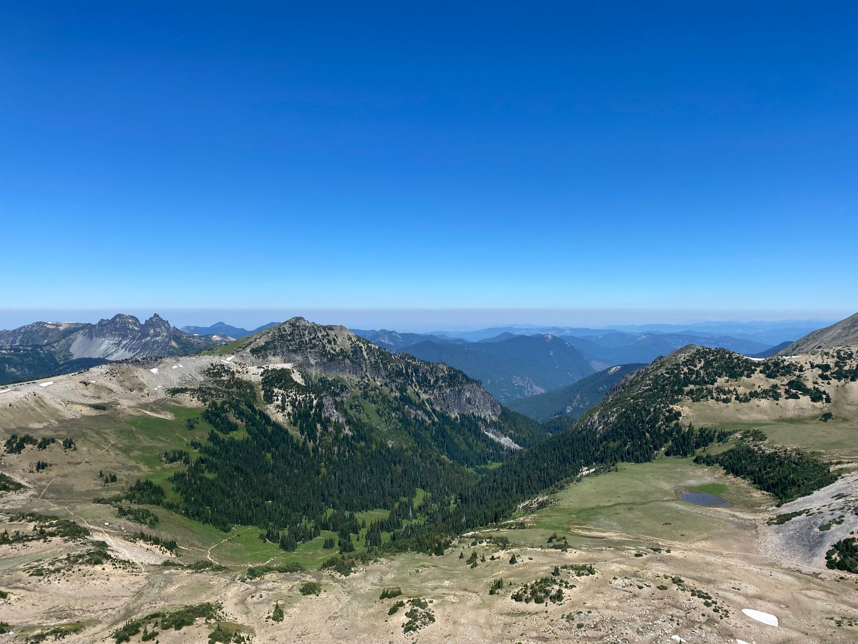
Hurricane Ridge is the accessible high country, reached by a paved road climbing from sea level at Port Angeles to about 5,200 feet in 17 miles. The payoff is immediate: subalpine meadow, wildflowers in season, black-tailed deer entirely unbothered by people, and a view south across the interior of the range to Mount Olympus and the glaciers most visitors never get near.
Hurricane Hill is the classic walk, a gently graded few miles round trip along a ridge with drop-offs on both sides and views in every direction, while the Meadow Loops near the visitor center are short and paved and Klahhane Ridge and Sunrise Point offer longer options.
This is the choice if you want mountains, big views, and the most park per hour of driving. It is also the busiest, and the parking fills completely in summer with waits of one to two hours at peak times. The road is seasonal in practice, closing in winter storms and historically having limited winter opening days, so check status before driving up.
Option two: the rainforest
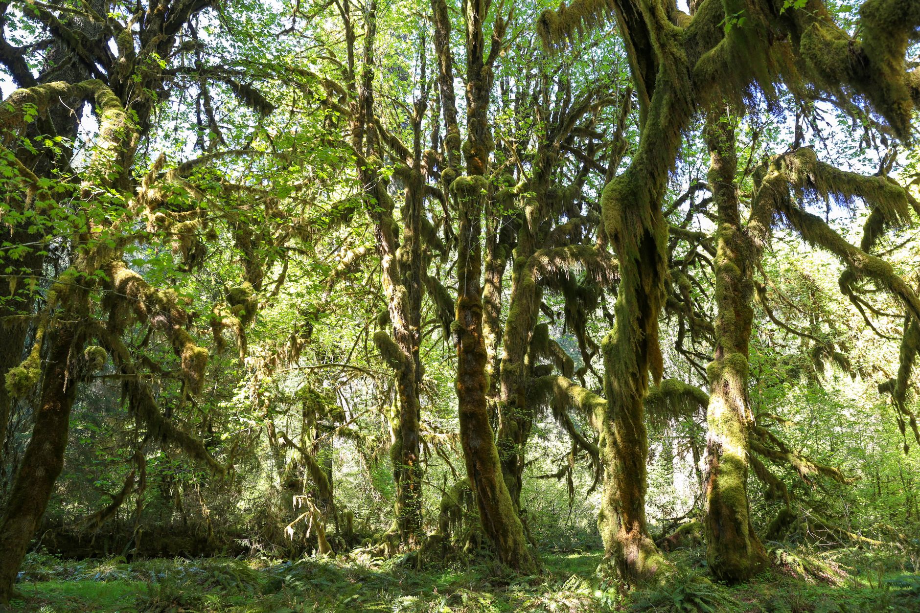
The Hoh is the one people picture: moss hanging in curtains from bigleaf maples, Sitka spruce and western hemlock at enormous scale, and a green so saturated it looks processed. It receives something in the order of twelve to fourteen feet of rain a year, which is what produces it, and this is a genuine temperate rainforest, one of the few in the world and unlike anything else in the lower 48.
The Hall of Mosses is a 0.8-mile loop and the single most photographed walk in the park, the Spruce Nature Trail is 1.2 miles and quieter, and the Hoh River Trail runs 17-plus miles up the valley toward Mount Olympus with even the first few miles excellent.
This is the choice if you want something you cannot see anywhere else. The cost is the drive, meaning that 18-mile spur off 101 each way, and parking that fills as reliably as Hurricane Ridge. If the Hoh is full, the Quinault rainforest to the south is a genuine alternative with a fraction of the traffic.
A One, Two or Three Day Olympic National Park ItineraryOption three: the coast
The least visited of the three and, for a lot of people, the best. Rialto Beach gives you sea stacks, drift logs the size of buses, and the Hole-in-the-Wall, a sea arch reachable at low tide about 1.5 miles up the beach. Ruby Beach further south is the classic photograph, and Second and Third Beach near La Push require short forest walks to reach and are correspondingly emptier.
What makes this coast different from most American coastline is that it is wild, with no development, no road running along it, forest coming right down to the drift line, and eagles overhead.
The tide governs everything. Headlands that are walkable at low water are impassable at high, people get cut off every year, so check a tide table before you go rather than after you arrive, and understand which headlands require a specific tide height. This is the choice if you want wildness, and it works in weather that ruins the other two.
Option four, if you want something different
There is a fourth choice that almost nobody makes, and on the right day it is the most interesting one. The Elwha valley, west of Port Angeles, is where what was, until the Klamath River project in 2024, the largest dam removal in United States history took place. Two dams, Elwha built in 1913 and Glines Canyon in 1927, blocked salmon from more than seventy miles of upstream habitat inside the park, neither had a fish ladder, and they came out between 2011 and 2014.
What you can walk to now is the Glines Canyon Spillway Overlook, looking down into the canyon where the dam stood with the abutments left deliberately in place, and the flats of the former Lake Mills, where alder and cottonwood have grown up across the old reservoir bed at a speed that is hard to believe. Madison Falls near the valley mouth is a few hundred yards and wheelchair-accessible.
Salmon are back above both dam sites. It is a short, easy, low-mileage day and it is the best thing on the peninsula to think about.
Coming from Seattle
The drive matters more than people expect, and there are two ways to do it. The ferry route, Seattle to Bainbridge Island then north and west on Highway 104, is roughly two and a half hours to Port Angeles once you are off the boat, with the sailing itself about thirty-five minutes. Foot passengers board easily while vehicles line up, and on summer weekends that line can be an hour or more, with the Edmonds to Kingston crossing the alternative from north Seattle.
Driving around through Tacoma and Olympia is roughly three hours to Port Angeles with no boat involved, and it is the reliable option when the ferry lines are bad or the sailings are canceled, which happens.
Either way, a one-day trip from Seattle to the Hoh is not realistic, because that is five hours of driving each way before you walk a step. Hurricane Ridge and Lake Crescent are the honest Seattle day trip, and the rainforest and the coast want an overnight.
Which to pick
Let the forecast decide. A clear forecast means Hurricane Ridge, because you get the views a cloudy day would deny you entirely. Gray or drizzling means the Hoh, since rainforest in rain is the correct experience and the light is better for it. Windy or dramatic weather means the coast, where storm-watching is a legitimate activity rather than a consolation.
Two other cases have clear answers. Arriving from Seattle for the day means Hurricane Ridge, honestly, because it is closest to the ferry routes and the only one that comfortably fits a day trip without most of it being spent in the car. And with children it means the coast or the Hoh, for the short walks, the immediate payoff and the absence of altitude.
Olympic National Park Must-Visit StopsThe mistake almost everyone makes
It is worth naming plainly, because it is the reason so many one-day Olympic trips end in frustration. People look at a map, see that the park is roughly sixty miles across, and plan to see the mountains in the morning and the rainforest in the afternoon. There is no road through the middle. The interior is roadless wilderness and every route in is a spur from Highway 101 running the perimeter, so Hurricane Ridge to the Hoh visitor center is about two and a half hours by car for a distance of twenty-five miles as the crow flies.
The second version of the same mistake is treating the coast as a quick add-on. Rialto and the La Push beaches are an hour and a half beyond Lake Crescent, and the walking there is on sand and cobble, which is far slower and more tiring than the mileage suggests.
Doing all three in a day is technically possible and it is not a good day, because it means roughly 250 to 300 miles of driving, perhaps twenty minutes at each stop, and arriving everywhere at the wrong time. Two is achievable if you start early and accept that one will be brief, and Hurricane Ridge in the morning with the coast in the late afternoon works reasonably since both sit in the northwest quadrant of the loop. But the peninsula rewards depth over coverage, and any one of the three landscapes is worth a full day on its own terms.
The gear
The difficulty of a single day at Olympic is that the park is three parks on a ring road, and the gear list has to cover whichever one you pick.
A rain shell, unconditionally. This is the wettest place in the contiguous United States and the rain is not seasonal in the way visitors expect.
A printed or downloaded tide table, if the coast is your choice. The headland crossings on this shoreline are passable at low water only, the alternative is a rope route over the point, and the tide is the difference between a walk and a rescue.
Waterproof footwear, for the rainforest mud and the wet beach cobble.
An America the Beautiful pass, since Olympic charges an entrance fee and it is collected.
Offline maps, because coverage on the peninsula is poor once you leave Port Angeles.
Layers for a five-thousand-foot range, which matters even on a single day: Hurricane Ridge in the morning and the Hoh in the afternoon is a twenty-degree swing and a change of climate.
And binoculars, for the Roosevelt elk in the river valleys, the marbled murrelets offshore, and the goats that used to be on the ridges and mostly are not any more.
Practical notes
There is an entrance fee, covered by America the Beautiful, and no timed-entry reservation system. Fuel up before you commit to a spur road, because services on the west side are thin and Forks is the main stop, and expect cell signal to be absent across most of the park including large stretches of 101.
Dogs are prohibited on nearly all trails with limited exceptions on parts of the coast, so check specifics, since this is one of the few parks with any exception at all. Lodging inside the park is limited to a few historic lodges that book far ahead, leaving Port Angeles, Forks and Lake Quinault as the practical bases.
Two things to expect on the ground: the weather differs enormously between the three zones on the same day, so Hurricane Ridge can be in cloud while the coast is clear and the reverse is just as common, and Roosevelt elk live in the rainforest valleys and are large, wild, and best watched from a distance.
Seeing less of it is the better strategy
Pick one. Check the forecast the night before and let it choose for you: mountains if it is clear, rainforest if it is gray, coast if it is wild. Add a generous margin to every drive time your phone gives you, and check the tide table if the coast is the answer.
Then give that one landscape a full day, because each of them deserves it and none of them is improved by being rushed on the way to another.
Olympic is the rare park where seeing less of it is the better strategy.
With more time, three days in Olympic covers doing all three properly. Washington's other great park corridor sits east of Seattle: the North Cascades, and city-side options are in hiking Seattle.
The version with time to do the whole ring is in three days in Olympic National Park, and the trail-by-trail detail is in Olympic Peninsula day hikes. The nearest city is in hiking Seattle, the volcano across the sound is in one day at Mount Rainier, and the coastal access rules that govern the beach walking are in public tidelands and private beaches.
One structural note that explains the drive times. Olympic has no road across it. The Bailey Range and the Olympic massif in the center are roadless, the park is served by a ring highway around the outside with short spurs pointing inward, and every spur is a dead end. That is not an oversight; it is why the interior is still what it is. It also means that two places twenty miles apart on the map can be three hours apart in a car, which is the single fact that ruins most first itineraries here.