Fish
Fish Fire
Fire Hike
Hike Bird
Bird


The single decision that determines whether a three-day Olympic trip works is where you sleep.
Most people book three nights in Port Angeles because it is the obvious base on the north side, and then spend the trip driving out and back along Highway 101, three or four hours in the car every day, reaching the far corners of the park at the worst times of day.
Move around the loop instead. Sleep in a different place each night, traveling in one direction, and the same three days become a trip rather than a series of commutes. The loop is roughly 330 miles and there is no road across the middle of the park, so working with that geography rather than against it is the whole trick.
The shape that works
Night one goes to Port Angeles on the north side, close to Hurricane Ridge and Lake Crescent. Night two goes to Forks or Lake Crescent on the west side, positioned for the Hoh and the coast. Night three goes to Lake Quinault in the southwest corner, or back toward home depending on where you started.
Going counterclockwise, meaning Port Angeles then west then south, works well if you are arriving from Seattle by ferry, while clockwise works if you come up 101 from Olympia. Either way you drive one long arc rather than four out-and-backs.
Day one: the alpine
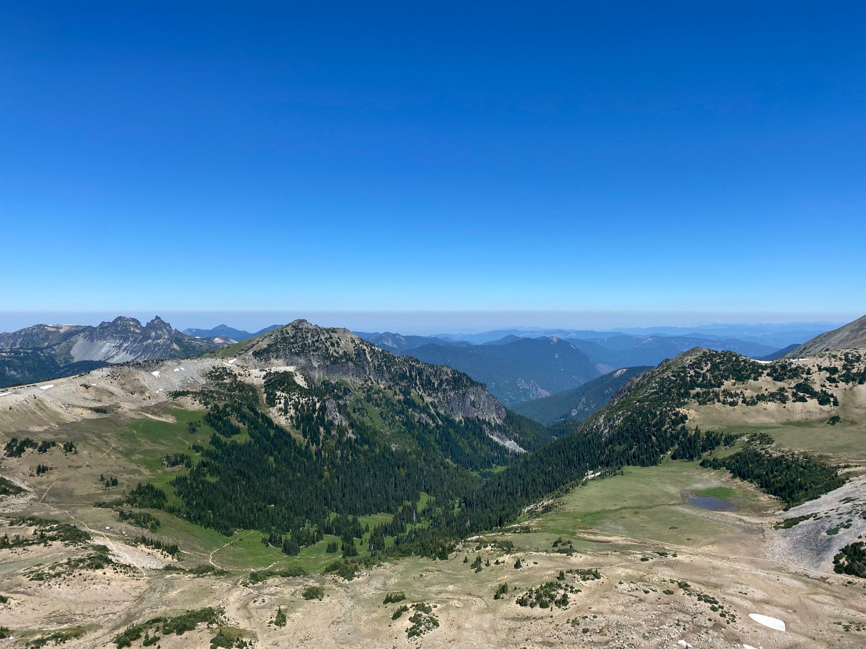
Hurricane Ridge is 45 minutes and 17 paved miles up from Port Angeles, taking you from sea level to about 5,200 feet. Hurricane Hill is the walk to do, a gently graded few miles round trip along a ridge with views south into the interior of the range, across at Mount Olympus and its glaciers, and north over the Strait of Juan de Fuca to Vancouver Island on a clear day. Black-tailed deer wander the meadows and ignore people entirely. For more, Klahhane Ridge extends the day considerably, and the Switchback Trail climbs to it steeply from the road.
Arrive early, because the parking fills completely in summer and waits of one to two hours are normal at peak times.
In the afternoon, drop back down and stop at Lake Crescent, 30 minutes west, a deep glacially carved lake of remarkable clarity, with the short Marymere Falls walk and the steeper climb up Mount Storm King, whose upper section involves fixed ropes and genuine exposure. Then sleep in Port Angeles.
A Four-Day Olympic National Park Itinerary for First-TimersDay two: rainforest and river
Head west and south. Sol Duc Valley, an hour and fifteen from Port Angeles, has Sol Duc Falls, a short, easy and beautiful walk to a waterfall dropping into a narrow gorge, plus the Lover's Lane loop for something longer. There are hot springs here too, developed and commercial rather than wild.
Then the Hoh Rain Forest, down an 18-mile spur off Highway 101. This is the one people come for: moss curtains on bigleaf maples, Sitka spruce at enormous scale, and a saturated green produced by twelve to fourteen feet of rain a year. The Hall of Mosses is 0.8 miles and the classic, the Spruce Nature Trail is 1.2 and quieter, and the Hoh River Trail runs 17-plus miles toward Mount Olympus, where walking even the first three or four miles takes you well beyond the day-visitor crowd into genuine old growth.
Sleep in Forks or on the west side.
Day three: the coast
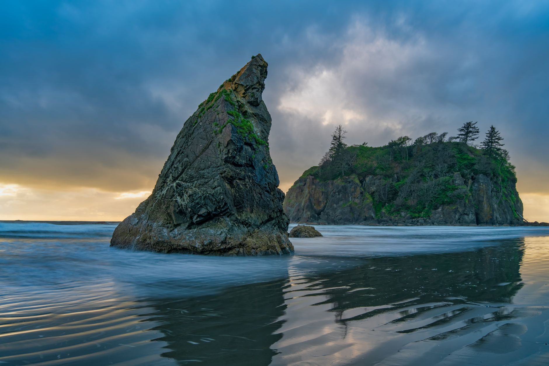
The least visited third of the park and, for many people, the best. Rialto Beach near La Push gives you sea stacks, drift logs the size of buses, and Hole-in-the-Wall, a sea arch about 1.5 miles up the beach and reachable only at low tide. Second Beach and Third Beach need short forest walks to reach and are emptier for it, while Ruby Beach further south is the classic photograph and sits right on 101.
The tide governs the day. Headlands walkable at low water are impassable at high, people are cut off every year, so check a tide table before you leave and note which headlands require a specific tide height.
If you are looping south, finish at Lake Quinault, a second rainforest valley with a fraction of the Hoh's traffic, a historic lodge, and some of the largest trees in the park.
Where to sleep
The perimeter geography decides your lodging as firmly as it decides your driving, and getting it wrong costs hours.
Port Angeles is the largest town on the peninsula, with the full range of motels, restaurants and a supermarket, twenty minutes from Hurricane Ridge and twenty from Lake Crescent, and it is the only place on the north side with genuine choice. Lake Crescent Lodge and Log Cabin Resort sit inside the park on the lake itself and book out months ahead, while Sol Duc Hot Springs Resort puts you at the Sol Duc trailhead with hot pools and closes for winter.
On the west side, Forks is unglamorous and perfectly functional and sits between the Hoh and the beaches. Kalaloch Lodge and the cabins on the bluff above the beach are the atmospheric option and are booked far in advance, and La Push has resort cabins right at the beach at Quileute Oceanside, on tribal land.
Camping is extensive, including Heart o' the Hills, Fairholme, Sol Duc, Hoh, Kalaloch, Mora and Ozette among others. Kalaloch and Sol Duc take reservations while several others are first come, first served and fill by early afternoon in July and August. Either book early or stay flexible, because the peninsula has a small number of beds spread over a very large loop, and a summer weekend without a reservation means sleeping a long way from where you want to be in the morning.
Two practical notes attach to the driving. Fuel is thin on the west side, where Forks is the main stop, so do not run low on a spur road. And signal is absent across most of the park and much of Highway 101.
The gear
Three days is the right length for Olympic because it lets you do the ring road once without rushing, and the gear list is a three-climate list.
A rain shell that genuinely works, since you will use it on at least one of the three days regardless of month.
A tide table for your coast day, corrected for the specific beach. This governs which day you do the coast on and what time you start, and it is the only piece of information on this list that can make a day impossible.
Waterproof footwear, for the rainforest and the beach.
Layers for a five-thousand-foot range, which over three days means packing for both the ridge and the river valleys rather than compromising.
Offline maps for the whole loop, since the ring road is a hundred and seventy miles with long stretches of no coverage.
An America the Beautiful pass.
And a cooler with supplies, which is a real recommendation on this peninsula rather than a convenience. Forks and Port Angeles have groceries and the stretches between them do not, restaurant hours on the west side are limited and seasonal, and a three-day loop where you have to solve dinner in Kalaloch at eight in the evening is a three-day loop with a problem in it.
Sorting the paperwork before you go
It is a short list, and each item catches somebody out. The park entrance fee covers seven days and every entrance, and an America the Beautiful pass covers it, with no timed-entry reservation system in place. Wilderness permits are required for all overnight backcountry trips, with quotas on the popular coastal and alpine zones, though this does not affect day hikes at all.
Beyond the park boundary the picture fragments. A Makah Recreation Permit, bought locally, is required for Shi Shi Beach and Cape Flattery, both of which sit on Makah tribal land rather than park land. Dungeness National Wildlife Refuge charges its own fee and bans dogs entirely. And a Northwest Forest Pass covers Olympic National Forest trailheads, which is where you go if you have a dog, because dogs are prohibited on nearly all park trails with narrow exceptions on parts of the coast. Plan for that before you arrive rather than at the trailhead.
Four land managers with four different fee structures and four different dog policies around one loop road is more than anyone should have to reconstruct the night before. Guidepole Hike carries the managing agency, its permit requirement and its dog rules against each trailhead, which on this peninsula is the difference between arriving at Shi Shi with the right permit and arriving with the wrong one.
Hiking Every Must-Do Trail at Olympic National ParkWhat makes this park unusual
This is worth understanding, because it explains why three separate days are the right structure rather than an indulgence. Olympic is effectively three parks under one designation, and the reason is isolation: the peninsula is cut off by the Pacific on two sides, the Strait of Juan de Fuca to the north and the Puget lowlands to the east. During the last glaciation ice surrounded the Olympics without ever overrunning the highest interior, leaving a refuge where species evolved on their own.
The result is a set of plants and animals found nowhere else on earth, including the Olympic marmot, the Olympic torrent salamander, the Olympic snow mole and several endemic plants. It is also why some species you would expect are absent, with no grizzly bears, no wolverines, no pikas, and historically no mountain goats, which were introduced in the 1920s and removed again between 2018 and 2020 after they damaged alpine vegetation and one killed a hiker on Klahhane Ridge.
The rainfall gradient is equally extreme. The Hoh takes twelve to fourteen feet a year on the windward side, while Sequim in the rain shadow forty miles east gets under twenty inches and grows lavender commercially, and little else in North America compresses that range into so short a drive.
The park is both a UNESCO World Heritage Site and an International Biosphere Reserve, and about ninety-five percent of it is designated wilderness, which is precisely why there is no road across the middle, and why your three days are spent driving the rim of something you never enter.
What to do with a fourth day
If you have one, the options open up considerably. Backpacking a coast section is the obvious move, and the Ozette Triangle is a 9-mile loop of boardwalk through forest to two beaches, with the longer coastal routes amounting to genuine multi-day wilderness. Walking further up the Hoh River Trail toward Glacier Meadows and the Blue Glacier is the classic Olympic backpacking objective.
Sol Duc to Seven Lakes Basin and the High Divide loop is arguably the finest backpacking route in the park at around 19 miles with big alpine scenery. And Staircase, in the southeast, is the quiet corner almost nobody visits.
Seasons
July to September is the reliable window, when Hurricane Ridge is clear of snow, the coast is at its most benign, and everything is open. Late spring brings high water, waterfalls at their best, and snow lingering at Hurricane Ridge into June in a heavy year.
Autumn is excellent, with bigleaf maples turning in the rainforest valleys, thinner crowds and dramatic weather on the coast. Winter closes or restricts the Hurricane Ridge road and makes the coast a storm-watching proposition, though the rainforest is good in winter since it is wet regardless.
The thing to expect in any season is that the three zones have different weather on the same day, routinely. Hurricane Ridge in cloud while the coast is clear is a normal Tuesday. Roosevelt elk are common in the rainforest valleys year-round, and they are large wild animals rather than scenery.
Three parks on a ring road
Book three different places to sleep and move around the loop in one direction. Do Hurricane Ridge on day one, arriving early. Do Sol Duc and the Hoh on day two, and walk further up the Hoh River Trail than the crowd does. Do the coast on day three with a tide table in hand.
Three days is enough for Olympic, but only if you stop treating it as one park with a center, and start treating it as three parks on a ring road.
With a single day, one day in Olympic covers how to choose between them. For the wider region beyond the park boundary, see the Olympic Peninsula, and for the other side of Washington, the North Cascades.
The compressed version is in one day in Olympic National Park, and the individual trails are in Olympic Peninsula day hikes. The other Washington parks are in one day at Mount Rainier and one day in the North Cascades. The city you probably flew into is in hiking Seattle.
A note on the fourth ecosystem people miss, since three days is enough to include it. The northeast corner of the peninsula around Sequim sits in the Olympic rain shadow and receives about sixteen inches of rain a year, roughly the same as Los Angeles. It is an hour from a rainforest that gets twelve feet. Nothing else in the country puts that contrast within a single afternoon's drive, and Dungeness Spit at the dry end is a good half day in weather that has closed everything else in.