Fish
Fish Fire
Fire Hike
Hike Bird
Bird

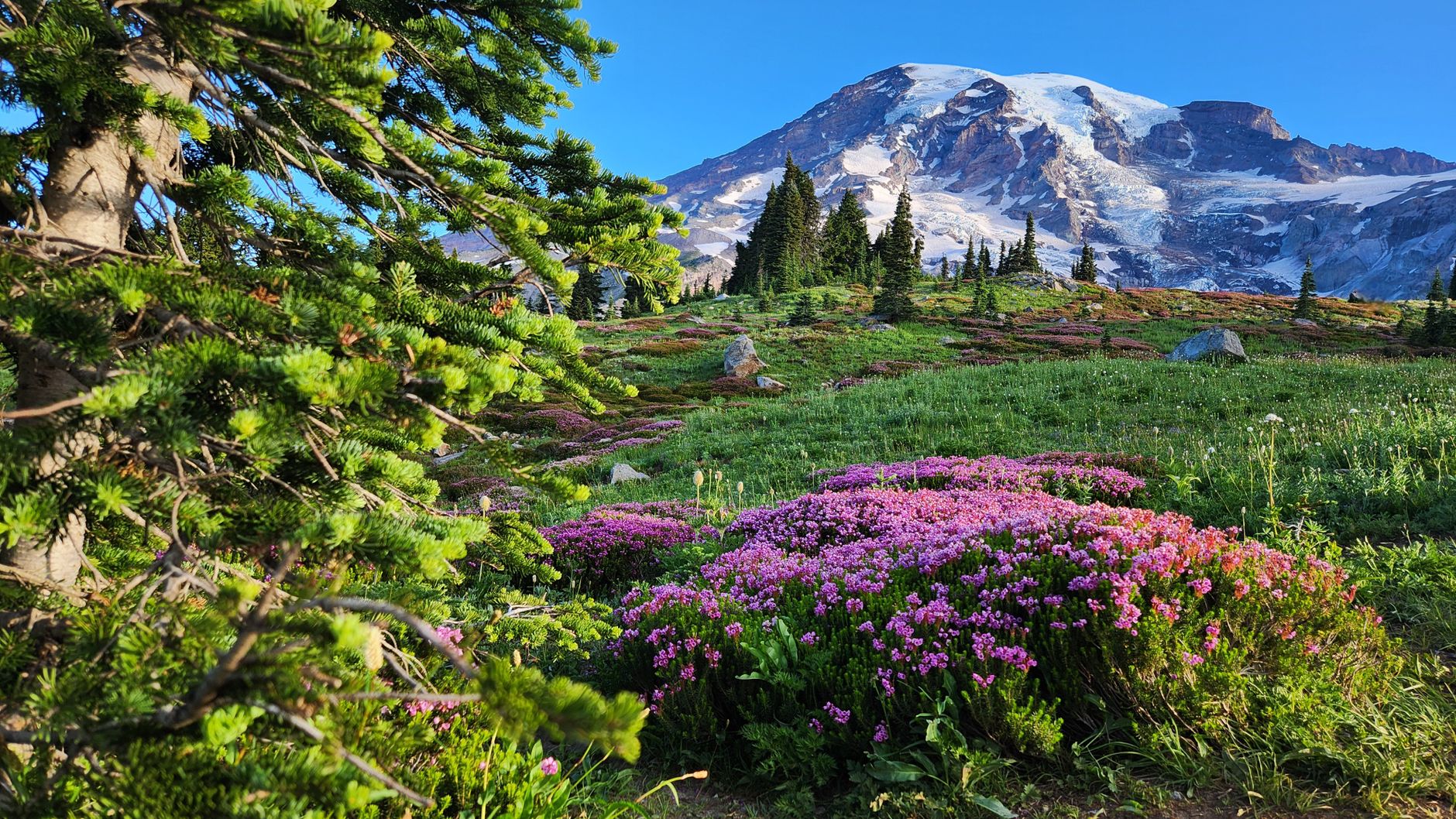

Mount Rainier is 14,411 feet of glaciated stratovolcano two hours from Seattle, and it carries more glacial ice than any other peak in the contiguous United States. On a clear day it is visible from a hundred miles away, which is why people in Washington simply call it "the mountain."
With one day, the decision is which side of it to stand on.
2026: timed entry is gone, so arrival time is the game
This is the single most useful planning fact for this year. Mount Rainier canceled its timed-entry reservation system for 2026, so you do not need a reservation to enter the park, including the Paradise and Sunrise corridors that previously required one. Entry is first come, first served.
The system was piloted in 2024 at both corridors, narrowed to Sunrise only in 2025 while Paradise was under construction, and dropped entirely for 2026. The Park Service framed it as a return to active parking management rather than a permanent end, citing improved lot staffing, real-time signage and earlier communication, so it may well return in future seasons. Confirm the current year's rules with Mount Rainier National Park before you go, because this park has changed its system three years running.
What that means practically is that the constraint is now arrival time rather than permission. Nobody can turn you away, and the parking lot can. Be at Paradise before 8am on a summer weekend and earlier in peak August, because the lot fills and when it does you are directed to overflow or turned back down the road. Sunrise fills later but has less parking and a long road up. Weekdays are transformatively better than weekends at both. The old timed-entry system essentially forced people to arrive early; without it, arriving early is a choice you have to make yourself.
The Sunrise Area of Mount Rainier National ParkParadise or Sunrise
They are different days.
Paradise: the south side
Subalpine meadows at about 5,400 feet directly beneath the mountain's south face, with the Nisqually Glacier in view and the summit filling the sky, and in late July and August the wildflower bloom here is among the best in North America.
The Skyline Trail is the signature hike at roughly 5.5 miles round trip with about 1,700 feet of gain, climbing through the meadows to Panorama Point with the mountain above and the Tatoosh Range behind you. It is the best single day hike in the park and it is correspondingly busy. Shorter options radiate from the same visitor center, including the Nisqually Vista loop, Alta Vista and Myrtle Falls, all paved or well-graded and all superb.
Paradise is also the wettest and snowiest place in the park. It holds record snowfall and the meadows are often still under snow into July.
Sunrise: the northeast side
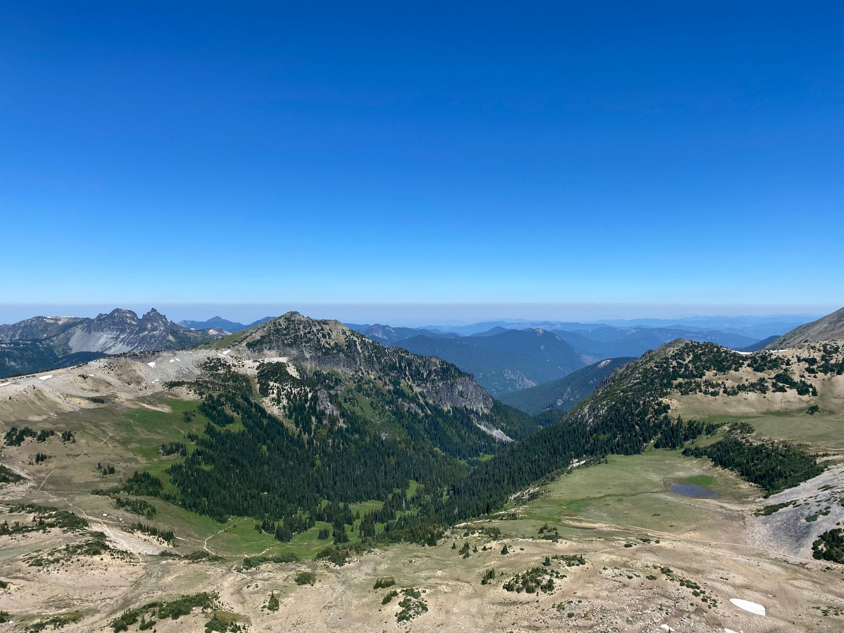
At about 6,400 feet, this is the highest point you can drive to in the park and a completely different landscape: drier, more open, subalpine parkland rather than lush meadow, looking across the Emmons Glacier, the largest glacier by area in the contiguous US.
The Burroughs Mountain Trail climbs onto a high tundra plateau with an extraordinarily close view of the mountain and its ice, and Mount Fremont Lookout is about 5.6 miles round trip to a fire lookout with a view north. Sunrise opens later in the season, typically early July, because the road is higher and holds snow longer, and it is less crowded than Paradise, though that is relative.
For a single day: Sunrise if the road is open and you want closer, wilder and quieter, or Paradise if you want the wildflowers or you are visiting in June.
The mountain makes its own weather
Rainier is high enough and isolated enough to generate its own cloud, and it is frequently invisible from its own parking lots. The mountain is "out" or it is not, in local phrasing, and a clear day in Seattle does not guarantee a clear day at Paradise, so check a webcam before committing to a two-hour drive. Lenticular clouds forming over the summit are a genuine sign of incoming weather and one of the more spectacular things you can see here.
Snow lingers absurdly late. Trails at Paradise are frequently snow-covered into July, and the Skyline loop can require traction and route-finding well into summer, so check the park's trail conditions rather than assuming an August trail is clear. Afternoon cloud build-up is routine, which makes mornings meaningfully more likely to give you the mountain.
One Day in Mount Rainier National Park: The Skyline TrailWhat else fits in a day
If you want something other than a subalpine meadow, four options are close to the roads. The Grove of the Patriarchs is an old-growth stand of enormous Douglas fir, cedar and hemlock on an island in the Ohanapecosh River, though access has been affected by bridge damage so check current status. Silver Falls, near Ohanapecosh, is a good low-elevation loop that works in bad weather.
Reflection Lakes, on Stevens Canyon Road, gives the classic mirrored-mountain photograph for a five-minute walk. And Comet Falls, about 3.8 miles round trip, is a steep climb to one of the tallest waterfalls in the park.
The gear
Rainier is a fourteen-thousand-foot volcano that generates its own weather, and a day here is a day of being ready for conditions the valley did not have.
Kahtoola MICROspikes, which are the item that most often decides whether the hike you planned is possible. Paradise sits at fifty-four hundred feet and holds snow on the Skyline Trail into late July in an average year, and well into August after a big winter. The snowfields are not steep, but they are firm in the morning and they are above runouts.
An insulating layer and a rain shell, because the mountain pulls moisture out of the Pacific and turns it into weather with very little warning. A clear morning at Paradise becoming a whiteout by noon is a normal event rather than a bad-luck one.
Sun protection, for the opposite condition, since the snowfields reflect ferociously and people get burned under their chin here.
Two liters of water.
An America the Beautiful pass, which covers the entrance fee.
An offline map, since coverage inside the park is essentially nil.
And binoculars, which are worth carrying for the goats on the ridges above Sunrise and for looking at the climbing route on the Emmons Glacier, where you can frequently pick out roped parties moving on the ice.
Five entrances, and picking the right one
Rainier is a big park with entrances a long way apart, and choosing wrong costs hours. Nisqually, in the southwest near Ashford, is the main and busiest entrance and the only one open year-round, and it is the way to Paradise, roughly two hours from Seattle or Tacoma. White River, on the northeast, is the way to Sunrise and typically opens in early July, and from Seattle that is a different drive entirely, around the north side.
Stevens Canyon, southeast near Ohanapecosh, gives access to old-growth forest, Silver Falls and the Grove of the Patriarchs area, connecting through to Paradise when the road is open. Carbon River and Mowich Lake, northwest, are the quiet corners, partly unpaved, with the park's temperate rainforest and far fewer people.
The roads behind those entrances run on their own schedules. The road to Sunrise typically opens in early July and closes in autumn, Stevens Canyon Road is similarly seasonal, and only the Nisqually to Paradise section stays open year-round, subject to closure and chain requirements in winter. So the practical consequence is that you decide which side you want before you leave, because you cannot casually switch and driving from Paradise to Sunrise is a long way round. Guidepole Hike carries which entrances and roads are currently open alongside the trailheads they serve, which on a park where the wrong gate costs you three hours is a routing question worth settling at the kitchen table.
Wildflower timing, if that is why you are coming
Paradise's meadows are the draw for a large share of summer visitors, and the timing is narrower than people expect. The bloom depends entirely on when the snow melts out, which varies by weeks from year to year, and in a normal season the meadows peak somewhere in late July to mid-August. In a heavy snow year it slides into late August, and in a light one it can be mid-July.
The sequence runs roughly from avalanche lily and glacier lily emerging at the snow edge, through lupine, paintbrush, bistort and magenta paintbrush at peak, into aster and pearly everlasting as it fades.
Two practical notes. Stay on the trail, because the meadows are fragile, the growing season is measured in weeks, and a boot print in a subalpine meadow persists for years. And check the park's current bloom reports rather than booking on last year's dates.
The mountain is a volcano, and that shapes the park
Rainier is an active stratovolcano, and it is considered one of the most dangerous volcanoes in the United States, not because an eruption is imminent but because of what sits downhill.
The hazard is not lava. It is lahars, fast-moving flows of volcanic debris and water generated when eruption or collapse mobilizes the enormous quantity of ice and loose material on the mountain. They travel down river valleys at speed and have historically reached areas now occupied by towns in the Puyallup and Nisqually drainages. That is why you will see lahar evacuation route signs in the valleys around the park and why there is a monitoring and warning system. As a visitor it is background rather than a live concern, but it explains the signage and it is part of why the mountain is studied as closely as it is.
It also explains the landscape you hike through. The glacial ice, more than any other peak in the contiguous US carries, is the reason the rivers run gray with rock flour, the reason valleys are U-shaped, and the reason the subalpine meadows sit where they do.
The Wonderland Trail, in case you get ideas
Standing at Paradise it is natural to wonder what the trail heading off into the distance does. It is the Wonderland Trail, a 93-mile loop entirely around the mountain with something in the order of 22,000 feet of cumulative gain. It is one of the great backpacking routes in North America and runs a competitive permit lottery, with a small number of walk-up permits released as well, and most people take ten to fourteen days.
Sections are day-hikable from the road corridors, and the Skyline Trail from Paradise uses Wonderland tread for part of its length, so if you do that hike you have walked a piece of it. It is worth knowing for two reasons: it explains the through-hikers with large packs, and it is the natural next step if a single day at Rainier turns into an obsession, which it frequently does.
Where to stay, and the drive
Rainier is a day trip from Seattle or Tacoma, and it is a better trip if it is not. Ashford, just outside the Nisqually entrance, is the obvious base for Paradise, small, geared entirely to the park, and about half an hour from the meadows, so staying there means arriving at Paradise before the day-trippers rather than behind them. Inside the park, the National Park Inn at Longmire is open year-round and the Paradise Inn seasonally, and both book well ahead.
Packwood, to the southeast, is the base for the Stevens Canyon side and is cheaper, while Enumclaw and Greenwater, northeast, serve the White River entrance and Sunrise. The drive from Seattle is roughly two hours to Nisqually in good conditions and considerably worse on a summer Saturday morning heading south, which is the strongest argument for staying the night before, because it converts the worst hour of the day into a twenty-minute drive.
A few things hold whichever side you pick. There is an entrance fee, covered by America the Beautiful. Fuel up outside the park, because there is no gas inside it. Cell signal is essentially absent across the park. And dogs are not permitted on trails.
Whichever side, get there early
Check a webcam. Drive early. Pick one side: Sunrise for the close-up and the quiet, Paradise for the flowers. Do the Skyline Trail or Burroughs Mountain depending on which you chose. Expect snow later into the summer than seems reasonable, and expect the mountain to be hiding some of the time.
And remember that in 2026 nobody is rationing entry, which means the only thing standing between you and a parking space is what time your alarm goes off.
The classic Seattle-side training hike is 45 minutes from the city, Mount Si, and if you have a whole day and the highway is open, the North Cascades are the other direction entirely. City-side options are in hiking Seattle.
The rest of the state's alpine hiking is in one day in the North Cascades and North Cascades day hikes. The nearest city, and the trails you can reach from it in an hour, is in hiking Seattle. The peninsula across the sound is in one day in Olympic National Park, and the training hikes people use to get ready for a day like this are in Mount Si and Mailbox Peak.