Fish
Fish Fire
Fire Hike
Hike Bird
Bird

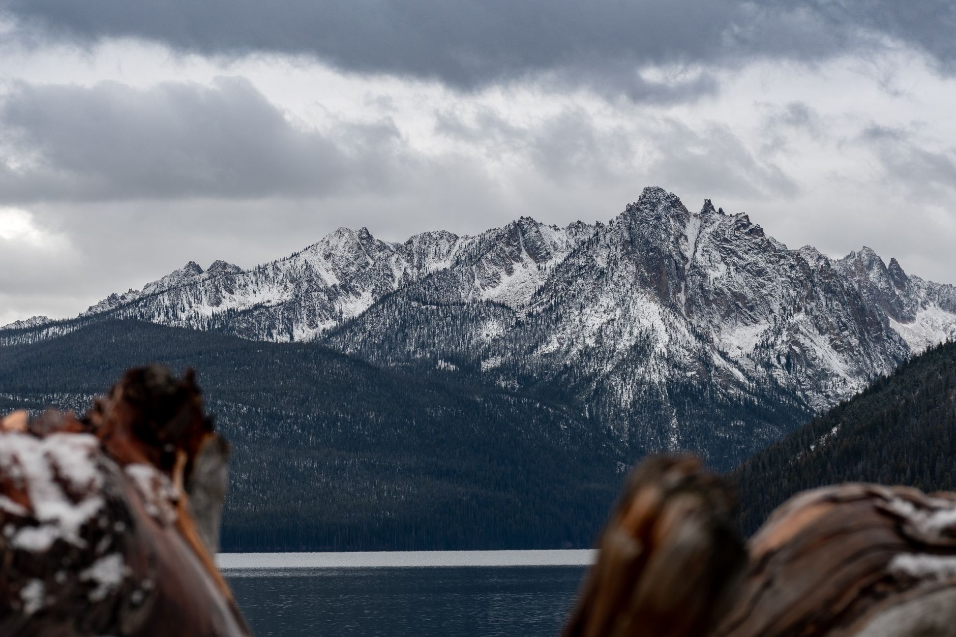

The Sawtooth Wilderness is the closest thing the lower 48 has to a range that nobody has heard of and everybody should have.
It sits in central Idaho above the town of Stanley, holds more than forty peaks above 10,000 feet and something over three hundred alpine lakes, and is built almost entirely of pale granite that turns gold at either end of the day. It looks like the Sierra with a fraction of the people.
And the permit system is a relief after everywhere else: free, self-issued, at the trailhead.
The permit, which is simple
A wilderness permit is required to enter the Sawtooth Wilderness. It is free, it is self-issued at the trailhead or at the wilderness boundary a short way in, and there is no reservation and no lottery. You fill in a form at a box, tear off your copy, and walk.
After the Enchantments at two percent odds and Half Dome's March lottery, that is worth stating plainly: one of the finest backpacking ranges in the United States has effectively open access. Confirm current rules with the Sawtooth National Recreation Area before you go, since regulations can change, but this has been the system for a long time.
The Alice-Toxaway loop
If you do one trip here, do this one. The Alice-Toxaway Loop runs roughly 18 to 21 miles depending on how it is measured and which variations you take, with somewhere around 3,000 to 4,000 feet of elevation gain, and most people do it over two to three days. It starts at the Tin Cup and Pettit Lake trailhead, reached by driving about 15 miles south from Stanley on Highway 75 to the Pettit Lake turnoff.
The loop's structure is what makes it so good. You climb past Alice Lake, which sits beneath the pyramid of El Capitan and is one of the most photographed places in Idaho for good reason, continue through the Twin Lakes basin, cross a pass, drop to Toxaway Lake, and return down a different drainage. You are rarely retracing your steps and the scenery changes constantly. Done clockwise you climb to Alice earlier while fresh, and counterclockwise saves the best-known lake for later. Both work.
Three days is the right shape for it rather than two. Start at Tin Cup in the late morning on day one, because there is no advantage to a dawn start on a short day, and climb past the lower lakes to Alice Lake, roughly 5 to 6 miles, arriving with time to sit. That is the point of the trip rather than a waypoint. Day two continues through the Twin Lakes basin, over the pass and down to Toxaway Lake, which is the biggest day, the highest ground, and the best of the scenery. Day three descends the Toxaway drainage back to Pettit Lake to close the loop, mostly downhill and shorter than day two.
That spacing gives you two proper evenings at alpine lakes rather than one, which is the difference between a walk and a trip. Camp on durable ground well back from the water, use established sites where they exist, and expect company at Alice, which is popular for good reason.
The Alice-Toxaway Loop in the Sawtooth WildernessThe other trips, and day hiking
The range rewards more than one visit. Redfish Lake is the hub on the north end, a large lake below the peaks with a lodge, a campground, and a boat shuttle across it that removes several miles from trips into the Redfish Lake Creek drainage, and it is the classic access point for Alpine Lake and the longer routes toward Baron Lakes and Cramer Lakes. Sawtooth Lake, from the Iron Creek trailhead, is the range's largest alpine lake and a superb long day hike or short overnight, sitting under Mount Regan. Hell Roaring Lake is a gentler option with a big view of the Finger of Fate, and the Cramer Divide and multi-day traverses link the basins for anyone with a week.
The range works as a day-hiking destination too. Alice Lake as an out-and-back is a long but very doable day from Pettit Lake at around 12 miles round trip, and it gives you the single best view in the range without a pack. Sawtooth Lake from Iron Creek is roughly 10 miles round trip and similarly rewarding. Fishhook Creek near Redfish is an easy few miles to a meadow with a classic peak view and works with children, and Bench Lakes climbs above Redfish for a view down onto the lake.
What all of them share is granite, water, and the particular quality of Sawtooth light in the last hour of the day.
The season is short and specific
Central Idaho is high and cold, and the range holds snow late. Late July through September is the reliable window, because earlier the passes hold snow and the creek crossings run high with melt, and later you are into serious risk of early-season storms at 9,000 feet.
August is the peak of it, with warm days, cold nights, and mosquitoes that vary enormously by year and by basin. In a wet year the mosquitoes in July and early August are bad, and this is not a minor complaint. September is the best month if you can take the cold, with the mosquitoes gone, the air clear, the crowds thinned and the light at its best, though nights drop well below freezing.
Worth calibrating for: Stanley regularly records some of the coldest temperatures in the lower 48, including in summer. Frost in August at the trailhead is normal, and it is colder at the lakes.
What the range asks of you
Altitude comes first, since trailheads sit around 7,000 feet and passes run to 9,000 and above, so anyone arriving from sea level will feel it and the standard advice applies: sleep a night at elevation first if you can. Real cold at night follows, in any month.
Water competence matters more here than the mileage suggests, because creek crossings early in the season are the main hazard and they run high with snowmelt through July. Distance from help is the other structural factor, as Stanley is small and remote, signal is absent in the wilderness, and evacuation is slow, which makes a satellite messenger a reasonable investment. Food storage discipline is required for black bears and for the extremely determined rodents around popular lakes.
And fire awareness shapes late summer, because Idaho burns and both smoke and active closures are real factors in August and September. That is the variable most likely to change between planning and driving, and it compounds with the roads: Highway 21 from Boise is subject to temporary avalanche closures in winter, and forest road and trailhead closures during a fire season can shut a drainage while the range next door stays open. Guidepole Hike carries current closure and access status alongside the wilderness boundary, which on a three-hour drive to a trailhead is the check worth doing the morning you leave.
Three Days Backpacking Idaho's Sawtooth WildernessUnderstanding the geography
The Sawtooths are compact, which is part of why they work so well for short trips. The range runs roughly 40 miles north to south, bounded on the east by the Sawtooth Valley and the headwaters of the Salmon River. The Salmon rises here, then runs 425 miles through the largest wilderness complex in the lower 48, and Highway 75 runs the length of that valley with essentially every trailhead coming off it.
That linearity matters practically. The peaks are west, the road is east, and the drainages run between them, so trips generally go up one drainage, cross a pass, and come down the next. You are rarely more than a day from the road, which makes the range unusually forgiving for people newer to backpacking despite the altitude and the cold.
The granite is a batholith, a huge body of intruded rock underlying much of central Idaho, weathering into the pale spires and slabs that give the range its name, and the lakes are glacial, sitting in cirques behind moraines. The White Cloud Mountains rise directly across the valley to the east, protected as wilderness since 2015, and offer a quieter alternative of similar character when the Sawtooth trailheads are busy.
Fishing, and why the lakes look empty
Something people notice: hundreds of alpine lakes, and many of them apparently lifeless. Most high Sawtooth lakes were naturally fishless, sitting above barriers that trout could never have climbed, and a great many were stocked over the twentieth century, some by aircraft, and are managed for fishing now, while others were left alone or have reverted.
If you are carrying a rod, an Idaho license is required and the regulations differ by water, since some lakes are catch-and-release and some have gear restrictions, so check the current rules rather than assuming a wilderness lake is unregulated.
If you are not carrying one, it is still worth knowing, because the presence or absence of fish is why some basins are loud with amphibians and others are silent. Stocked trout eat frogs and salamander larvae, and the ecological argument about high-lake stocking is live in every western range.
The gear
The Sawtooths sit high, the season is short, and the nights are colder than the latitude suggests. The gear list is built around those three facts.
A sleeping bag rated well below freezing, which is the item people get wrong. Alice Lake sits above eighty-five hundred feet, the basin holds cold air, and frost in August is normal rather than remarkable. A thirty-degree bag here is a bad night.
A head net and repellent, because the mosquitoes in these basins during the weeks after snowmelt are genuinely severe. Early July is peak bloom and peak mosquito simultaneously, and a head net weighs almost nothing.
A satellite communicator, since there is no coverage in the wilderness and the trailheads are a long way from Stanley.
Trekking poles, for the Toxaway side of the loop, where the descent from the pass is long and loose.
A water filter, which is straightforward here since the lakes and outlets are everywhere.
Bear-resistant food storage. Black bears rather than grizzlies, but the popular lake basins have habituated animals and the Forest Service asks for it.
And sun protection, because this is high granite country with reflective rock and snow patches, and the ultraviolet at nine thousand feet is not the ultraviolet you are used to.
Leaving it as you found it
Alpine granite basins recover from damage extremely slowly, and the Sawtooths take enough traffic that it shows. Camp on rock, sand or established sites rather than on vegetation, and never on the fragile turf right at a lakeshore, with 200 feet back from water the rule of thumb where terrain allows. Use a stove rather than a fire, because wood is scarce above the treeline, fire scars persist for decades on granite, and fire restrictions are common in late summer anyway.
Pack out everything, and follow current human-waste guidance, since in heavily used basins the expectation has shifted toward packing that out too in some ranges, so check what the Sawtooth National Recreation Area currently asks. Keep groups small, because wilderness regulations cap group size and the ecological logic is obvious at a small lake basin.
The permit here is free and unlimited, which is a privilege rather than a right, and it survives because people mostly behave.
Getting there and staying
Stanley is the base, a town of a few hundred people at the foot of the range, with the Sawtooths filling the skyline in a way that is startling on first arrival. It is roughly three hours from Boise over Highway 21, a beautiful drive subject to temporary avalanche closures in winter, or a similar distance from Sun Valley over Galena Summit.
Services are limited, amounting to fuel, food and a handful of places to stay, and it books up in summer, with campgrounds around Redfish and the highway corridor filling on summer weekends. The Redfish Lake boat shuttle is worth knowing about even for day hikers, and the Stanley Ranger Station is the place to check current conditions, fire restrictions and trail reports.
Why more people do not know about this
Go late July to September, and September if you can handle the cold. Pick up the free permit at the trailhead. Walk the Alice-Toxaway loop over three days rather than two.
Carry warm layers you would not pack for August, expect the mosquitoes in July, and check the fire situation before you commit to a drive of three hours. Then sit at Alice Lake in the last hour of light and work out why more people do not know about this place.
Idaho's other trail town is three hours south and has more than 190 miles of trail starting at the city limits, hiking Boise. And on the smoke that decides a lot of Idaho trips in August: hiking in wildfire smoke.
The other great granite range on the same latitude band, with a longer season and far more people, is in Eastern Sierra day hikes. The nearest city, and its foothill trail system, is in hiking Boise. The permit systems that govern comparable wilderness elsewhere are in the Enchantments permit lottery and Mount Whitney as a day hike, and the general question of which agency's rules apply is in dog-friendly trail rules by agency.