Fish
Fish Fire
Fire Hike
Hike Bird
Bird


The Sierra Nevada is a tilted block. Its western slope rises gradually across a hundred miles of foothills and forest, while its eastern face drops abruptly to the desert floor of the Owens Valley in one of the great escarpments in North America.
For a hiker that geometry is a gift. On the west side, reaching alpine terrain means a long approach. On the east side, the roads do the climbing, because side canyons off Highway 395 run steeply up to trailheads at 9,000 and 10,000 feet and you step out of the car already above the treeline.
Which changes the nature of the problem entirely. The walking is often easy. The altitude is not.
Little Lakes Valley: the best value in the range
If you do one hike on the east side, do this one. The Mosquito Flat trailhead sits at 10,244 feet, the highest paved trailhead in the Sierra, and from it the Little Lakes Valley trail runs about 7.2 miles round trip to Gem Lakes with roughly 1,200 feet of gain, passing seven named lakes on the way. Mack, Marsh, Heart, Box, Long, Chickenfoot and Gem are strung along Rock Creek in a glacial valley with 13,000-foot peaks on both sides.
The terrain runs from 10,244 up to about 11,130 feet. Gentle grade, enormous scenery, seven lakes, and there is nothing else in California that gives you this much alpine for this little effort.
To get there, turn west onto Rock Creek Road from Highway 395 at Toms Place, 15 miles south of Mammoth Lakes and 25 miles north of Bishop, and drive about 10 miles to the end of the road, passing Rock Creek Lake near the top. You can turn around at any of the lakes, and even reaching Mack and Marsh, well under two miles in, gives you the valley.
Convict Lake: the two-mile classic
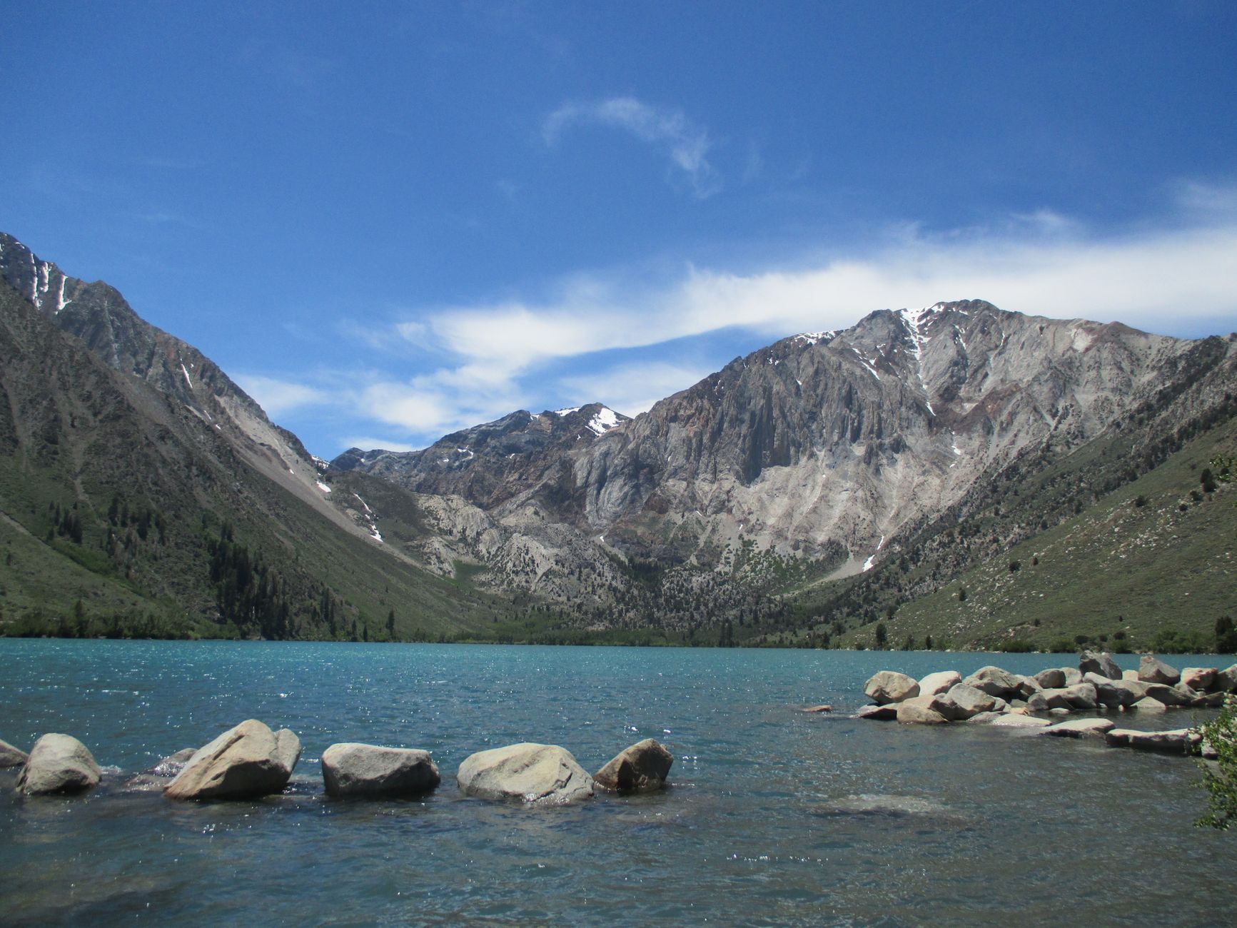
A 2-mile loop around a lake at about 7,580 feet, held in a bowl of dramatically colored metamorphic rock that looks nothing like the granite elsewhere in the range. The trail is gentle and the scenery is disproportionate to the effort.
It sits a short distance off Highway 395 south of Mammoth and it works for almost anyone: children, a rest day, a late arrival, or bad weather higher up. The name comes from an 1871 escape from the state prison at Carson City and the gunfight that followed at the lake, which is a better story than most lake names get.
The Little Lakes Valley Trail: Hiking to Eight Lakes off Highway 395The rest of the menu
The east side is a series of canyons, each with its own road and its own lakes, and what unites them is that a short drive up a canyon replaces a long walk up a mountain.
The Mammoth Lakes Basin holds a cluster of lakes reachable on short trails, including Lake George, Crystal Lake and Duck Pass for something longer, all within minutes of town. The Lakes Basin above Bishop, up Bishop Creek Road, gives Lake Sabrina, South Lake and North Lake, each with trails climbing into the John Muir Wilderness, and the autumn color here when the aspens turn is the best in California. McGee Creek and Hilton Lakes are quieter alternatives near Rock Creek. And Devils Postpile, a national monument near Mammoth, has a remarkable columnar basalt formation and Rainbow Falls, with access typically by mandatory shuttle in summer, so check current requirements before planning around it.
Five Day Hikes in the Eastern SierraAltitude is the actual difficulty
This needs stating clearly, because the mileage figures are deceptive. A 7-mile hike with 1,200 feet of gain sounds like a moderate afternoon. Starting it at 10,244 feet, having driven up from sea level yesterday, is a different proposition, and around a third of people feel some effect of altitude at this elevation, which does not correlate with fitness.
Sleeping at elevation first is what helps most, and a night in Mammoth at about 7,900 feet or Bishop at 4,150 makes a measurable difference, with two nights better than one. Beyond that, go slower than feels necessary particularly in the first hour, and drink more than you want to, because the air is extremely dry as well as thin.
Know the symptoms, meaning headache, nausea, unusual breathlessness and poor sleep, and understand that the treatment is descending, which on the east side is unusually easy because the car is parked at the top of a road that goes down. Do not push through it, since altitude sickness gets worse with continued exertion at height rather than better.
Why the east side looks like this
The escarpment is not a coincidence of scenery, it is the reason the hiking works the way it does. The Sierra Nevada is a fault block, a single enormous slab of granite tilted upward along its eastern edge, so the west side is the gentle top of the tilt and the east side is the broken edge, dropping from over 14,000 feet to a valley floor around 4,000 in a matter of miles. It is one of the steepest sustained escarpments in North America.
Four consequences follow for a hiker. Canyons are short and steep, because the creeks draining the crest cut straight down the face, so the side roads climb hard and fast and gain thousands of feet in a few miles, which is why the trailheads sit so high. You are in the rain shadow, since storms drop their moisture on the western slope and leave the east side dry, clear and sunny far more often, which is why the light is so good and the air feels so thin.
The transitions are abrupt as well, and you drive from sagebrush desert through pinyon and Jeffrey pine to alpine granite in twenty minutes, a compression of life zones that would otherwise need hundreds of miles of latitude. And volcanic features interrupt the granite throughout, with the Long Valley Caldera near Mammoth, the Mono Craters and Devils Postpile all volcanic, which is why Convict Lake's colored metamorphic rock looks so unlike everything around it.
The gear
Eastern Sierra day hiking starts at elevations where most ranges end, and the gear list is dominated by altitude, sun and cold.
High-SPF sunscreen and a sun hoody, which is the item that makes the biggest difference to how the day feels. At ten thousand feet the ultraviolet is roughly forty percent stronger than at sea level, the air is thin and dry, and reflected light off granite and snow adds to it. A hoody beats reapplying sunscreen on a windy pass.
Three liters of water capacity, because the air is dry enough that you lose water breathing without noticing, and dehydration is the most common cause of what people report as altitude sickness.
An insulating layer, since a July afternoon at Mosquito Flat can be seventy degrees and the same spot at seven in the morning is below freezing.
A rain shell, for the afternoon thunderstorms that build over the crest through July and August with real reliability.
Trekking poles, for descents that are long and sustained.
An Interagency or Adventure Pass for the trailhead parking, since almost all of these are Inyo National Forest.
And bear-resistant food storage, which is required at many trailheads here rather than suggested, because the bears along 395 have learned that a car with food in it is a food source.
The road-closure problem
The canyon roads are what make the east side work, and they are also its main constraint. Rock Creek Road, Bishop Creek Road and the rest close in winter and reopen when the snow allows, which in a heavy year can be well into June, and even in summer the last stretch to a trailhead can remain gated after the lower road opens.
Tioga Pass, the Highway 120 crossing into Yosemite, is the big one. It closes with the first substantial snow, often in November and sometimes earlier, and typically reopens between late May and early July, so if your plan involves crossing the crest that date governs everything and Caltrans is the authority on it. Highway 395 itself stays open year-round but can close briefly in storms, and it is a long way between services in winter.
The habit worth building is to check road status before you check trail conditions, because a closed road makes the trail question irrelevant, and this is the single most common way east-side plans fail. Guidepole Hike carries road and trailhead access status alongside the route, which on a range where the road does the climbing is the first thing to check rather than the last.
Permits, passes, and practical notes
Most of these are day hikes requiring no permit, which is the other reason the east side is so usable. Overnight trips into the John Muir Wilderness and beyond do require wilderness permits, and popular trailheads run quota systems through Recreation.gov, so if your day hike turns into an idea about a backpacking trip, that is where the administration starts. Parking at some trailheads requires an Interagency or Adventure Pass depending on the forest and site, so check for your specific canyon with the Inyo National Forest. And note that Mount Whitney, at the south end of this same escarpment, has its own separate and highly competitive permit system, and it is not a casual addition to an east-side trip.
On the ground, Highway 395 is the spine, everything comes off it, and the drive itself with the escarpment rising thousands of feet on your left is part of the experience. Mammoth Lakes and Bishop are the two bases, with Mammoth higher, more resort-like and better for acclimatizing, and Bishop lower, cheaper and the better base for the Bishop Creek canyons. Services thin out fast once you leave 395, signal is patchy in the canyons and absent higher up, and bears are present with the Inyo taking food storage seriously, so use the lockers at trailheads and campgrounds. The sun at 10,000 feet in thin dry air is punishing, and it is the most reliably underestimated hazard here.
Season
July through October is the window for the high trailheads, since Rock Creek Road and the other canyon roads close in winter and open when the snow allows, typically late spring to early summer.
Late September and early October is the best time to be here. The aspens turn, with the Bishop Creek drainage famous for it, the air is at its clearest, the crowds have gone, and the mosquitoes are finished. Midsummer brings afternoon thunderstorms that build over the crest with real speed, and above the treeline there is no shelter, so start early and be off the high ground by early afternoon. Winter turns the whole region over to skiing and the canyon roads close.
Rest days, and making it a longer trip
Most people arrive on Highway 395 heading somewhere else and stop for a day, and the east side rewards giving it more. Two or three days lets you acclimatize and then use the altitude rather than fight it: a low day at Convict Lake or in Bishop first, then Little Lakes Valley, then something in the Bishop Creek canyons.
Altitude also means you may want a rest day, and the valley has better options than most mountain regions. The Ancient Bristlecone Pine Forest in the White Mountains across the valley holds the oldest known non-clonal trees on Earth at over 4,000 years, above 10,000 feet with short interpretive trails, and the drive is long and worth it. Mono Lake north of Mammoth is a saline lake with tufa towers and a boardwalk at the south shore, geologically strange and easy walking. Bodie, a preserved gold-rush ghost town north of Mono Lake, is kept in arrested decay rather than restored.
Closer to the valley floor, Alabama Hills near Lone Pine has short walks among weathered rock arches with the highest peak in the lower 48 directly behind them. The Long Valley area east of Mammoth holds a well-known concentration of natural and semi-developed hot springs sitting in open sagebrush with the Sierra crest as a backdrop, where etiquette matters and some sit on public land with no facilities. And Manzanar, south toward Lone Pine, is the site of a World War II Japanese American incarceration camp and now a national historic site. Not a hike, and worth the stop.
Seven miles at ten thousand feet
Sleep a night in Mammoth or Bishop before you hike high. Drive up Rock Creek Road to Mosquito Flat and walk Little Lakes Valley as far as you feel like, because every lake is a legitimate turnaround. Do Convict Lake on an easy day. Go in late September for the aspens if you have the choice.
And take the altitude seriously in a way the mileage will not warn you about. Seven flat-ish miles at 10,000 feet is not seven flat miles.
The Sierra's most famous permit lottery sits at the north end of the range, the Half Dome cables, and if you want the mountains without the altitude, one day in Yosemite is over the crest to the west.
The single most demanding day hike on this side of the range is in Mount Whitney as a day hike. The park on the other side of the crest is covered in one day in Yosemite and three days in Yosemite, and the high country walk that most resembles these trails is Clouds Rest. The comparable granite range further north is in backpacking the Sawtooths.