Fish
Fish Fire
Fire Hike
Hike Bird
Bird

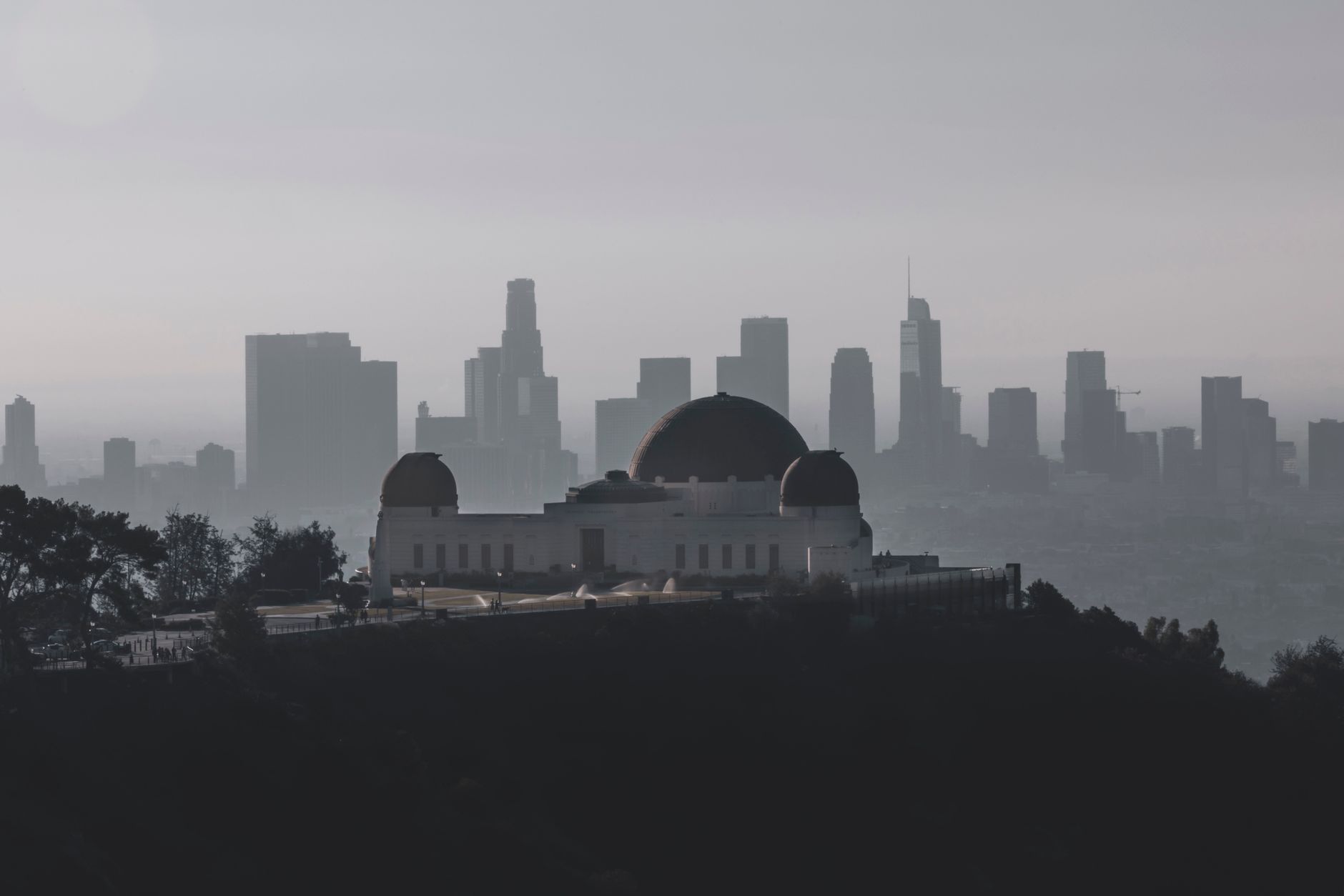

The thing outsiders get wrong about Los Angeles is the shape of it.
The picture is freeway and sprawl to the horizon. The reality is that a mountain range runs through the middle of the city, the Santa Monica Mountains, reaching from Griffith Park in the east all the way to Point Mugu on the coast, and a much taller range walls off the northern edge, the San Gabriels, rising past 10,000 feet within forty miles of downtown.
Between them, Greater LA has more accessible vertical relief than almost any large American city. Most residents are twenty minutes from a trailhead. Very many are twenty minutes from a thousand-foot climb.
The Santa Monica Mountains
This is the range inside the city, protected as a National Recreation Area, and it is a patchwork of federal, state, county and conservancy land stretching roughly fifty miles east to west.
Griffith Park at the eastern end is the urban anchor, running to over 4,000 acres, among the largest municipal parks in the country, with a genuine trail network. The Griffith Observatory sits on its flank and trails climb from it to Mount Hollywood at 1,625 feet for a view over the basin. The Hollywood Sign hikes from Brush Canyon or Innsdale are the ones everyone asks about, and they reach the ridge behind the letters rather than the letters themselves, which are fenced. Runyon Canyon nearby is the celebrity-adjacent short steep loop, busy and off-leash-friendly.
West of the 405 the range gets serious. Los Liones and Topanga State Park, which claims to be the largest park within the boundaries of a major American city, offer real half-day loops, though the Temescal Canyon Trail remains closed for Palisades Fire recovery, while Sandstone Peak at 3,111 feet is the range's high point, a roughly six-mile loop in the western Santa Monicas with an ocean-to-valley summit view. Solstice Canyon, Escondido Falls and Point Mugu State Park carry the Malibu end, where the mountains meet the ocean directly.
Tying it together is the Backbone Trail, running about 67 miles along the crest of the whole range from Will Rogers to Point Mugu, completed in 2016 after decades of easement acquisition. It is the region's thru-hike, and it sits entirely inside a metropolitan area of thirteen million people.
Backbone Trail Orientation: What to ExpectThe San Gabriels
The big mountains, and the reason LA has genuine alpine hiking. Angeles National Forest covers most of the range, with the San Gabriel Mountains National Monument designated in 2014 over a large part of it.
Chantry Flats, above Sierra Madre, is the classic front-range trailhead. Sturtevant Falls is roughly 3.3 miles round trip with about 400 feet of gain to a 50-foot waterfall in Big Santa Anita Canyon, past a hillside of historic private cabins reachable only on foot, and longer routes continue to Sturtevant Camp and up to the ridge. Mount Wilson at 5,710 feet holds the historic observatory where Hubble established that the universe is expanding, and you can drive up or climb it from Chantry Flats or Sierra Madre for a serious day of around 14 miles and 4,500 feet.
Mount Baldy, properly Mount San Antonio, is the range's high point at 10,064 feet, and the standard routes from Manker Flats are hard, exposed days that hold snow and ice into spring and kill people most winters. The Ski Hut trail and the Devil's Backbone are not casual outings. At the other end of the scale, Echo Mountain and the Sam Merrill Trail from Altadena climb to the ruins of a Victorian mountain resort, and Eaton Canyon is the busy family option, where the falls beyond the maintained trail are a chronic rescue site. The Sam Merrill, Echo Mountain, Mount Lowe and Eaton Canyon trails across the Altadena front range are closed for Eaton Fire recovery through December 31, 2027, so confirm access before planning any of them.
Everything else
The Verdugos and San Rafael Hills sit between Glendale, Burbank and Pasadena, offering steep fire roads, big views, almost no shade, and a fraction of the traffic the bigger ranges get. The Puente Hills and Chino Hills State Park cover the eastern suburbs, and the Palos Verdes Peninsula has bluff trails above the ocean and tide-pool coves, geologically distinct from everything else in the basin.
Two further options are worth the drive. The San Bernardinos put San Gorgonio at 11,503 feet, the highest peak in Southern California, within a two-hour drive, and it requires a wilderness permit. And Point Dume and Malibu Creek State Park, where MASH was filmed, round out the coastal side.
The Great Hiking Era
Between roughly 1890 and 1938, Los Angeles was one of the most enthusiastic hiking cities in America, and the ruins of that period are on the trails today.
The front range of the San Gabriels filled with trail resorts, camps and hotels reachable only on foot or by burro, serving a city that walked into the mountains on weekends by the tens of thousands. Switzer's Camp in the Arroyo Seco, Sturtevant Camp in Big Santa Anita, Martin's, Opid's and dozens more ran on pack-train supply lines. The Mount Lowe Railway, opened in 1893, carried passengers by cable incline and electric trolley from Altadena to a hotel complex on Echo Mountain, the White City, whose searchlight was visible for miles out to sea, and on toward Mount Lowe itself. It was a genuine engineering spectacle and a national attraction.
It did not last. Fire took the Echo Mountain Hotel in 1900 and the Alpine Tavern in 1936, floods repeatedly destroyed the right of way, and a 1938 flood finished off much of the trail infrastructure across the entire front range. The automobile did the rest, because the Angeles Crest Highway opened up country that had previously required a two-day walk and the resort economy evaporated.
What remains is unusually good hiking. The Sam Merrill Trail from Altadena climbs to the Echo Mountain foundations, where you can still see the concrete pads, the incline bullwheel and the railway grade. The Mount Lowe Railway Trail follows the old alignment past the Circular Bridge site and the Alpine Tavern ruins. Sturtevant Camp is still standing above Chantry Flats and still reachable only on foot, and the pack station below it operated for a century. The cabins you pass in Big Santa Anita Canyon are the same story: private structures on Forest Service permits, built in the 1910s and 1920s, with no road access, still supplied by hand.
It is a strange and specific pleasure, walking a chaparral canyon twenty minutes from a freeway past the foundations of a mountain hotel that a hundred thousand people a year once rode a cable railway to reach.
Fire has rewritten this landscape
You cannot hike Los Angeles honestly without understanding this. The chaparral covering these mountains is a fire-adapted ecosystem that burns naturally on a decades-long cycle, and the combination of a century of suppression, extreme fire weather and ignition sources has pushed that far past its natural rhythms.
The Station Fire in 2009 burned over 160,000 acres of the San Gabriels and closed large sections of the front range for years. The Woolsey Fire in 2018 burned a huge portion of the Santa Monica Mountains including much of Malibu Creek and Point Mugu. The Bobcat Fire in 2020 took another 115,000 acres, and the January 2025 fires burned through the front range above Altadena and Pacific Palisades.
The consequences are permanent features of hiking here. Trails close for years after a burn, debris flows in the first winters after a fire are a serious hazard on canyon trails, regrowth chaparral is impenetrable off-trail, and shade disappears from routes that had it.
Always check current closures, because this is the single most volatile variable in Southern California hiking and it changes faster than any guidebook can track. It is also the case for carrying a map that knows about it: Guidepole Hike shows current closure status and the managing agency alongside the trail, which in a region where a fire can shut a front-range canyon for three years is the difference between a plan and a wasted drive to a gate.
The Mishe Mokwa Loop and Sandstone Peak in the Santa Monica MountainsHeat, season, and time of day
LA's hiking calendar is inverted, like the Bay Area's, but harder. Winter is the best season, being cool and often clear, with occasional rain that greens the hills and snow on the San Gabriels visible from the beach, and spring brings wildflowers and the last green before everything turns.
Summer and early autumn are the dangerous part. Inland valleys and the Verdugos regularly exceed 100°F, the chaparral gives no shade, and heat illness on LA trails is a routine emergency-services call. The answer is time of day rather than season, so start at sunrise and be finished by ten, because the same trail that is dangerous at 2 p.m. is pleasant at 6 a.m.
Two other windows matter. Santa Ana wind events in autumn bring extreme heat, single-digit humidity and the highest fire danger of the year, so do not be deep in a canyon on a red flag day. And the San Gabriels above 6,000 feet hold winter conditions from roughly December through April, with Baldy in particular requiring ice axe and crampons and the skill to use them.
The gear
Los Angeles hiking is two ranges with opposite problems: a low coastal range that is hot and dry, and a high one that gets serious winter. The gear list covers both.
More water than feels reasonable, which is the single most important line here. The Santa Monicas have almost no shade, no water, and reliably reach the nineties, and the search and rescue calls in this county are overwhelmingly heat and dehydration rather than falls.
A sun hat and high-SPF sunscreen, for the same reason.
An early alarm, which is genuine equipment in this city. A seven in the morning start in the Santa Monicas is a different hike from a ten in the morning start, and in summer it is the difference between pleasant and dangerous.
Poison oak wash, since it is abundant in every canyon bottom in the Santa Monicas and most people who get it got it in the first mile.
An Adventure Pass for the Angeles National Forest trailheads, which is a separate thing from anything the Santa Monica Mountains National Recreation Area wants.
A fire and closure check before you drive, which is not optional here. Large sections of both ranges have burned in the last decade, closures after a fire last years rather than weeks, and trails reopen unpredictably.
And traction plus an ice axe for Mount Baldy in winter, which is a genuinely alpine mountain at ten thousand feet with a fatality record to match, forty-five minutes from downtown.
Fees, access, and practicalities
An Adventure Pass is required for parking at many Angeles National Forest trailheads including Chantry Flats, at around $5 a day or $30 a year, and an America the Beautiful pass covers it. State parks charge separately, while most Santa Monica Mountains NRA and city trailheads are free. Note that Chantry Flats road access has been repeatedly closed by storm damage and fire, sometimes for years, which shifts everyone to Sierra Madre and lengthens the day considerably.
On the trail itself, rattlesnakes are common from spring through autumn on nearly every route described here, poison oak is abundant in the canyons, and ticks appear in the wet season. Mountain lions are present in the Santa Monicas as a famously isolated population, cut off by the 101 freeway, which is why the Wallis Annenberg Wildlife Crossing is being built over it, set to open in December 2026. And parking is the real constraint at popular trailheads, since Runyon, Eaton Canyon and the Hollywood Sign approaches fill early and carry contentious neighborhood restrictions.
Getting there without a car
Less hopeless than the city's reputation suggests, and improving. Griffith Park is served by DASH shuttles and the Metro B Line to Vermont/Sunset with a connection. Runyon Canyon is a short walk from Hollywood Boulevard stations. Eaton Canyon and the Sam Merrill Trail in Altadena are reachable by Metro A Line to Sierra Madre Villa or Allen and a local bus, and Will Rogers and the Palisades end of the Backbone sit on Metro bus routes along Sunset.
The San Gabriel high country and the western Santa Monicas realistically need a car. But the everyday thousand-foot climb, the thing that makes LA a good hiking city, is largely transit-reachable, and that is where the parking problems are worst anyway.
Where to start
A morning is Griffith Park to Mount Hollywood, with the Sam Merrill and Echo Mountain ruins in Altadena closed for Eaton Fire recovery through 2027. A half day is Sturtevant Falls from Chantry Flats, or Solstice Canyon in Malibu. A full day is Sandstone Peak in the western Santa Monicas, or Mount Wilson from below if you want the whole 4,500 feet. And a big day is Baldy, in the right season, with the right gear.
The habit worth forming, if you live here, is to go at dawn. The city is an excellent hiking town for about four hours a day in summer, and all day for half the year.
The northern California version is hiking the San Francisco Bay Area. For the state's high country: one day in Sequoia National Park. On the smoke and closures: hiking in wildfire smoke and is that trail public.
The other California city with a large greenbelt is in hiking the San Francisco Bay Area. The parks within a long drive are in one day in Sequoia National Park and one day in Yosemite, and the Sierra day hikes north of here are in Eastern Sierra day hikes. The fire closures that shape access are worth reading alongside red flag warnings explained.