Fish
Fish Fire
Fire Hike
Hike Bird
Bird


Everyone in Yosemite is looking at Half Dome. Clouds Rest is the mountain looking down on it.
At 9,926 feet it stands roughly a thousand feet above Half Dome's 8,844, sits directly behind and above it, and offers what a lot of people who have done both consider the superior view, because from Clouds Rest you see Half Dome as an object in a landscape rather than standing on it looking out.
It requires no permit for a day hike. There is no lottery, no application fee, no March deadline. You drive to a trailhead and walk. The reason more people do not is that Half Dome is famous and this is not.
The route from Tenaya Lake
There are two ways up, and one of them is dramatically more sensible. From Tenaya Lake on Tioga Road, the trail runs roughly 12.5 to 14.5 miles round trip with about 1,775 feet of elevation gain, starting at around 8,150 feet. Sources vary on the exact distance depending on where you park and which junction you count from, but the gain figure is consistent and it is the number that matters.
Seventeen hundred feet over that distance is a gentle profile by Sierra standards, so you are walking a long way rather than climbing hard, through lodgepole pine and open granite country with the ground rising steadily. From Yosemite Valley the same summit is a brutal proposition of roughly 20-plus miles with over 5,000 feet of gain, usually done as part of a longer trip.
The Tenaya Lake approach is what makes Clouds Rest a reasonable day hike, and it is entirely a product of Tioga Road doing the climbing for you, because that road tops out at nearly 10,000 feet so you start the hike already in the high country.
Clouds Rest, Yosemite: A Hike GuideThe fin
The last section is why this hike has a reputation among people who know it. The summit is reached along a narrow granite ridge, a fin of rock with the ground dropping away steeply on both sides, falling toward Tenaya Canyon on the left and toward Little Yosemite Valley on the right.
It is not technical. There is no scrambling in the Class 3 sense and the walking surface is solid granite. But it is genuinely exposed, in places only a few feet wide with several thousand feet of air on either hand, and there are no railings, cables or barriers of any kind. Use extreme caution beyond the Clouds Rest foot trail marker, which is where the park's own signage draws the line.
For people comfortable with heights it is one of the great walks in the Sierra. For people who are not, it is the point at which the hike ends, and that is a completely reasonable outcome, because the view from just below the fin is already enormous. Wind is the variable that changes it, since a gusty day on a narrow granite ridge is a different proposition from a still one.
The view, and Tenaya Canyon below it
From the summit you get one of the more complete panoramas available in Yosemite. Half Dome sits below and in front of you, seen in profile from above, which almost nobody photographs because almost nobody goes there. Yosemite Valley runs west with El Capitan and the valley walls, and the Clark Range and the Sierra crest fill the east and south, with a very long way visible in every direction on a clear day.
The drop on the north side falls into Tenaya Canyon, and that has a reputation worth knowing about. It is the drainage running from Tenaya Lake down to Yosemite Valley, and it is one of the more serious pieces of terrain in the park: steep polished granite, waterfalls, pools, and sections requiring technical descent. It has caught out enough people over the years to have acquired local folklore, the park signs it for experienced parties with technical skills only, and it is emphatically not a shortcut from Clouds Rest to the Valley. From above it looks like a deep, clean-walled canyon, which makes it one of the more striking things visible from the summit: a piece of Yosemite almost nobody travels through, immediately below one of its better viewpoints.
The argument for Clouds Rest over Half Dome is that you get the icon in the frame instead of standing on it, and you get it without cables, a lottery, or a line.
Tioga Road governs everything
The hard constraint on this hike is not permits or fitness. It is a road. Tioga Road, Highway 120 across the park, closes with the first substantial snow, often in November and sometimes earlier, and typically reopens somewhere between late May and early July depending entirely on snowpack, because plowing a road at 9,945 feet takes as long as it takes.
When it is closed, Tenaya Lake is unreachable and the only approach is the long, hard route from the Valley. So the practical season for Clouds Rest as a day hike is roughly July through October, and the opening date is worth checking with the park rather than assuming. Caltrans and the park both publish the status, and in a heavy year plans built around a June trip fall apart.
No Half Dome Permit? Hike Clouds Rest from Tenaya LakeThe permit question
Day hiking Clouds Rest requires no wilderness permit. You need only whatever park entry requirements apply, and in 2026 Yosemite is not operating a timed-entry reservation system, so entry is straightforward this year. Overnight trips do require a wilderness permit through the park's quota system, and the Sunrise Lakes and Tenaya Lake trailheads have their own allocations.
That asymmetry is the whole point of this article. The same mountain, on the same day, is either a lottery-free walk or a permitted overnight depending on whether you sleep out, and nothing on the ground marks the difference. Guidepole Hike carries the permit requirement against the trailhead and the trip type rather than against the mountain, which is what makes the free version findable at all: the reason so few people walk Clouds Rest is not that it is hard to get, it is that Half Dome's lottery is the only thing anyone hears about.
Entry rules change annually, so confirm with Yosemite National Park before you travel.
The gear
Clouds Rest from Tenaya Lake is fourteen miles with less than two thousand feet of gain, which makes it sound easier than it is, and the gear list is shaped by altitude and sun rather than by steepness.
Three liters of water capacity, because the trail starts above eight thousand feet in dry air and the exposed sections have no shade.
A water filter, since there are creeks in the first few miles and nothing on the ridge.
Shoes with sticky rubber, for the summit fin. The last few hundred yards are bare granite with drop-offs on both sides, it is not technical, and the surface is what you are trusting.
A sun hoody and high-SPF sunscreen, because you are above nine thousand feet on light-colored granite for most of the day.
A headlamp, since fourteen miles at altitude takes most people eight or nine hours and the Tioga Road parking is a long way from anywhere in the dark.
A rain shell, for the afternoon build-up that is routine over the Sierra crest through July and August. Being on that fin in a thunderstorm is the one genuinely dangerous scenario on this hike.
And bear-proof food storage at the trailhead, meaning the lockers at Tenaya Lake, because leaving food in a car on Tioga Road is how a bear breaks a window.
Altitude, quietly
This is worth flagging because the gentle profile disguises it. You start at 8,150 feet and finish at 9,926, which is high enough to affect people arriving from sea level, particularly on a long day, and the fact that the climbing is gradual makes it easy to under-notice.
The symptoms are the usual ones, meaning headache, unusual fatigue and nausea, and the response is the usual one, which is to stop and, if it does not resolve, to descend. Sleeping a night in the park or in the Eastern Sierra beforehand helps materially, and Tuolumne Meadows at 8,600 feet is ideally placed for exactly that.
The other approach, and the through-hike
There is a second way to do this that a lot of strong hikers prefer. Tenaya Lake to Yosemite Valley, over Clouds Rest and down, is a long point-to-point of roughly 20 miles finishing on the Valley floor. It is mostly downhill after the summit, dropping from 9,926 feet to around 4,000, and it strings together the high country, the summit fin, and the descent past Half Dome's shoulder into the Valley.
It needs a shuttle or two cars, and the Yosemite Valley shuttle and the seasonal Tuolumne bus have historically made that workable without arranging your own, though you should check current transit before relying on it. The attraction is that it uses gravity properly, because Tioga Road delivers you to 8,150 feet and you spend the day descending to the Valley with a 9,926-foot summit in the middle. The cost is that 20 miles is a serious day regardless of the profile, and the last few thousand feet of descent on tired legs is punishing.
Adding Half Dome from the Clouds Rest side is possible for very strong parties who hold a Half Dome permit, and it converts a permit-free hike into a permitted one.
Why Yosemite's high country is different
Most visitors never see the part of the park this hike sits in, and it is worth explaining what they are missing. Yosemite Valley is a glacially carved trench at around 4,000 feet, dramatic and enclosed and the reason the park exists in the public imagination, and it is also seven square miles holding the overwhelming majority of the park's visitors.
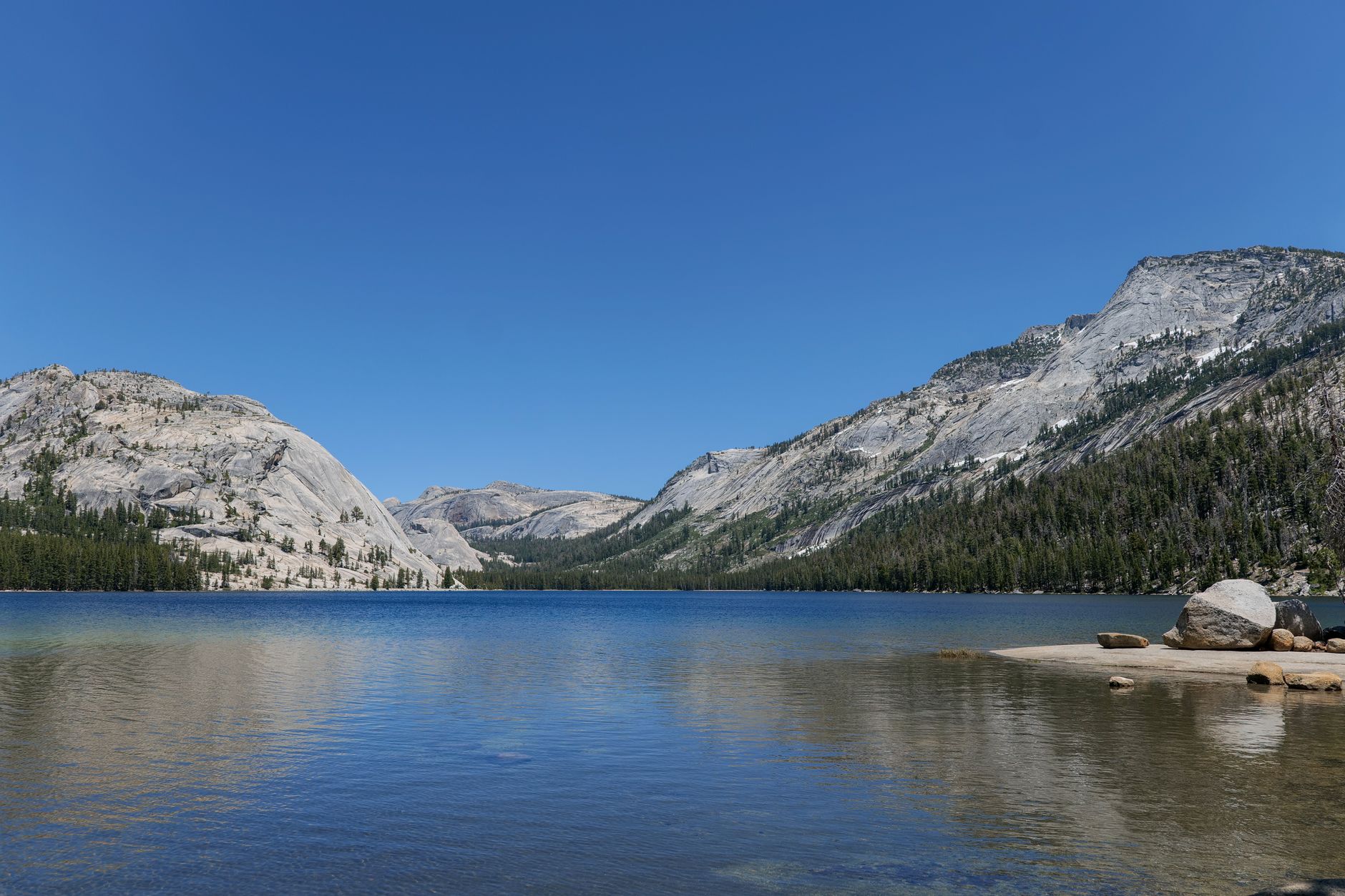
The high country along Tioga Road is a different landscape entirely: open granite domes and slabs, subalpine meadow, lodgepole pine and lakes, at 8,000 to 10,000 feet. It is quieter by an order of magnitude, cooler in summer, and it is where the park's backcountry is. Clouds Rest sits on the boundary between them, with high country on the approach and a summit looking straight down into the Valley, and that transition is a large part of why the view works.
It also combines well with everything else up there. Tenaya Lake itself is worth an hour at either end, a large alpine lake right on the road with granite domes around it. Tuolumne Meadows further east is the natural base and a completely different Yosemite from the Valley. And Cathedral Lakes and Lembert Dome are the other classic Tioga Road day hikes. The practical implication is simple: if you are in Yosemite in July or August and the Valley feels unbearable, drive up Tioga Road, because it is the same park and it does not feel like it.
Practical notes
Start early, because twelve to fourteen miles at altitude takes most people seven to ten hours and afternoon thunderstorms over the Sierra are routine in summer, and a narrow exposed granite fin is the last place to be in lightning. Parking at Tenaya Lake fills, particularly on summer weekends.
Water is limited, since there are creek crossings early on but the upper route is dry granite, so carry two to three liters and filter what you can. There is no shade for much of the upper route and the granite reflects hard at 9,000 feet. Bears are present and food storage rules apply throughout the park including at trailheads, so use the lockers. Dogs are not permitted, as on nearly all national park trails. And signal is absent across the high country.
Half Dome from above, with nobody behind you
Check that Tioga Road is open, because nothing else matters until it is. Sleep high the night before if you are coming from sea level. Start early from Tenaya Lake, carry more water than the gentle profile suggests, and be honest with yourself at the foot of the fin.
Then walk the last quarter mile of granite ridge, sit down somewhere sensible, and look at Half Dome from above with nobody waiting in line behind you.
It is the best view in Yosemite and it costs a tank of gas and an early alarm.
The famous alternative, with its cables and its March lottery, is covered in the Half Dome cables. With a single day in the park, one day in Yosemite lays out the options. And the altitude that quietly affects this hike is explained in hiking at altitude.
The more famous summit, five hundred feet lower and visible from the top of this one, is in the Half Dome cables. The park is covered in one day in Yosemite and three days in Yosemite. The east side of the same crest is in Eastern Sierra day hikes, and the hardest day in the range is in Mount Whitney as a day hike.