Fish
Fish Fire
Fire Hike
Hike Bird
Bird

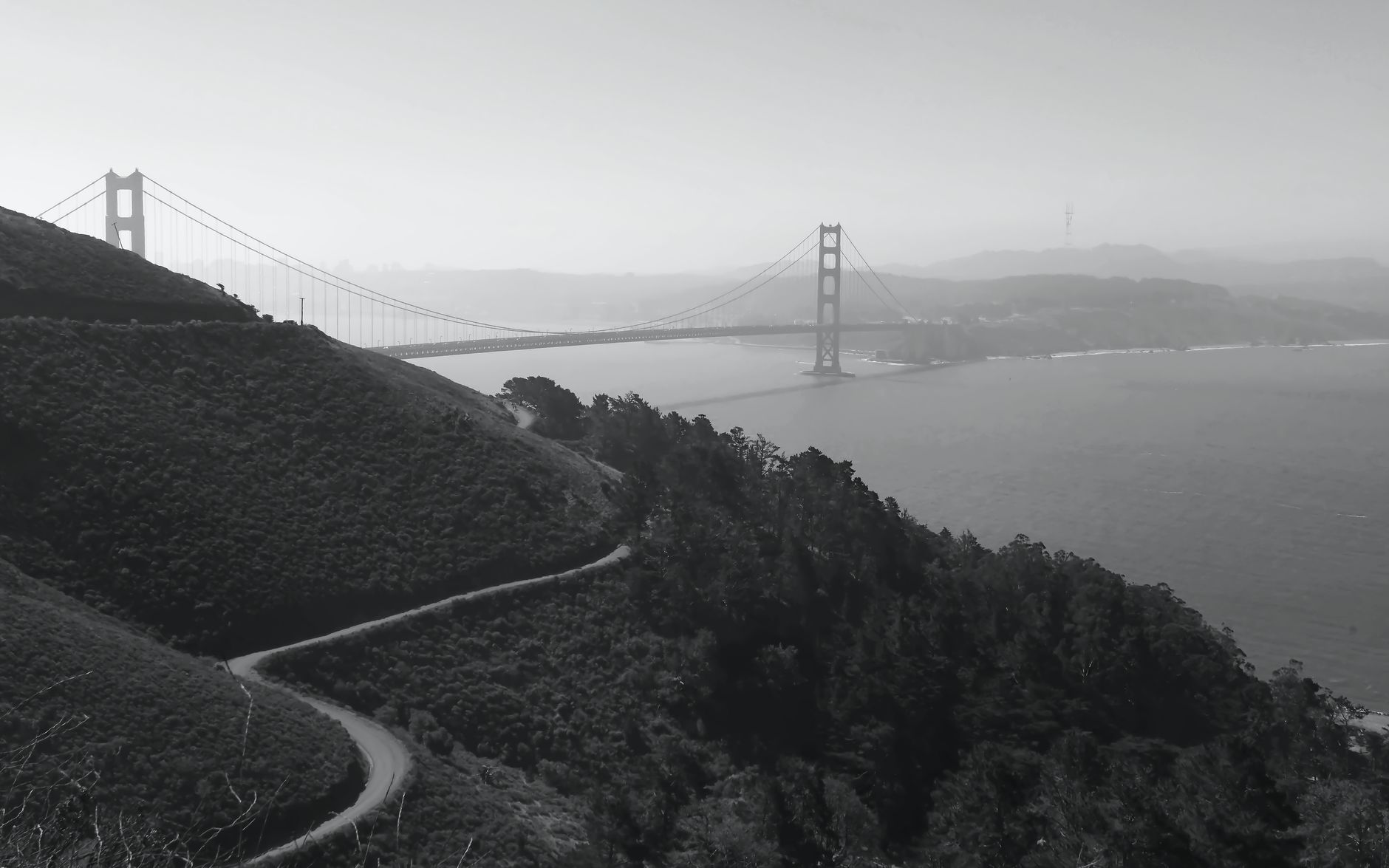

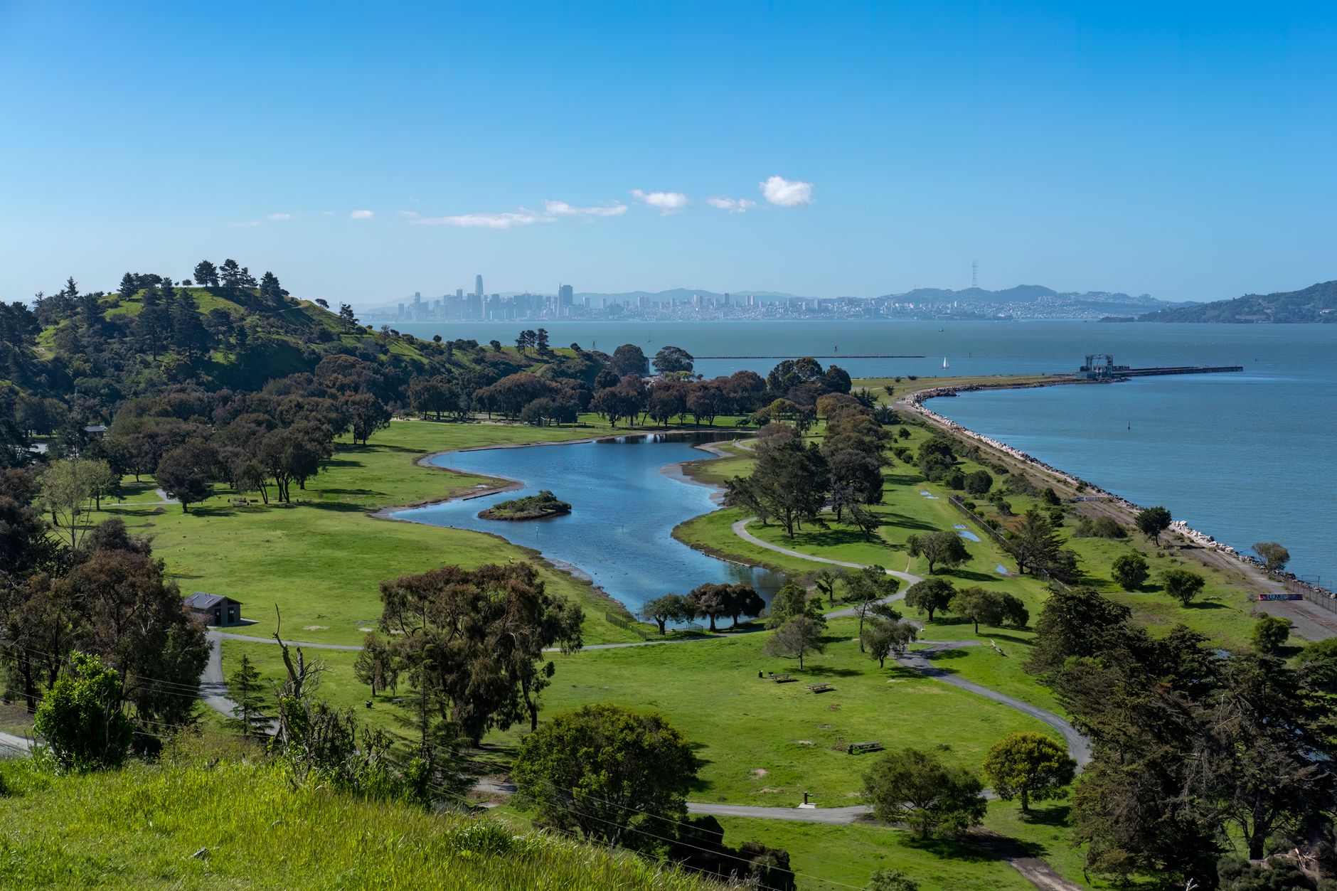
Fly into the Bay Area and the thing that should strike you, once you know to look for it, is how much of the land around the bay is empty.
Not empty by accident. Ringing roughly seven million people is one of the largest protected greenbelts around any American city: well over a million acres of parkland, watershed land, agricultural easement and open space preserve. It was assembled piecemeal across more than a century by a scatter of agencies that were often not coordinating with each other, and the result is a hiking resource that is difficult to exhaust.
The practical consequence is that a resident of San Francisco, Oakland or San Jose can be walking in redwoods, chaparral, coastal prairie or oak savanna within forty minutes, frequently by bus.
Why the greenbelt exists
Three separate forces built it, none of which set out to build a greenbelt. The first was watershed protection, as the water utilities bought enormous tracts to protect reservoirs: the Marin Municipal Water District lands on Mount Tamalpais, the San Francisco watershed on the Peninsula, EBMUD's holdings in the East Bay hills. Much of this is now open to hikers, some by permit, and it accounts for a great deal of the green on the map.
The second was the military. The Bay Area was ringed with coastal defense installations from the 1850s onward, and when they closed the land became parkland, producing the Presidio, the Marin Headlands, Fort Funston and Angel Island. That is why some of the most spectacular headland walking in the country sits directly across the bridge from a major city.
The third was deliberate acquisition. The East Bay Regional Park District, founded in 1934, is now one of the largest regional park agencies in the United States, the Midpeninsula Regional Open Space District has protected a huge swathe of the Santa Cruz Mountains since 1972, and the Golden Gate National Recreation Area, established the same year, tied the federal pieces together.
So the land you walk on is federal, state, county, regional, municipal or utility, often within the same afternoon, with different dog rules, different bike rules and different hours on each. That is the practical cost of a greenbelt assembled by accident, and it is what Guidepole Hike carries under the trail here: which agency you are on, and where that changes, on a map where the boundaries are otherwise invisible from the ground.
Best Hiking Trails in the San Francisco Bay AreaMarin: the headlands and the mountain
Cross the Golden Gate and the Marin Headlands begin immediately, with ridge trails running above the bridge and the city behind them, dropping to Rodeo Beach and the old gun batteries. The Coastal Trail and the Miwok and Wolf Ridge loops give five to eight miles with real elevation and one of the best urban views anywhere.
Behind them rises Mount Tamalpais, 2,571 feet at the East Peak, with roughly sixty miles of trail on the mountain itself connecting into a network measured in the hundreds. There are redwood canyons on the north side, chaparral on the south, and views from the Farallones to the Sierra on the clearest winter days.
Three things on the mountain are worth naming. The Dipsea Trail runs about 7.4 miles point to point from Mill Valley over the shoulder of Tam to Stinson Beach, a famously steep and undulating route and the course of the oldest trail race in America, run since 1905, with the steps out of Mill Valley the famous part. Muir Woods, at the base, holds old-growth coast redwood and requires a parking or shuttle reservation, though the trails above it are free and far quieter. And Point Reyes, an hour north, is a different scale of place entirely, with Tomales Point, Chimney Rock, the Alamere Falls coast and tule elk.
The East Bay
Underrated, enormous, and the best transit-served hiking in the region. Tilden Regional Park and the ridge above Berkeley connect into a chain running most of the length of the East Bay hills, where Wildcat Canyon, Sibley Volcanic, Huckleberry, Redwood Regional and Anthony Chabot run more or less continuously and the East Bay Skyline National Recreation Trail links about 31 miles of them.
Two are unusual enough to seek out. Redwood Regional Park holds second-growth coast redwood inside Oakland, descended from trees so large that ships once used them as a navigational landmark from the Golden Gate. Sibley is a former quarry that exposes the innards of an extinct volcano, with labyrinths built by visitors down in the pits.
Further east, Mount Diablo at 3,849 feet is the region's big mountain: a state park with a summit road, long strenuous trails up from several sides, and a claimed viewshed larger than almost anywhere in the western hemisphere on the rare clear day.
The Peninsula and the South Bay
The Santa Cruz Mountains run down the spine of the Peninsula, and the Midpeninsula open space preserves cover much of the eastern slope. Purisima Creek Redwoods, Rancho San Antonio, Windy Hill, Russian Ridge and Skyline Ridge offer everything from flat family loops to hard climbs of two thousand feet, mostly free and mostly uncrowded on weekdays.
Three others are worth the drive for different reasons. Big Basin Redwoods, California's oldest state park, burned catastrophically in the 2020 CZU fire and has been reopening in stages, and the recovery is itself worth seeing, because coast redwood resprouting from fire-scarred trunks is one of the more remarkable sights in the state. Henry Coe, southeast of Morgan Hill, is the largest state park in northern California and the closest thing to genuine backcountry within reach of the bay: steep, hot, dry and empty. And Mission Peak above Fremont is the South Bay's cult climb, about 6 miles round trip and 2,100 feet, treeless, brutally hot in summer, and famous for the line at the summit pole.
San Francisco itself
Two walks inside the city are better than their length suggests. Angel Island, reached by ferry from San Francisco or Tiburon, has a five-mile perimeter road, a summit trail up Mount Livermore at 788 feet with a 360-degree view of the entire bay, and the preserved immigration station that processed hundreds of thousands of arrivals from Asia between 1910 and 1940. It is the rare hike where the boat ride is part of the appeal.
Lands End, on the city's northwestern corner, runs a coastal trail along cliffs above the Golden Gate, past shipwreck remains visible at low tide and the ruins of the Sutro Baths. Under three miles, reachable by Muni, and the closest thing the city proper has to a wilderness walk.
The two long trails
Two region-wide projects tie the greenbelt together, and both are worth knowing even if you never walk them end to end.
The Bay Area Ridge Trail is planned as a roughly 550-mile loop along the ridgelines that ring the bay, and around 415 miles are open. It links Mount Tamalpais, the Marin Headlands, the East Bay hills, Mount Diablo's flanks and the Santa Cruz Mountains crest, and because it follows the high ground almost any segment gives you a view of the bay. The signage is consistent across the dozens of agencies whose land it crosses, which is the actual achievement.
The San Francisco Bay Trail is its opposite number at sea level, planned at about 500 miles around the shoreline itself with over 350 miles complete. Flat, largely paved, frequently on levees and old salt-pond dikes, and superb for birds, with the Alviso and Don Edwards sections at the south end running through restored salt ponds that still glow pink and orange from the salt-tolerant algae left over from a century of commercial harvest. Between the two you can pick your elevation and get a continuous route almost anywhere in the region.
Serpentine, and why the wildflowers are strange
The Bay Area sits on a chaotic geological assemblage, the Franciscan Complex, scraped off a subducting oceanic plate, and one of its components matters enormously to what grows here. Serpentinite is California's state rock, and soils derived from it are low in calcium, high in magnesium and heavy metals, and hostile to most plants. Where it outcrops, the ordinary grassland and chaparral thin out, and in their place grows an unusually high concentration of endemic wildflowers that tolerate the chemistry and have nowhere else to go.
The practical result is a set of places where March and April are extraordinary. Ring Mountain in Marin holds the Tiburon mariposa lily, found on that single hillside and nowhere else on earth. Edgewood Preserve does the same job on the Peninsula, and Coyote Ridge near Morgan Hill is where the bay checkerspot butterfly depends on serpentine plantain.
Serpentine outcrops are visible as pale bluish-green rock carrying thin, stunted vegetation. Once you can spot it you start seeing it all over the region, and it explains why one hillside is smothered in flowers while the next one over is nothing but wild oats.
Mount Tamalpais: A Bay Area Hidden GemFog, seasons, and the local logic
The Bay Area's hiking calendar is upside down relative to most of the country. Winter and spring are the best seasons, because rain falls between November and April, the hills turn green, creeks run, wildflowers peak in March and April, and visibility on clear post-frontal days is extraordinary.
Summer is the difficult one. The hills go gold and dry, inland temperatures climb past 100°F in the East Bay and South Bay, and the coast disappears under fog, which makes Mission Peak and Diablo dangerous in a July afternoon. The fog is best understood as a microclimate machine: it pours through the Golden Gate and over the coastal hills, and it can be 58°F at Rodeo Beach and 95°F in Walnut Creek on the same afternoon, twenty miles apart. Plan around it rather than against it, which means coast in summer and inland in winter. Autumn is warm, clear and stable, with the fog retreating, and it is often the best hiking weather of the year without the green.
The gear
Bay Area hiking is a Mediterranean climate with a fog machine attached, and the gear list is about temperature swings and one plant.
Poison oak wash, which belongs at the top of any Bay Area list. It is in essentially every canyon and shaded slope in the region, it is leafless and easy to walk through in winter, and washing within a couple of hours with a dedicated cleanser makes a real difference.
A wind shell, since the ridges from the Marin Headlands to Mount Tamalpais to the Peninsula skyline are exposed to the gap winds coming through the Golden Gate.
More water than the distance suggests, because the East Bay and the inland Peninsula in summer are hot and shadeless in a way the coastal reputation does not prepare people for.
Layers you can shed fast, which is the actual Bay Area skill. Starting in fog at fifty-five degrees, climbing above it into eighty-degree sunshine, and dropping back into fog on the descent is an ordinary afternoon on Tam.
Sun protection, for the part above the fog.
A transit app, because a surprising number of these trailheads are reachable by bus or ferry and the parking at the popular ones is bad.
And trekking poles, for the long steep fire road descents that make up much of the East Bay park system.
Hazards, fees, and getting there
Poison oak is everywhere and is the single most common way to ruin a Bay Area hike, so learn the leaf, stay on trail and wash afterward. Ticks are abundant in the wet season grass, rattlesnakes appear on warm inland trails from spring, and mountain lions are present throughout though encounters are extremely rare.
Fees vary by agency, with state parks and Muir Woods charging, most regional and open space preserves free, and some East Bay parks charging on weekends only. Dog rules vary enormously and sometimes between adjoining parks, since East Bay Regional Parks are famously permissive while national park units and state parks generally are not. And transit works better here than anywhere else in California: BART to Tilden-adjacent trailheads, the Marin Headlands shuttle, Muni to Lands End and the Presidio, and Caltrain to the Peninsula preserves with a bike.
Where to start
One morning is the Marin Headlands loop from Rodeo Beach, for the view back at the bridge. One day is Mount Tam, either the Dipsea toward Stinson or a redwood-canyon loop on the north side. One day in the East Bay is Redwood Regional to Skyline, which is a redwood forest inside Oakland.
And if you live here, the honest advice is to stop treating any of it as a destination. The whole point of a greenbelt this size is that a good three-hour walk is always within forty minutes of wherever you happen to be.
Southern California's version is hiking Los Angeles, and the state's marquee park is one day in Yosemite. For the water in the middle of it all: how to fish San Francisco Bay.
The other California city with a serious trail network is in hiking Los Angeles. The birding version of this region is in birding San Francisco Bay and Point Reyes and its vagrants. The parks within a long drive are in one day in Yosemite and one day in Sequoia National Park.