Fish
Fish Fire
Fire Hike
Hike Bird
Bird

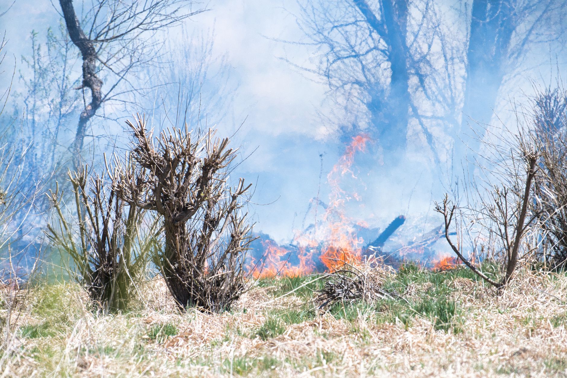

A Red Flag Warning is one of the most widely reported and least well understood weather products in the country.
The single most important thing to know: it is not a statement that a fire is burning. It is a statement about the weather.
What it means
A Red Flag Warning is issued by the National Weather Service when a combination of weather conditions and dry fuels creates an environment in which any fire that starts is likely to ignite readily, spread rapidly and behave dangerously. It is a warning to fire agencies, land managers and the public that the margin for error has disappeared.
The closely related product is the Fire Weather Watch, which means the same conditions are possible in the coming period and is typically issued further ahead. The relationship is the same as between any weather watch and warning: a watch means conditions are possible, usually issued twelve to seventy-two hours ahead, and a warning means conditions are occurring or imminent, usually within twenty-four hours.
The criteria
The thresholds are set locally by each National Weather Service office in coordination with land management agencies, because what constitutes dangerous fire weather in the Great Basin is different from what it means in the southern Appalachians. The common ingredients:
- Low relative humidity, frequently a threshold somewhere in the range of fifteen to twenty-five percent, sustained for a number of hours, because dry air pulls moisture out of fuels rapidly.
- Wind. Sustained speeds or frequent gusts above a threshold, commonly in the range of fifteen to twenty-five miles per hour, since wind supplies oxygen, pushes flame into unburnt fuel and carries embers ahead of the fire.
- Dry fuels. This is the precondition and it is measured rather than assumed, using fuel moisture and energy release indices, and wind and low humidity over wet fuels do not produce a warning.
- Dry lightning, which is a separate trigger on its own, because thunderstorms producing lightning with little or no rain reaching the ground can start many fires simultaneously across a large area, and a warning may be issued for that alone.
Some offices also use the Haines Index or similar measures of atmospheric instability, which relate to how erratically a fire will behave once established, and increasingly the Hot-Dry-Windy Index, which combines the variables into one number.
What it is not
Three distinctions are worth being clear about. It is not a fire danger rating, because the Low through Extreme ratings posted on signs at forest boundaries come from land management agencies and reflect a longer-term assessment including fuel conditions and seasonal drying, while a Red Flag Warning is a short-term weather product from a different agency. You can have Extreme fire danger with no Red Flag Warning, and the reverse.
It is not a fire restriction either. Restrictions on campfires, chainsaws, off-road driving and other ignition sources are imposed by land management agencies and counties on their own schedules, and they frequently coincide with red flag conditions while remaining legally separate. And it is not an evacuation notice, because it carries no instruction to leave anywhere.
What usually comes with it
In practice a Red Flag Warning often arrives as part of a cluster. Fire restrictions may be raised or extended. Public Safety Power Shutoffs have become common in parts of the west, particularly California, where utilities de-energize transmission and distribution lines in high-risk areas during extreme fire weather because equipment is a known ignition source, and if you are in a shutoff area the practical consequences are significant: no power for potentially days, no well pumps, no medical equipment, and no cellular service once tower batteries fail.
Prepositioning of resources is the other common accompaniment, as agencies move engines, crews and aircraft into the forecast area in advance, which is why response is sometimes remarkably fast during red flag events. Aviation restrictions may also be issued over any fire that does start.
Fire Weather Watch versus Red Flag Warning: The Timeline of EscalationHow fire weather is forecast
A little on the machinery, because it explains why warnings sometimes verify poorly and sometimes arrive with very little lead time. Predictive services exist at both the national and geographic-area level, staffed by meteorologists working specifically on fire, and they issue outlooks running from days to months ahead covering expected fire potential rather than only weather. Fuel moisture is measured continuously through a network of remote automated weather stations across the west, which report temperature, humidity, wind and precipitation and feed the indices behind both fire danger ratings and warnings.
Energy release component and burning index are computed values combining fuel moisture, fuel type and weather to describe how much energy a fire would release and how hard it would be to control. The forecast difficulty is wind, because downslope wind events are notoriously hard to predict in exact timing and location, depending on the interaction of a pressure gradient with terrain at a scale finer than many models resolve, so a forecast can be right about the day and wrong about the six hours, and in fire weather six hours matters enormously.
Verification is imperfect in both directions, since warnings are issued that do not produce a fire, which is the point, and occasionally severe fire weather materializes faster than the warning process. What this means for a member of the public is to treat the warning as a genuine signal and treat its absence as weak reassurance.
Reading the fire danger sign
Since fire danger ratings are the product most people see, on a sign at a forest boundary, they are worth decoding. The ratings run Low, Moderate, High, Very High and Extreme, and they are calculated from the National Fire Danger Rating System using fuel moisture, weather and fuel type. What they mean in operational terms:
- Low. Fires start with difficulty and spread slowly, and control is straightforward.
- Moderate. Fires start from most accidental causes and spread at a moderate rate in open fuels, while timber fires may still be slow.
- High. Fires start easily and spread rapidly, short-distance spotting is common, and control becomes difficult unless caught early.
- Very High. Fires start very easily from all causes, spread quickly and burn intensely, spot fires are frequent, and control becomes hard once established.
- Extreme. Fires start and spread extremely rapidly and burn with high intensity, long-range spotting, crowning and erratic behavior are likely, and direct control at the head of the fire is unlikely to be effective.
The key distinction from a Red Flag Warning is that this rating reflects the state of the fuels and the season and changes over days and weeks, while a warning reflects the weather over the next day. Both can matter, and the worst days are the ones where an Extreme rating meets a Red Flag Warning.
Why It Is Called a Red Flag Warning, and What Raises Fire DangerThe wind events with names
Some of the most dangerous red flag conditions come from specific regional wind patterns, and knowing yours is useful.
- Santa Ana winds in southern California: offshore flow from the interior, hot, extremely dry, funneled and accelerated through passes, typically autumn into winter.
- Diablo winds in the San Francisco Bay Area, the northern equivalent, offshore and dry.
- Chinook winds on the east side of the Rockies: warm downslope flow that can raise temperatures dramatically and strip moisture from fuels in hours.
- East winds in the Pacific Northwest: offshore flow through the Columbia Gorge and the Cascade passes, responsible for several of the region's most destructive fire events.
- Foehn winds generally, of which all of the above are examples: air descending a mountain range, warming and drying as it compresses.
The common feature is that these are downslope, offshore, warming and drying, and they arrive with strength. They are the conditions under which the largest and fastest fire growth happens.
The gear
A red flag warning is a forecast rather than an emergency, and the useful preparation is the sort that has to be done in advance.
Your county's alert signup, already done, because the warning itself comes from the National Weather Service and the evacuation notice that may follow comes from the county. Those are different systems and enrolling in one does not enroll you in the other.
A charged power bank, since red flag conditions are now routinely accompanied by public safety power shutoffs, and a shutoff takes your internet, your well pump and your phone charging with it.
Water stored in advance, for the same reason. An electric well pump without power is not a water supply.
A full tank of fuel, which is the cheapest preparation on this list and the one people skip. Stations without power cannot pump.
A battery or hand-crank radio, because during a shutoff local AM and FM are frequently the only channel still carrying evacuation information.
Nothing that throws a spark, and this is the part that is genuinely in your control. Chains dragging behind a trailer, a mower blade on a rock, a grinder, a chainsaw without a spark arrestor, a vehicle parked on dry grass with a hot catalytic converter. A large share of red flag day ignitions are equipment-caused rather than lightning.
And a cleared perimeter around the house, done in spring rather than on the day. Five feet of noncombustible ground against the walls is the highest-value defensible space work there is.
What to do
The honest guidance is that for most people the response is preparation rather than action.
- Do not start anything. No burning, no equipment that throws sparks, no chainsaws in the heat of the day, no dragging chains, no parking a hot vehicle on dry grass. A very large share of wildfires are human-caused, and red flag days are when a careless ignition becomes a disaster.
- Check your fire restrictions, which are separate and may have changed.
- Charge everything if you are in a potential shutoff area, and fill water containers.
- Keep vehicles fueled, because a shutoff takes fuel stations offline.
- Review your evacuation plan and zone. This is the day to know it, not the day after.
- Bring in anything that could become an ember problem, including doormats, cushions and firewood stacked against the house.
- Pay attention, because red flag events are when new starts happen and when existing fires make their biggest runs.
That last one is the hard part, since a Red Flag Warning tells you the conditions and not what is happening near you. Guidepole Fire puts active fires, satellite hotspot detections, smoke forecasts and air quality on one map, so that on a red flag day you can see whether anything has started nearby and how it is developing rather than refreshing several separate sites. On the days that matter, the useful question is not what the forecast says. It is what is on the ground right now.
Defensible space, briefly
The long-term answer to red flag days is what the house looks like before one arrives. Zone 0, the first five feet, is the highest-value zone and the most neglected, and the rule there is nothing combustible against the structure: no bark mulch, no shrubs under windows, no stacked firewood, no doormats and no stored items under the deck, with gravel, bare soil or hardscape instead. Zone 1, from five to thirty feet, is about breaking up continuous fuel, so space shrubs, remove dead material, prune tree limbs up away from the ground and keep grass short. Zone 2, from thirty to a hundred feet or more, is about reducing density, removing ladder fuels that carry fire from the ground into the canopy, and spacing tree crowns.
The house itself matters as much as the vegetation, because ember-resistant vents, a Class A roof, enclosed eaves, dual-pane windows and non-combustible siding do more in an ember storm than clearance alone. Embers are the mechanism, since most homes lost in wildfire are ignited by embers landing on or near the structure rather than by a wall of flame arriving, which is why the first five feet and the vents matter disproportionately.
None of this is a red flag day task. All of it is why a red flag day is survivable.
The short version
A Red Flag Warning is a weather product, meaning conditions favor extreme fire behavior if a fire starts, and a Fire Weather Watch is the same thing further out. Fire danger ratings and fire restrictions are different things again, from different agencies.
Low humidity, wind and dry fuels are the ingredients, with dry lightning as a separate trigger. And the correct response is not to panic but to not start anything, and to make sure the plan you would need tomorrow exists today.
For more, wildfire evacuation levels explained covers what happens if one does start, and how to read a wildfire smoke map covers tracking it once it does.
What happens if the warning turns into a fire, and what the notification levels mean, is in wildfire evacuation levels explained. Once something is burning, following the smoke is in how to read a wildfire smoke map and the air quality index explained. If it settles in for a week, the indoor answer is setting up a clean air room.
And if you are trying to keep training through a fire season rather than simply waiting it out, that is in exercising in wildfire smoke.