Fish
Fish Fire
Fire Hike
Hike Bird
Bird


Most cities have some trails. Boise has a system, and the distinction matters.
Ridge to Rivers manages more than 210 miles of trail across the Boise Foothills, and it is integrated rather than a collection of separate parks. Trails connect. You can leave from a neighborhood park at 2,700 feet and, if you want, keep climbing on connected tread to around 7,000 feet at Bogus Basin.
That continuity is the thing. It means a Boise hike is defined by how far you feel like going rather than by which trailhead you drove to.
Starting from downtown
Camel's Back Park, at the north end of Hyde Park, is the classic entry point, and the Camel's Back Trail is a 3-mile loop from the Heron Street lot, climbing over the distinctive hump the park is named for and connecting straight into the wider network.
From there the Hulls Gulch Reserve opens up. Hulls Gulch runs 12.6 miles in total, split into two very different halves, with Lower Hulls Gulch carrying about 813 feet of gain and Upper Hulls Gulch about 2,246, and a West Bank Trail to Hulls Gulch loop at around 3 miles is the standard short outing. The Military Reserve just east of downtown is another immediate access point, with its own loops through a shaded gulch, which is a genuine rarity in these dry foothills.
All of this is walkable or a short bike ride from central Boise, which is the part that surprises visitors.
Hiking Table Rock: Boise's Best ViewTable Rock: the one with the view
This is the flat-topped mesa on the eastern skyline with a cross and a transmitter on it, and the hike most visitors ask about. Several routes climb it and they are uniformly steep, gaining the plateau quickly from the valley floor.
The reward is a view over the entire Treasure Valley, taking in the city, the Boise River, the farmland beyond and the foothills rolling north. It is a sunrise and sunset hike above all, and the sandstone up there was quarried for the Idaho State Capitol. Go early in summer, because it is fully exposed, south-facing, and brutally hot by mid-morning.
Going higher: Bogus Basin
Here is what makes Boise unusual among western cities. Bogus Basin, the ski area, sits about 16 miles up a winding road from town at around 7,000 feet, and there are roughly 50 miles of high-elevation trail above and below it. In summer that is a different climate zone entirely, with pine forest, cool air and wildflowers, while the foothills below are baked brown.
Which means Boise effectively has a summer escape valve twenty-five minutes from downtown. When the foothills hit 100°F, you drive up and it is twenty degrees cooler. The Shafer Butte area at the top has the best of it, and the road is paved and open in summer.
What foothills hiking is like
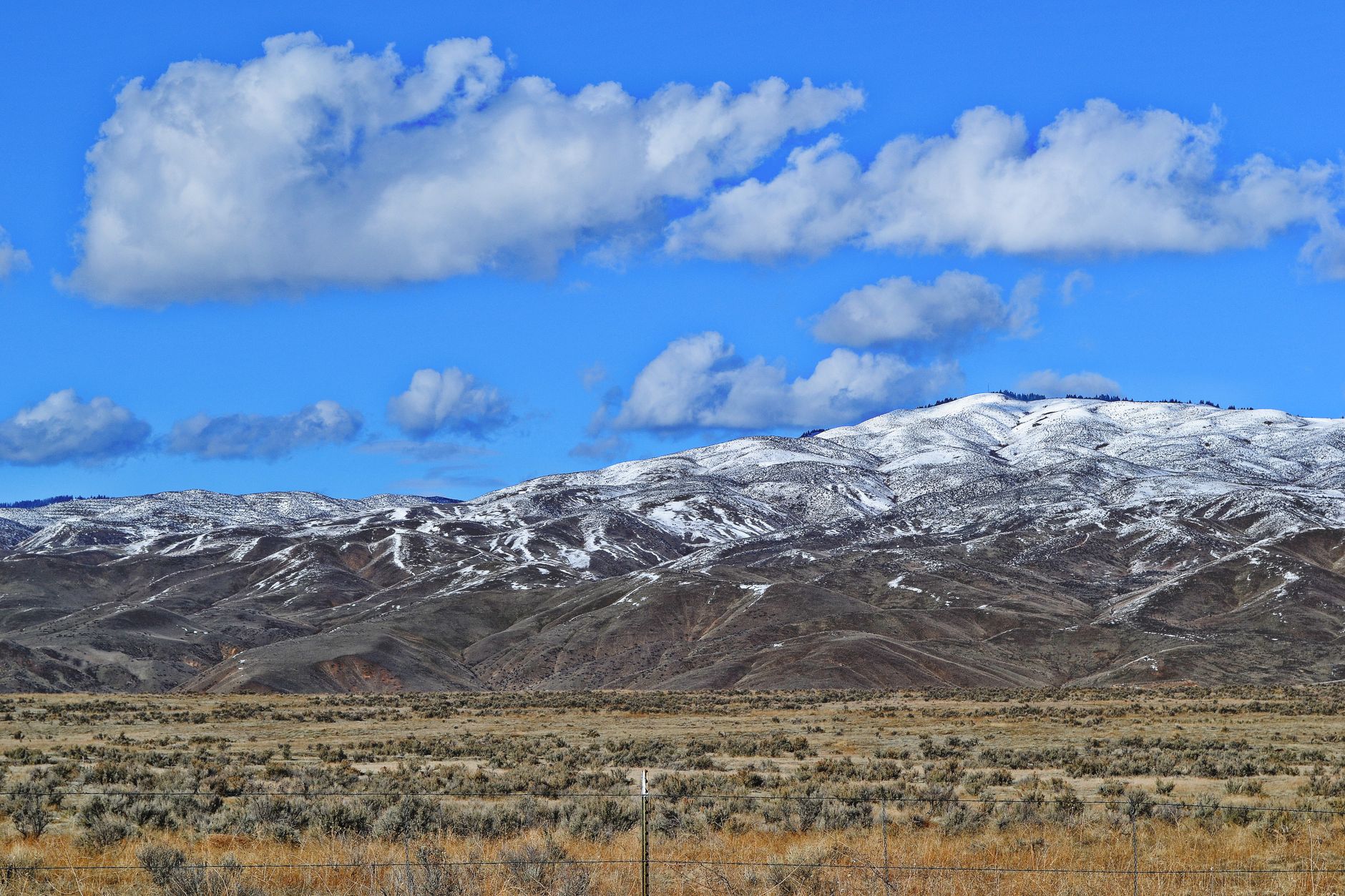
The Boise Foothills are high desert grassland and sagebrush rather than forest, and that shapes everything. There is almost no shade below Bogus, so expect full sun on nearly every trail, and it gets extremely hot, with Boise summers routinely exceeding 100°F and the foothills running hotter than the valley floor in the afternoon. Carry water, because there is none on the trails and the climate is arid.
The tread is dusty and loose in summer and turns to notorious sticky clay when wet, which brings up the important local rule. Muddy trails should not be walked on. Ridge to Rivers posts trail conditions and asks people to stay off when wet, because foothills clay takes deep footprints and ruts that persist all season and cause real erosion. This is taken seriously locally and it is the single most important piece of Boise trail etiquette, so check the conditions page after rain or during the spring thaw.
Beyond that, rattlesnakes are present as in any sagebrush country, so watch where you put your hands and feet on rocky sections, and ticks appear in spring. Smoke season affects Boise in August and September as it does everywhere in the interior West. There are no fees and no permits anywhere on Ridge to Rivers trails.
Ridge to Rivers Foothills Trail EtiquetteThe mountain biking question
This is worth addressing directly, because it shapes the experience here more than in most cities. Boise is a serious mountain biking town and the foothills network is heavily used by bikes, so on a spring evening on the popular lower trails you will be passed regularly.
Ridge to Rivers manages this actively. Some trails carry directional restrictions, some are day-of-week specific, alternating uphill and downhill bike travel or restricting bikes on certain days, and some are hiker-only. All of it is signed at the trailhead and on the interactive map. The same applies to dogs, since off-leash is permitted on designated trails and not on others, and it is signed trail by trail.
The practical advice is to read the sign before you start, and if you want a quiet walk, pick a hiker-preferred trail or go early. Conflict is rare and the culture is generally good, but the system only works because people read the rules.
How the system came to exist
Ridge to Rivers is worth understanding, because it explains why Boise's hiking feels different from a city that merely has some parks. It is a partnership rather than a single agency, with the City of Boise, Ada County, the Bureau of Land Management, the Forest Service and the state all managing pieces of the foothills, and Ridge to Rivers coordinating them into one signed, mapped, connected network. That is why trails cross ownership boundaries without you noticing, and why signage stays consistent across 210 miles.
The seams are still there underneath, which is why the rules change trail by trail rather than at any visible line: a leash requirement, a bike restriction, or a seasonal closure follows whichever agency owns that particular parcel. Guidepole Hike carries the ownership layer and the per-trail rules under the network, so the question of who manages the ground you are on, and what that permits today, is answerable before you leave the house.
It is also why the Foothills Levy matters locally. Boise voters have repeatedly taxed themselves to buy foothills land and keep it open, and a substantial part of what you walk on was bought that way rather than inherited. The open space above the city is a deliberate purchase, renewed by vote, which is the context for the muddy-trail rule and trailhead etiquette generally. This is a system the city bought, maintains and can degrade, and erosion from walking wet clay is the most visible way one person can damage it.
The gear
Boise foothills hiking is high desert on the edge of a city, which means sun, dust and a surprisingly good winter.
Two liters of water, because there is none on the foothills trails and the air is dry enough that you lose it without noticing.
A sun hat and high-SPF sunscreen, since the foothills are sagebrush and grass with essentially no shade anywhere in the system.
Trail runners with grip, which suit this ground better than boots. The trails are hardpack dirt and decomposed granite.
Gaiters, which is an unusual entry on an urban hiking list and belongs on this one. The soil here is fine and it gets into everything, particularly on descents.
A headlamp, for the after-work loops that are a large part of how this system gets used.
An air quality app, since Boise sits in a valley that traps both winter inversions and summer wildfire smoke, and both make the foothills unpleasant.
And microspikes, for the winter, which is the best season here. The foothills sit low enough to be snow-free most of the winter and high enough to be above the valley inversion, so a January climb up Table Rock frequently comes out into sunshine above a gray city.
What the foothills are
The Boise Foothills are the southern edge of a much larger landscape, and understanding that explains the terrain. They rise off the Snake River Plain, a vast arc of volcanic and sedimentary lowland across southern Idaho, and climb into the Boise Mountains, part of the wider central Idaho highlands that culminate in the Sawtooths a few hours north. So the foothills are a transition, running from high desert sagebrush at the bottom to ponderosa and Douglas fir at the top around Bogus Basin, and that gradient is the practical point: you gain a climate zone by driving or walking uphill, which is why the Bogus escape works in July.
The soil is largely loess, meaning wind-deposited silt, over decomposed granite, which is exactly why it turns to that notorious sticky clay when wet and to fine choking dust when dry. It is also why the foothills erode so readily and why the trail-condition rules exist at all.
The vegetation is sagebrush steppe and it is more fragile than it looks. Cheatgrass, an invasive annual, has spread widely and increases fire frequency, which in turn removes native sagebrush, and the burned patches you will see on the foothills are part of that cycle.
Beyond the foothills
Boise's position is better than the foothills alone suggest. The Boise River Greenbelt runs more than 25 miles of paved path along the river through the city, which is flat and not hiking but is an excellent connector that links parks and gets you between trailheads by bike.
Further out, Idaho City and the Boise National Forest sit about an hour northeast on Highway 21 and put you in pine forest with proper mountain trails and hot springs. The Owyhee Canyonlands to the southwest are remote high desert with deep rhyolite canyons, a completely different landscape and a serious undertaking requiring self-sufficiency. Bruneau Dunes to the southeast has the tallest single-structured sand dune in North America, which is an odd and worthwhile short outing. And the Sawtooths are three hours north over Highway 21, which is the drive that turns a Boise weekend into an alpine one.
Seasons, and the winter advantage
Spring is the best season by a wide margin, when the foothills green up, wildflowers come out and temperatures are ideal, and it is also when the mud rule matters most. Summer means dawn hikes in the foothills or driving up to Bogus Basin, because midday in the foothills in July is a bad idea. Autumn is excellent, being cool, stable and quiet, with the smoke usually clearing.
Winter is the underrated one, and it makes Boise a good winter hiking city, which is unusual in the interior West. The foothills sit at 2,700 to 4,000 feet and face largely south and west, so the lower trails are frequently bare and walkable through December, January and February while every mountain range within two hours is under deep snow. Winter days here are often clear and cold, the light on the sagebrush is excellent, and the trails are quiet compared with the spring rush.
Two caveats attach to that. The freeze-thaw cycle produces the muddiest conditions of the year, and a trail frozen solid at 8am can be a clay swamp by 2pm, which is exactly when damage happens, so morning is better. And the valley gets winter inversions that trap cold, polluted air for days at a time, in which case climbing above the inversion into sun is one of the great local moves. Higher up, Bogus Basin turns over to skiing and snowshoeing, so the whole system stays usable year-round in one form or another.
The rent on a system like this
Start at Camel's Back and go as far up Hulls Gulch as you feel like. That is the archetypal Boise outing and it needs no planning at all. Do Table Rock at sunrise. When it gets hot, drive to Bogus Basin and hike in the pines instead.
And stay off the trails when they are muddy. In a city whose entire trail identity rests on a connected, volunteer- and taxpayer-supported network, that is the rent.
Idaho's alpine is three hours north over Highway 21: backpacking the Sawtooths. And on the August air that shapes late summer here: hiking in wildfire smoke.
The range three hours north, and the best backpacking in the state, is in backpacking the Sawtooths. The raptor concentration downriver is in the Snake River Birds of Prey area. Comparable western trail-town systems are in hiking Missoula and hiking Bozeman, and the state land question that shapes the edges of the foothills is in state trust lands and access.
And a note on why this system exists at all, because it is unusual. Ridge to Rivers is a partnership rather than a single agency: city, county, Bureau of Land Management, state and private landowners, coordinated into one continuous trail network across ownerships that would otherwise be a patchwork of dead ends. Boise voters have also passed open space levies specifically to buy foothills land before it was subdivided. Two hundred and ten miles of trail starting from downtown is not an accident of geography, it is thirty years of deliberate purchasing, and the parts still in private hands are the reason some trails end abruptly.