Fish
Fish Fire
Fire Hike
Hike Bird
Bird

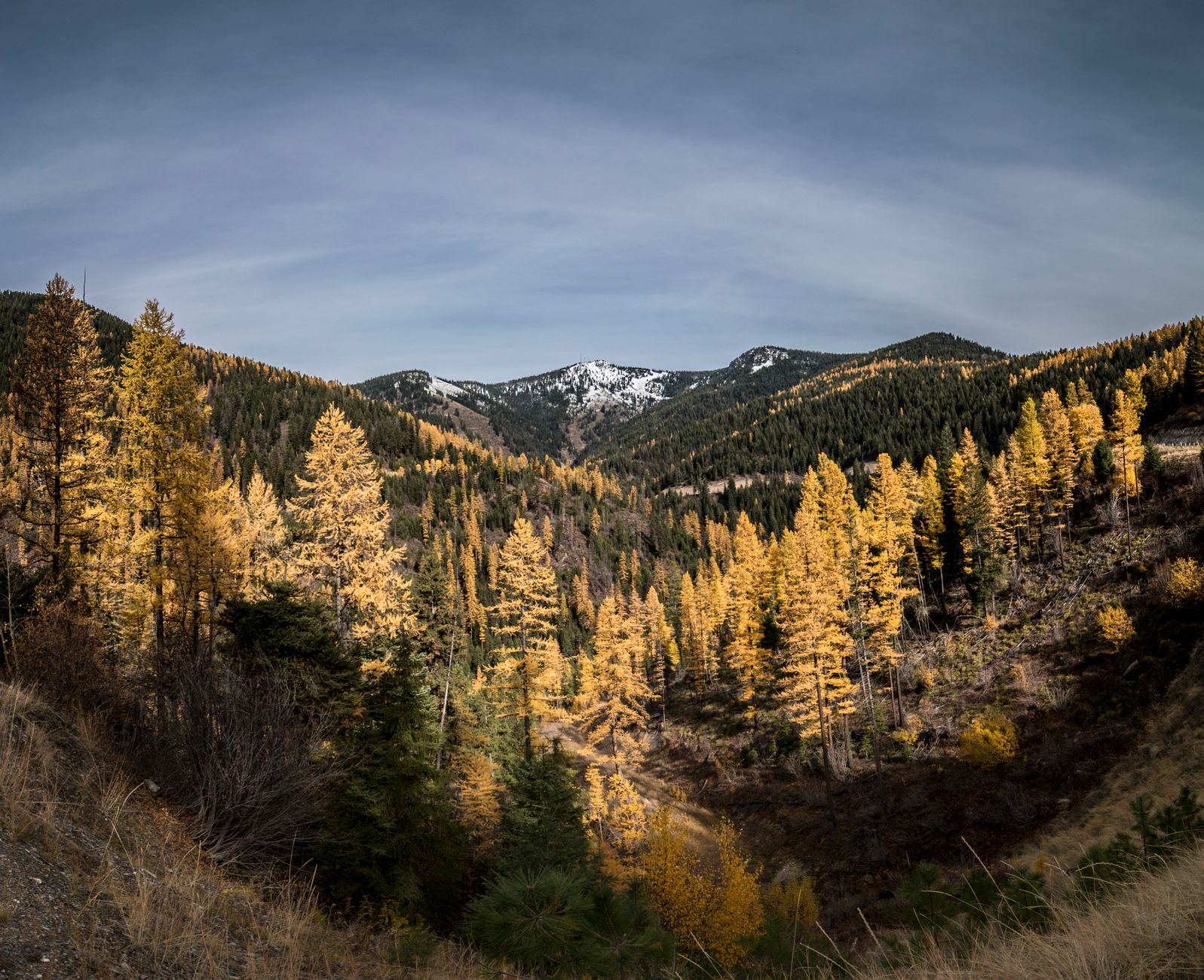

Missoula sits in a bowl where five valleys converge, and mountains are visible from essentially everywhere in it. The University of Montana campus backs directly onto the base of a 5,158-foot peak. There is a 61,000-acre wilderness area at the top of a road that starts in a residential neighborhood.
For a town of about 78,000, the access is absurd.
The M: the one everybody does
A concrete letter M sits on the west face of Mount Sentinel directly above the university, and the trail to it is Missoula's civic ritual. It is short, at about 1.5 miles round trip with roughly 620 to 640 feet of gain, climbing eleven switchbacks up the open grassy face, and it takes forty minutes at a normal pace and less if you are trying.
The grade is steep and the face is exposed and hot in summer, so it is harder than the distance suggests, but it is accessible to almost anyone willing to go slowly. Students do it between classes, it is busy at every hour of daylight, and at sunset it becomes a social event. The view is the entire Missoula valley, the Clark Fork running through it, and the ranges beyond. Start from the trailhead behind the university off Campus Drive, with no fee and no permit.
Hiking Missoula's Iconic M TrailKeep going: the full Sentinel
The M is where most people stop, and the mountain does not. Continuing to the summit of Mount Sentinel makes it roughly 3.5 miles round trip with about 1,900 feet of gain, two to three hours, and it is a completely different experience, because the crowds evaporate above the M, the trail traverses open grassland, and the summit view opens north and east into country the M does not show you.
There is also the Hellgate Ridgeline approach, which is longer and quieter and worth taking once you know the standard route. From the top you look across at Mount Jumbo, down Hellgate Canyon, and north toward the Rattlesnake, which is the best available orientation to everything else in this article.
Mount Jumbo: the other one
Directly across Hellgate Canyon from Sentinel, Mount Jumbo is Missoula's second in-town mountain, carrying an L on its flank for Loyola High School and a network of trails up its open slopes.
The important thing about Jumbo is that large parts of it close seasonally for wintering elk and deer, typically from around December through spring. This is a real closure, actively enforced and widely respected locally, and it exists because the mountain is genuine winter range for animals that need it. Check the current closure status before heading up between autumn and late spring. When it is open, the North Zone and the saddle give a gentler, quieter alternative to Sentinel with equally good valley views.
The Rattlesnake
This is the one that makes Missoula unusual rather than merely pleasant. The Rattlesnake National Recreation Area and Wilderness begins at a trailhead about four miles from downtown, at the top of a residential street, and extends into 61,000 acres of drainage running north through lakes, forest and genuine backcountry.
The lower Rattlesnake Corridor is a wide, gentle, old road-bed trail along the creek that works for running, families and bikes, and it goes on for miles. Go far enough and you are in wilderness with alpine lakes, on foot from a city bus route.
One practical note matters here. The Rattlesnake is in part Missoula's municipal watershed, and there are restrictions in the upper portions, with no dogs in some zones and no swimming in others, and the rules differ between the recreation area and the wilderness itself. Check current regulations with the Lolo National Forest rather than assuming.
Between that and Jumbo's elk closure, Missoula is a town where the question is less whether a trail is public than which zone you are in and what month it is. Both closures move, both are enforced, and neither is obvious from the trailhead. Guidepole Hike carries the zone boundaries and current closure status under the trail, which here is the difference between a planned evening on Jumbo and a locked gate in March.
Blue Mountain and the west side
Blue Mountain Recreation Area, southwest of town, is the other significant network, with dozens of miles of trail through forest to a summit with a lookout and a view back over the valley. It is the best option when Sentinel is too hot or too busy, and it holds snow for skiing and snowshoeing later into spring.
Waterworks Hill and the North Hills, immediately north of downtown, offer short open-grassland walks with big views and are a favorite for a quick evening loop. Pattee Canyon, south of town, has shaded forest trails that are excellent in summer heat and groomed for skiing in winter. And the Clark Fork River trail system connects the university, downtown and several parks along the water, linking to the base of both Sentinel and Jumbo, which is how you put together a car-free hiking day here.
What Missoula hiking is like
The in-town mountains are open grassland rather than forest. Sentinel and Jumbo are grassy faces, which means no shade and serious summer heat on the climbs, and it means both are dry, so carry water because there is none up there. The gain comes fast as well, with Sentinel's 1,900 feet arriving in about a mile and a half, so these are steep and short rather than long and gradual.
July and August are hot on the open faces, and the M at 2pm in August is unpleasant, so go early or go at dusk. Rattlesnakes exist, on Mount Sentinel in particular, which is not what the mountain is named for but is worth knowing, and they want nothing to do with you. Ticks appear in spring and standard Montana precautions apply.
The other thing to expect is company moving faster than you. Missoula is a serious running town relative to its size, and the in-town mountains function as a training ground, with Sentinel used for hill repeats, steady traffic on the Rattlesnake corridor, and an established calendar of local races including a hill climb up Sentinel that draws a crowd. Practically, that means the trails are busier at 6pm than at noon, uphill traffic has right of way and the convention gets used on the narrow switchbacks of the M, and the etiquette is relaxed and generally good. It also means local knowledge is easy to find, since the gear shops in town know current trail and smoke conditions and the university's outdoor program runs trips for people newer to the area.
There are no fees or permits on the in-town trails, dogs are allowed on leash on most of it with restrictions in parts of the Rattlesnake, and parking is easy by any city's standards.
Hiking the Smokejumper's Trail to the Top of Mount SentinelThe smoke season
Missoula sits in a valley that traps air, and western Montana burns in late summer. In a bad year, August and September air quality here is among the worst in the country.
This is not an occasional inconvenience, it is a seasonal feature that shapes when locals hike. The valley inversion holds smoke in, so the town can be significantly worse than the ridges above it, making this one of the few places where climbing gets you into cleaner air rather than the reverse.
Check air quality alongside the weather from July onward, and treat AQI above 150 as a reason to shorten or shelve a hard climb.
The gear
Missoula hiking starts in town and goes straight up a dry south-facing hillside, which sets most of this list.
A sun hat and sunscreen, because the Sentinel and Jumbo faces are grassland with no shade at all and they bake from mid-morning onward.
Two liters of water, for the same reason. These are short hikes that dehydrate people.
Trail runners with grip, since the tread is dry dirt and loose gravel on a steep grade rather than technical ground.
An air quality app, which in Missoula is a genuine daily planning tool rather than an occasional one. The valley sits in a bowl that traps smoke, August and September are routinely unhealthy, and the difference between a good day and a bad one is not visible from a window.
Tick repellent, for the grassland in spring, which is exactly the habitat and exactly the season.
Microspikes, for the winter version of the M trail, which is a packed icy staircase from December through March and is walked daily regardless.
And a headlamp, since the after-work climb up Sentinel in winter is a Missoula institution and it happens in the dark.
Why the town is shaped like this
Missoula sits in a bowl, and the bowl has a history that explains the terrain you hike on. During the last ice age an ice dam repeatedly blocked the Clark Fork and impounded Glacial Lake Missoula, a body of water hundreds of feet deep covering the valley the town now occupies, and when the dam failed it released catastrophic floods that scoured eastern Washington and carved the Channeled Scablands. This happened dozens of times.
You can see the evidence from the trails. Horizontal shorelines are visible on the flanks of Mount Sentinel and Mount Jumbo, terraces cut by the lake's surface at successive levels, and once you know to look for them they are unmistakable from anywhere in town. So when you climb the M you are climbing a slope that was underwater, past the high-water marks of a lake that emptied in a matter of days.
The five converging valleys, meaning the Clark Fork, the Bitterroot, the Rattlesnake, Hellgate Canyon and Grant Creek, are why the town has mountains on every side, and why it traps air so effectively in both winter inversions and smoke season.
Going further: the Bitterroots
Missoula's in-town hiking is excellent for a city. Its real advantage is what sits within an hour. The Bitterroot Range runs south along the Montana-Idaho state line, and its eastern face is cut by a series of steep, parallel, glacially carved canyons including Blodgett, Bass Creek, Kootenai, Mill Creek and Lost Horse, each with a trail running in beneath granite walls that draw climbers from across the region.
Blodgett Canyon, near Hamilton, is the best known: a broad, flat-floored canyon with walls rising over a thousand feet and a trail that runs level for miles before it climbs. It is one of the most striking pieces of accessible landscape in Montana and roughly an hour from Missoula. Kootenai Creek, near Stevensville, is the other one worth naming, a canyon walk that stays close to a fast river for miles and one of the best easy-to-moderate options within an hour.
The other directions are quieter and closer. North of town the Rattlesnake keeps going into genuine wilderness. West, the Ninemile and Grant Creek drainages offer forest walking without the drive to the Bitterroots, and Lolo Pass on Highway 12 follows roughly the route the Lewis and Clark expedition took over the range, with trails and a visitor center at the pass. East over the pass lies the Garnet Range and its ghost town.
That is the real answer to what Missoula offers: a small city where a two-hour hike starts on campus and a serious mountain day starts an hour from your front door.
Seasons, and where to start
Spring is the best time on the grassland mountains, when they are green and cool with wildflowers on Sentinel and Jumbo, though Jumbo may still be closed for elk. Summer means dawn or dusk on the open faces and shaded forest at Pattee Canyon or Blue Mountain in the middle of the day. Autumn is superb, with larches turning in the Rattlesnake, cool air, and the smoke usually clearing by late September. Winter keeps the low trails open and often snow-free on the south-facing grass, while the Rattlesnake and Pattee turn over to skiing and snowshoeing.
Do the M once, then do it again and keep going to the Sentinel summit, which is the better hike by a distance. Save Jumbo for when it is open. Use the Rattlesnake for the long gentle days and the wilderness days both. Retreat to Pattee Canyon or Blue Mountain in the heat.
And check the smoke from July onward, because in this valley it decides more hiking plans than the weather does.
Montana's marquee hiking is four hours north: one day in Glacier and Grinnell Glacier. And because smoke shapes the season here more than anywhere: hiking in wildfire smoke.
The range an hour south, with the canyons in it, is in Bitterroot canyon hiking. The other Montana college town with the same trail culture is in hiking Bozeman, and the national park to the north is in one day in Glacier National Park and the Highline Trail. When the smoke arrives, the planning logic is in how to read a wildfire smoke map.
A note on the ground itself, since it explains why the hillsides look the way they do. Mount Sentinel and Mount Jumbo are the shoreline of Glacial Lake Missoula, which filled this valley repeatedly at the end of the last ice age and drained catastrophically dozens of times. The horizontal lines across the face of Jumbo that people take for game trails are the old strandlines, cut when the lake stood at that level for long enough to leave a mark. You are climbing a lakebed.