Fish
Fish Fire
Fire Hike
Hike Bird
Bird


Glacier National Park was named for what carved it, not for what is still in it, and that distinction gets sharper every decade. The park held around 150 glaciers in the mid-1800s. It holds a fraction of that now, and the survivors are small and shrinking.
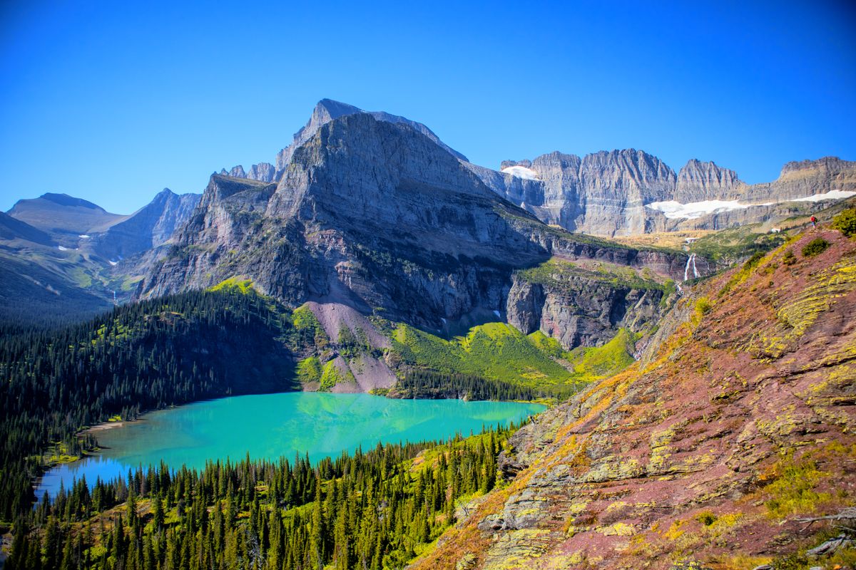
Grinnell Glacier is the one most people can walk to. It sits in a cirque under the Continental Divide at the head of the Many Glacier valley, and the trail to it is among the finest day hikes in the United States: a ledge cut into a cliff face, several hundred feet above water so turquoise it looks artificial.
It is also disappearing. Repeat photography from the same vantage points across a century shows the retreat plainly, and the visible ice is a small remnant of what the trail was built to reach.
The two versions of the hike
This is the decision that shapes the day. The full hike is 10.6 miles round trip with about 1,600 feet of elevation gain, starting from the Grinnell Glacier trailhead near Many Glacier Hotel and walking the length of Swiftcurrent Lake and Lake Josephine before the climbing begins.
The boat shortcut cuts it to about 7.2 miles. Glacier Park Boat Company runs two vessels in sequence, roughly eight minutes across Swiftcurrent Lake, a short walk between docks, then about twelve minutes across Lake Josephine on the Morning Eagle, which removes 3.4 miles of lakeside walking. From the head of Lake Josephine it is about 7.6 miles round trip, with the climbing itself accounting for most of the roughly 1,600 feet of gain.
The boats book out, because they are popular and limited and in peak season tickets go well in advance, so check with the boat company directly rather than assuming you can walk up. The honest recommendation is to take the boat one way and walk back: the lakeside miles are pleasant but they are the least interesting part of the route, and walking out means you are not tied to a return sailing while standing at a glacier in good light.
Mid-July, not June
The Grinnell Glacier trail does not typically open until mid-July, and this catches out a lot of people, because Many Glacier is accessible well before that and the lower trail is walkable. The upper section holds snow across the cliff traverse, and a snow slope on an exposed ledge above a several-hundred-foot drop is not a place to improvise, so the park closes it until it is safe and clears it when it can.
If you are planning a Glacier trip in June with Grinnell as the centerpiece, plan something else as well. The usable season runs roughly mid-July to late September, and September is arguably the best of it: fewer people, cooler walking, larches turning on some slopes, and the crowds gone after Labor Day.
2026: no vehicle reservation, but read the shuttle rules
A meaningful change this year. Glacier eliminated vehicle reservations park-wide for 2026 across Going-to-the-Sun Road, Many Glacier, Two Medicine and the North Fork, though you do still need a valid park entrance pass. That removes the single biggest planning headache of recent seasons. It does not remove the parking problem, because Many Glacier's lots are small and fill very early and Grinnell is one of several marquee trails feeding off them, so arrive at dawn or expect to circle.
Separately, the Going-to-the-Sun Road shuttles to Logan Pass run on a reservation-only system in 2026, with a portion of tickets released 60 days ahead from May 2 and the remainder at 7pm for next-day travel from June 30, and from July 1 private vehicle parking at Logan Pass is limited to three hours. None of that governs Many Glacier, which is a separate valley reached by a separate road, but it matters if you are combining Grinnell with a Sun Road day.
That is the thing worth holding onto about this park: "the rules at Glacier" is not one rule set, it is several, and they differ by valley in ways that are easy to conflate when everything is filed under one park name. Guidepole Hike carries the rules against the trailhead rather than the park, which here is the difference between showing up at Many Glacier expecting a shuttle system that only exists forty miles away. Rules also change year to year, so confirm with Glacier National Park before you travel.
Bears, seriously
Many Glacier is prime grizzly habitat and this is not a formality. The walk along Lake Josephine passes through dense brush and berry ground with limited sightlines, the upper basin is open country where bears feed, and sightings on this trail are routine rather than rare.
Carry bear spray accessible on your body rather than in the pack, on a hip belt or chest strap where you can reach it in two seconds, and know how to use it before you need to. Make noise, particularly on blind corners and in brush along the lakes, by talking and clapping, because bear bells are widely considered inadequate. Hike in a group where you can, since groups of four or more have a markedly better record. Do not run, and do not approach for a photograph regardless of distance. And check park alerts, because the park closes trails for bear activity with little notice and Grinnell is closed periodically for exactly that reason.
Bear spray cannot be flown with, so buy or rent it locally, and every outfitter in the valley has it.
How to Hike to Grinnell Glacier, with the Many Glacier Boat RidesWhat the trail is like
After the lakes the trail begins climbing and the character changes entirely. It traverses a cliff face on a ledge blasted into the rock, with a wall on one side and a long drop to Grinnell Lake on the other. The tread is good and it is not technical, but it is exposed and narrow in places, and there is a section where a waterfall runs across the trail. You walk through it, and you get wet.
Below you, Grinnell Lake is a color that photographs badly because nobody believes it. That turquoise is rock flour, glacial silt ground fine enough to stay suspended and scatter light, and it is the visible product of the glacier you are walking toward.
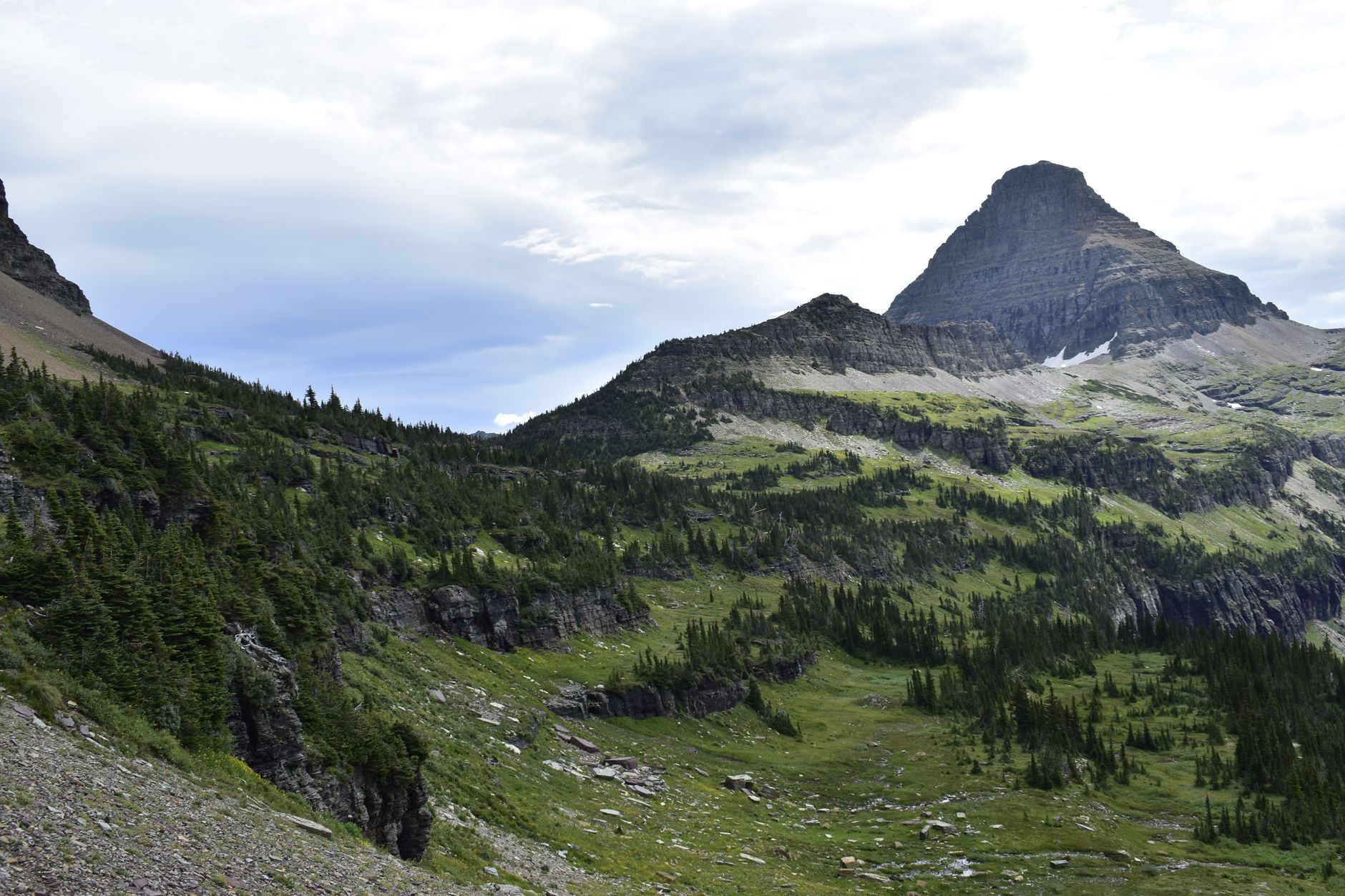
Higher up the route crosses scree and often a snow patch or two even in August, then arrives at Upper Grinnell Lake, a meltwater lake studded with icebergs, with the glacier above it and the Continental Divide behind. Mountain goats and bighorn sheep are common in the upper basin. It is one of the great trail payoffs in North America.
What the light does here
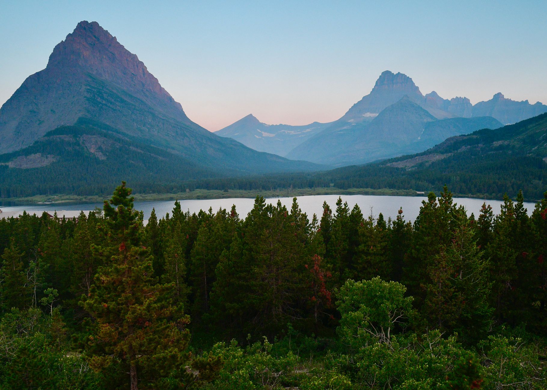
Many Glacier is one of the great photographic valleys in North America, and the geometry is worth knowing because it decides when to be where. The valley opens east, so sunrise hits the peaks at its head, meaning Grinnell Point, Mount Wilbur and Mount Gould, while the floor is still in shadow, and on a still morning the reflection in Swiftcurrent Lake is the shot everyone comes for, happening before most people are awake.
On the trail, the morning traverse puts warm light on the cliffs opposite and on Grinnell Lake below, and it is also the cooler time to be on an exposed rock face that holds warmth. By midday the light flattens and the turquoise goes pale. Late afternoon does something different again, because the sun drops behind the Divide early in a valley this deep, so the upper basin falls into shadow well before sunset while the eastern peaks stay lit. It is beautiful, and it is a reason not to linger, since you would then be descending an exposed ledge in fading light with tired legs, walking out through bear country at dusk when bears are most active.
So be at the top by late morning and moving down by early afternoon. Starting early solves the parking, the light, the heat and the bear timing in one decision.
What to Know Before Hiking the Grinnell Glacier TrailWhat is happening to the ice
It is worth being precise, because "the glaciers are melting" is vague enough to be easy to ignore. Grinnell has been photographed from fixed vantage points for over a century and the US Geological Survey has run a repeat-photography program comparing those images, and the results are not subtle: the ice occupied the entire basin you now walk across, and the lake at its foot did not exist. Upper Grinnell Lake is meltwater, and it is there because the glacier retreated far enough to leave a hole.
When you stand at the overlook, the geography tells the story without needing the photographs. The moraines, the ridges of debris a glacier bulldozes to its edges, mark where the ice used to end, and the gap between those ridges and the current ice is the retreat, measurable by eye.
The park's projections for the remaining glaciers are not optimistic, and Grinnell is among the more visible cases because it is the one so many people see. Whatever you think about the wider picture, the specific thing in front of you is smaller than it was when the trail was built to reach it.
The gear
Grinnell Glacier is the best day hike in Glacier National Park and it runs through the densest grizzly habitat in the lower forty-eight, which shapes the whole list.
Bear spray, bought or rented locally because it cannot be flown with, and carried on a hip belt rather than in a pack. The Many Glacier valley has a high density of grizzlies, the trail passes through berry brush and around blind corners above the lakes, and the park closes this trail for bear activity several times most seasons.
A rain shell and an insulating layer, since the trail climbs to sixteen hundred feet above the valley on a north-facing wall and the weather on the Continental Divide changes without warning.
Two liters of water plus a filter, because the streams crossing the trail are glacial and abundant.
Trekking poles, for a descent that is long and, in the upper section, on loose rock.
Binoculars, for the mountain goats and bighorn sheep on the cliffs above the trail, which are close and routine, and for scanning the far slopes for bears before you walk under them.
And a boat shuttle ticket booked ahead, which is the item that changes the day most. The boats across Swiftcurrent and Josephine cut roughly three and a half miles off the round trip, they sell out days in advance in season, and without one the hike is a different and considerably longer proposition.
The rest of the Many Glacier valley
Grinnell gets the attention but the valley holds several of the park's best trails, and if the boat is booked out or the glacier trail is closed for bears, the alternatives are excellent.
Iceberg Lake is roughly 9.7 miles round trip to a lake that holds floating ice into summer, in a cirque ringed by cliffs, and many people rate it above Grinnell on a gentler grade. Ptarmigan Tunnel is a long day to a tunnel blasted through a rock wall in the 1930s, opening onto a completely different view north, and it is one of the strangest and best pieces of trail engineering in the park, with the tunnel doors closed outside the short summer season.
Cracker Lake is a longer, quieter walk to water that is arguably an even more absurd turquoise than Grinnell Lake, and Swiftcurrent Pass climbs to the Divide with big views and connects through to the Highline. All of them share the same small parking lots, the same bear considerations, and the same short season.
Where to stay, and why it matters
Many Glacier is not somewhere you drop into casually, and the lodging decision shapes the hike more than it does in most parks. Many Glacier Hotel, a Swiss-chalet-styled building on the shore of Swiftcurrent Lake, and the Swiftcurrent Motor Inn at the head of the valley are the only accommodation in the valley, and they book roughly a year ahead. Staying in either means walking to the trailhead rather than competing for a parking space, which on this trail is worth more than the room, and Many Glacier Campground is similarly hard to get and similarly valuable.
Outside the valley, Babb and St. Mary are the nearest options and put you a genuine drive from the trailhead on a slow road, while East Glacier and Browning are further still. If you are staying outside, a dawn start is not ambition, it is arithmetic. A calendar note as well: the valley's facilities run a short season and close early in September, well before the hiking does, so check what is open for your dates rather than assuming a September trip has August's infrastructure.
The rest is preparation. Many Glacier is remote, reached from Babb on the park's east side down a long road, with limited services nearby, so fill up before you turn in. There is no potable water on the trail, so carry two liters minimum and more on a hot day, though there is meltwater to filter high up. Weather changes fast and the traverse is exposed, so carry a shell and a warm layer even in August, because storms roll over the Divide with little warning. Dogs are not permitted, as on all Glacier trails. Cell signal is effectively absent in the valley. And nights are cold even in midsummer at this latitude and elevation.
The gap between the ice and the moraines
Go mid-July at the earliest, and September if you can choose. Book the boat, take it in and walk out. Start at dawn for the parking and the light. Carry bear spray where you can reach it and make noise along the lakes. Expect to get wet at the waterfall and expect to be cold at the top.
And take a minute at Upper Grinnell Lake to look at how far the ice is from the moraines it built. That gap is the reason to come now rather than later.
If you have a day in the park rather than a specific objective, one day in Glacier covers how to spend it. Montana's other great trail town is two hundred miles south: hiking Missoula.
The park's other signature walk, from the top of the pass, is in the Highline Trail, and the day-trip framing is in one day in Glacier National Park. The nearest Montana ranges without the crowds are in Bitterroot canyon hiking, and the towns to stage from are in hiking Missoula and hiking Bozeman.