Fish
Fish Fire
Fire Hike
Hike Bird
Bird

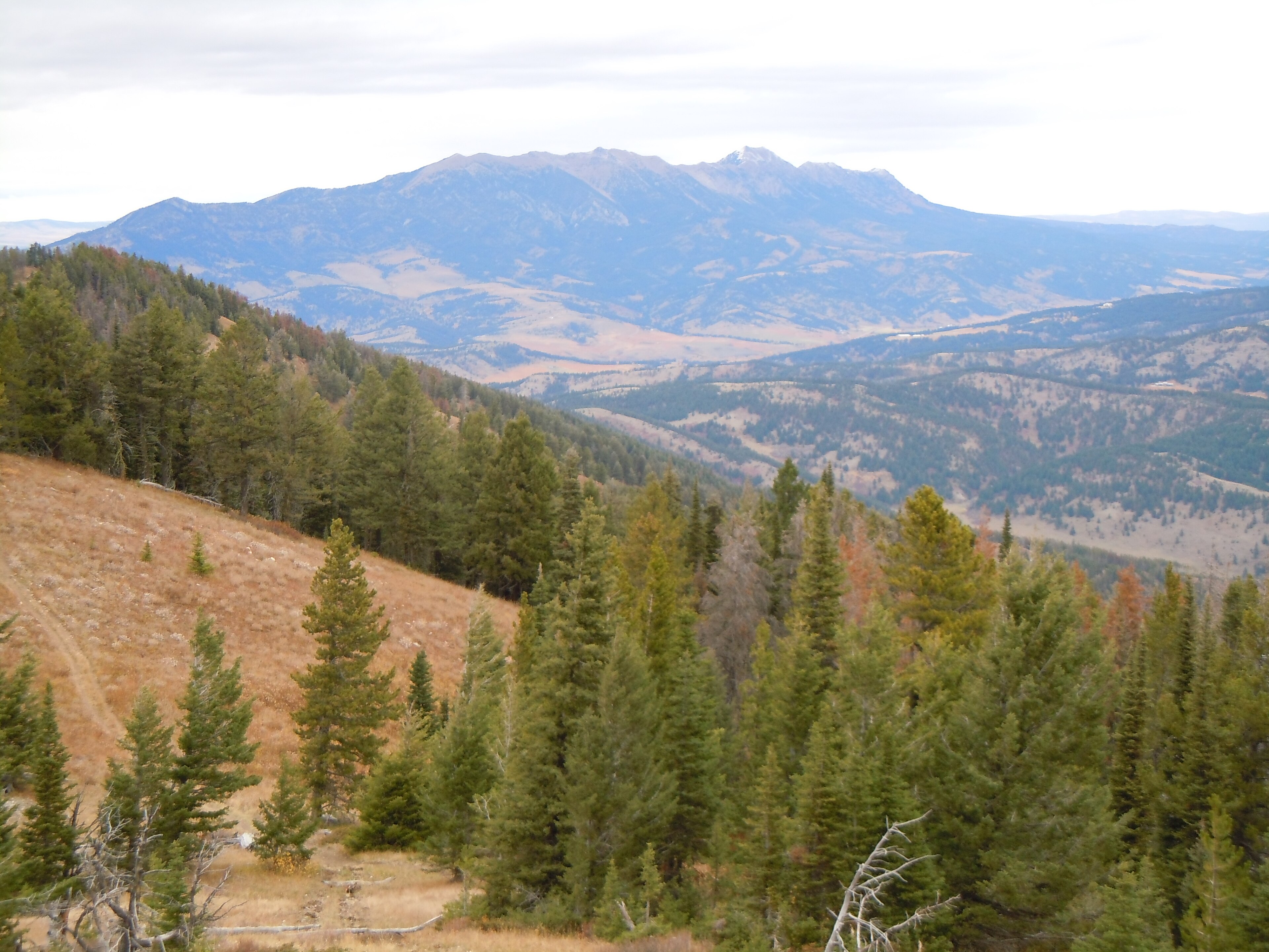

Two trailheads sit across Bridger Drive from each other, four miles from downtown Bozeman, and between them they account for a startling share of the walking done in this town.
On the south side is the M, a whitewashed letter on the flank of the Bridgers that Montana State students first laid out in 1915. On the north side is Drinking Horse Mountain, a loop that did not exist until 2009. Locals do one or the other before work, and visitors usually do the M because they can see it from the highway.
Both are worth your time. But the more interesting thing about hiking in Bozeman is the system they belong to, and how it got built.
Main Street to the Mountains
Since 1990, the Gallatin Valley Land Trust has been assembling a trail network that now runs to nearly 100 miles, connecting downtown Bozeman to the mountain ranges on either side of the valley. It is called Main Street to the Mountains, and the name is literal, because you can now walk 8.2 miles from Main Street to the top of the Triple Tree trail in the Gallatin foothills without driving anywhere.
The reason this is unusual has nothing to do with mileage. The Gallatin Valley floor is private land, meaning ranches, farms and increasingly subdivisions, and there was no public corridor to build on. GVLT built the network by negotiating conservation easements and trail easements across private property, one landowner at a time, over thirty-five years, alongside the City of Bozeman and dozens of other partners.
That is why the map looks the way it does. A trail will run along a creek, cross a road, cut behind a neighborhood, and continue onto Forest Service land, changing legal status four times without ever announcing it. It also means these trails come with obligations that federal land does not impose, because where a route crosses private ground under easement the corridor is what was granted and the field beside it is not. Staying on the trail is the entire deal, and Bozeman's system works because that gets respected.
This is the clearest case in the state for knowing whose ground you are on rather than guessing. Guidepole Hike carries the ownership and easement layer under the trail, so on a network assembled parcel by parcel from private land, where the corridor ends is something you can see rather than infer from a fence line.
The M
The town's default hike, and a good one. From the trailhead at the mouth of Bridger Canyon, two routes climb to the letter: the steep one goes straight up the fall line and is short, brutal and popular with people training for something, while the gradual one switchbacks across the face and is roughly twice as long for the same gain. They meet at the M.
Call it 1.5 to 2 miles round trip and about 850 feet depending on which way you go up and down, and most people take the switchbacks up and the steep route down, which is hard on the knees and fast. From the top you get the Gallatin Valley laid out below, the Spanish Peaks and the Gallatin Range to the south, and the Bridger Ridge running north above you. Parking is the constraint rather than the trail, since the lot is small, it fills on summer evenings and weekends, and the shoulder parking is contentious.
It does not end at the letter. The trail continues up the ridge, and if you keep going you reach Mount Baldy, roughly 8 miles round trip with about 4,300 feet of gain, which turns a town hike into a serious mountain day. Beyond Baldy the Bridger Ridge runs north over Saddle Peak, Ross Peak, Sacagawea Peak and Hardscrabble, and the full traverse is the route of the Bridger Ridge Run, one of the harder mountain races in the country.
One clarification, because it causes real confusion: Missoula also has an M trail, on Mount Sentinel, with its own switchbacks and its own university. They are different trails in different cities, three hours apart.
Drinking Horse Mountain
The better hike of the two, and the newer one. It is a 2.1-mile loop climbing about 700 feet on natural-surface singletrack, beginning with a handsome timber bridge over Bridger Creek, and there are two routes to the top so you can go up one and down the other without repeating ground. The summit view takes in Bridger Canyon, the Gallatin Valley, and the M directly across the road, which is a pleasant piece of symmetry.
The land history is worth knowing. GVLT facilitated the donation of the land to the U.S. Fish and Wildlife Service, and the Bozeman Fish Technology Center sits at the base, then raised community money to build the trail, which opened in 2009 and is now a National Recreation Trail. Dogs are allowed off leash, which is why half of Bozeman is up there on a summer evening, and which is a rule set by a land manager most hikers would never guess was involved.
Hiking to Grotto Falls in Hyalite Canyon, BozemanHyalite Canyon
Twenty minutes south of town up a paved road, and by common measure the most heavily visited recreation area in Montana. It is Forest Service ground in the Custer Gallatin National Forest, with a reservoir, three campgrounds, two day-use areas, and a set of trails covering the full range from wheelchair-accessible to alpine.
Palisade Falls is the easy one, a 1.1-mile out-and-back on fully paved trail, stroller and wheelchair accessible, ending at an 80-foot waterfall. Fifteen minutes of walking for an impressive payoff makes it the best thing in the Bozeman area to do with small children or visiting parents. Grotto Falls is a short, mostly gentle walk to a cascade dropping into a pool on the lower Hyalite Creek Trail.
Hyalite Creek Trail proper is the big one, about 11 miles round trip to Hyalite Lake with roughly 1,900 feet of gain, passing a string of waterfalls on the way up, and it is the classic long day here. Hyalite Peak adds about two miles beyond the lake and takes you to a genuine summit above 10,000 feet, while History Rock, Blackmore and Emerald Lake fill in the middle ground. The road is paved to the reservoir and gets very busy on summer weekends, so go early.
In winter the canyon transforms completely. Hyalite is one of the premier ice climbing venues in North America, home to the Bozeman Ice Festival, and the road is plowed to the reservoir with Nordic trails groomed beyond it.
In town, and the rest of the valley
Peets Hill and Burke Park form the in-town ridge, a short climb from the east side of downtown to a grassy spine with the whole valley on display. It is where Bozeman goes at sunset and it connects directly into the wider trail system. The Gallagator Linear Trail is the old railroad grade running through the middle of town, flat and tree-lined, linking downtown to the university and the museum.
Sourdough Canyon, on Bozeman Creek, runs south from the edge of town on an old road, gentle and shaded, and is the go-to when Hyalite is busy. Triple Tree and the Sypes Canyon trails climb the foothills on either side of the valley with big views for moderate effort. And Sacagawea Peak, reached from Fairy Lake on the far side of the Bridgers, is the range high point at 9,650 feet and one of the best short-effort summits in Montana, about four miles round trip with mountain goats usually in attendance.
None of these need a pass. The M, Drinking Horse, Peets Hill and the GVLT trails are free, and Custer Gallatin trailheads in Hyalite are generally free too, though the campgrounds and some day-use sites charge. Dogs are welcome nearly everywhere and off-leash on several trails, which is one of the real pleasures of hiking in this town. Signal is fine on the front-country trails and gone in upper Hyalite.
The gear
Bozeman hiking runs from a trail that starts at the edge of town to canyons with grizzlies in them, and the list has to cover the range.
Microspikes, which get more use here than almost anywhere. The M trail and Drinking Horse are walked all winter and both ice up completely, and Hyalite Canyon Road stays open to a plowed trailhead that serves ice climbers.
Bear spray, for anything up Hyalite or further into the Gallatins. The Greater Yellowstone grizzly population has expanded steadily north and west, bears are now regular in drainages where they were absent twenty years ago, and the local advice has changed accordingly.
A wind layer, since the ridges above town are exposed and the Gallatin Valley is windy by default.
Sun protection, for elevation that starts at five thousand feet and goes up.
Trekking poles, for the descents.
A weather eye on the afternoon, which is a real item in a range where summer thunderstorms build fast over the crest and the exposed ridges are the wrong place to be when they do.
And tick repellent, for the lower grassland trails in spring, which is the same habitat and season problem as in Missoula.
Season, weather, and what to expect
The M, Drinking Horse and Peets Hill are close to year-round, being low, sunny and south-facing in places, and Bozeman locals hike them through the winter on packed snow with traction devices. Spring turns them to mud, and using them in that state damages the tread badly. Hyalite's lower trails open in late spring while the high country holds snow well into July, and the Bridger Ridge and Sacagawea want July through September.
Autumn is the best season here, with cold mornings, gold aspen and larch, no crowds and the clearest air of the year. Two hazards bracket the summer: Bozeman sits at 4,800 feet and the valley's afternoon thunderstorms in July and August build fast over the ridges, where being caught on the Bridger Ridge is dangerous, and smoke is the August and September problem as it is everywhere in western Montana.
The Waterfall Hike Near BozemanWildlife, and the grizzly question
Black bears are throughout the Bridgers and the Gallatins. Grizzlies are the more serious consideration, because the Gallatin Range south of town connects to the Greater Yellowstone ecosystem and grizzly range has been expanding steadily northward into it. Upper Hyalite and the southern Gallatins are country where carrying bear spray and knowing how to use it is the local standard rather than an overreaction, while the front-country trails at the M and Drinking Horse are a different matter entirely.
Beyond bears, mountain goats are reliable on Sacagawea Peak, and moose are common in the willow bottoms along Bridger Creek and in Hyalite and are more likely to hurt you than a bear is. Ticks appear in spring on the grassy foothills, and rattlesnakes are rare but present at lower elevations.
A note on how fast this is changing
Bozeman has been one of the fastest-growing towns in the United States for most of the last decade, and it shows on the trails. The practical effects are ordinary: the M lot fills earlier than it used to, Hyalite on a July Saturday can feel like a suburb, and trailheads that locals remember as empty now have overflow parking. Weekday mornings and shoulder seasons are where the town still feels like itself.
The less obvious effect is that the easement model the whole network depends on is now competing with development pressure on exactly the ground it needs. Every new stretch of Main Street to the Mountains is negotiated against land that has become extremely valuable. That is worth knowing when you are on a trail that runs politely along the edge of somebody's hayfield, because it is not an accident of geography and it was not cheap.
Where to start
An hour gets you Drinking Horse, up one route and down the other. A morning gets you the M by the switchbacks, continuing up the ridge as far as you feel like turning around. An easy afternoon is Palisade Falls and then the reservoir. A full day is Hyalite Creek to the lake, or Sacagawea Peak from Fairy Lake. And a hard day is the M to Baldy, 4,300 feet from a trailhead you can bike to.
The thing to notice while you are doing any of it is that nearly every one of those trails crosses ground somebody chose not to develop. Bozeman's trail system is a negotiated object, and it is the reason a fast-growing town of this size still has nearly 100 miles of walking starting at its edges.
Missoula's version of the same idea, and its own M, is in hiking Missoula. Southwest of here the Bitterroot canyons run off Highway 93, and Montana's marquee park is a day in Glacier. On the bear question: hiking in bear country. On the easements and who owns what: is that trail public. And Bozeman is the gateway to the Madison and the Livingston spring creeks if you would rather fish than climb.
The other Montana college town with the same culture is in hiking Missoula, and the range south of it is in Bitterroot canyon hiking. The national park to the north is in one day in Glacier National Park, the Highline Trail and the Grinnell Glacier trail. The birding version of western Montana is in western Montana birding.