Fish
Fish Fire
Fire Hike
Hike Bird
Bird

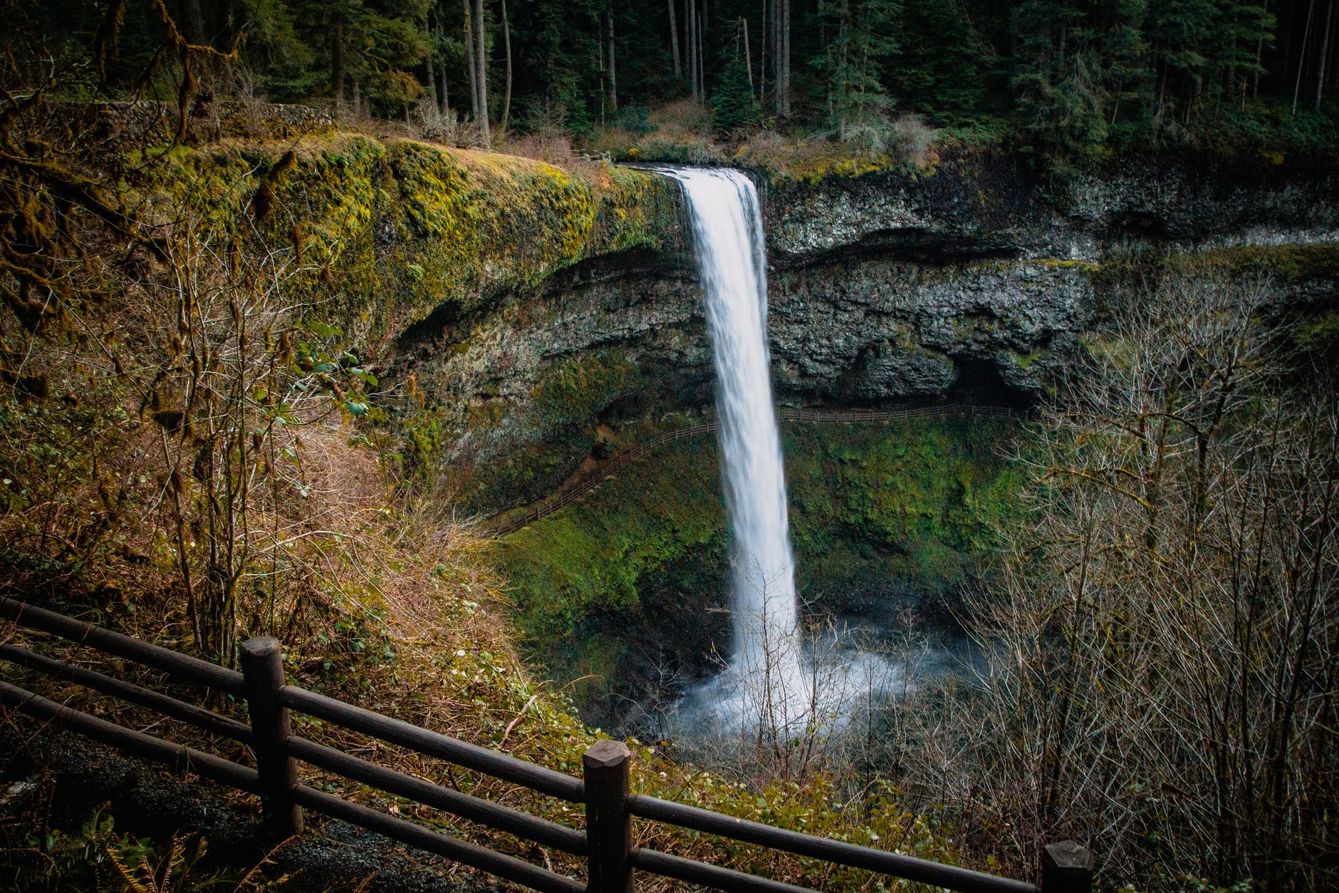

There is a specific and slightly disorienting experience available at Silver Falls State Park: standing on a dry trail, in a dim stone room, looking out through a wall of falling water.
The park offers it four times on the same loop.
The Trail of Ten Falls is Oregon's most famous day hike and the centerpiece of the state's largest state park, at over 9,000 acres in the foothills of the Cascades, about an hour from Portland and twenty-five minutes from Salem.
The loop
The full circuit runs roughly 7.2 to 8 miles depending on which connectors you use, with somewhere around 1,300 to 1,600 feet of cumulative elevation change, most of it in the descents into and climbs out of the canyon. It passes ten named waterfalls, ranging from about 27 feet to around 178.
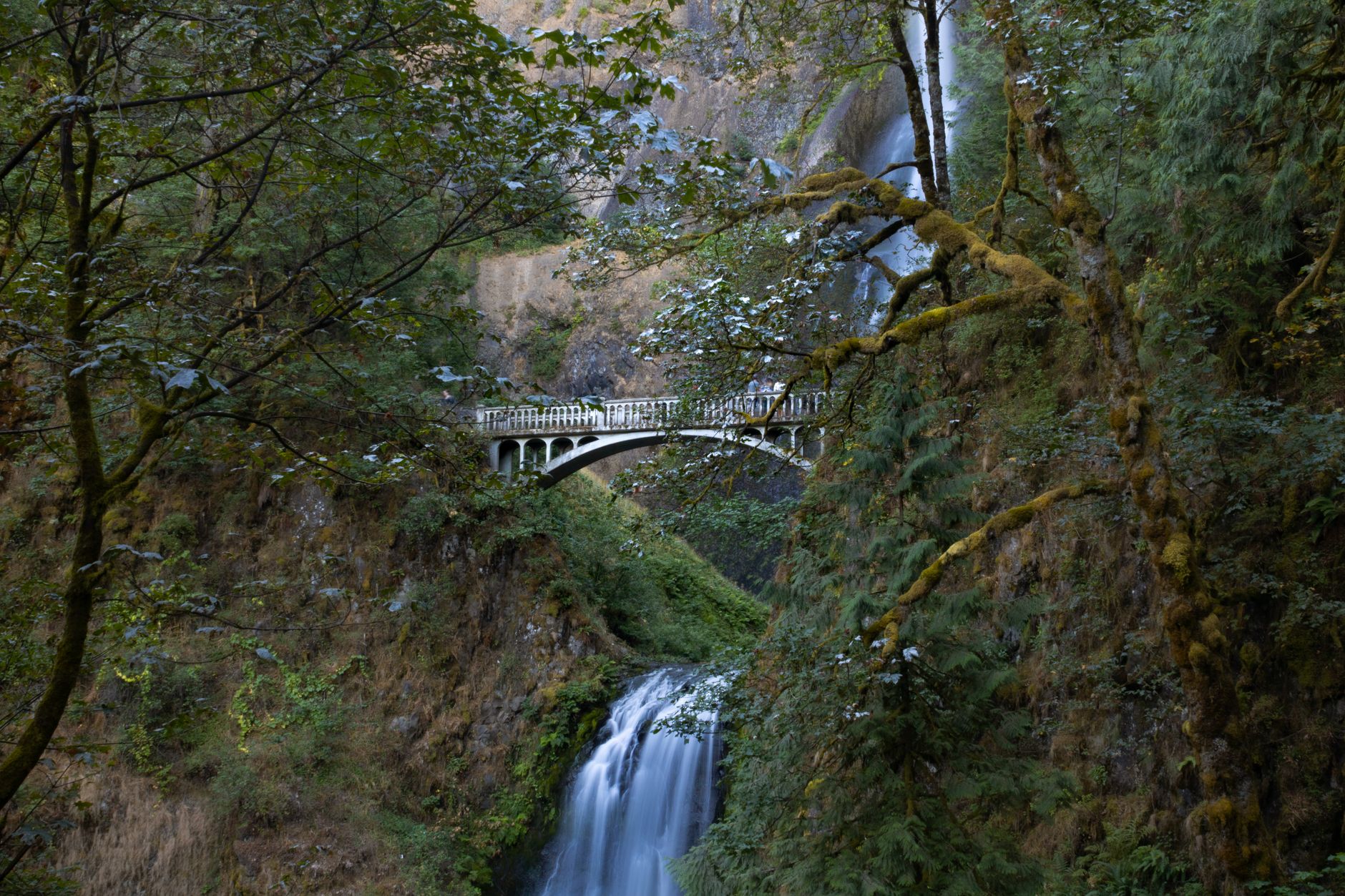
South Falls, at 177 feet, is the signature. It drops clear of an enormous overhung amphitheater and the trail runs behind it along the back wall, which is the one on every photograph of the park, and it sits a two-minute walk from the main parking lot, so you can see the best thing here without hiking at all. Lower South Falls at 93 feet is the second walk-behind and arguably the more impressive tunnel.
Middle North Falls and North Falls complete the four you can walk behind, and North Falls at 136 feet has the largest cavern of the set, a cathedral-scale space under the basalt. Double Falls, tucked up a side canyon, is the tallest in the park at around 178 feet and one of the least visited because it requires a short spur, while Drake, Lower North, Twin and Winter Falls fill out the ten.
Why you can walk behind them
The geology is doing something specific and it is worth two minutes. The canyon is cut through Columbia River Basalt, a stack of enormous lava flows that poured across this region roughly 15 to 16 million years ago, and between and beneath the hard basalt flows sit softer layers: older sedimentary rock, and the crumbly, rubbly tops and bottoms of individual flows.
Silver Creek's forks cut down through the stack. Where a stream reaches the edge of a resistant basalt flow it pours over it, and the falling water and its spray then attack the soft layer underneath, hollowing it out backwards while the hard cap above holds up unsupported. Run that process for long enough and you get an overhung amphitheater with a roof of solid basalt and a floor of eroded softer rock, and a route along the back of it, behind the water.
It is the same mechanism that produces the plateau waterfalls of Tennessee, working on volcanic rock instead of sandstone. Silver Falls just has an unusual number of them in an unusually small area.
Shorter versions
Most people should not do the full loop, and the park is well set up for that. South Falls alone is a few minutes from the parking lot to the viewpoint, and about a mile if you drop down and walk behind it and back. The South Falls to Lower South Falls loop is roughly two miles and gets you both of the two best walk-behinds, so if you have ninety minutes, that is the hike.
The Winter Falls loop cuts the circuit roughly in half using the connector trail, at about five miles, and still collects most of the good ones. And North Falls from the North Falls trailhead is a short out-and-back to the biggest cavern in the park, which is the best return on effort of anything here. The Rim Trail runs above the canyon and lets you shortcut between the two halves.
What the walking is like
The trail is superb and heavily engineered, with much of it built by the Civilian Conservation Corps in the 1930s, and the stonework, steps and railings are theirs.
It is wet, because spray zones behind the falls soak the trail and the rock stays slick most of the year, which is why the handrails exist. There are a lot of steps, and the descents into the canyon are steeper than the gentle overall profile suggests. And it is a canyon, so it is dark, which makes photography difficult and cold, with the temperature at the bottom several degrees below the rim.
One rule catches people out, and it is unusual. Dogs are not allowed on the Canyon Trail, which is the core of the Trail of Ten Falls, and that is a significant exception in a generally dog-friendly state system. They are permitted on the Rim Trail and other park trails, which means the dog rule changes partway around a single loop inside a single park, with nothing on the ground marking where. Bikes are similarly restricted to specific trails rather than the canyon. Guidepole Hike carries rules at trail level rather than park level, which is exactly the granularity this place needs.
When to go
Winter and spring are the best, which is the opposite of when most people come, because peak flow runs from the winter rains through spring snowmelt and a waterfall park in a dry Oregon August is a diminished thing. Late autumn brings bigleaf maple color in the canyon and the water returning.
Summer is the busiest by a large margin and the falls are at their weakest, with the park crowded on July and August weekends and the parking lots filling. Winter occasionally brings ice, which closes the walk-behind sections when the roof starts shedding.
The park is in the Cascade foothills, so it rains a lot, around 60 to 70 inches a year in this belt. Go anyway, in the rain, and the place is at its best with the fewest people in it.
How the park nearly did not exist
Silver Falls came very close to being a national park, and its failure to become one is the reason it looks the way it does. In the 1920s the area was surveyed for national park status and rejected, on the assessment that the land had been too heavily logged and quarried to meet Park Service standards, because the canyon had been worked over, there was a small settlement, and the forest was cut.
Oregon took it instead. The state began acquiring land in the 1930s and the Civilian Conservation Corps did the rest: the trail system, the stone and timber South Falls Lodge, the bridges, the retaining walls and much of the infrastructure still in use. The lodge is now on the National Register of Historic Places, and the CCC's work is the reason a trail through a wet basalt canyon has survived ninety years of use.
The forest you walk through has regrown in the interval, which is a quietly encouraging thing to know while walking it, because what was judged too damaged for a national park in 1926 is now Oregon's flagship state park, and the second-growth Douglas fir and bigleaf maple in the canyon are substantial.
One piece of the old use is still worth knowing. There was once a daredevil attraction at South Falls, where cars were pushed over the lip for paying spectators during the Depression. It is a useful reminder that the standards a place is held to change, and that the park protecting this canyon is younger than the practice of driving vehicles off the top of it.
The Ultimate Waterfall Hike in Oregon: the Trail of Ten FallsThe wider park
Most visitors never leave the canyon, which means the rest of the 9,000 acres is quiet. The backcountry trails on the park's eastern side run for miles through second-growth forest with no waterfalls and almost no people, and there is a designated backpacking camp, which is a rarity in a state park this busy, reached by several miles of walking.
Over 20 miles of horse trails and a separate bike trail system occupy the uplands, deliberately kept away from the canyon. The Rim Trail above the canyon is the connector most people use only to shortcut, and it is a pleasant walk in its own right with a completely different feel from the wet gorge below. And Winter Falls, reached from its own trailhead on the road, is seasonal in the most literal sense: a substantial waterfall after rain and a damp streak on the rock in August.
The gear
The Trail of Ten Falls takes you behind four waterfalls, which means the gear list is a wet one even when it is not raining.
A waterproof jacket, which you will need under the falls regardless of the forecast. The spray behind South Falls and North Falls is heavy and continuous.
Shoes with grip on wet rock, because the trail behind the falls is a basalt shelf that stays wet permanently and is worn smooth.
A dry bag or a fully waterproof phone case, for the same reason.
An Oregon day-use parking permit for the lot, which Silver Falls charges for.
Layers, since the canyon holds cold air and the temperature behind a waterfall is meaningfully lower than at the rim.
A tripod, if the photographs are why you came, because the standard silky-water exposure needs a slow shutter and there is not enough light in the canyon to hand-hold it.
And an early start, which is the practical answer to the busiest state park in Oregon. The main lot fills by mid-morning on summer weekends and the trail behind South Falls becomes a queue.
Photographing it, if that is why you came
A lot of people make this trip specifically for the pictures, and the canyon is difficult. It is dark, because closed second-growth canopy plus basalt overhangs means very little light reaches the trail, and the contrast between a bright sky above the falls and the shaded canyon floor is extreme.
Overcast is better than sun, since a gray wet day gives even light and saturated green, which is the look everybody wants from this park, while bright summer sun produces blown highlights on the water and black shadow everywhere else. The spray is relentless in the walk-behind sections, so bring lens cloths and accept that you will be wiping between every frame. A tripod is close to necessary if you want the silky-water long exposure, and the light levels mean handheld shots need higher ISO than people expect.
The best angle at South Falls is from behind and slightly downstream, where you get the water, the amphitheater roof and the pool together. Winter gives you the volume, autumn gives you the bigleaf maple color, and spring gives you both plus wildflowers.
The Trail of Ten Falls in Oregon's Silver Falls State ParkPractical notes
A day-use parking permit is required, and Oregon charges $10 for the day for in-state visitors and $12 for out-of-state, with a $60 annual resident permit. This is one of the parks that has always charged, and the wider picture is in six states, six ways to charge you for a trailhead.
Camping and cabins are available and book six months ahead. The park has a lodge, a café and a conference center, so this is a developed destination rather than a wilderness. It is about an hour from Portland and twenty-five minutes from Salem, with no public transport, and you should arrive before 10 a.m. on a summer weekend or expect to circle. And there is no swimming in the pools beneath the falls, which is enforced, because the undercut rock and cold water are a genuine hazard.
The honest recommendation
If you have one visit and want the best of it, come in February or March, in the rain, park at South Falls, and walk the two-mile loop to Lower South Falls and back. You will walk behind two enormous waterfalls at full winter volume, in a green dripping canyon, with a fraction of the summer crowd.
If you want the full circuit, add the Winter Falls connector for five miles or do the whole eight, and finish at North Falls for the biggest cavern in the park.
Oregon's other volcanic-rock waterfall country is in the Multnomah-Wahkeena loop and hiking Portland. The coast's state parks are covered in hiking the Oregon Coast, the high desert version at Smith Rock, and the state's only national park at one day at Crater Lake.
The Columbia Gorge version of the same landscape is in the Multnomah and Wahkeena loop and Beacon Rock. The nearest city is in hiking Portland, the dry side of the state is in Smith Rock and Bend Oregon day hikes, and the parking permit is in state park passes by state.
A note on why you can walk behind these falls when you cannot at almost any other waterfall in the region. The Columbia River Basalt flows here are stacked, and between each flow is a softer layer of weathered rock and baked soil. The creek erodes that soft interbed out from under the hard basalt lip faster than it wears the lip back, leaving an overhang with a dry shelf under it. Four of the ten falls have developed one large enough to walk through. The trail did not create those alcoves; it just follows them.
If this trip sells you on Oregon's state parks, the other two worth planning around are Tryon Creek, which is old growth inside Portland, and Wallowa Lake, which is the jumping-off point for the Eagle Cap Wilderness in the far northeast corner of the state.