Fish
Fish Fire
Fire Hike
Hike Bird
Bird

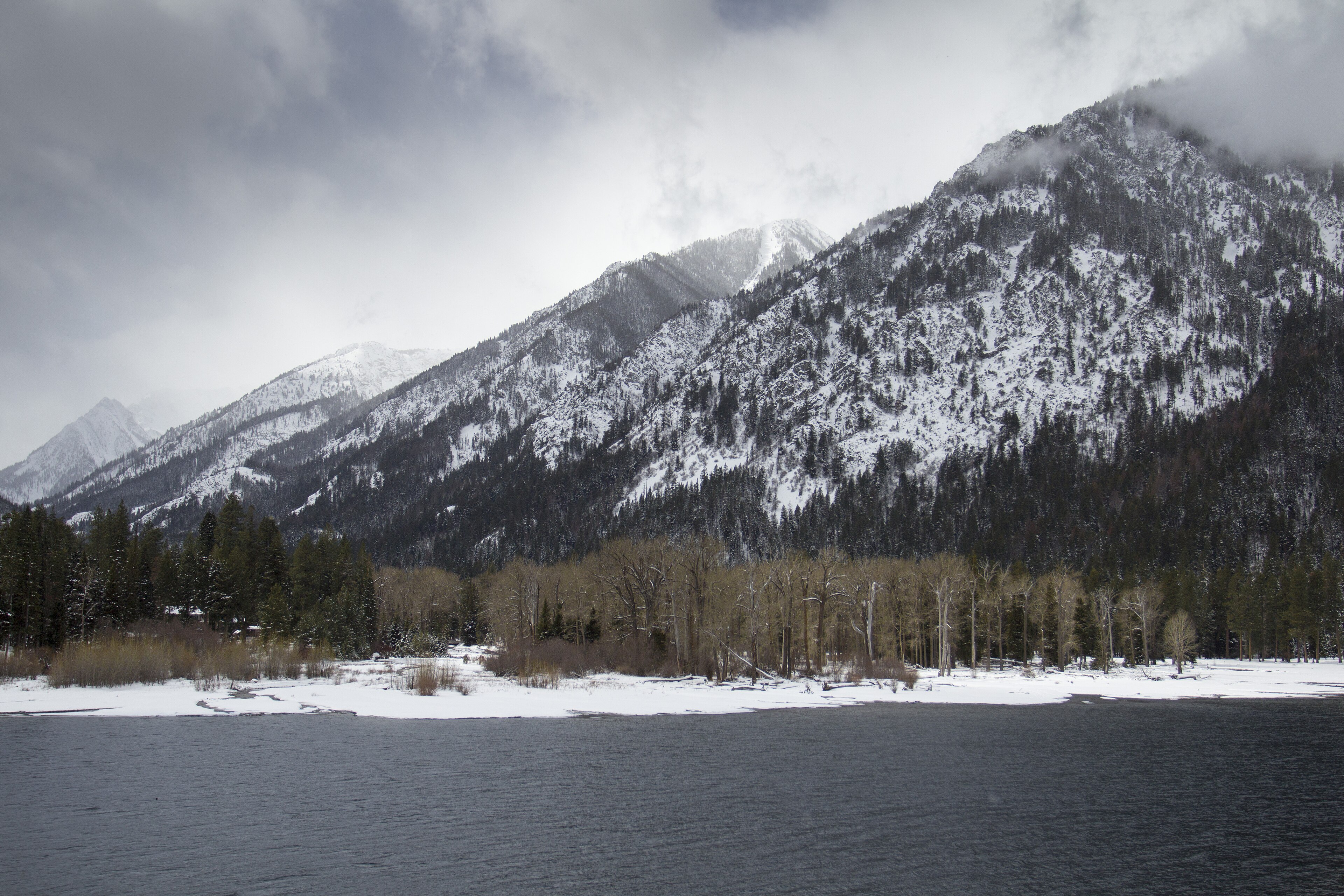

Drive south from Joseph and the road runs up between two enormous parallel ridges, with a lake between them, and a wall of mountains at the end.
Those ridges are lateral moraines, and they are among the most perfectly formed anywhere in the world. They rise close to a thousand feet above the lake, run for miles, and hold the water in place. Geology courses use photographs of them.
Wallowa Lake State Park occupies a small area at the head of the lake, and its real significance is what it opens onto: the Eagle Cap Wilderness, the largest wilderness area in Oregon.
What a moraine is and why this one matters
A glacier moving down a valley carries rock, picking up material at the head, plucking it from the walls and grinding it beneath. At the sides of the ice, debris accumulates in ridges called lateral moraines, and at the snout, where the ice stops advancing and melts, it dumps everything it is carrying into a terminal moraine. When the ice retreats those ridges remain, and if the terminal moraine seals the valley mouth, meltwater ponds behind it and you get a lake.
Wallowa Lake is the textbook case. During the last glaciation ice filled this valley and stopped just short of the Wallowa Valley floor, building moraines of exceptional size and symmetry, and the lake sits behind them. What makes it unusual is how intact and legible it is, because most moraines are eroded, vegetated or built on, and these are clean, continuous and obvious from the road, which is why they turn up in textbooks.
The Wallowas, and why they are granite
The range is often called the Oregon Alps, and the comparison is not marketing. Eagle Cap Wilderness covers over 350,000 acres, with more than 500 miles of trail and dozens of alpine lakes above 7,000 feet, and it is a landscape of sharp peaks, cirques, hanging valleys and alpine lakes that looks far more like the Sierra Nevada or the Idaho Sawtooths than like the Cascades.
The reason is that the Wallowas are not Oregon in origin. Most of the state is volcanic: Cascade stratovolcanoes, Columbia River flood basalts and the High Lava Plains. The Wallowas are built from a granitic batholith, a mass of magma that cooled slowly deep underground and was later uplifted and exposed. Around that core sit older rocks that arrived from somewhere else entirely, because the range is part of an accreted terrane, a fragment of island arc and seafloor that formed in the Pacific and was rafted east on a moving plate until it collided with North America and stuck, and the limestone and marble in the range contain fossils of tropical marine organisms.
Glaciation did the shaping, filling these valleys repeatedly and carving the cirques, the U-shaped valleys, the hanging tributaries and the moraines at the lake, and a few small glacier remnants and permanent snowfields survive in shaded high cirques, much reduced. The range is also remote, in the far northeastern corner of Oregon, six hours from Portland, and it sees a fraction of the traffic that comparable terrain gets elsewhere.
Nez Perce country
The Wallowa Valley is the homeland of the Wallowa band of the Nez Perce, and that history is inseparable from the place. Chief Joseph, whose Nez Perce name was Hin-mah-too-yah-lat-kekt, led the band during the crisis of 1877, when the government reversed an earlier agreement and ordered them onto a reservation in Idaho. The result was the Nez Perce War and a fighting retreat of roughly 1,170 miles across Oregon, Idaho, Wyoming and Montana, pursued by the US Army, ending forty miles short of the Canadian border.
Joseph's father, Old Chief Joseph, is buried at the north end of Wallowa Lake, and the gravesite is a short walk from the road. The town at the head of the valley is named Joseph. The band was never allowed to return.
The park itself
Small, developed and busy in summer. The campground is among the more popular in Oregon and books six months out, the lake has a swimming area, boat rental and a marina, and short walks run along the lakeshore and to the head of the lake.
The Wallowa Lake Tramway climbs from beside the park to the summit of Mount Howard at 8,150 feet on a steep gondola ride, and at the top there are a few miles of easy loop trails along the ridge with a view over the whole range and the valley. It is privately operated and it costs money, and it is the only lift-served alpine access in Oregon. Old Chief Joseph's gravesite is at the lake's north end.
The park is best understood as a basecamp rather than a destination.
What you came for
The trailhead at the head of the lake is the main western entrance to Eagle Cap. Chief Joseph Mountain Trail climbs steeply from the park with big views back over the lake and its moraines, and makes a good half day. The West Fork Wallowa River Trail runs up the valley toward Six Mile Meadow and eventually to Frazier Lake and Glacier Lake, and the first few miles make an easy out-and-back.
Aneroid Lake is the classic day objective, roughly 12 miles round trip with about 3,000 feet of gain to an alpine lake in a cirque, and it is a long, honest day. Ice Lake is the harder one at around 16 miles round trip with 3,700 feet, and one of the finest alpine lakes in Oregon. Eagle Cap itself, at 9,572 feet, is the range's centerpiece though not its highest summit.
The permit situation at that trailhead is worth understanding before you park, because three systems meet within a few hundred yards. Wilderness permits are required for the Eagle Cap, self-issued at trailheads at time of writing, a Northwest Forest Pass or America the Beautiful pass covers parking at Forest Service trailheads, and the state park has its own day-use arrangements that do not carry over onto national forest ground. Guidepole Hike carries the managing agency and what it requires against the specific trailhead, which where a state park boundary and a wilderness boundary sit a short walk apart is the difference between a legal parking spot and a citation.
The Lakes Basin, and going in
The reason people plan multi-day trips here is a cluster of alpine lakes below Eagle Cap. The Lakes Basin sits at around 7,500 feet and holds Moccasin, Mirror, Douglas, Horseshoe and Craig Lakes within a few miles of each other, in open granite country with the peak above, and getting there means roughly eight to ten miles and several thousand feet from the Wallowa Lake trailhead, usually via the West Fork and Six Mile Meadow.
Mirror Lake is the classic camp, with Eagle Cap reflected in it, and it is heavily used enough that camping restrictions apply around the shoreline. Eagle Cap itself is a straightforward walk-up from the basin, about three miles and 2,000 feet, and the summit view covers the whole range, while the full loop over Horton Pass or Polaris Pass and back down another drainage makes a four to five day trip.
The practicalities are the usual granite-country ones: camp 200 feet from water, store food properly, expect mosquitoes in July, carry a stove because fire restrictions are common, and be off high passes by early afternoon in thunderstorm season.
The Wallowa Lake Tramway and Wallowa Lake State ParkJoseph, Enterprise, and getting food
For somewhere six hours from Portland, the valley is unusually well set up. Joseph sits at the head of the valley below the mountains and has become a small arts town, known particularly for bronze foundries, several of which operate here, and the main street carries large bronze sculptures, which is not what most people expect in rural eastern Oregon. Enterprise, a few miles north, is the county seat and the more workaday of the two, with a well-regarded brewery.
Wallowa Lake village, at the head of the lake beside the park, has the tramway, cabins and a cluster of seasonal businesses, and it closes down substantially outside summer. Groceries are in Enterprise and Joseph, so buy before you go up to the lake.
Hells Canyon, the deepest river gorge in North America, is roughly an hour east of Joseph via the Imnaha road, and the Hat Point overlook is one of the great viewpoints in the American West, though the road is long, gravel and seasonal. Most visitors to the Wallowas never make it over there, and it is arguably as remarkable as the mountains.
The gear
Wallowa Lake sits at the foot of the Eagle Cap Wilderness, which is the largest wilderness in Oregon, and the gear list is a mountain one.
A wilderness permit, which is free and self-issued at the trailhead for day use, and which the Forest Service does check. Overnight trips into the most popular basins have additional requirements worth confirming.
Serious mosquito protection, because the Lakes Basin in the weeks after snowmelt is among the worst in the state for it, and July is simultaneously the best month to go and the worst for insects.
A bear-resistant food system, since black bears work these basins and the popular lakes have habituated animals.
Layers for eight thousand feet, which is where the basin sits. Frost in August is normal up there.
An early start in summer, both for the afternoon thunderstorms that build over the Wallowas and because the trailhead lots at the head of the lake fill.
Offline maps, since there is no coverage past the lake.
And trekking poles, for the climb into the basin, which gains around three thousand feet over six miles and gives all of it back on the way out.
Winter, and the other season
The valley does not close when the snow comes, it changes. The tramway shuts and the high country becomes the preserve of ski tourers and snowshoers with avalanche training, because the Wallowas hold a serious avalanche hazard and the terrain is unforgiving. Nordic skiing on groomed and ungroomed routes around the valley is well established, with trails near Salt Creek Summit and elsewhere, and Wallowa Lake itself freezes in cold years.
Wildlife viewing improves, since elk move down to the valley floor in winter and are visible in numbers, and bighorn sheep concentrate on the lower slopes. The road up to the lake stays open and the village largely closes.
Backcountry skiing in the range is good and committing, with long approaches, no patrol, and a snowpack that develops persistent weak layers in the continental climate, so this is avalanche-course terrain rather than a casual outing. For most visitors the honest answer is that winter here is for looking rather than going, which given what there is to look at is not a poor trade.
Destination Oregon: The Wallowa Lake TramwaySeason and practical notes
Mid-July through September is the alpine season, since snow lingers at elevation and the high passes clear late. June is beautiful in the valley and still winter above 7,000 feet, and autumn is superb, with larch turning gold in the high basins in late September and early October and the crowds gone. Afternoon thunderstorms are routine in July and August, and the exposed ridges are no place to be in one.
An Oregon day-use parking permit applies at the state park, at $10 for the day in-state and $12 out-of-state. Bears are present and food storage matters on overnights, mosquitoes in the Lakes Basin in July are notorious, and signal is absent in the wilderness and patchy in the valley. Mountain goats are common on the high ridges and bighorn sheep have been reintroduced. The valley is about six hours from Portland and four from Boise.
What to do
A day is the tramway up Mount Howard for the ridge loops, then Old Chief Joseph's grave and the lakeshore. A big day is Aneroid Lake, twelve miles and three thousand feet. And a trip is four or five days into the Lakes Basin, which is one of the best backpacking destinations in the Pacific Northwest and one of the least crowded.
On the drive in, stop and look at the moraines. A glacier built those ridges out of ground-up mountain, stopped exactly where the valley opens, and left a lake behind a wall of its own rubble. There is nowhere better in the country to see it.
More Oregon in the Trail of Ten Falls, Smith Rock and day hiking Bend. Comparable granite country is at backpacking the Sawtooths, and Oregon's fee rules are in six states, six ways to charge you for a trailhead.
The other eastern Oregon high country is in Bend Oregon day hikes and hiking South Sister. The nearest comparable granite wilderness across the state line is in backpacking the Sawtooths. The permit and agency distinctions that apply once you leave the state park are in state park versus national forest, and the camping booking is in state park camping reservations.
A last note on how to shape a first visit, because the park and the wilderness behind it are really two trips. The state park itself is a campground, a lake shore and a tramway at the head of a valley, and it works as a relaxed two-day stop. The Lakes Basin above it is a serious mountain objective with a long climb and a short season. Trying to do both properly in the same weekend is how people end up doing neither well, and the basin is the one that rewards having a whole day for it.