Fish
Fish Fire
Fire Hike
Hike Bird
Bird

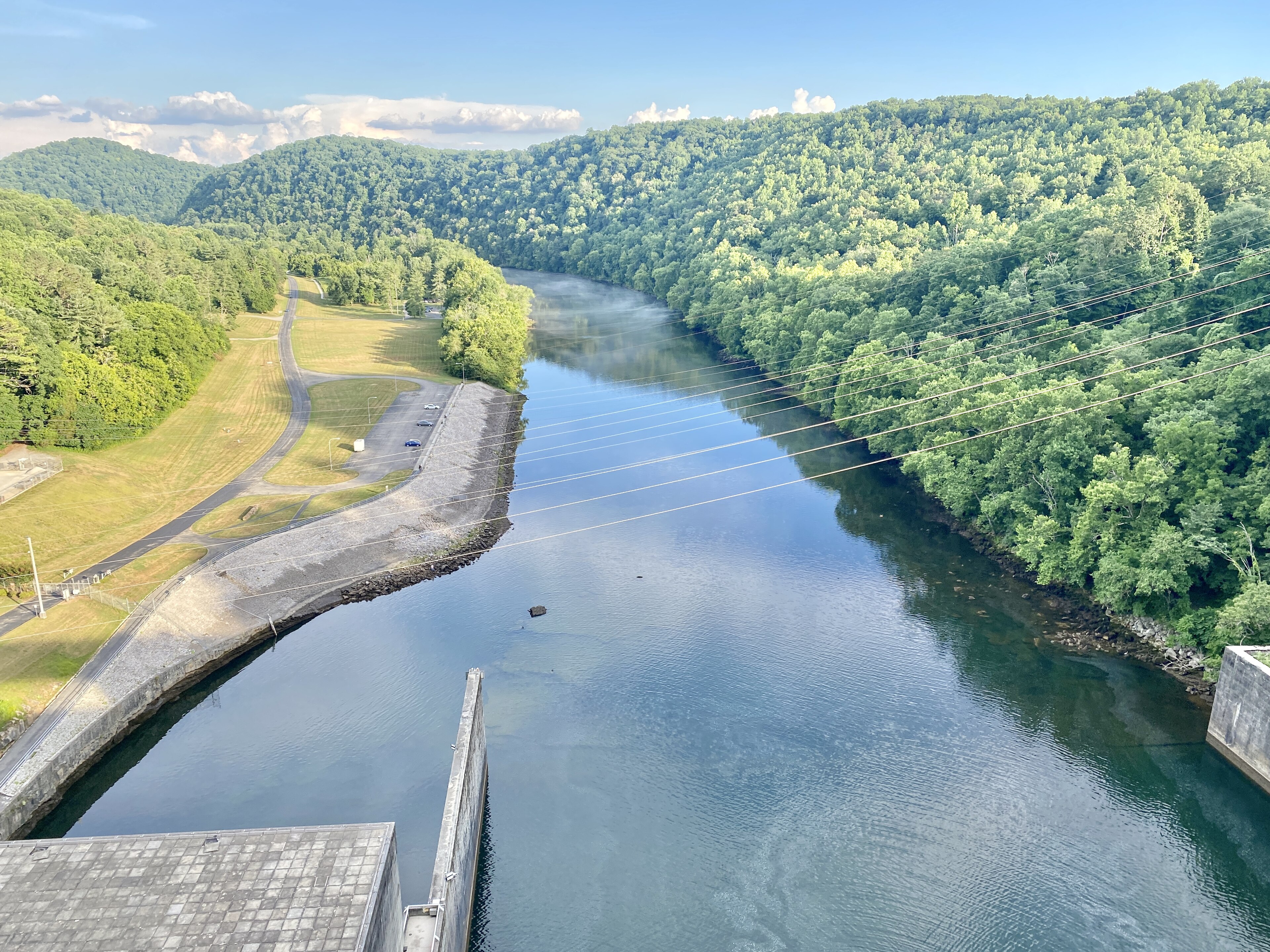

In October 1933 the newly created Tennessee Valley Authority began work on the Clinch River in Anderson County. By March 1936 Norris Dam was finished, and the region it sat in had been permanently rearranged.
It was the TVA's first dam and its proof of concept: flood control, navigation and cheap public electricity in one project, in a region where most farms had no power at all.
The state park either side of the river occupies land the TVA bought and did not flood, which makes it a slightly odd shape and gives it a slightly odd character. It is a park made of leftovers, and the leftovers are good.
What the dam did
The honest version includes both halves. It worked: Norris controlled floods on the Clinch, generated power for a region that largely lacked it, and served as the template for the dams that followed, and it is a National Historic Landmark and a designated civil engineering landmark.
It also displaced people. The reservoir flooded farms, communities, roads, churches and cemeteries, thousands of residents were bought out or removed under eminent domain, and families who had farmed the valley for generations were relocated. Graves were moved. Whole settlements ceased to exist. That is not a footnote here, it is the landscape, and when you walk the trails you are walking on ground that was purchased in the same transaction as the ground under the water.
The town of Norris was built from scratch by the TVA as a planned community for the workers, with a greenbelt, curved streets and its own school, and it still exists as an interesting piece of New Deal planning to drive through.
The park, in two halves
The park is split by the river and the halves feel different. The east side holds the main campground, the cabins and the more developed facilities, while the west side has the Lenoir Museum, the Rice Grist Mill and the threshing barn, plus quieter trails.
The Rice Grist Mill, built in the 1790s, was moved here when its original site was flooded. Relocating historic structures out of the reservoir footprint was standard TVA practice, and several buildings in the park arrived that way.
The trails
About twenty miles of trail across the park, none of it long, most of it wooded and rolling. The Lake View Trail and the Marine Railway Trail run along the reservoir side with water views, the Songbird Trail is short, flat and good for birds along the tailwater below the dam, the Andrews Ridge and Eagle trails climb the ridges with modest elevation, and the Grist Mill Trail connects the historic structures on the west side.
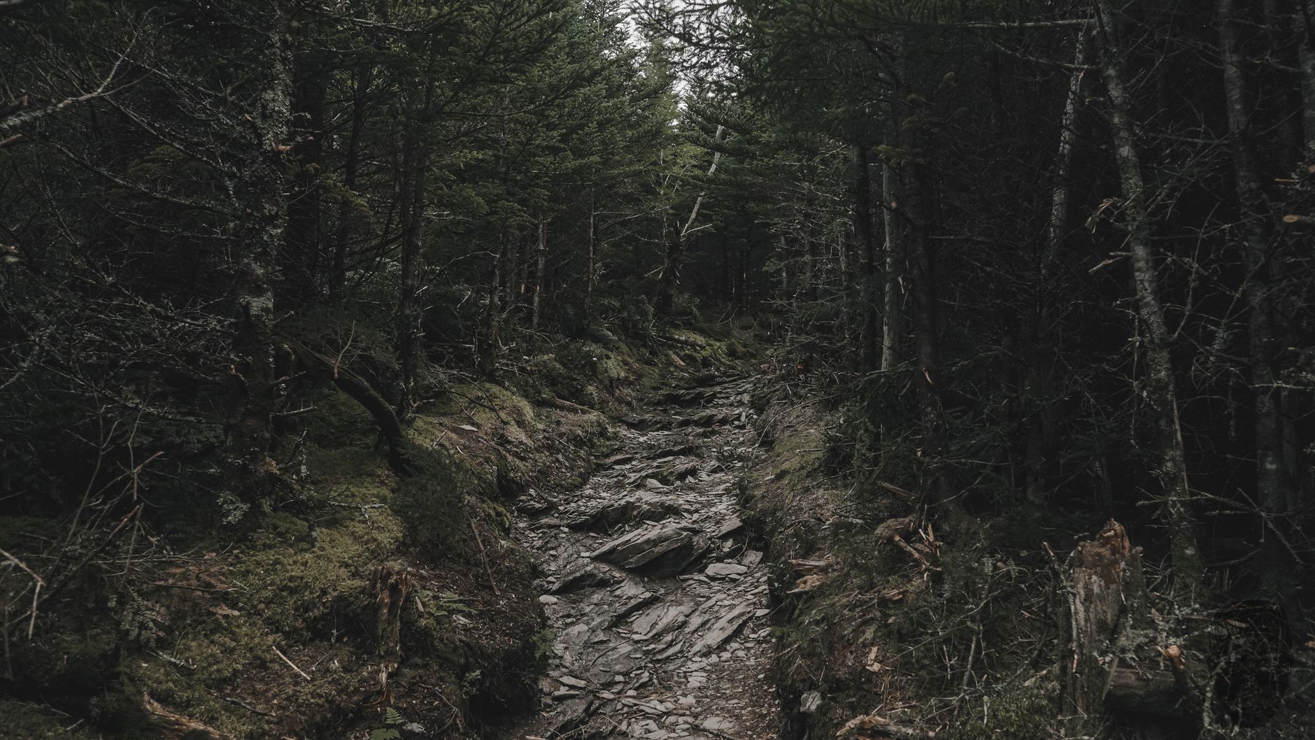
The River Bluff Trail is the best of them, a loop above the Clinch below the dam with spring wildflowers that are locally famous, and late March and April here are excellent. None of this is hard, and Norris is a park for a pleasant half day rather than an objective.
One oddity worth mentioning: parts of the network are groomed for cross-country skiing in the rare winters when East Tennessee gets enough snow to justify it. It does not happen most years, and when it does, Norris is one of very few places in the state set up for it, having kept the equipment and the marked routes for the two or three weeks a decade that they are usable. Mountain biking uses parts of the network in season.
The tailwater
Below the dam the Clinch River becomes something unusual. Water released from the bottom of a deep reservoir comes out cold, year-round, in a region where rivers are otherwise warm, and that has created a tailwater trout fishery on the Clinch that is among the best in the southeastern United States, holding brown and rainbow trout in water that would otherwise never support them.
For a hiker this matters in two ways. The Songbird Trail and the river access below the dam are where you will see anglers, and the cold water and sudden rises on generation are a genuine hazard, as they are below every TVA dam. Generation schedules change the river fast, so if you are near the water below a dam, treat rising water and warning signals seriously.
The rest of the TVA landscape
One dam is a structure. What the TVA did in this valley was something else, and Norris is the door into understanding it. By the 1940s the authority had built or acquired a system of dams across the Tennessee River and its tributaries, operated together to control floods, maintain a navigable channel and generate power, and that coordination was the innovation more than any single structure.
The electricity changed the region materially. Rural electrification in the Tennessee Valley moved from a small minority of farms to near-universal service within a couple of decades, and the cheap power drew industry, including, during the war, the enormous secret facility at Oak Ridge twenty minutes from here, which needed more electricity than most American cities.
So the landscape around Norris is not only a reservoir and a park. It is the visible part of a program that electrified a region, remade its economy, produced the material for a weapon, and displaced tens of thousands of people to do it.
If that history is what brings you, the essential companion stop is the Museum of Appalachia, fifteen minutes away in Clinton, an open-air collection of relocated buildings, tools, instruments and domestic objects assembled over decades by one family, a Smithsonian affiliate and idiosyncratic in a way that institutional museums are not. It matters next to Norris Dam because it documents the world the reservoir displaced, since the cabins, the barns, the churn dashes and the fiddles came from the kind of communities that were bought out and flooded, and seeing them assembled makes the abstraction of eminent domain concrete. The Lenoir Museum in the park itself addresses the same thing at smaller scale. It is easy to visit a dam and admire the engineering, and harder, and better, to also see what the valley held before the water.
The wildflowers, specifically
Worth its own note because it is the strongest single reason to time a visit. The River Bluff Trail runs along a north-facing slope above the Clinch, and the combination of moisture, shade and rich soil produces one of the better spring ephemeral displays in East Tennessee.
Spring ephemerals are woodland plants that complete their entire above-ground life in the few weeks between the ground thawing and the canopy closing, so they emerge, flower, set seed and vanish, and the window is short. At Norris that window is roughly late March into April, with trillium, Virginia bluebells, trout lily, bloodroot, dutchman's breeches, hepatica and wild geranium the usual cast, and in a good year the slope is carpeted.
Go in the third week of the display rather than the first, and go on a weekday if you can, because this is not a secret locally.
Norris Dam State ParkThe lake, and the shape of it
Norris Lake is worth understanding as a landscape rather than a body of water. It holds roughly 800 miles of shoreline, which sounds impossible for a lake of its surface area until you look at the map, because the reservoir flooded the valleys of the Clinch and the Powell and every tributary hollow became an arm. The result is a dendritic shape, branching like a tree, with enormous edge length relative to area, and that shape is why the lake feels private despite heavy use. There is always another arm.
Water levels move seasonally by design. The TVA draws the reservoir down through autumn and winter to create flood storage capacity ahead of the wet season, then refills it in spring, so a visitor in February sees a very different lake from one in June, with exposed banks and stranded boat ramps. This is not drought, it is the system working.
For a hiker the drawdown exposes shoreline that is walkable in winter and underwater in summer, including, in places, traces of the pre-reservoir landscape: road beds, foundations and fence lines that emerge when the water is low enough. That is an affecting thing to come across on a February walk, and it is the clearest possible reminder of what the lake is sitting on.
The gear
Norris Dam is the gentlest park in this Tennessee group and the gear list reflects that, with one item that is about timing rather than equipment.
A wildflower guide, which is a genuine recommendation here rather than a flourish. The north side of the river below the dam is one of the better spring ephemeral displays in east Tennessee, and the window is roughly late March through April.
Binoculars, for the same reason and for the eagles, which nest on the lake and are reliable.
Awareness of generation schedules, which is the practical item. The Tennessee Valley Authority publishes when it is releasing water through Norris Dam, the river below rises fast when it does, and anybody wading or fishing down there needs to know the schedule rather than guess it.
Tick repellent, for the woods on both sides.
Ordinary trail shoes, because this is moderate hiking rather than plateau gorge work.
A camera for the dam itself, which is worth photographing as a piece of 1930s engineering rather than only as scenery.
And time for the Lenoir Museum and the grist mill, which most visitors skip and which are the reason a good deal of the history of this valley is legible at all.
The Norris Watershed
Adjoining the state park is the Norris Watershed, roughly 2,000 acres of forest owned by the town of Norris, laced with its own trail network, open to the public and free. It was among the earliest municipal forests in the region managed deliberately for watershed protection and demonstration forestry, and the trails connect into the state park system, which effectively doubles the walking available from a single trailhead.
It is also a different land manager with its own rules, on ground that looks identical, which is the recurring theme of hiking in this region. Within a couple of miles here you can be on state park land, on a municipal forest and on TVA reservation shoreline, three owners with three sets of rules on dogs, bikes, camping and hunting, and nothing on the ground tells you which one you are standing on. Guidepole Hike carries the managing agency and its rules under the trail, which at a park stitched together from what a federal agency bought and did not flood is the layer that decides what applies.
Norris Dam State Park in East TennesseeSeason and practical notes
Spring is the best, specifically late March and April, for the wildflower display on the River Bluff Trail. Autumn brings color and comfortable walking, summer is hot and humid and the lake is the point for most visitors, and winter is quiet, mild by northern standards, and the bare trees open up the river views.
There is no entrance fee, as at every Tennessee state park. Camping and cabins are available and some cabins are original CCC-era construction, dogs are welcome on leash, and the park is about twenty-five minutes north of Knoxville, which makes it the closest good state park to the city and an easy evening walk for anyone living there. The dam itself has a visitor overlook and is worth ten minutes, signal is reasonable across most of the park, and there are ticks in season with copperheads on the ridges.
Why it is worth the trip
Norris will not compete with the plateau gorges on drama. There is no 250-foot waterfall and no sandstone arch.
What it has instead is legibility. This is a landscape that was deliberately made, within living memory, by a federal agency acting on a policy, and almost everything you see is a consequence of that: the lake, the town, the relocated mill, the cold river, the trout, the trails through land bought for a reservoir that stopped short.
Walk the River Bluff Trail in April for the wildflowers, look at the dam, drive through Norris, and the whole New Deal becomes a place rather than a chapter heading.
The rest of Tennessee's parks are in Fall Creek Falls, Burgess Falls and Pickett. The plateau's long trail is the Cumberland Trail, the Smokies are an hour east in one day in the Smokies, and the state's other great cold-release fishery is covered in fly fishing the Caney Fork.
The other east Tennessee parks are in Pickett State Park and the Cumberland Trail, which passes nearby. The national park an hour and a half southeast is in one day in the Great Smoky Mountains and Charlies Bunion. The dam-controlled river pattern here is the same one described in Rock Island State Park, and Tennessee's no-fee policy is in state park passes by state.
A last note on the history under the water, since it is part of what this park is. Filling Norris Lake in 1936 flooded farms, roads, churches and cemeteries across five counties, and around three thousand families were relocated. Some of the graves were moved and some were not. The Tennessee Valley Authority's own records document the process in detail, and the Lenoir Museum in the park holds a good deal of what was salvaged from the valley. It is a pleasant lake with a difficult origin, and both are true.