Fish
Fish Fire
Fire Hike
Hike Bird
Bird

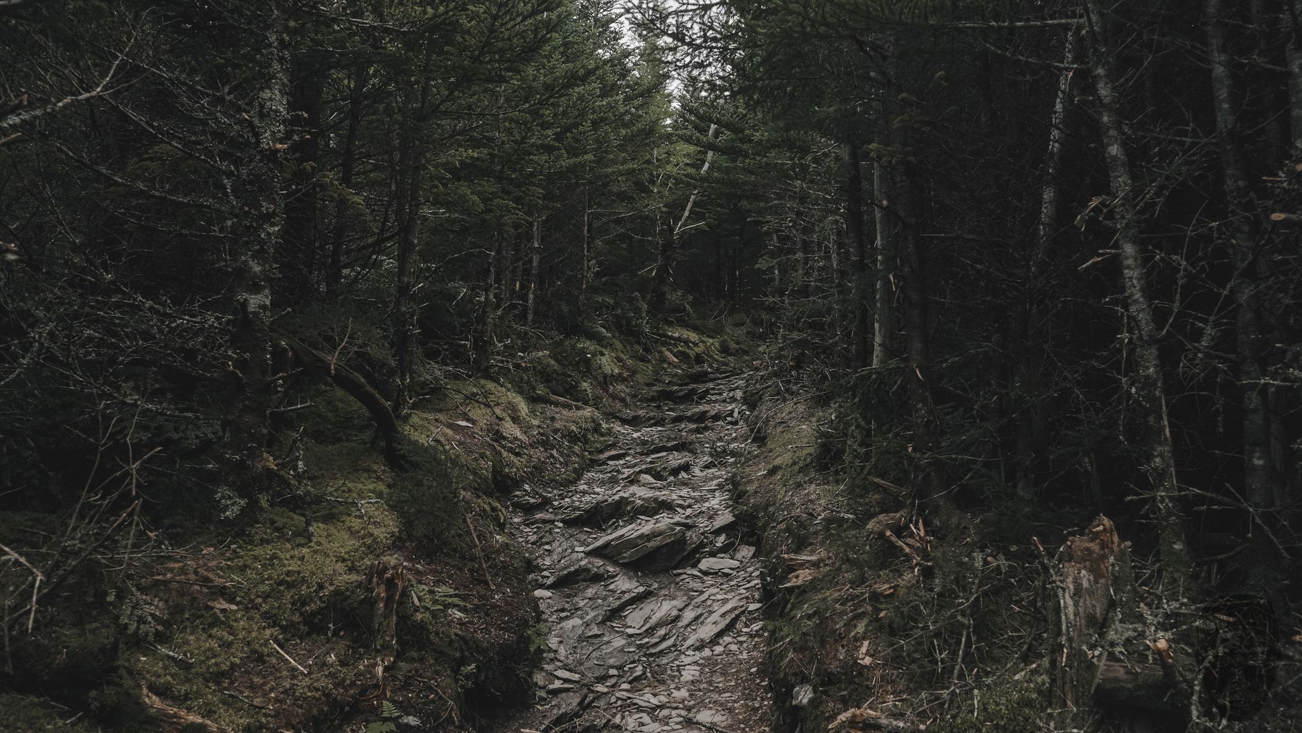

Mount LeConte is the third-highest peak in Great Smoky Mountains National Park at 6,593 feet, behind Kuwohi and Mount Guyot. It is also the highest peak lying entirely within Tennessee, because the two above it sit on the state line.
Five trails reach the summit. The Boulevard runs 5.4 miles from its junction with the Appalachian Trail. Bullhead is 6.9 miles and the least crowded. Rainbow Falls is 6.6. Trillium Gap is 8.9, or about 6.5 from alternative parking, and it is the one the llamas use.
And then there is Alum Cave, 4.9 miles to the summit, the shortest, the steepest, and by a wide margin the most interesting. It is the busiest trail in the park for good reason.
What the day involves
Call it 11 miles round trip with roughly 2,800 feet of gain, and six to eight hours at a normal pace with stops. It is a strenuous day, though it is not technical and it does not require anything you would call scrambling. What makes it distinctive is that the trail keeps producing landmarks, because most long climbs are a forest slog with a view at the end and this one hands you something roughly every mile.
Arch Rock comes about 1.4 miles in, a natural tunnel through black slate weathered open over time, which you climb through on stone steps with a steel cable handrail bolted to the rock, and it is the first sign the trail is not ordinary. Inspiration Point follows shortly after, where the forest breaks and you get the first real view across the valley to the ridges opposite with a heath bald falling away below.
Alum Cave Bluffs arrives at about 2.2 miles, and it is not a cave but a vast concave overhang of rock roughly 80 feet high, dry underneath even in rain, where saltpeter was mined in the nineteenth century. Most day hikers turn around here, which makes this the natural half-day option and the reason the lower trail is so busy.
Above the bluffs the trail changes character. It narrows, climbs onto exposed ledges cut into the mountainside, and runs beside genuine drop-offs, with more cables bolted along these sections as handholds. In dry weather it is straightforward, and in ice it is the crux of the route and the reason people get hurt here. The last mile enters spruce-fir forest, the ice-age remnant that survives on these high summits, and the temperature drops noticeably.
How to Hike Mount LeConte via the Alum Cave TrailThe lodge at the top
LeConte Lodge has operated near the summit since 1925 and is the highest inn providing lodging anywhere in the eastern United States. It is a cluster of rough log cabins and a central dining hall sleeping about 60 guests, open roughly March through November, and there is no road: everything, meaning food, linens and supplies, arrives by llama pack train three times a week and by helicopter at the start and end of the season. There is no electricity in the cabins, no showers, and no vehicle access of any kind.
Staying there requires booking a long way ahead, because demand vastly exceeds 60 beds a night and the reservation system opens well in advance, so check the lodge's own booking process rather than assuming availability.
Even as a day hiker the lodge is worth reaching. It sells lunch and famously good hot chocolate to people who have just climbed 2,800 feet, and sitting on the porch among the llamas while steam comes off your jacket is a singular experience in American hiking.
The summit is not the view
A thing that catches people out: the true summit of Mount LeConte is a wooded high point with no view at all, just a cairn and trees. The views are at three separate spots a short walk from the lodge, and you should visit at least one.
Cliff Tops is the sunset viewpoint, a rock shelf looking west and southwest, and the most popular. Myrtle Point faces east and is the sunrise spot, reached along a narrow ridge through rhododendron, and it is the better of the two on a clear morning. High Top is the actual summit and is where the cairn sits.
If you are a day hiker with limited time, Cliff Tops is a few minutes from the lodge and delivers most of what you came for.
Choosing between the five routes
If Alum Cave is closed, or the lot is full, or you want a quieter day, the other four are different experiences rather than lesser versions.
Rainbow Falls, at 6.6 miles, climbs past an 80-foot waterfall that forms a rainbow in afternoon light and freezes into a spectacular ice column in winter. It starts from Roaring Fork, and the falls at 2.7 miles make a good destination in themselves. Trillium Gap, at 8.9 miles or about 6.5 from alternative parking, passes behind Grotto Falls, one of the few waterfalls in the park you can walk under, and it is also the llama route, so if you time it right on a supply day you will meet the pack train coming down, which children find far more memorable than any view.
Bullhead, at 6.9 miles, is the quiet one, with fewer landmarks, more solitude, and the best option on an October Saturday when everything else is heaving. The Boulevard, 5.4 miles from the Appalachian Trail junction, is the high route along the crest reached from Newfound Gap, the most alpine-feeling of them and the least practical as an out-and-back day hike unless you arrange a shuttle.
A popular combination is up Alum Cave and down Rainbow Falls or Trillium Gap with two cars, which gives you two entirely different mountains for the price of one shuttle. That is worth planning properly rather than improvising, because the five trailheads sit on three different roads, with Alum Cave on Newfound Gap Road, Rainbow Falls and Trillium Gap off Roaring Fork, and the Boulevard up at Newfound Gap itself, and Roaring Fork is one of the roads that closes seasonally. Guidepole Hike carries all five routes against the trailheads they leave from, with current road status on each, which is what makes a two-car traverse something you can arrange the night before rather than the morning of.
Mount LeConte Sunrise Hike: Why Alum Cave Is the Best RouteThe mountain's weather, and why winter changes everything
Mount LeConte receives something in the order of 80 inches of precipitation a year and is in cloud for a large share of it. That is what sustains the spruce-fir forest near the top and it is what makes the trail conditions so variable.
The practical consequences are worth internalizing. Rock stays wet here long after rain stops, and the slate underfoot on the lower trail is slippery when damp. The cabled ledges are cut into rock that seeps. Rime ice, frozen fog that builds horizontally into the wind, coats everything near the summit for weeks at a time in winter and is far more slippery than snow. And because the trailhead sits at about 3,800 feet on Newfound Gap Road while the summit is 6,593, you are frequently walking through two or three different weather systems in a single ascent, so starting in warm drizzle and topping out in horizontal ice is a normal LeConte day in February rather than an unlucky one.
That makes the seasonal difference larger here than on almost anything else in the park. Summer is warm and humid at the trailhead and pleasantly cool at the top, with afternoon thunderstorms common, and the exposed ledges are not somewhere to be in lightning. Autumn is the best window, with clear air, color on the lower slopes and the coolest hiking of the year, and it is also the busiest, with the small trailhead lot filling very early in October.
Winter and early spring transform it. The upper ledges hold ice for months after the trailhead has thawed, and the cables become the only thing between you and a long slide. Microspikes are not optional from roughly December through March, the park regularly reports injuries on this exact stretch, and snow can persist near the summit into April.
A short history of a very old path
People have been coming up here for a long time, and for reasons other than recreation. The saltpeter workings at Alum Cave Bluffs date to the nineteenth century, when the mineral deposits under the overhang were mined for gunpowder manufacture, and the Confederacy took an interest during the Civil War. Alum, epsom salts and copperas were extracted here too, which is where the name comes from.
LeConte Lodge opened in 1925, before the national park existed, since Great Smoky Mountains National Park was not established until 1934, and the lodge was originally built to house people brought up the mountain to be persuaded that this landscape was worth protecting. It worked, and the lodge's survival as a private concession inside a national park is a direct legacy of that campaign.
The trail itself has been rebuilt repeatedly, most substantially after storm damage, and the cables and stone steps you use are the product of continuous maintenance rather than original construction. Trail crews still work it hard, which is why an eleven-mile route carrying that much traffic remains in the condition it does.
The gear
Alum Cave is eleven miles round trip with twenty-seven hundred feet of gain, on a trail with cable handrails bolted into rock, and the gear list is mostly about the top being a different mountain from the bottom.
Kahtoola MICROspikes, from November through March and sometimes later. This is the item that matters here more than on any other trail in the park. The bluffs section has ice on it when the trailhead is clear, the cable handrails exist because that section is genuinely exposed, and the rescues on this trail are overwhelmingly winter slips.
Trekking poles, for a descent that is long, wet and rooted.
An insulating layer plus a rain shell, because LeConte at sixty-six hundred feet is one of the wettest and coldest places in the eastern United States. It receives snow in every month except July and August.
Two liters of water, since the sources on the trail are unreliable.
A Park It Forward parking tag, for the Alum Cave lot, which fills by eight in the morning most of the year.
A headlamp, which is not optional if you are going for sunrise from the top and is a good idea regardless.
And cash or a card for the lodge, if you have a reservation there, and a willingness to accept that you almost certainly do not, because the LeConte Lodge lottery is one of the hardest reservations in American hiking.
Who this trail is not for
This is worth saying plainly, because the trail's popularity misleads people. If you are uncomfortable with exposure, the ledges above Alum Cave Bluffs will not be pleasant, and while they are not technical and they have cables, there are sections with a substantial drop on one side and a narrow tread.
If you have not done a hike with 2,800 feet of climbing, this is a hard introduction, and the descent is harder on the body than the ascent. If it is icy and you do not have traction, turn around at the bluffs, which is the most specific piece of advice in this article and the one most often ignored, because the lower trail feels fine and the change happens gradually. And if you are bringing a dog, you cannot, not on this trail and not on nearly any trail in this park.
None of that is a reason to skip it. Alum Cave Bluffs alone, at 2.2 miles, is one of the better short hikes in the southeastern United States.
Practical notes
The parking is small and fills before dawn in peak season. There are two lots on Newfound Gap Road and both overflow, roadside parking is limited and enforced, and a Park It Forward parking tag is required for any stop over 15 minutes at $5 daily, $15 weekly or $40 annually per vehicle.
There is no water on the trail that you should drink untreated and no facilities between the trailhead and the lodge. Dogs are not allowed, which as on almost all national park trails is a hard prohibition rather than a leash rule. And weather at the summit is not the weather in Gatlinburg, which sits 5,000 feet lower, so carry an insulating layer and a shell regardless of the forecast in town.
It earns the traffic
Start early, both for the parking and to leave margin on an eleven-mile day. Turn around at Alum Cave Bluffs without embarrassment if the day is not going well, because that is a fine hike in itself. If you continue, treat the cabled ledges as the serious part rather than a novelty, and carry traction anywhere near winter.
Get to the lodge, buy the hot chocolate, walk out to Cliff Tops, and then give yourself real time for the descent, because 2,800 feet down on tired legs is where the day gets long.
It is the best trail in the park and it earns the traffic.
The park's highest ground is a very different proposition on the other side of the crest: Kuwohi is half a mile of pavement to a higher summit. The most exposed view in the park is a ridge walk from the same road: Charlies Bunion. And the streams you cross on the way up hold wild brook trout: fly fishing the Great Smokies.
The park's other great walk from Newfound Gap is in Charlies Bunion, and its highest and easiest summit is in Kuwohi. The wider trips are in one day in the Great Smoky Mountains and three days in the Great Smoky Mountains. The comparable high-elevation walk to the northeast is in the Roan Highlands.