Fish
Fish Fire
Fire Hike
Hike Bird
Bird

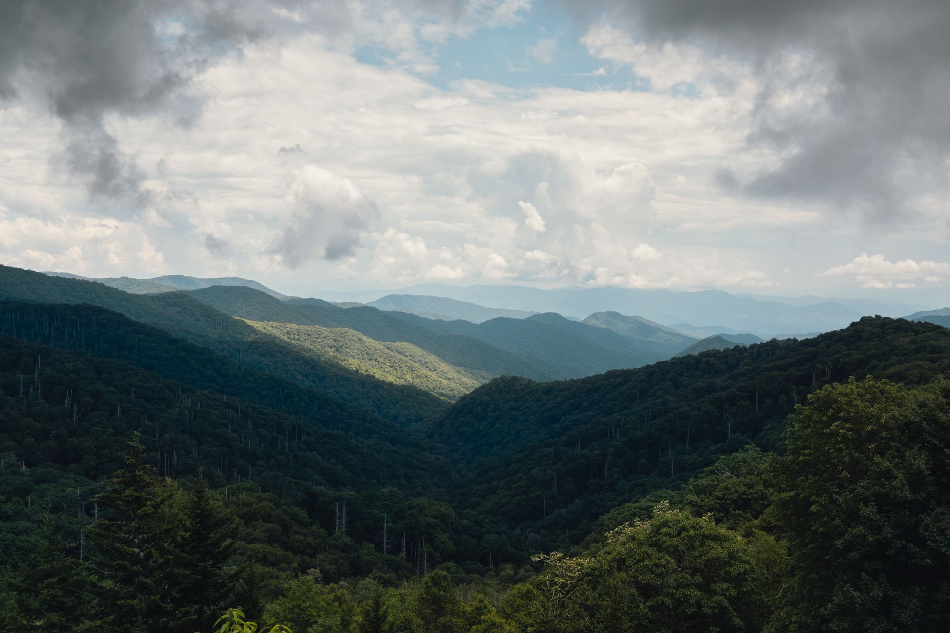

The Great Smoky Mountains are green to the summits. That is the defining quality of the range: it is one of the most heavily forested landscapes in North America, and it is why views here come from gaps in the canopy rather than from open rock.
Charlies Bunion is the exception, and the reason it is an exception is a story about damage.
Why the rock is bare
In 1925 a fire burned through this section of ridge, killing the trees and the shallow root systems that held the thin mountain soil in place. In 1929 a catastrophic flood hit the same slope, and with nothing left to bind it the soil washed off, scouring the ridge down to rock.
A century later it has not come back. Soil takes a very long time to build on a steep Appalachian ridge, and the exposed rock face is now a permanent feature of the landscape, a 5,565-foot bare outcrop on the western wing of a jagged section of crest known as the Sawteeth.
The view exists because of an ecological catastrophe. That is worth knowing while you stand on it.
The hike
Just over eight miles round trip with about 1,640 feet of elevation gain, starting at Newfound Gap at 5,046 feet on the Tennessee-North Carolina state line and heading east on the Appalachian Trail.
That profile is unusual and it is what makes this hike so good. You start high, so there is no long grinding approach climb, and you step out of the parking area straight onto the crest at 5,000 feet and stay near it the whole way, with the gain accumulating in undulations rather than a single ascent.
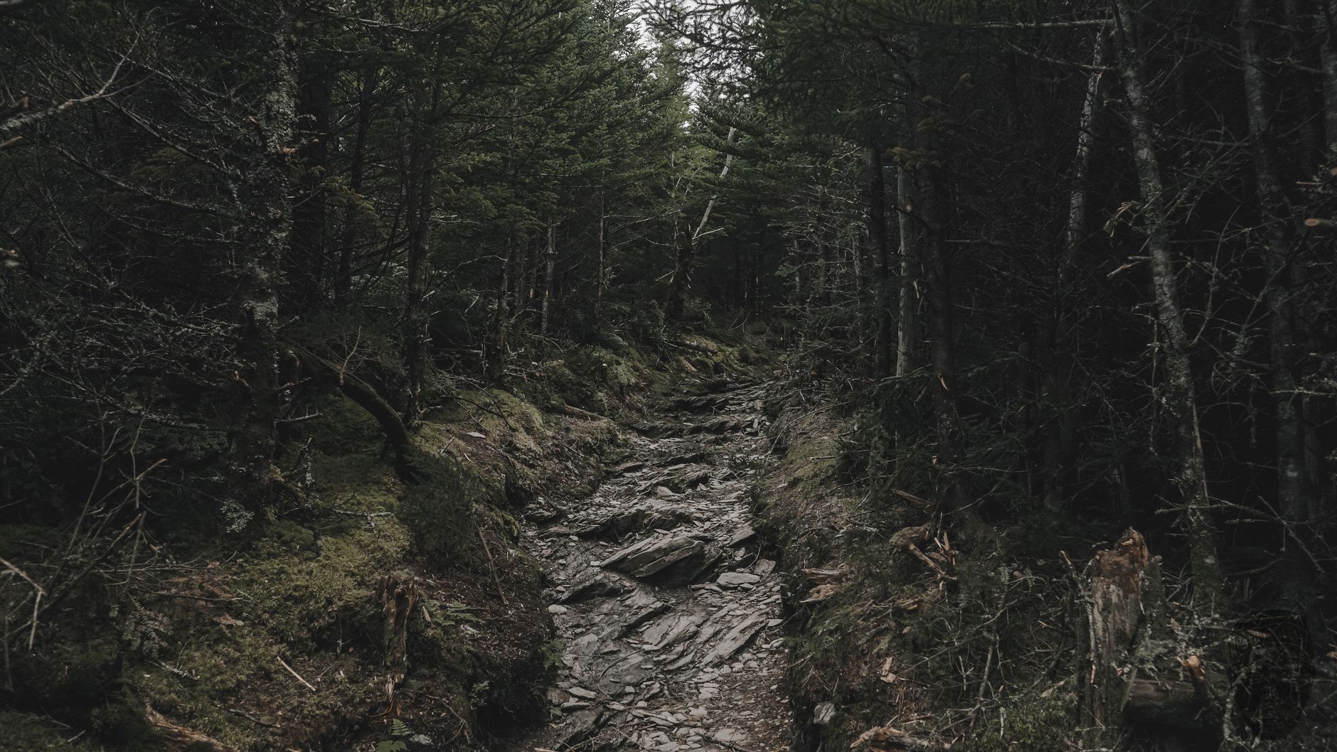
What you get for it is four miles of genuine ridge walking on the Appalachian Trail, through spruce-fir forest, with views opening on both sides: North Carolina on the right and Tennessee on the left. Very few day hikes in the eastern United States give you this much time on a crest. The tread is rocky and rooty throughout with steep pitches, which makes it more demanding than 1,640 feet suggests, and the return leg has its own climbing because of the undulation.
About 2.7 miles in you pass the Icewater Spring shelter, one of the Appalachian Trail's backcountry shelters, with a spring and a privy. It makes a natural break and it is a good place to meet thru-hikers in spring.
Charlies Bunion Trail GuideThe Bunion itself
At the end the trail reaches a short spur that loops around the rock outcrop, and this is where care is required. The rock is exposed on multiple sides with substantial drops, the surface is uneven, and there are no railings, no fences and no barriers of any kind. In wet or icy conditions it is dangerous, and even dry it deserves respect.
Stay on the established path around the outcrop, and understand that the photograph everyone takes, standing on the point with the Sawteeth behind, involves being close to an edge with a long way to fall.
The view from it is the finest on any day hike in the park: the jagged crest of the Sawteeth running east, the deep valley of the Greenbrier below to the north, and ridgeline after ridgeline stacking into haze.
The Sawteeth, and what you are looking at
From the outcrop the dominant feature is the ridge running east, a jagged, narrow, broken crest that earned the name the Sawteeth. This is unusual terrain for the Southern Appalachians, which are generally rounded, weathered and soft-edged after hundreds of millions of years of erosion, and the Sawteeth are steeper and more broken than almost anything else in the range. From Charlies Bunion you are looking along their length rather than at them side-on, which exaggerates the effect.
Below to the north the ground falls away into the Greenbrier, one of the deepest and least-visited valleys in the park, and on a clear day you can follow ridgeline after ridgeline north into Tennessee until they dissolve into the blue haze the range is named for.
That haze is not pollution, or at least not primarily. The forest emits volatile organic compounds that scatter light, which is what produces the blue, so you are watching several million acres of trees breathe.
Charlies Bunion: The Tourist Bunion versus the Real BunionWalking a piece of the Appalachian Trail
One of the quieter pleasures of this hike is that you are not on a park trail that happens to be scenic. You are on the Appalachian Trail, the 2,190-mile footpath from Georgia to Maine, on one of its most celebrated sections.
The Smokies stretch of the AT runs about 71 miles along the state-line crest and contains the trail's highest point at Kuwohi. Thru-hikers reach it in April and May, roughly a month into a northbound walk, and it is where a lot of them decide whether they are going to Maine.
If you hike this in late April through May you will meet them, and they are easy to spot: lighter packs than you expect, dirtier, moving faster, and generally delighted to talk to anyone who is not another thru-hiker. The Icewater Spring shelter at 2.7 miles is where they stop, and an hour there in spring is a good part of the day.
The white blazes on the trees are the AT's markers, painted at intervals the whole way to Katahdin. Following them for four miles is a small thing and it does not feel like one.
Seasons
Late spring, meaning May and early June, is arguably the best time, when the spruce-fir is fresh, the ridge is cool while the lowlands are already humid, and Appalachian Trail thru-hikers are moving through, which gives the shelter a particular atmosphere.
Summer is comfortable up here compared with Gatlinburg 4,000 feet below, but afternoon thunderstorms build fast and you do not want to be on an exposed rock outcrop on a ridge in lightning. That is the single most important seasonal hazard on this hike, so start early and be off the rock by early afternoon.
Autumn delivers the clearest air of the year and the biggest views, along with the park's worst crowds and a Newfound Gap parking area that fills before eight. Winter transforms the place: Newfound Gap Road closes in serious storms, the ridge accumulates snow and rime ice, and the outcrop becomes a place for experienced winter hikers with traction and not for anyone else. On a clear cold day with the ridges under snow it is spectacular, and it is a serious undertaking.
The gear
Charlies Bunion is eight miles on the Appalachian Trail from Newfound Gap, staying above five thousand feet the whole way, and it is the most exposed walk in the park.
An insulating layer plus a windshell, which is the pairing that matters. The trail runs along the state line crest, the wind comes across it unobstructed, and the temperature at the Bunion is routinely fifteen or twenty degrees below Gatlinburg with wind on top of that.
Kahtoola MICROspikes in winter, for the same reason as on Alum Cave. The crest ices reliably and the Bunion itself is a rock outcrop with drop-offs on three sides.
Shoes with stiff soles and real tread, because the Appalachian Trail on this section is a rock staircase for long stretches and thin-soled shoes are punishing over eight miles of it.
Two liters of water, since there is no reliable source between Newfound Gap and Icewater Spring.
A Park It Forward parking tag for the Newfound Gap lot.
A rain shell, always, in a place that receives eighty-five inches a year.
And trekking poles, which earn their place on the rocky descent back from the crest rather than on the climb.
What this hike asks of you
Exposure tolerance at the end, first of all, because the four miles are straightforward walking and the last hundred feet are not, with nothing to hold. Weather judgement next, since you are on a crest above 5,000 feet with no bail-out for four miles and storms here arrive faster than the view of them suggests. Layers, because Newfound Gap runs 10 to 20 degrees cooler than Gatlinburg and the ridge is windy, and people arrive dressed for a Tennessee summer and are cold within twenty minutes. And water, which you carry, because the Icewater Spring shelter has a spring but you should treat anything you take from it and there is nothing else.
Administratively it wants a Park It Forward parking tag, required for any stop over 15 minutes anywhere in the park at $5 daily, $15 weekly or $40 annually per vehicle, and Newfound Gap is patrolled.
The other thing to check is the road rather than the trail. Newfound Gap Road closes in storms, and the closure applies to the road, not just to the trail, which means a perfectly walkable ridge can be entirely unreachable because the only way to its trailhead is shut. Guidepole Hike carries road and trailhead access status alongside the route, which on a hike that starts at a mountain pass is the question that decides whether the day happens at all.
Beyond that, the trail is well-signed and hard to lose, being the Appalachian Trail, blazed white, with marked junctions. Dogs are not permitted, as on nearly every trail in this park. Cell signal is unreliable on the ridge and absent for much of the drive. And the Rockefeller Memorial at the parking area, where Franklin Roosevelt formally dedicated the park in 1940, straddles the state line and is worth two minutes before you set off.
Extending it
If eight miles is not enough, the ridge keeps going and the options are excellent. The Jump Off is a short, steep, unofficial-feeling spur off the Boulevard Trail junction that delivers a view many people rate above the Bunion itself, looking directly across at the Sawteeth, and it adds roughly a mile and a half round trip and a good deal of climbing.
Continuing east past the Bunion on the Appalachian Trail takes you into the Sawteeth proper, which is rougher, narrower, and almost entirely empty of day hikers. And the Boulevard Trail branches off toward Mount LeConte, 5.4 miles from the junction, which turns this into a very long day or a shuttle hike.
How this compares to the park's other big views
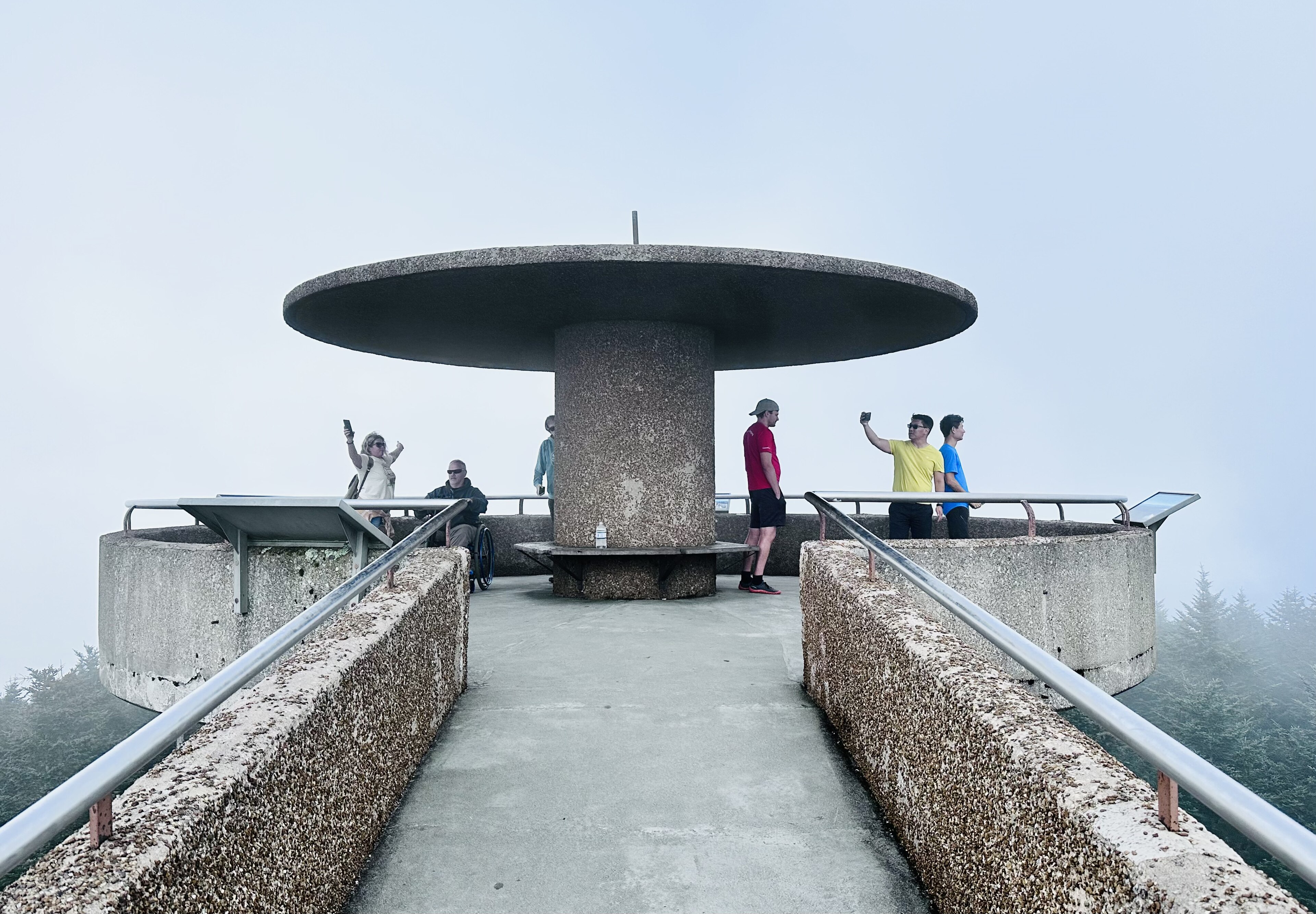
This is worth setting expectations on, because the Smokies offer several and they are not interchangeable. Kuwohi is higher and has a tower, getting you a 360-degree panorama for half a mile of paved walking, and it is also fogged in a great deal of the time and crowded whenever it is not. Mount LeConte's viewpoints, Cliff Tops and Myrtle Point, require an eleven-mile day and reward it, but they look out over the Tennessee side rather than along a dramatic crest.
Charlies Bunion gives you something neither offers: the sense of standing on a narrow edge of the range with the mountains falling away on both sides. It is the most exposed view in the park, and exposure is exactly what the Smokies otherwise lack. If you only do one big-view hike here and you are comfortable near edges, this is the one.
A fire, a flood, and a view
Start from Newfound Gap early, walk four miles of the finest ridge in the eastern United States, be careful on the rock, and turn around. Take a layer you think you will not need. Watch the sky in summer. Carry traction in winter or do not go.
And take a minute at the outcrop to consider that the view you drove three hours for is the direct result of a fire and a flood a hundred years ago, and that the forest below you would look exactly like this everywhere if the same thing had happened a few ridges over.
The park's marquee climb starts a few miles down the same road: Alum Cave to Mount LeConte. Its highest ground is Kuwohi, reached from the same crest. If you have one day and are deciding how to spend it, one day in the Smokies lays out the options. And the streams in the valleys below hold wild brook trout: fly fishing the Great Smokies.
The other Newfound Gap classic, and the harder one, is in Alum Cave to Mount LeConte. The park's highest point, half a mile from a parking lot, is in Kuwohi. Itinerary versions are in one day in the Great Smoky Mountains and three days in the Great Smoky Mountains, and the nearest city trail system is in hiking Chattanooga.
A note on what you are standing on, because it is the reason the view exists. The Bunion is bare rock rather than forest for a specific and recent reason: a fire in 1925 burned the slope, and a cloudburst in 1929 stripped the soil off the burn scar entirely, leaving the rock exposed. Almost every other viewpoint in this park is a gap in trees. This one is a scar, still not healed a century later, which is worth thinking about the next time somebody describes the Smokies as untouched.