Fish
Fish Fire
Fire Hike
Hike Bird
Bird

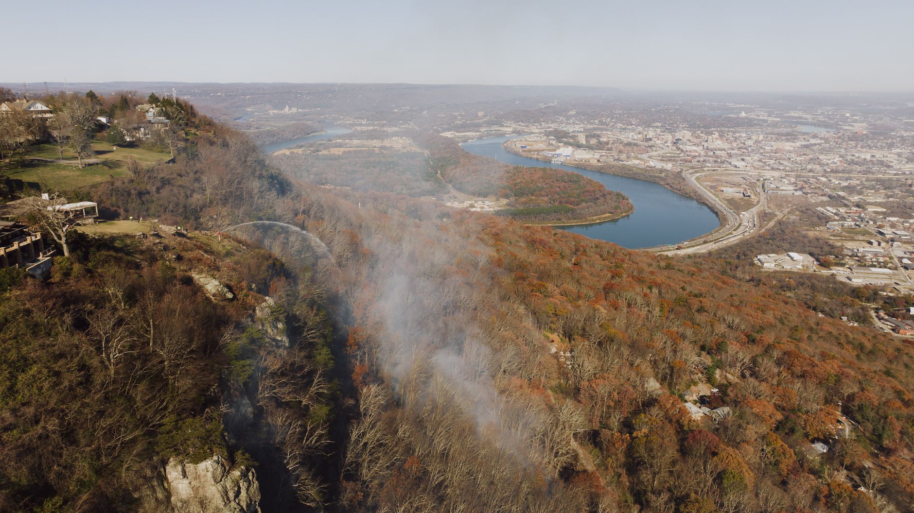

Chattanooga has a geography most cities would build an entire tourist industry around, and instead it built an aquarium.
The city sits where the Tennessee River cuts a gorge through the Cumberland Plateau, a genuine water gap several hundred feet deep and one of the more dramatic pieces of terrain east of the Mississippi. Lookout Mountain rises roughly 1,300 to 1,700 feet above the city on the south side, reaching about 2,000 feet above sea level, while Signal Mountain and the plateau escarpment run along the north, and the river loops around Moccasin Bend between them.
All of it is walkable, much of it is inside the city or minutes from it, and the crowds are a fraction of what the equivalent would draw in Colorado or Washington.
Lookout Mountain
The headline, and rightly. The Lookout Mountain unit of Chickamauga and Chattanooga National Military Park holds over 30 miles of hiking trails on the mountain's slopes and summit, which is a remarkable amount of trail for something you can see from downtown.
Sunset Rock is the one to know, a broad sandstone ledge on the western face with an enormous view over Lookout Valley and a well-established climbing area besides. From Point Park at the top it is roughly 1.1 to 1.75 miles one way on the Bluff Trail, an easy walk, while from the Cravens House partway down the mountain it is about 2.5 miles round trip climbing steadily, which is the better hike. It is called Sunset Rock for the obvious reason and it earns it.
The Bluff Trail runs along the base of the summit cliff line for miles, connecting the mountain's trail network, while the Gum Springs and Skyuka trails drop down the mountain and back and Glen Falls is a short steep walk to a waterfall on the mountain's face. The Civil War history is inescapable up here and worth knowing, because this ground was fought over in November 1863 in what became known as the Battle Above the Clouds, and the park exists because of it. The trails run through it constantly.
The Sunset Rock Hike via Cravens House, Lookout MountainSignal Point and the Cumberland Trail
The north side of the gorge, and the better hiking if you want distance rather than a view for a short walk. Signal Point is a small national park unit on the edge of Signal Mountain with an immediate overlook across the Tennessee River Gorge, right from the parking area, and from there the Cumberland Trail heads north along the rim.
Edwards Point is the destination, just under 2.8 miles out from Signal Point, or roughly 5 to 5.5 miles round trip, taking about two to three hours at a moderate pace. The trail follows the gorge rim past waterfalls, through rock gardens and boulder fields, with repeated overlooks down into the gorge several hundred feet below.
This is the southernmost stretch of the Cumberland Trail, Tennessee's long-distance state scenic trail, which is still being built in sections along the plateau. Walking it here is walking a piece of a project that has been under construction since 1998.
Inside the city
Stringer's Ridge is the one that surprises people: roughly 7 miles of trail on a wooded ridge in North Chattanooga, minutes from downtown, with a view of the skyline framed by trees. It is a former industrial and residential ridge that was bought and protected, and it functions as the city's lunchtime and after-work trail network. It is not wilderness and does not pretend to be, but a genuine wooded hill with real trails inside a city is worth more to a resident than a spectacular thing two hours away.
Enterprise South Nature Park on the northeast side has miles of trail and paved paths across a former Army ammunition plant, with old bunkers scattered through the woods, and it is flat, easy, and good for families or a run. The Tennessee Riverwalk runs for miles along the river through the city, and while it is not a hike it is a good long walk that connects a lot of the city on foot.
The Best Hiking Trail Near Chattanooga: Signal MountainThe Tennessee River Gorge
West of the city the river enters the gorge proper, and this is the wildest ground close to Chattanooga. The Tennessee River Gorge Trust protects a large area through here, and trails including Pot Point and the Mullens Cove Loop run through it, all longer, rougher and much quieter than anything on Lookout Mountain. This is where to go when you want to not see anyone.
It is also the section that makes the geography legible, because standing on the rim watching the river cut through the plateau explains the entire city's existence in one look.
Worth noting what that means administratively. Within twenty minutes of downtown you can be on National Park Service ground at Point Park or Signal Point, a state scenic trail on the Cumberland, city-owned land at Stringer's Ridge, and a private land trust's holdings in the gorge, and the fees, dog rules and hours differ across all four. Guidepole Hike carries the managing agency and its rules under each trail, which in a city stitched together from this many owners is the difference between a plan and an assumption.
Why the geography is like this
It is worth understanding what you are looking at, because Chattanooga's terrain is unusual and it explains the city. The Cumberland Plateau is a vast flat-topped tableland running from Alabama up through Tennessee and into Kentucky, capped with hard sandstone and edged by steep escarpments. It is an obstacle, and rivers generally go around it.
The Tennessee River does not. It cuts straight through, carving a gorge several hundred feet deep, the fourth largest river canyon east of the Mississippi and sometimes called the Grand Canyon of the Tennessee. The city grew where it did because that gap was the way through the plateau, first for river traffic and then for railroads, which is exactly why armies fought over it in 1863.
Lookout Mountain is not really a mountain in the Appalachian sense. It is a long, narrow finger of the plateau itself, separated by erosion, which is why it has a flat top and steep sandstone cliffs rather than a summit ridge, and the same is true of Signal Mountain on the north side. That is why the hiking here feels different from the Smokies two hours northeast. You are not climbing peaks, you are walking along the edges of a broken tableland, and the views come from cliff lines rather than summits.
The climbing scene, and why it matters to hikers
Chattanooga is one of the significant rock climbing destinations in the United States, and this affects the hiking in practical ways. The sandstone here, at Sunset Rock, in the Tennessee River Gorge and at bouldering areas across the region, draws climbers from across the country, and Sunset Rock is an established climbing area, so expect ropes, gear and people topping out where you are standing.
For a hiker the effect is mostly positive. The trail network is better developed and better maintained than a city this size would otherwise support, because climbers use approach trails constantly. It also means some trails you find on maps are climber approaches rather than hiking routes, which makes them steeper, rougher, and likely to end at a cliff base rather than a view. And it means the outdoor infrastructure in town is unusually good for a city of about 185,000, with gear shops, trail information and people who know current conditions all easy to find.
The gear
Chattanooga hiking is sandstone caprock above a river gorge, which produces a specific set of conditions: short steep approaches, exposed rock at the top, and a lot of humidity.
Shoes with sticky rubber, which matters here for the same reason it matters on the Cumberland Plateau generally. The rock is sandstone, it stays damp under canopy, and the sections along the bluff line are where people slip.
Trekking poles, because the pattern is short and steep in both directions. Lookout Mountain gains fourteen hundred feet in under two miles from the valley floor.
Two liters of water, since the humidity here does more to you than the temperature suggests and the ridge trails have no water.
Tick repellent, taken seriously from March through October. Permethrin on clothing is the version that works.
A headlamp, because the gorge goes dark early under hardwood canopy.
A rain shell, for a place that gets over fifty inches a year in short heavy bursts.
And an America the Beautiful pass, which is worth having because several of the best trails here sit on Chickamauga and Chattanooga National Military Park land, and because the Smokies are two hours away.
What Chattanooga hiking is
Plateau-edge hiking is its own thing, and a few honest characteristics apply. The vertical is real but compressed, because Lookout Mountain reaches about 2,000 feet above sea level while rising only about 1,300 to 1,700 feet above the city, and trails gain several hundred to a thousand feet in short distances. These are steep rather than long.
Cliff edges are largely unfenced, with rim trails running along drop-offs and no barriers, and Sunset Rock in particular is a flat ledge with a long fall off the front that is a popular place to sit. Sandstone gets extremely slippery, and wet rock with leaves on it is the local hazard, with a season running from October well into spring. Summer is humid rather than mountain-fresh, July is hot and heavy, and the gorge holds it. Ticks and snakes are present, with copperheads and timber rattlesnakes both living here and neither looking for you.
On the practical side, Point Park charges a small entrance fee as a National Park Service site, while most other trailheads including Signal Point, Stringer's Ridge and Enterprise South are free. Parking at Signal Point is small and fills on good autumn weekends. Signal is decent in the city and on Lookout Mountain and patchy in the gorge. And dogs are allowed on leash on most Chattanooga-area trails including the Cumberland Trail sections and the city ridges, which is a real difference from the Smokies two hours northeast, where they are banned.
The city built itself around this
Chattanooga's relationship with its outdoors is not accidental, and it is a genuine part of why the hiking here is as accessible as it is. The city spent decades as a heavily polluted industrial center, famously named the dirtiest city in America in the 1960s, and the recovery from that has been deliberate and outdoor-focused. The Tennessee Riverwalk, the reclamation of the waterfront, the protection of Stringer's Ridge from development, and the land conservation work of the Tennessee River Gorge Trust are all part of the same long project.
The practical result for a hiker is that trail access is unusually well organized for a city this size, with signed trailheads, parking that exists, and connections between the city and the surrounding terrain that have been thought about rather than left to chance. It also means the hiking is integrated into daily life here rather than being a weekend expedition, and Stringer's Ridge at six on a weekday evening is full of people who came straight from work, which is not something you can say about most southeastern cities.
Using it without a car
More is walkable or bikeable from downtown than you would expect. Stringer's Ridge is reachable on foot or by bike from North Shore, across the river from downtown, and the Tennessee Riverwalk connects a long stretch of the city on a continuous paved path, linking to enough green space to build a genuine half-day on foot.
Lookout Mountain is the harder one without a car. The Incline Railway climbs it from St. Elmo and is startlingly steep, and while it is priced and operated as a tourist attraction rather than as transport for hikers, it does deposit you at the top near Point Park, from which Sunset Rock is roughly 1.1 to 1.75 miles away. That is a legitimate car-free route to a very good view. Signal Point and the gorge effectively need a car.
Seasons, and where to start
Autumn is the best season by a distance, bringing color across the gorge, dry rock, cool air and the clearest views of the year, and October weekends are the busiest of a not-very-busy year. Winter is excellent and almost empty, because leaf-off opens up views that are screened the rest of the year, waterfalls run high, and the temperature is ideal for climbing Lookout Mountain. Spring brings wildflowers and high water with the falls along the Cumberland Trail at their best, and summer means early starts, when the swimming options in the surrounding area become the point.
An hour gets you Stringer's Ridge and the skyline through the trees. A morning gets you Lookout Mountain and Sunset Rock, either the short way from Point Park or the better 2.5 miles up from Cravens House. Most of a day gets you Signal Point to Edwards Point, five and a half miles along the gorge rim on the Cumberland Trail. A day with solitude means going west into the Tennessee River Gorge. And a weekend opens the plateau northwest, where the gorges at Savage Gulf are about an hour away and rank among the best hiking areas in the state.
Chattanooga is a legitimately great small hiking city. It just does not go on about it.
An hour northwest, the plateau opens into the gorge system at Savage Gulf. The state's marquee mountain hiking is northeast in the Smokies, one day there or three, and the grassy balds of the Roan Highlands are the other great Tennessee ridge walk.
The plateau country an hour northwest is in Savage Gulf, which is the same geology at a larger scale. The national park two hours northeast is covered in one day in the Great Smoky Mountains and its signature walks in Charlies Bunion and Kuwohi. The high grassland further northeast is in the Roan Highlands.