Fish
Fish Fire
Fire Hike
Hike Bird
Bird

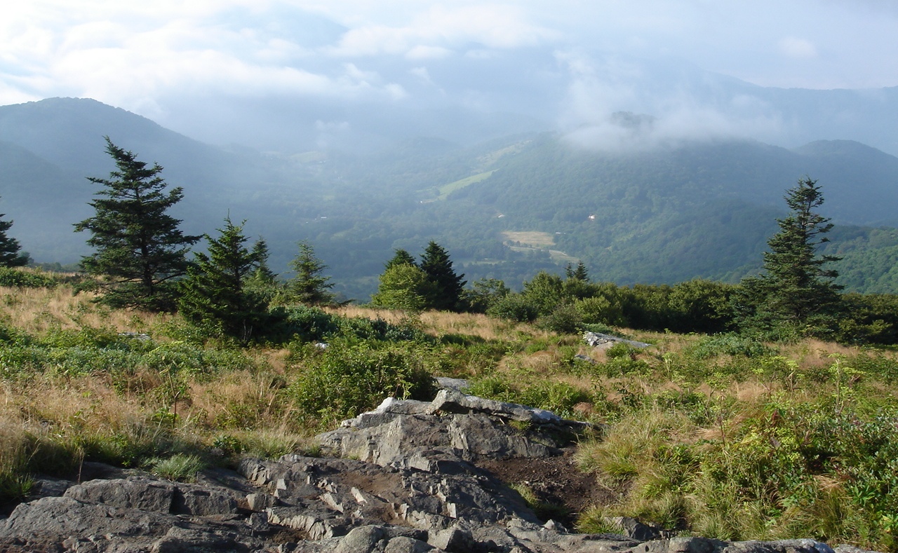

Everywhere else in the Southern Appalachians, the mountains are forested to the summit. That is the defining fact of the range.
The Roan Highlands are not. Along roughly seven miles of crest on the Tennessee-North Carolina line, the trees stop and roughly a thousand acres of open grassland takes over, rolling across a series of summits between about 5,800 and 6,200 feet. You can see for a very long way in every direction, on foot, with no rock scrambling and no treeline to climb to, because there is no treeline here. There is just, inexplicably, grass.
Nobody is completely certain why the balds exist. Theories run from prehistoric grazing by megafauna, through Native American burning, to Cherokee and later European livestock grazing, to soil and microclimate effects. What is agreed is that they are not naturally self-sustaining at this point, because without active management through mowing, grazing and cutting, the forest steadily encroaches and the balds shrink.
So what you are walking on is partly a landscape and partly a decision to keep it.
The hike everyone comes for
The classic outing starts at Carvers Gap, a parking area on the state line at about 5,500 feet where TN Highway 143 becomes NC 261, and heads north on the Appalachian Trail over three balds in succession.
Round Bald comes first, about 0.7 miles from the parking area, a short steady climb out of a spruce-fir fringe and onto open grass where the view arrives all at once. For a great many people this is enough: under a mile to one of the best views in the eastern United States. Jane Bald, at 5,807 feet, is roughly another three quarters of a mile on with a dip and a climb between, and the trail here is rocky in places and increasingly open. Grassy Ridge Bald is the far end and the highest, reached by leaving the Appalachian Trail on a spur, and the full outing to Grassy Ridge and back from Carvers Gap is about five miles round trip. That is the version worth doing if you have the time and the legs, because the crowds thin markedly past Jane Bald.
None of it is technically difficult. It is exposed, undulating and windy, which is a different kind of demanding.
The rhododendron, and mid-June
The other reason people come is the bloom. Near Tollhouse Gap, on the Roan massif, is what is described as the largest natural rhododendron garden in the world, a vast concentration of Catawba rhododendron that erupts into magenta flower in mid-June, with peak bloom usually around June 15 to 20 though it moves with the season.
It is spectacular and it is not a secret. That week is by far the busiest of the Roan year, with a festival, full parking and considerable traffic on narrow mountain roads. If you want the bloom, go midweek and go early. If you want the balds to yourself, come literally any other week.
The rhododendron gardens sit about two and a half miles from Jane Bald, and are also reachable by road on the Roan massif itself, which is the usual approach for people who are not hiking the AT section.
Hiking Roan Mountain: Round Bald, Jane Bald and Grassy Ridge BaldThe other direction: Carvers Gap south
Most people go north. Going south from Carvers Gap takes you up onto the Roan massif proper and into deep, dark spruce-fir forest, a completely different landscape a few hundred yards from the same parking lot.
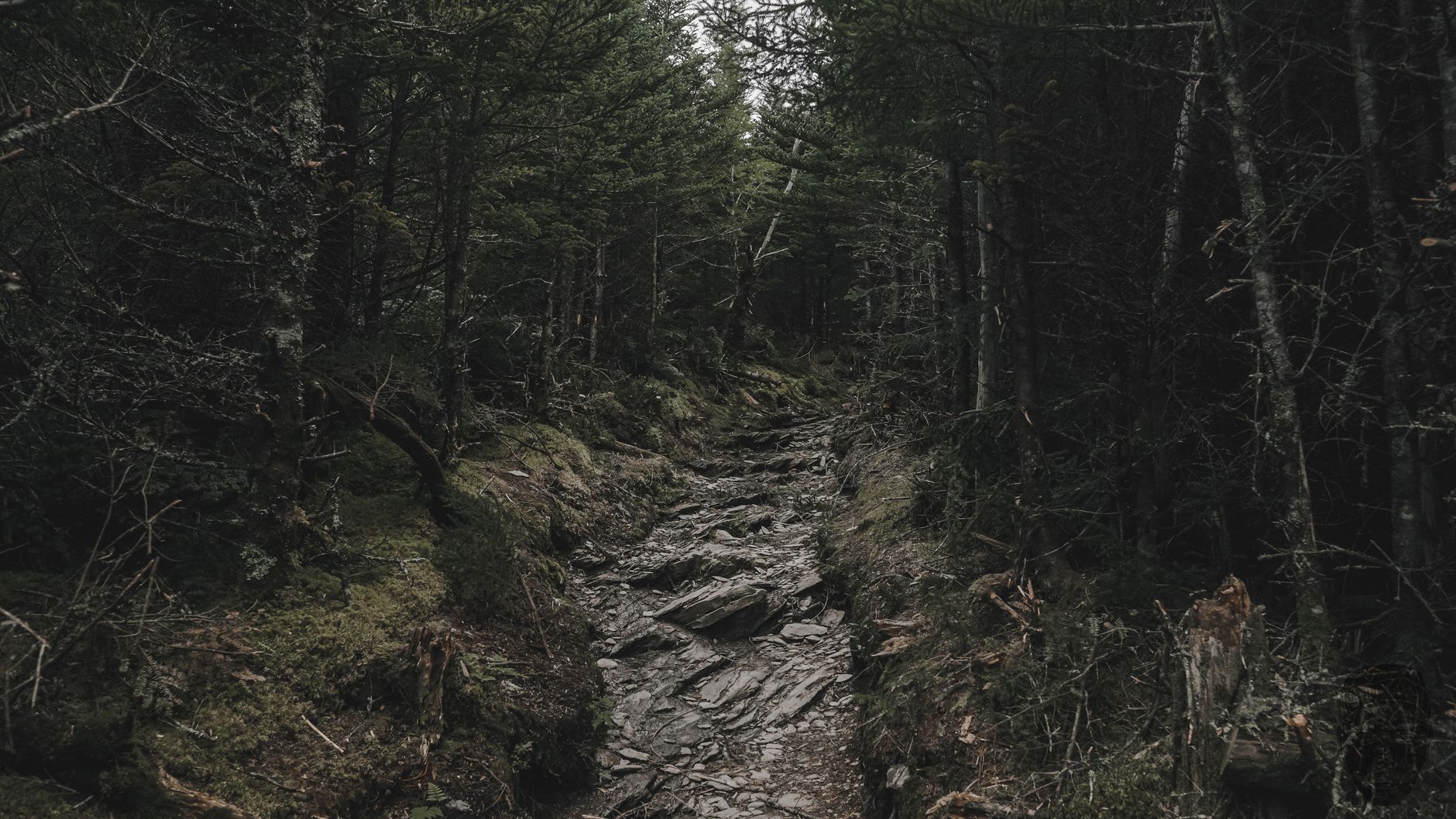
This is the ice-age relic forest that survives only on the highest Southern Appalachian summits, and Roan holds one of the largest and healthiest remnants of it. Walking south is cool, sheltered and shadowed where walking north is open and windswept, so on a hot or a very windy day it is the better choice, and it is far quieter besides.
The full traverse
For a serious day, the Carvers Gap to US 19E section of the Appalachian Trail runs about 14.7 miles with roughly 2,000 feet of elevation gain, typically taking around eight hours. It takes in the balds, then continues north over Little Hump and Hump Mountain into more open grassland, arguably even better than the first three balds and with a fraction of the people.
It is a point-to-point, so it needs a shuttle or two cars, and that logistics problem is the main reason it stays quiet. It is widely regarded as one of the finest single sections of the entire Appalachian Trail, and on a clear day with the balds running away ahead of you it is easy to see why.
Why the balds matter beyond the view
The grassland is not just scenery. It is habitat that exists almost nowhere else, and a good deal of what lives on it lives nowhere else either. The Roan balds support rare and endemic plants adapted to a high, cold, windswept, treeless environment that is vanishingly uncommon in the eastern United States. Gray's lily, a striking red-orange wildflower found only in a handful of Southern Appalachian locations, grows here and is threatened, and the alder-dominated shrub bald and high-elevation grassland communities are tracked as globally rare.
Bird life follows the habitat, and this is one of the better places in the southeast to find species that otherwise breed far north. The spruce-fir on the massif holds northern birds at the southern limit of their range, and the open balds hold a different set entirely a few hundred yards away.
All of which is why the management matters. The Southern Appalachian Highlands Conservancy, the Forest Service and volunteers actively mow, cut and in places graze the balds to hold back the forest, and without that work the grassland closes in within decades, leaving the species that depend on it nowhere to go. It is one of the few landscapes where staying on the trail is not an abstraction. The grass is the point, and it is being kept alive deliberately.
Is This the Best Spot on the Appalachian Trail? The Roan HighlandsWeather up here is its own thing
The Roan Highlands are high, exposed, and consistently among the harshest weather in the Southern Appalachians. Wind is constant, because there is nothing to break it across a thousand acres of open grass, so a calm day in the valley is a breezy day on the balds and a windy day in the valley is unpleasant up top. It is cold too, significantly cooler than the surrounding lowlands year-round, with the summits holding snow and rime ice well into spring.
Storms are a genuine hazard, since you are the tallest thing on an open grassy summit with no shelter for miles, which means afternoon thunderstorms in summer are a reason to get off the balds rather than to wait them out. Fog rolls in fast, and while the AT is well-blazed, open grassland in thick fog is disorienting in a way forest is not. And winter access is limited, because the roads to Carvers Gap close or become hazardous in snow and the gap sits at 5,500 feet.
Carry a windshell in July. Carry more than that in any other month.
The gear
The Roan balds are above six thousand feet on an exposed ridge in the southern Appalachians, which is a specific and frequently underestimated combination.
A windshell, which is the single most useful item here and the one people leave in the car. The balds are treeless by definition, the ridge runs northeast to southwest across the prevailing wind, and a pleasant fifty-five degree day in the parking lot is a hard thirty-five on Grassy Ridge with wind.
An insulating layer to go under it, for the same reason.
Two liters of water, because there is no water on the ridge. The springs are down at the shelters and the walking is more exposed and more sustained than the modest mileage suggests.
Sun protection, which is the other consequence of walking on grass rather than under canopy. This is the most exposed sustained hiking in the eastern United States and people get burned here in a way they do not expect from Tennessee.
An offline map and a compass, since the balds are one of the few places in the East where fog can genuinely disorient you. The Appalachian Trail is blazed but the social paths across the grass are not.
Trekking poles for the descent off Grassy Ridge, which is steeper than it looks.
And MICROspikes from December through March, when the ridge holds rime ice and the ground under it is frozen grass, which is far more slippery than rock.
Getting there, and the practicalities
Carvers Gap is remote in a way that surprises people looking at a map of Tennessee. It sits above the small town of Roan Mountain, in the far northeast corner of the state near the North Carolina line, roughly two hours from Asheville and about two and a half from the Tri-Cities. The approach is TN Highway 143, which climbs steeply and continuously from the valley for several miles of tight curves before topping out at the gap where it becomes NC 261. It is a good road but not a fast one, the sort of drive that takes longer than the distance implies, and in winter it ices and is sometimes impassable.
There are no services at the gap, meaning no water, no food, no fuel and a privy at best, and the town of Roan Mountain at the bottom is small, so fill up and buy what you need before you start climbing. Carvers Gap parking is free and there is no fee for the Appalachian Trail section, which makes this an unusually cheap day out by national park standards, though the lot is not large and in mid-June or on an October weekend it fills early. There is no water on the balds, so carry it, and signal is patchy to absent on the crest and on the approach roads.
Roan Mountain State Park, down in the Doe River valley, is the obvious base and a good one, with campsites, cabins and its own low-elevation trails along the river for a rest day. It is a separate entity from the highlands themselves, which confuses people: the state park is in the valley, the balds are on the ridge above, and you drive between them.
That separation is the general shape of the place. A short walk here can cross national forest, an Appalachian Trail corridor, conservancy-managed bald and a state line, with a state park operating independently below, and the rules move with it. Dogs are allowed on the AT here on leash, which is a meaningful difference from the Smokies two hours west where they are banned outright. Guidepole Hike carries the managing agency and its rules under the trail, which on a ridge held together by four different organizations saves reconstructing it from four websites.
What a first visit should look like
If you have never been, the honest recommendation is modest: park at Carvers Gap and walk to Round Bald. Seven tenths of a mile, a steady climb through a fringe of spruce and fir, and then the trees stop and you are on open grass at about 5,830 feet with mountains in every direction. It takes half an hour, it is one of the great short walks in the eastern United States, and it requires nothing of you.
Sit there for a while. Decide from the top of Round Bald whether you want Jane Bald, and from Jane Bald whether you want Grassy Ridge. The trail is built for exactly that kind of incremental commitment, and there is no shame in stopping at any of them, because the view does not improve dramatically as you go, it just becomes more yours as the people thin out.
That is the opposite of how most famous hikes work, and it is why Roan suits a mixed group, a short day, or bad legs better than almost anything else of this quality. One thing it does ask in return: stay on the trail, because the bald ecosystem is fragile and heavily used and social trails across the grass are a visible and growing problem on a landscape whose survival depends on deliberate work.
When to go, and the version most people never do
Mid-June is the rhododendron, accepting the crowds. Late June through September gives the balds at their greenest, with long days and the best odds of clear views, and it is the sweet spot. October brings color and the clearest air of the year, along with cold wind and a busy first two weekends. And winter is something entirely different, rime-crusted grass and enormous visibility, if you are equipped for exposed winter conditions and can reach the trailhead.
Park at Carvers Gap, walk north, and decide at Jane Bald whether you are going on to Grassy Ridge. Take a windshell whatever the forecast says. Go midweek in June if you want the bloom, and any other week if you want the space.
And if you want the version most people never do, arrange a shuttle and walk the fourteen miles to US 19E over Little Hump and Hump Mountain. There is nothing else quite like it east of the Rockies.
Two hours west, the same Appalachian Trail crosses a very different landscape, forested to the summits, with one famous bare exception at Charlies Bunion, and its highest point at Kuwohi. If you are heading to the Smokies as well, three days there pairs well with a Roan day on the way through.
The other great southern Appalachian high-elevation walk, on the same rock and with the same weather, is in Charlies Bunion and Kuwohi. The plateau hiking two hours west is a completely different landscape, covered in Savage Gulf. The nearest city with a hiking culture built around this terrain is in hiking Chattanooga, and the agency rules that change from one side of the state line to the other are in dog-friendly trail rules by agency.