Fish
Fish Fire
Fire Hike
Hike Bird
Bird

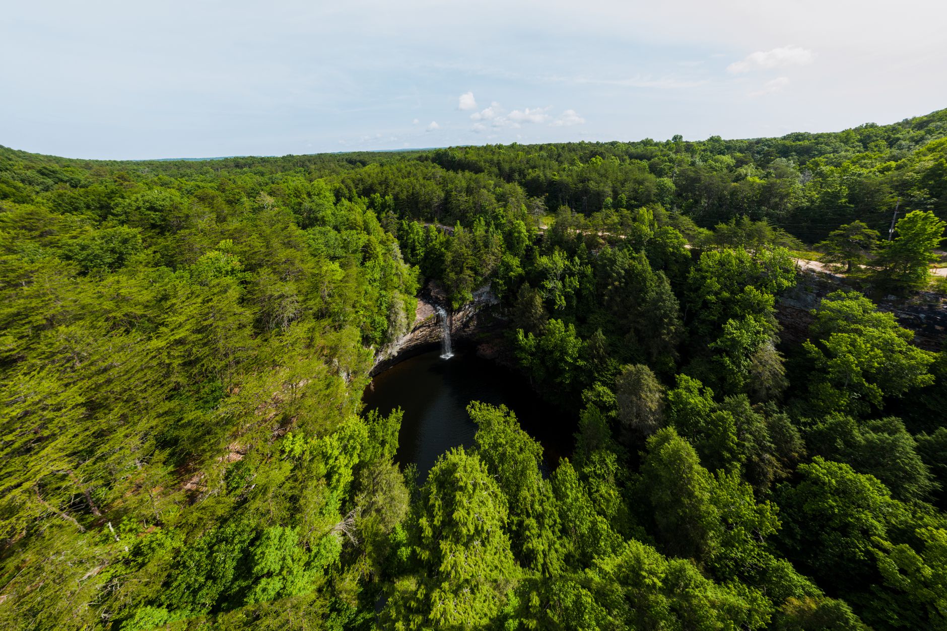

Fall Creek Falls drops 256 feet into a shaded plunge pool at the head of a gorge, and it is one of the highest waterfalls in the eastern United States.
It is also about four minutes' walk from a parking lot, which is why the overwhelming majority of the people who come here see it, photograph it, and drive home having experienced roughly one percent of the place.
The park covers more than 29,800 acres across the eastern rim of the Cumberland Plateau, making it one of Tennessee's largest and most visited. The waterfall is the advertisement. The gorges are the park.
The plateau, and why there are so many waterfalls
The Cumberland Plateau is a broad, flat-topped upland capped with hard sandstone laid down in the Pennsylvanian period, sitting on softer shale and limestone underneath. Streams running across the flat top eventually reach the edge, and when they do they pour over the resistant sandstone caprock and immediately begin cutting into the softer rock below, which undercuts the lip and leaves a free-falling drop with an overhung amphitheater behind it.
That is the standard plateau waterfall, and this region has more of them than almost anywhere in the country. It is also why so many of them can be walked behind, and why the rock beneath them is perpetually crumbling. The gorges here, Cane Creek Gorge in particular, are what happens when that process runs for a very long time.
The waterfalls
There are six worth naming, ranging from about 8 feet to 256. Fall Creek Falls is the headline at 256 feet, with the overlook a few minutes from parking and the descent to the base short, steep, rocky and strenuous on the way back up, though standing at the bottom of it is worth every bit of the climb out.
Cane Creek Falls is 85 feet and sits near the nature center, and it is arguably the more photogenic of the two because it drops in a broad curtain rather than a single ribbon. Cane Creek Cascades is the low, wide one beside the swinging bridge, a suspension footbridge over the water that is the park's second-most-photographed object. Piney Falls and Rockhouse Falls drop into the same gorge from opposite sides and can be seen together from an overlook, and Coon Creek Falls completes the set.
A visitor who walks to all six has done a good day and still not left the developed core.
The trails that matter
The Gorge Overlook Trail is the introduction, a moderate loop of a couple of miles connecting the nature center, the swinging bridge and viewpoints over Cane Creek Gorge, and if you have two hours this is the walk. The Base of the Falls Trail is the short steep descent to the foot of Fall Creek Falls, under a mile round trip and far harder than that sounds. The Paw Paw Trail loops several miles around the gorge rim through hardwood forest and is the best moderate half-day in the park.
The Cable Trail is the notorious one, a very steep scramble down into Cane Creek Gorge assisted by a fixed cable, short, hazardous when wet, and responsible for injuries, though it is also the fastest way into the gorge bottom. Piney Creek Falls Trail and the Woodland Trail fill in the middle distance.
The Lower Loop and Upper Loop overnight trails total roughly 30 miles between them and are the backpacking system. They see a fraction of the day-use traffic, cross the gorges, and are the reason to think of this as a real hiking park rather than a waterfall stop.
The gorge is not a joke
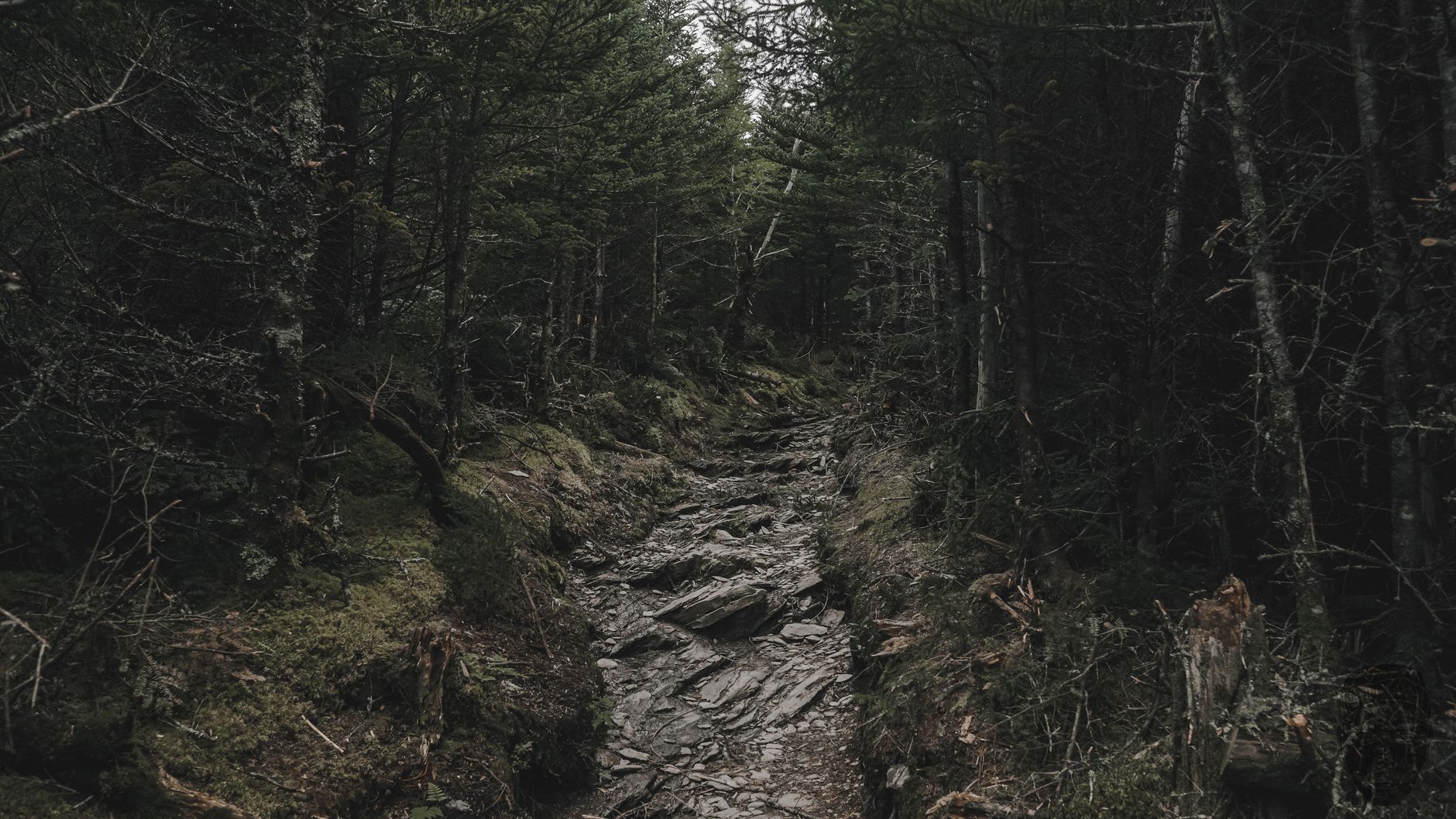
Worth saying plainly, because the accessibility of the overlook creates a false impression of the terrain. Cane Creek Gorge is several hundred feet deep with near-vertical sandstone walls, the routes into it are steep, rocky, frequently wet and slick with algae on the smooth rock, and the Cable Trail in particular is a scramble rather than a hike.
Water levels change fast. A plateau stream draining a large flat catchment can rise substantially within an hour of heavy rain upstream, and the gorge bottom is exactly the wrong place to be when it does. Rescues here are routine and difficult, and the park closes gorge routes in bad conditions.
Those closures are worth obeying and worth checking, because they apply to specific routes rather than the park, they change with the weather rather than the season, and nothing at the overlook four minutes from your car tells you that the way down is currently shut. Guidepole Hike carries closures at trail level alongside the route, which in a park where the headline attraction stays open while the interesting half does not is the distinction that matters.
The park's slightly strange history
Fall Creek Falls exists in its current form because of two separate federal programs and one long argument. The land was acquired by the federal government in the 1930s under Depression-era programs that bought up worn-out farmland, ground that had been cleared, cropped, eroded and abandoned on thin plateau soil, and the Civilian Conservation Corps and the Works Progress Administration built the early infrastructure, with the area developed as a recreation demonstration project before being transferred to Tennessee in the 1940s.
What you walk through today, in other words, is largely second-growth forest on recovering farmland rather than virgin wilderness. The gorges were too steep to farm and hold the oldest trees, and on the plateau top you can still find rock walls, home sites and the odd chimney in the woods.
The long argument concerned the inn. The original 1970s lodge became structurally obsolete, was demolished, and was replaced with a new inn that opened in 2021 after years of debate about how much development belongs inside a state park. The result is a comfortable place to stay in the middle of a very good hiking area, and a live example of the recreation-versus-preservation tension that runs through every state park system.
The trees are worth noticing
The plateau supports a mixed mesophytic forest, which is a technical way of saying it is one of the most botanically diverse temperate forests on earth. There is no single dominant canopy species, and instead you get oaks, hickories, tulip poplar, maples, basswood, beech, buckeye, magnolias and hemlock all sharing the same slope in shifting proportions, with the southern Appalachians and the Cumberland Plateau holding the best surviving examples of this forest type anywhere.
The gorge walls compress that diversity further. North-facing slopes are cool and damp and support species that otherwise belong hundreds of miles north, including hemlock, yellow birch and a rich understory of ferns and mosses, while south-facing slopes a few hundred yards away are dry oak and pine. You can walk between the two in ten minutes.
Hemlock is in trouble, because the hemlock woolly adelgid, an introduced insect, has been killing eastern hemlock across the region for two decades, and the standing gray skeletons in the gorges are its work. Treatment programs exist but the losses are heavy, and the cool shaded stream microclimates hemlock creates are going with it.
Spring wildflowers on the gorge slopes are exceptional in late March and April, with trillium, bloodroot, hepatica and dutchman's breeches, and that is the strongest argument for a spring visit beyond the water levels.
Fall Creek Falls State Park: Things to Do, Hiking and CampingWhen to come
Winter is underrated and arguably the best season, because the falls are at full volume, the leaves are off so the gorge structure is visible, there is nobody here, and ice forms on the walls in a cold snap. Spring brings wildflowers on the gorge slopes and the highest water.
Autumn is the busiest and the most beautiful, since the plateau hardwood color in late October is superb and every overlook has a line. Summer is hot, humid, buggy and the falls are at their weakest, which matters because in a dry late summer Fall Creek Falls can reduce to a trickle and visitors arriving in August after a rainless month are frequently disappointed. It is also when the swimming holes and the lake are the point, so plenty of people come anyway.
The gear
Fall Creek Falls is the largest state park in Tennessee and the hiking is gorge hiking, which sets most of this list.
Grippy footwear with real tread, for descents to the base of the falls that are steep, rooted and wet from spray year round.
Trekking poles, because the pattern here is the plateau pattern: you go down first and climb out at the end when you are tired.
Tick and chigger repellent, treated as necessary rather than optional from late spring through autumn.
A weather check for upstream rain, which matters at the base of any of these falls. The gorges drain quickly and the water comes up faster than it looks like it should.
More water than the mileage suggests, since middle Tennessee humidity does more to you than the temperature or the distance implies.
A headlamp, because the gorges are dark under canopy well before sunset and the climb out is the part you do last.
And offline maps, since the trail network here is extensive, several junctions look alike, and coverage in the gorges is poor.
The other things people do here
This is a large developed park and the hiking is one of several reasons to come, which is worth knowing if you are traveling with people who do not walk. The lake has kayak, canoe and paddleboard rental, and fishing for bass and bluegill. The bike trails include a paved multi-use path through the developed area and a set of purpose-built mountain bike trails that have grown considerably in recent years. The nature center runs interpretive programs and is the trailhead for several of the best short walks, horseback riding operates from a stable in the park, and camping covers several campgrounds plus backcountry sites on the overnight loops, with cabins and the inn as well.
The practical consequence for a hiker is that the developed core is busy and social in a way the gorges are not. Twenty minutes of walking separates the two worlds completely, and most visitors never make that crossing.
Fall Creek Falls: The Hike to the BaseNearby, if you have more than a day
The Cumberland Plateau within about an hour of here holds an unusual density of good hiking. Savage Gulf, an hour south, is wilder and rougher and has the Great Stone Door, the single best short viewpoint on the plateau. Cummins Falls, an hour north near Cookeville, has the permit-controlled gorge and the free overlook, and Burgess Falls packs four waterfalls into three quarters of a mile.
Further afield, Rock Island has a waterfall emerging from the side of a cliff as a side effect of a hydroelectric scheme, Virgin Falls on state natural area land drops into a sinkhole and disappears underground, and the Cumberland Trail threads the whole escarpment with several of its best segments within reach.
A long weekend based in Spencer, Sparta or Cookeville can cover most of that, and the whole cluster is free to enter.
Practical notes, and where to start
There is no entrance fee, because Tennessee has long charged nothing to enter its state parks, which is one of the remarkable facts about hiking in this state. That is policy rather than law, and individual parks have added parking and activity charges, so confirm the current position with Tennessee State Parks before you budget on it. and the comparison is in six states, six ways to charge you for a trailhead. Camping, cabins and the inn do cost money and book out well ahead, particularly in October, with Tennessee opening reservations six months in advance.
Dogs are welcome on the trails, leashed, and excluded from the inn, cabins and swimming areas. The park has a lot of infrastructure, including an inn, a restaurant, a golf course, a lake, bike rental and a nature center, so this is a developed destination park rather than a wilderness. Signal is patchy and gone in the gorges. And copperheads and timber rattlesnakes are present, along with ticks and chiggers in numbers from spring through autumn.
For the walking: two hours gets you the Gorge Overlook loop, the swinging bridge and Cane Creek Falls. Half a day adds the descent to the base of Fall Creek Falls and the Paw Paw loop. A full day is the Paw Paw and Piney Creek trails together, or a long section of the Upper Loop. And an overnight on the Lower Loop takes you into the country the day visitors never see.
The park is roughly two hours from both Nashville and Chattanooga, which makes it the obvious long weekend from either. The nearest comparable gorge country is Savage Gulf, an hour south and considerably wilder, and the plateau's long-distance route is the Cumberland Trail. Chattanooga's own trails are in hiking Chattanooga, and the permit-controlled gorge at Cummins Falls is an hour north.
The other plateau waterfall parks are in Burgess Falls, Cummins Falls and Virgin Falls, and the largest gorge system on the plateau is in Savage Gulf. The long trail that links much of this country is in the Cumberland Trail, and the fact that none of it charges an entrance fee is explained in state park passes by state. For an easier middle Tennessee day within reach of Nashville, the trail network at Montgomery Bell is the one locals use year round.