Fish
Fish Fire
Fire Hike
Hike Bird
Bird


Most state parks are a shape on a map with an entrance station and a parking lot. The Justin P. Wilson Cumberland Trail is a line.
It is Tennessee's first and only linear state park, planned to run more than 300 miles down the eastern escarpment of the Cumberland Plateau, from Cumberland Gap where Tennessee meets Virginia and Kentucky, to the Tennessee River Gorge near Chattanooga on the Alabama and Georgia line, passing through eleven counties.
Roughly 200 miles are open across some forty trailheads, with further sections built but not yet opened and more under construction. It has been under assembly since the late 1990s and it is not finished. That unfinished quality is the single most important thing to understand before you plan anything here.
What a linear park means in practice
It is discontinuous. The Cumberland Trail is not a continuous 200-mile footpath with gaps at the end, it is a series of finished segments separated by stretches where the land has not yet been acquired, the route has not been built, or a road walk would be required, and you cannot currently thru-hike it end to end on trail. Access is by trailhead, with no gate, no entrance station and usually no facilities beyond a gravel pull-out and a kiosk.
The rules change as you walk. A linear corridor threads through other state parks, natural areas, wildlife management areas, private land under easement, road crossings and occasionally a town, so what is legal can shift several times in a day, and none of those transitions is marked on the ground. This is the clearest case in the corpus for carrying an ownership layer rather than a trail map: Guidepole Hike shows which agency or owner the corridor is crossing and what each permits, which on a park that is thirty feet wide and three hundred miles long is the difference between walking a state park and walking somebody's back field.
The map also ages badly, because new sections open and others close for construction or land negotiation, so check current segment status before you drive, since this is a trail where last season's information is unreliable. And it was built by volunteers, with a great deal of the tread cut by volunteer crews through long-running trail-building programs that bring people in from all over the country for a week at a time, which shows in the enormous care and, in places, the enormous ambition about what constitutes a reasonable grade.
Why the route is where it is
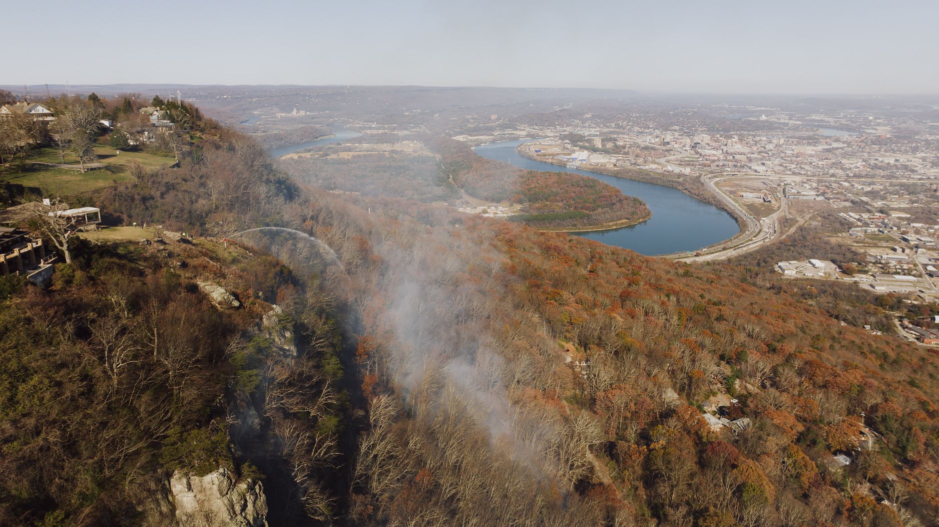
The trail follows the eastern escarpment of the Cumberland Plateau, and that is a deliberate and inspired choice. The plateau's eastern edge is where the flat sandstone-capped upland breaks abruptly down toward the Tennessee Valley, and the result is a nearly continuous band of gorges, bluffs, rock houses, arches and waterfalls running the length of the state, which is the most concentrated interesting terrain in Tennessee outside the Smokies.
By stringing itself along that edge the trail collects the plateau's best features one after another. Where the Appalachian Trail runs the crest of the Blue Ridge a hundred miles east, the Cumberland Trail runs the rim of the plateau, and the two offer completely different walking. The sandstone caprock is the recurring character, producing the bluff lines you walk beneath, the rock houses where softer rock has weathered out from under the cap, and the waterfalls that drop clear of the wall.
The segments worth doing
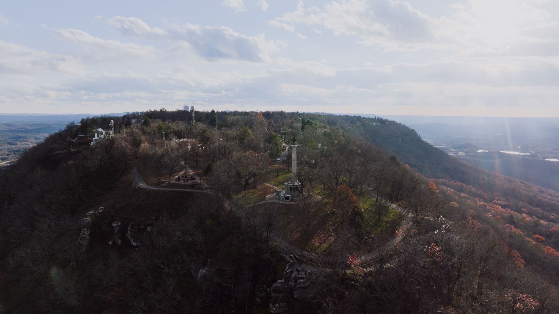
Because the trail is discontinuous, you plan by segment rather than by mile. The Tennessee River Gorge and Signal Point section near Chattanooga is the southern end and one of the best, running from Signal Point down through Middle Creek and the Edwards Point area with sustained bluff-top views over the gorge, and it is steep, rocky and spectacular.
Possum Creek and the North Chickamauga Creek Gorge segments north of Chattanooga run beside a boulder-filled creek beneath high bluffs, with swimming holes. The Obed Wild and Scenic River area near Wartburg has the trail crossing rugged sandstone gorge country connected to a National Park Service unit, which is a good illustration of how the corridor threads through other agencies' land.
Further north, Black Mountain near Crossville reaches one of the higher points on the plateau with rock formations and long views, Cumberland Mountain and Cove Lake at the northern end near Caryville climbs the escarpment with heavy elevation change, and Piney River offers waterfalls and a gentler grade, which makes it a good introduction.
What the walking is like
Harder than the elevation profile suggests, which is the standard plateau story. The tread is rocky, with sandstone blocks, roots and step-ups constant on many segments, so mileage here is slower than the same distance in the Smokies. The gradients are abrupt, because the escarpment is not gentle and segments frequently drop several hundred feet into a gorge and climb straight back out, repeatedly.
Creek crossings are common and often unbridged, and after rain they can be difficult, because the plateau's flat catchments make streams rise fast. Blazes are white and the trail is generally well marked, though junctions with old logging roads and connector paths can be ambiguous. Water is available in the gorges and scarce on the rims, which inverts the usual planning assumption. And it is hot and humid from June through September, with the gorges holding both.
What you see out there
The plateau escarpment has a specific vocabulary of features, and the trail collects all of them repeatedly. Rock houses are the signature, formed where a hard sandstone cap sits on softer rock and the soft layer weathers back to leave a wide shallow overhang, sometimes a few feet deep and sometimes big enough to shelter a hundred people. They are dry and cool and were used for thousands of years, and several along the escarpment hold archaeological deposits, which is one reason digging or disturbing them is a serious offense.
Arches and natural bridges form by the same process taken further, where a fin of rock is undercut from both sides until it perforates, and the plateau has a great many, most unnamed. Bluff lines run for miles as continuous vertical bands, and the trail spends a lot of its time either along the top of one or along the bench beneath it, while boulder fields at the base are collapsed caprock and several segments pick their way through house-sized blocks.
Waterfalls appear wherever a side stream reaches the bluff line, which on this escarpment is constantly, and many are seasonal and spectacular in winter. And cane, the native bamboo Arundinaria, fills some of the creek bottoms in dense stands called canebrakes, once far more widespread and now a rare habitat.
The forest, and what was taken out of it
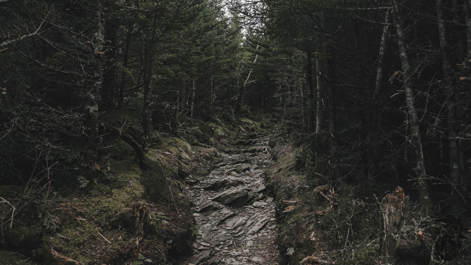
The plateau supports mixed mesophytic forest, among the most botanically diverse temperate forest on earth, with no single dominant canopy species, so oak, hickory, tulip poplar, maple, beech, basswood, magnolia and hemlock share the same slopes in shifting proportions.
The gorges compress a lot of that diversity into a short distance. A cool damp north-facing wall supports hemlock and yellow birch that properly belong hundreds of miles north, while the dry south-facing slope across the creek is oak and pine, and ten minutes of walking crosses between them.
Hemlock woolly adelgid has killed a great deal of the eastern hemlock along this escarpment over the past two decades, and the standing gray trunks in the gorges are its work, taking with them the deep shaded stream microclimates hemlock created. Much of the forest is second growth on land logged hard in the late nineteenth and early twentieth centuries, when the plateau was stripped for timber and coal, and old rail grades, tram beds and coal seams appear along several segments, with a few of the trail's own routes following them.
The Cumberland Trail from Signal Point to Rainbow FallsCamping and overnights
Backcountry campsites exist along several segments, and the arrangement varies by section, because some require a permit or registration, some are first come, and some segments have no legal camping at all since the corridor is too narrow or crosses easement land.
That is a direct consequence of the linear-park structure. Where the trail is a narrow strip through private ground there is nowhere to legally sleep, so plan overnights around the segments that support them rather than assuming you can stop anywhere.
Several segments connect to state park campgrounds, including Cove Lake and Cumberland Mountain, which makes a car-supported multi-day approach far easier than a true backpacking trip.
The gear
The Cumberland Trail is a linear park under construction, which makes the gear list different from a state park loop.
Boots with real ankle support, because the tread here is rock, root and side-hill on sandstone rather than graded path, and the finished segments were built by volunteers with hand tools rather than machines.
Current segment maps, which is the item that matters most and the one that goes out of date. The trail is being built piece by piece, segments open and close, and a guidebook from four years ago will send you to a trailhead that now connects to something it did not.
A water filter, since the segments cross creeks constantly and carrying a day's water on the plateau in summer is unnecessary weight.
Trekking poles, for the gulf descents and climbs, which are the shape of every segment on this trail.
Tick and chigger repellent, which on the Cumberland Plateau in summer is not optional. Permethrin on clothing is the version that works, and chiggers in particular are a serious nuisance from June through September.
Offline maps, because there is no coverage in the gorges.
And blaze orange in autumn, since several segments cross state wildlife management areas and state forest where hunting seasons are open and the trail corridor is not a closed zone.
How to help, and why people do
An unusual amount of this trail exists because volunteers built it, and that remains true. Organized trail-building programs bring crews here for week-long stints, particularly during spring break, and have done for years, with participants coming from across the country, sleeping in base camps and spending their days moving rock and cutting bench, adding several miles of finished tread in a good season. Friends of the Cumberland Trail and allied groups run regular work days, and land trusts continue to acquire the parcels that will close the gaps.
The reason this matters to a visitor is that it explains the tread you are walking on. Long staircases of set stone, cribbing on steep sidehill and carefully benched traverse across loose slope are not the products of a machine. Somebody carried those rocks.
It also means the trail's future is not guaranteed by a budget line. A 300-mile linear park assembled parcel by parcel over three decades depends on continued acquisition, and the gaps that remain are the hard ones, which is a decent argument for spending a day on a work crew if you find yourself nearby.
Completing the Cumberland TrailSeason, and practical notes
Autumn is the best, with plateau hardwood color peaking in late October and the humidity finally gone. Winter is excellent walking, because bare trees expose the bluff structure, the waterfalls run hard and the snakes are asleep, with ice on north-facing rock the hazard. Spring brings wildflowers, the highest water and the most difficult creek crossings, and summer is hot, humid and buggy, though the gorge swimming holes are the compensation.
There is no entrance fee, as with every Tennessee state park. Dogs are allowed leashed. Signal disappears in the gorges immediately. Copperheads and timber rattlesnakes are present throughout, along with ticks and chiggers in season. Trailhead parking is small and often unpaved, and several trailheads sit on narrow county roads. And checking segment status before driving cannot be overstated on a trail still under construction.
Where to start
If you want one day and the best of it, take the Signal Point to Edwards Point section above the Tennessee River Gorge. It is spectacular, close to Chattanooga, and representative of what the trail does well. If you want gorge bottom and water, take North Chickamauga or Possum Creek. And if you want the rugged version, go to the Obed.
If you want to understand the project rather than just walk a piece of it, look at the map of what is open against what is planned. A 300-mile state park assembled parcel by parcel over three decades, through eleven counties, largely by volunteers, is an unusual thing to have built, and the finished parts are as good as hiking gets in this part of the country.
The designation itself is explained in natural area, scenic trail, reserve. Nearby plateau gorges are covered in Savage Gulf and Fall Creek Falls, the southern terminus city in hiking Chattanooga, and the mountains a hundred miles east in three days in the Smokies.
The plateau parks the trail connects are covered in Savage Gulf, Fall Creek Falls and Virgin Falls. The city at its southern end is in hiking Chattanooga, and the designation that governs a park shaped like a line is explained in state natural areas explained. The hunting-season overlap is in state park versus national forest.