Fish
Fish Fire
Fire Hike
Hike Bird
Bird

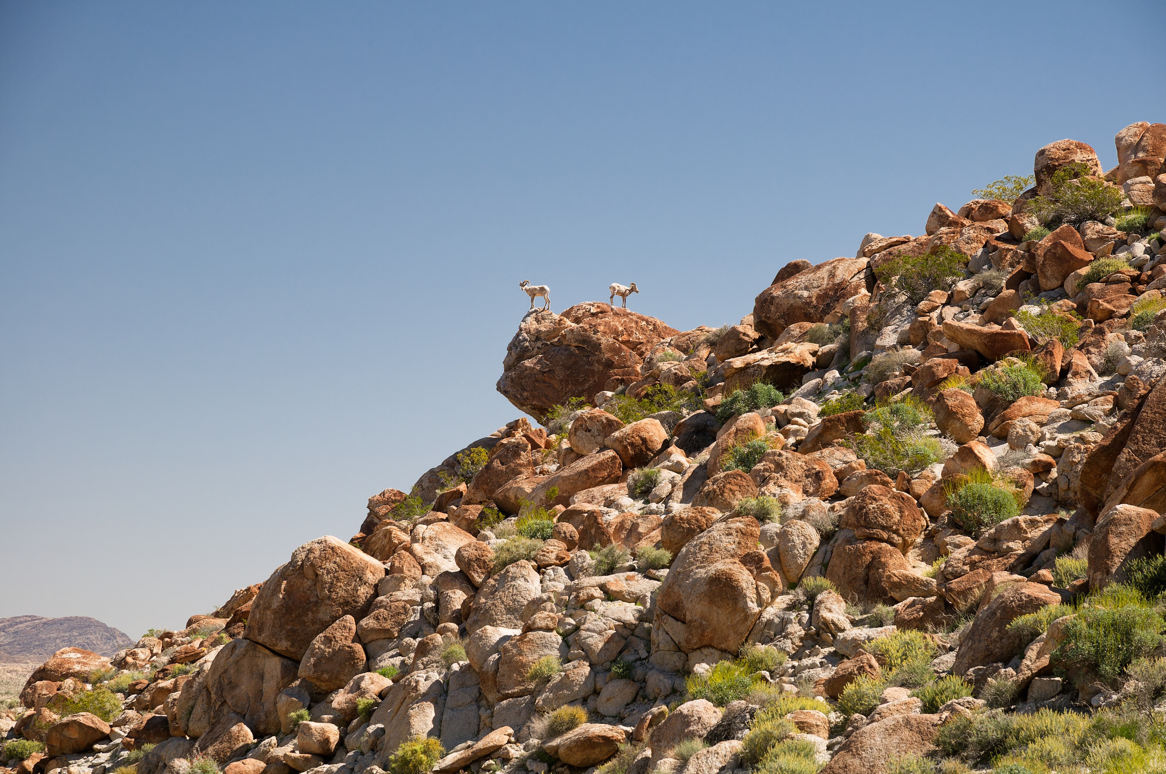

Anza-Borrego Desert State Park covers 650,000 acres, which makes it the largest state park in California and larger than the great majority of American national parks.
It contains one small town, Borrego Springs, which sits in a hole in the middle of the park with park land on every side. It has something in the region of five hundred miles of dirt road, twelve wilderness areas, and a trail network that is less a network than a set of suggestions.
Most Californians have never been.
What kind of desert this is
This is the Colorado Desert, the western arm of the larger Sonoran Desert, and it is not the same thing as the Mojave a hundred miles north. The distinction matters on the ground, because the Colorado Desert is lower, hotter, and has two rainy seasons: winter storms from the Pacific and, in some years, summer monsoon moisture pushing up from the Gulf of California. That second season is why this desert supports plants the Mojave does not.
Ocotillo is the signature, with tall whip-like stems that leaf out within days of rain and drop the leaves again when it dries, sometimes several times a year, putting out scarlet flowers at the tips in spring. Agave, cholla, barrel cactus, creosote and smoke tree fill in the rest. And elephant trees, at their northern limit here, are a Baja species with peeling papery bark, so finding one is a small event.
The palm oases
The park's most surprising feature is water. California fan palm, Washingtonia filifera, is the only palm native to the western United States, and it grows where groundwater reaches the surface along fault lines, with Anza-Borrego holding more than twenty-five palm groves, among the largest concentrations anywhere.
Borrego Palm Canyon is the accessible one and the park's most-walked trail, roughly three miles round trip from the campground up a rocky wash to a grove of several hundred palms around a running stream, with a small waterfall in wet years. It is a startling place, because you walk up a bare desert canyon for a mile and a half and arrive in dense shade with water running over rock.
Bighorn sheep use the canyon and the park is named for them, since borrego is Spanish for sheep. The peninsular bighorn population here is federally endangered, and the canyon closes seasonally in sections to protect access to water in the hottest months.
The rest of the walking
The Slot is a narrow sandstone slot canyon near Borrego Springs, reached on a short walk and narrow enough to touch both walls in places, and it is the most photographed thing in the park after the flowers. Hellhole Canyon climbs to Maidenhair Falls, a seasonal waterfall in a fern-hung alcove, on a moderately hard six-mile round trip.
Calcite Mine is a strange loop through sandstone fins and slots at a site where optical calcite was mined for bombsights during World War II, and the Wind Caves in the Fish Creek badlands are wind-eroded hollows in sandstone. Font's Point is a viewpoint over the Borrego Badlands, reached by four miles of soft sand road that regularly strands two-wheel-drive vehicles, and the view at sunset over the eroded badlands is the park's best.
Two more are worth the drive. Ghost Mountain climbs to the remains of Marshal South's homestead, where a family lived without running water or electricity from 1932 to 1947 as a deliberate experiment, and the Pictograph Trail reaches Kumeyaay rock art and a dramatic dry fall.
The superbloom
Every few years this park makes national news. When winter rain falls in the right amounts at the right intervals, and the temperatures cooperate, the desert floor produces a mass wildflower bloom of desert lily, sand verbena, dune evening primrose, desert sunflower and ocotillo, in densities that carpet the ground.
It does not happen most years, because the conditions are specific and unforgiving, and a dry winter or a badly timed heat wave produces nothing. When it does happen, Borrego Springs is overwhelmed, since a town of a few thousand can receive tens of thousands of visitors in a weekend and the roads, parking and facilities are not built for it.
If you are chasing a bloom, go midweek, go early, expect traffic, and stay on established roads and trails, because the damage a crowd does to desert soil takes decades to heal. The bloom typically runs late February into April in a good year, starting at low elevation and moving up.
The badlands and the fault
The eroded terrain that fills the eastern half of the park is there because of an earthquake, or rather several million of them. The San Jacinto and Elsinore fault zones run through Anza-Borrego as part of the wider San Andreas system, and the valley floor here is being pulled apart and dropped down while the ranges either side rise, with sediment accumulating in the basin for millions of years.
That sediment is now being lifted and cut by erosion, which produces the Borrego Badlands and the Carrizo Badlands: soft, layered, almost unvegetated terrain eroded into ridges, gullies and razor-edged ridgelines.
The layers hold an exceptional fossil record. This is one of the richest late Cenozoic fossil areas in North America, with mammoths, saber-toothed cats, giant ground sloths, camels and the enormous flying bird Aiolornis, all from a period when this desert was grassland and woodland with permanent rivers. Collecting fossils is prohibited and the sites are not publicized. Wind caves and mud caves in the Carrizo badlands are erosional features you can walk into, and the mud caves in particular are a genuine and slightly alarming caving experience with no infrastructure whatsoever.
The night sky
Borrego Springs became California's first International Dark Sky Community in 2009, and the whole valley is managed for it. Outdoor lighting in the town is shielded and low, and because the town sits in a bowl surrounded by park land with no through traffic, there is no light dome from anywhere.
What that gets you is the Milky Way as a structured band with visible dust lanes, zodiacal light in spring and autumn, and a horizon-to-horizon darkness that is rare within three hours of two major metropolitan areas. Winter gives the longest nights and the driest air, the Borrego Springs Village area holds astronomy events through the season with several outfits running public observing nights, and camping anywhere on the open-camping ground gives you a dark sky site to yourself.
Anza-Borrego Desert State Park Sees a Big Wildflower BloomAnza's route, and the Overland Trail
The park's name is half historical and the history is worth two minutes. In 1775 and 1776 Juan Bautista de Anza led an expedition of more than 240 colonists, along with a thousand head of livestock, overland from Sonora in Mexico to the San Francisco Bay, to found a settlement there.
The route crossed this desert, and the crossing was the hardest part of it, because water sources were days apart, the livestock suffered, and the party depended on Indigenous knowledge and on wells the advance party had located. The expedition succeeded, and the settlement it established became San Francisco.
The route is now the Juan Bautista de Anza National Historic Trail, a 1,200-mile designated corridor from Nogales to the Bay Area, and Coyote Canyon in the park is one of the best-preserved stretches of it. That canyon is also one of the few places in Anza-Borrego with reliable running water, which is precisely why the route went through it.
The gear
Anza-Borrego is the largest state park in California and it is a genuine desert, which makes this the most consequential gear list in this group.
A gallon of water per person per day, minimum, which is the standard desert figure and is not padded. There is no water in this park outside the developed areas, and the rescues here are heat and dehydration almost without exception.
A sun hat and long sleeves rather than less clothing, which is the desert answer that surprises people: covering up loses you less water than exposing skin does.
Offline maps and a paper backup, since coverage across six hundred thousand acres of desert is essentially nil and the road network is extensive and confusing.
Sturdy shoes for sand and rock, because the palm canyons involve boulder scrambling and the washes are loose.
A dawn start, which is the only reasonable way to hike here from March onward. By ten in the morning in April the canyons are already hot.
A flash flood check, because the washes that are the trails here drain a large area, and rain forty miles away in the mountains arrives down them.
And recovery gear if you leave pavement, meaning at minimum a shovel, boards and a way to air down, since the park's dirt roads are soft sand and getting stuck out there is a serious situation.
The other things in the valley
Borrego Springs is small and there is more to it than a base for hiking. Galleta Meadows holds around 130 metal sculptures by Ricardo Breceda, commissioned by the late landowner Dennis Avery and scattered free across the desert floor on both sides of the road, including a 350-foot serpent that crosses under a road, mammoths, sabertooth cats, gomphotheres, and a jeep with paratroopers. Many depict the actual prehistoric fauna whose fossils come out of the badlands nearby, which makes them considerably better than they might sound.
They are also, and this is the part that catches people, on private land rather than park land: open to the public, free, and unsigned. Finding them is part of the appeal, and it also means the rules there are the owner's rather than the state's, on ground that looks identical to the 650,000 acres around it. Guidepole Hike carries the ownership layer under the desert floor, which in a park with a town in a hole in the middle of it and private parcels scattered through the valley is more useful than it sounds.
Beyond the sculptures, the Borrego Art Institute and a handful of restaurants sit around the town's single roundabout, Font's Point Road, Coyote Canyon and the Truckhaven area are the main four-wheel-drive routes, and the Salton Sea is an hour east and is its own extraordinary and troubling landscape.
Wildflower Superbloom at Anza-Borrego Desert State ParkHeat is the whole safety story
This needs to be stated without hedging. Summer temperatures routinely exceed 110°F and have gone well beyond, there is no shade, no water on most trails, and no cell coverage across most of the park. The hiking season is October through April, and outside that, walking here in the middle of the day is dangerous, because people die in this desert.
Carry more water than you think, because a gallon per person per day is the standard figure and it is a minimum in warm conditions. Start at dawn. Tell someone your plan, since most of the park has no signal. And treat flash floods as the other hazard, because the washes and slot canyons that make the walking interesting are drainage channels, and a storm miles away can fill them.
Practical notes, and a weekend
Day-use parking fees apply at developed areas and a California Golden Poppy annual pass at $125 covers most state park day use, though much of the park is open with no fee at all. Camping is unusually free-form, because Anza-Borrego permits open camping across most of the park, meaning you can pull off a dirt road and camp, which is close to unique in the California state park system, while the developed campgrounds at Borrego Palm Canyon and Tamarisk Grove take reservations. Dogs are restricted, as in all California state parks, largely to roads and campgrounds rather than trails. And four-wheel drive opens up most of the park, because many of the best places are down soft sand roads.
For a weekend: take the first morning up Borrego Palm Canyon to the oasis, three miles, before it warms up. Spend the afternoon at the Slot, then the sculptures. Watch sunset from Font's Point over the badlands if your vehicle can take the sand road, then spend the night anywhere dark, which is everywhere. On day two, do Hellhole Canyon to Maidenhair Falls, or the Calcite Mine loop.
The park is two hours from San Diego and three from Los Angeles, and it is emptier than any national park within that radius by an enormous margin.
California's other extremes are in Big Basin after the fire and Point Lobos. Southern California's mountains are in hiking Los Angeles, and the state's fee and dog rules are in six states, six ways to charge you for a trailhead and the state parks that want your dog.
The other California parks in this library are in Mount Diablo, Henry Coe and Point Lobos. The nearest metropolitan trail network is in hiking Los Angeles. The Golden Poppy pass and California's fragmented fee structure are covered in state park passes by state, and the heat reasoning here is the same one in hiking at altitude applied to a different stressor.