Fish
Fish Fire
Fire Hike
Hike Bird
Bird


Roughly five percent of the original old-growth coast redwood forest survives. The rest was logged, mostly between 1850 and 1950, and most of what stands today is second or third growth.
Humboldt Redwoods State Park protects the largest single remaining piece: the Rockefeller Forest, around 10,000 acres of uncut old growth in one continuous block on the alluvial flats of the Eel River.
That is not the largest redwood park. It is the largest surviving contiguous ancient forest of the species anywhere, and it exists because a group of people got there before the mills did.
Why the flats matter
Coast redwoods grow tallest on alluvial flats, the flood-deposited soil of river bottoms, deep and rich and constantly renewed. That is why the biggest trees are not on the ridges. Periodic flooding buries the base of a redwood in silt, and rather than killing it the tree responds by growing new roots higher up, so over centuries this produces trees standing in ground that has risen many feet around them.
The flats are also, unfortunately, the easiest ground to log and the best farmland, which is why alluvial old growth was cut first and why so little of it remains. Rockefeller Forest is the great exception, sitting on Bull Creek Flats, and the trees there are among the tallest and largest on Earth.
Save the Redwoods League
The park exists because of a road trip. In 1917, three men, Madison Grant, Henry Fairfield Osborn and John C. Merriam, drove north from San Francisco on the newly opened highway and found active logging in the Eel River groves. They founded the Save the Redwoods League in 1918, and it began buying groves outright, funded largely by memorial donations from individuals and families.
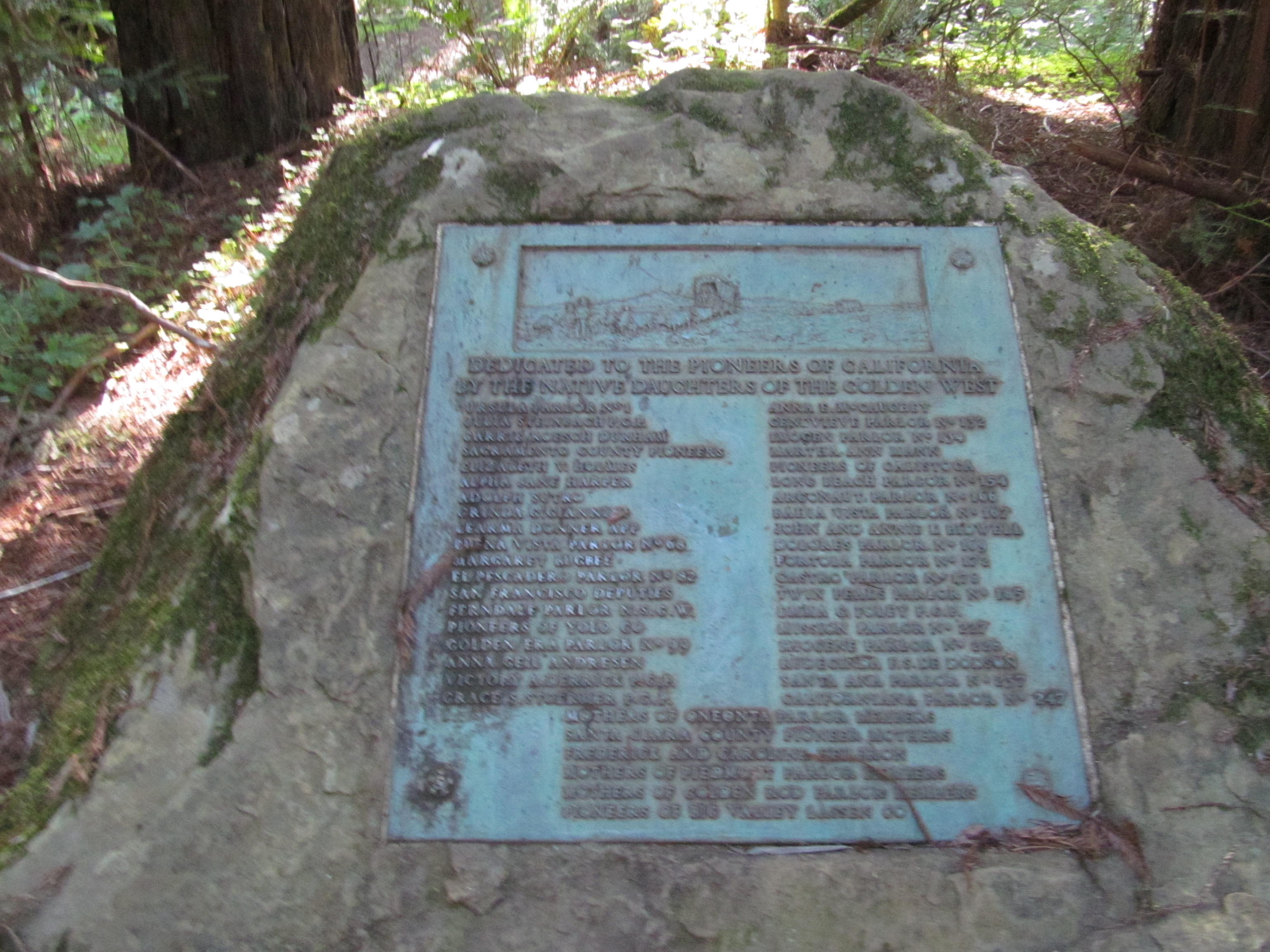
That memorial grove model explains what you see today, because the park is a mosaic of individually purchased and named groves, each with a modest bench or plaque. Between 1926 and 1929 John D. Rockefeller Jr. contributed two million dollars, then an extraordinary sum, and in 1931 the League completed the purchase of Bull Creek Flats, which is why the forest carries his name. The League is still buying redwood land, more than a century on.
The walking
The park covers about 53,000 acres with over 100 miles of trail, but the essential walking is short and flat.
Founders Grove is the introduction, a half-mile flat loop through enormous trees including the fallen Dyerville Giant, which was once among the tallest known and came down in 1991, and standing beside a fallen redwood is a better lesson in scale than standing beneath a live one. Rockefeller Loop is the essential walk at roughly 0.7 miles, flat, through the heart of the largest old-growth stand on Earth, taking twenty minutes that are the best twenty minutes in the park.
For more, the Bull Creek Flats Trail extends that for several miles along the creek through more of the same forest and is where you go to be alone, while the Drury-Chaney Loop is another flat old-growth walk with a dense understory of redwood sorrel, and the Homestead and River Trail loops give riverside walking. Grasshopper Peak is the long day at about 13 miles round trip with 3,300 feet of gain to a fire lookout site, climbing out of the flats into the ridge forest, and almost nobody does it.
The Avenue of the Giants
The 31-mile scenic road parallels Highway 101 through the park and it is the reason most visitors come. It is the old highway alignment, narrow and slow, running directly beneath the trees with pullouts at the major groves.
Driving it takes an hour without stopping and half a day with. Stop. The groves along it are the park, and the difference between seeing redwoods through a windshield and walking into a grove is the whole point. The road also carries the usual roadside redwood attractions of the mid-twentieth century, drive-through trees and the like, which are mostly on private land just outside the park.
The trees, and how to read one
Coast redwood is the tallest tree species on Earth, with the tallest known individuals exceeding 380 feet, though the record holders are further north in Redwood National Park and their locations are deliberately unpublished. Humboldt holds some of the largest by volume, including trees with trunk diameters over 20 feet, and mature trees here are commonly 500 to 1,200 years old with some considerably older. They depend on fog, drawing a meaningful fraction of their summer water directly from it condensing on their needles, and their bark, up to a foot thick, low in resin and high in tannin, is why they survive fire and resist insects. The understory is redwood sorrel, sword fern and huckleberry, with trillium and rhododendron in spring.
A few things to look for make a grove walk considerably more interesting. Fire scars are the black cavities at the base of many trunks, sometimes big enough to stand inside, called goose pens after the use settlers put them to, and a tree can lose most of its base to repeated fire and stay alive because the living tissue is a thin layer just under the bark that only needs continuity somewhere around the circumference. Burls are the knobbly swellings on trunks and at ground level, holding dormant buds and providing the mechanism by which a redwood regenerates after damage, which is why you see rings of trunks around an absent parent.
Reiterated trunks are the vertical stems growing out of the upper branches of very old trees, effectively new trees growing on top of the original crown, and old redwoods can carry dozens, producing a canopy structure that supports soil, ferns, huckleberry and even other trees hundreds of feet up. Buttressing and flare at the base tells you about flooding, since trees on the alluvial flats often have their original root collar buried many feet down. Shallow roots are the reason they fall, because there is no taproot and the root plate is broad and rarely more than ten or twelve feet deep, relying on interlocking with neighbors. And fallen trunks persist for centuries because the wood resists decay, acting as nurse logs for the next generation.
The Eel River, and the flood that changed everything
The river that made these trees possible has also repeatedly tried to destroy the park around them. The Eel River drains a large, steep, geologically unstable catchment and carries one of the highest sediment loads of any river of its size in North America, and that sediment is what built the alluvial flats the big trees grow on.
In December 1964, an atmospheric river event produced the largest flood in the recorded history of the region. The Eel reached flows that are difficult to comprehend, the town of Weott was inundated to a depth of over thirty feet, and whole communities along the river were destroyed and never rebuilt. A marker on a pole in Weott shows the 1964 high-water line, well above head height and well above the roof of the building beside it, and it is worth stopping for.
The flood also tore through Bull Creek Flats, taking a substantial number of old-growth redwoods with it, because upstream logging had destabilized the watershed and the creek arrived carrying an enormous debris load. That damage prompted a long and expensive watershed restoration effort of buying out the upstream logging land, removing roads and stabilizing slopes, so that the creek would stop eating the grove.
It is a useful lesson in what protecting a forest requires. Owning the trees is not enough if somebody upstream owns the hillside, and that is the general shape of the access and ownership problem everywhere: what happens on the ground you are standing on is decided partly by parcels you cannot see from it. Guidepole Hike carries the ownership layer under the trail, which in a park assembled grove by grove from a hundred separate purchases is a more interesting map than the trail network alone.
Avenue of the Giants: One of California's Best DrivesWhat lives here
The old-growth flats support a specific and unusual set of species. Marbled murrelets are seabirds that nest, improbably, on the mossy branches of old-growth conifers up to fifty miles inland, flying to the ocean to feed, and they were not observed nesting until 1974 because nobody thought to look three hundred feet up a redwood. They are threatened, and their dependence on old growth is one of the strongest arguments for protecting what remains. Northern spotted owls use the same forest.
Beyond the birds, the Pacific fisher, a large member of the weasel family, persists here in one of its remaining California populations, and Roosevelt elk are present though less visible than further north. Banana slugs are the mascot and they perform real work breaking down the litter layer. And redwood sorrel carpets the floor and folds its leaves down within minutes of direct sun hitting it, which you can watch happen in a light gap.
The gear
Humboldt Redwoods holds the largest remaining stand of old-growth coast redwood anywhere, and the gear list is short because the walking is easy.
Rain gear, since this is the wet end of the California coast and the season runs from October through April.
A warm layer, because a redwood grove is a cold place. The canopy blocks the sun, the fog drips through it, and the flat under those trees is ten degrees below the road.
A tripod, if you are photographing, which is not optional in a grove. There is very little light on the forest floor and the exposures are long.
A wide-angle lens, and the honest warning that comes with it: photographs of redwoods almost never work, because there is no way to convey scale without a person in the frame, and a wide lens makes the trees look smaller rather than larger.
Sturdy shoes rather than boots, since the grove trails are flat, soft duff and mostly short.
Food and fuel from a town, because the Avenue of the Giants has very little on it and what there is keeps limited hours.
And patience on the Avenue itself, which is a thirty-one mile two-lane road through the trees that people drive slowly for good reason.
Season and conditions
Any time of year works here, which is unusual. Winter and spring bring rain, and the forest is at its best wet, with the colors saturated, the creeks running and nobody there, though the Eel River floods periodically and can close roads. Summer is dry and foggy in the mornings, which is the redwoods' preferred condition and keeps the flats cool, and autumn is warm and clear.
The flats are dim year-round, which matters for photography and for how cold you feel standing still.
The Three Best Redwood Groves on the Avenue of the GiantsWhere to stay, and the practicalities
The Avenue corridor is thin on services and worth planning. Garberville and Redway to the south have the most, including groceries and restaurants, while Myers Flat, Miranda and Weott along the Avenue itself have very little: a shop, a diner, a handful of cabins. Ferndale, northwest toward the coast, is a preserved Victorian town and the pleasant place to base if you want somewhere to eat properly, and Scotia was a company town owned outright by the Pacific Lumber Company until the 2000s, with its mill and Victorian housing worth a slow drive through for the industrial history.
Camping in the park at Burlington, Hidden Springs and Albee Creek is the better option, books six months ahead, and Albee Creek out on Mattole Road is the quietest. Fuel before you commit to the Avenue.
There is no fee to drive the Avenue of the Giants or to walk most of the groves, though day-use fees apply at some developed areas. Dogs are restricted to roads, campgrounds and picnic areas rather than trails, as in most California state parks. It is about four hours north of San Francisco on Highway 101, facilities are limited to a visitor center at Burlington and the small towns along the road, and signal is poor through the flats. Do not climb on fallen trees or cut into bark, because the forest floor here is fragile and heavily walked.
What to do with a day
Drive the Avenue from the south, stopping at Founders Grove. Turn west onto Mattole Road and walk the Rockefeller Loop, which is the single most important twenty minutes available. Continue on Bull Creek Flats Trail for as long as you like. And if you want a hard day, climb Grasshopper Peak and see the flats from above.
While standing in Rockefeller Forest, it is worth registering the arithmetic: ninety-five percent of this was cut, this is the largest piece left, it is about ten thousand acres, and it survives because in the 1920s a man wrote the checks.
California's redwood story continues in Big Basin after the fire, Fern Canyon and Jedediah Smith. The state's rules are in six states, six ways to charge you for a trailhead and the state parks that want your dog.
The other redwood parks are in Prairie Creek and Fern Canyon, Jedediah Smith Redwoods and, in a very different condition, Big Basin after the fire. The Oregon coast just north is in the Samuel Boardman corridor, and the fee and pass structure is in state park passes by state.