Fish
Fish Fire
Fire Hike
Hike Bird
Bird


Two hikes described identically can be wildly different days.
"Eight miles, moderate" tells you almost nothing. Eight miles on a flat rail-trail is a pleasant afternoon. Eight miles with 3,500 feet of gain on loose scree, finishing with a Class 3 scramble, is a serious undertaking that will take twice as long and leave you unable to walk downstairs the next day.
The mileage is the least informative number on the page, and "moderate" is not a measurement at all. Here is what to read instead.
Elevation gain is the real number
If you take one thing from this, take that gain matters more than distance and is the number to look at first. A rough conversion used by hikers and mountaineers for over a century, sometimes called Naismith's rule, holds that 1,000 feet of ascent costs roughly the same time and effort as two extra miles of flat walking. It is approximate and it breaks down on very steep or very rough ground, but it is a far better planning tool than mileage alone.
Apply it and the comparison changes completely. Eight flat miles is eight effort-miles. Eight miles with 3,000 feet of gain is eight, plus six for the climbing, so roughly fourteen effort-miles. That is why the second hike takes twice as long, and why people who plan on distance alone are routinely finishing in the dark.
Watch for cumulative gain against net gain while you are at it. A ridge walk that undulates can carry 3,000 feet of cumulative gain while the summit is only 1,200 feet above the trailhead. Trail descriptions vary in which one they quote, and the cumulative figure is the one your legs experience.
Grade: how the gain is delivered
The same 2,000 feet spread over five miles and crammed into one mile are entirely different experiences. Grade is the ratio of rise to run, expressed as a percentage, so you divide the vertical gain by the horizontal distance covered.
-
Under 5 percent is barely noticeable, the grade of a gentle valley trail.
-
5 to 10 percent is a comfortable sustained climb, the grade of well-built switchbacks.
-
10 to 15 percent is steep. Most hikers slow markedly and stop talking, and this is the grade of a classic hard day hike.
-
15 to 20 percent is very steep. You are pushing on your knees going up and braking hard coming down.
-
Over 20 percent is often not a graded trail at all, but a direct fall-line path, an old miners' route, or something with the word "peak" in the name.
Mount Si averages around 15 percent for four miles, which is what makes it a training hike rather than a walk. The M in Missoula is steeper still and gains only 640 feet, which is why it takes forty minutes and still hurts.
Descent is not free. Steep downhill is where knees fail, where people fall, and where the day gets slow if the tread is loose, and a 20 percent grade going down is arguably harder to manage than the same grade going up.
Calculating Hike DifficultyClass ratings: what the terrain requires
The Yosemite Decimal System was devised by members of the Sierra Club in Southern California in the 1950s. Most people know it as a rock climbing scale, but classes 1 to 4 describe hiking and scrambling, and those are the ones that appear in trail descriptions.
-
Class 1 is hiking or running on a trail, hands stay in pockets, and it covers the overwhelming majority of American trails.
-
Class 2 is simple scrambling with the occasional use of hands, meaning talus, boulder fields and rough tread, where you might touch rock for balance.
-
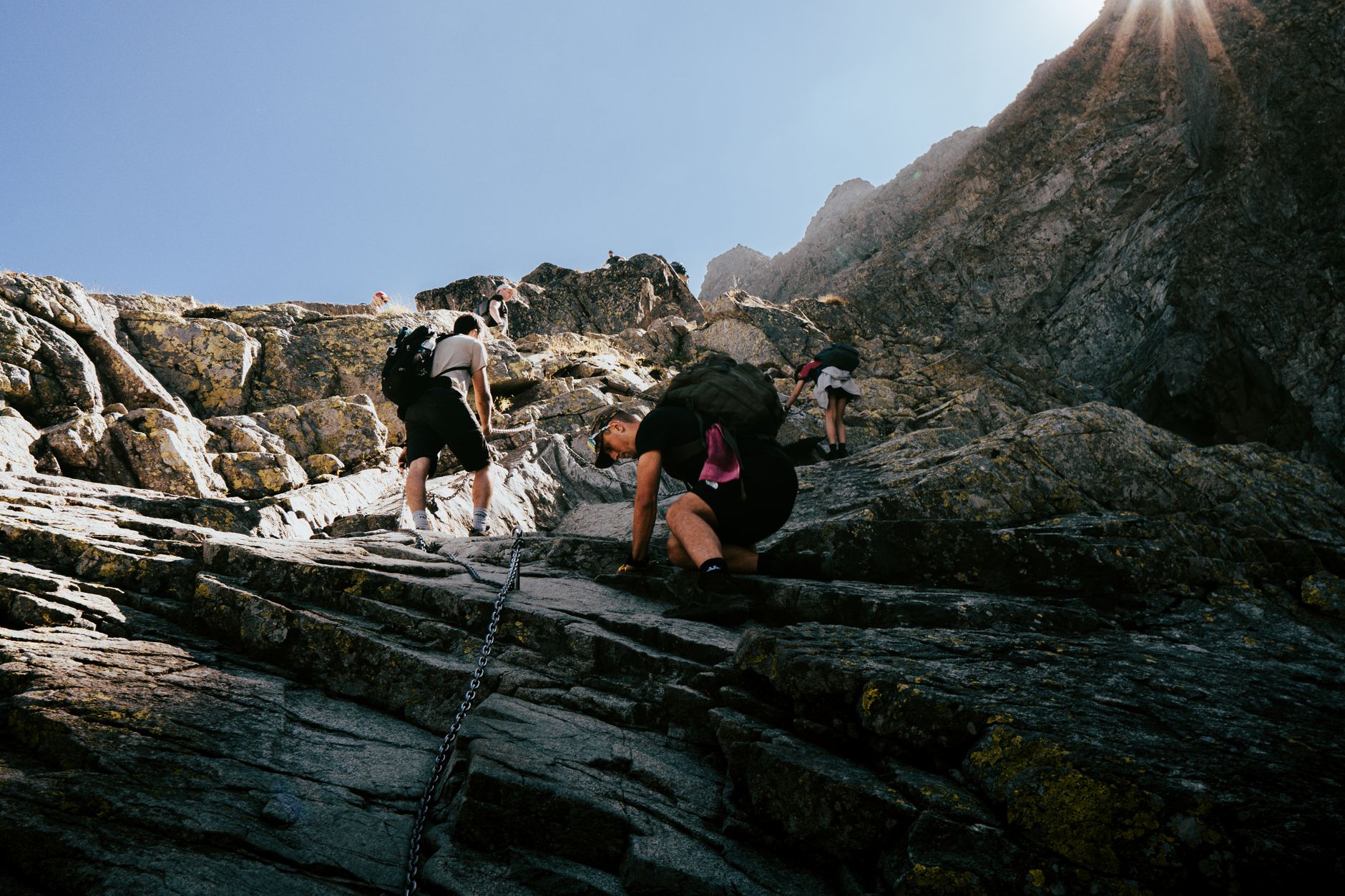
Class 3 is scrambling. Hands are required, exposure appears, and a rope could be carried. This is where a hike becomes something else, and the Haystack on Mount Si is Class 3, as is the summit block on a great many western peaks.
-
Class 4 is simple climbing, often with real exposure, a rope is frequently used, and falls could be fatal. This is beyond hiking.
-
Class 5 is technical roped climbing with belays, subdivided 5.1 through 5.15.
The critical boundary for hikers is between 2 and 3. Class 2 is rough walking, while Class 3 requires you to climb, usually above a drop, often with no protection and no easy way to reverse a move you should not have made. A great many people discover that distinction the hard way, at the top of a hike they thought was a hike. Down-climbing Class 3 is materially harder than climbing it, because you cannot see your feet or the holds below you, so if you are not confident you can reverse every move, do not make it.
Why "moderate" is meaningless
Trail apps and guidebooks apply difficulty labels and they are not comparable across sources. They are relative to the region, so strenuous in Florida and strenuous in Colorado describe different universes. They are relative to the audience as well, since a National Park Service rating aims at general visitors while a mountaineering club's rating assumes members.
Worse, they collapse several variables into one word. Distance, gain, exposure, tread quality, altitude and route-finding all get compressed into "moderate" and you cannot tell which one is driving it. Crowd-sourced ratings drift on top of that, because a trail rated by thousands of people includes the opinions of everyone who turned around early and everyone who ran it. Use them as a rough first filter, then look at the actual numbers.
The variables nobody puts in the summary
Tread quality comes first, because loose scree, talus, wet roots, polished granite and mud all slow you down and increase effort independently of grade, and a mile of boulder-hopping can take as long as three miles of trail. Altitude is next: above 8,000 feet everything is harder and above 10,000 feet noticeably so, which means a 10-mile hike at 11,000 feet is not a 10-mile hike.
Exposure is not physically harder but it governs whether you can do the route at all, since some people are fine with 2,000 feet of air beside them and some are not, and neither correlates with fitness. Route-finding adds time and mental load wherever the trail is faint, the boulder field is cairned, or a section runs cross-country. Water availability changes the arithmetic directly, because a dry route means carrying more weight. Sun exposure turns an open south-facing climb in August into a different hike from the same numbers in forest. And conditions override all of it, since snow, ice and mud can turn a Class 1 trail into something requiring traction and judgement, which is why a route's summer rating tells you nothing about it in May.
The Difference Between Class 1 and Class 4 HikingA practical way to estimate your day
Do this once before you go and you will plan better forever. Calculate effort-miles as distance plus gain in thousands of feet multiplied by two. Divide by your honest pace, remembering that most reasonably fit hikers manage 2 to 2.5 effort-miles per hour on decent trail, slower on rough ground and faster if you are conditioned. Add stops for lunch, photographs, navigation and the pace of the slowest person, realistically 25 to 50 percent on top. Then compare the total to your daylight and subtract an hour for margin.
A 10-mile hike with 3,000 feet of gain is 16 effort-miles, which is 6.5 to 8 hours of moving, which is 8 to 11 hours car to car. That is a full day starting at dawn rather than a leisurely morning, and that calculation is exactly what people skip.
The numbers only help once you know your own conversion rate, so calibrate yourself. Do a hike you can measure, with a known distance and gain, and time it honestly, recording moving time and total time separately. Then do a harder one. After three or four you will know whether you are a 2 mph or a 3 mph hiker in effort-miles, and how much your pace degrades in the last quarter of a long day. Track your descent speed separately, because many people climb well and descend slowly and the descent is half the day. And note what stops you, since some people run out of legs, some run out of lungs, and some run out of tolerance for exposure, and knowing which lets you pick objectives that suit you rather than ones that defeat you.
One arithmetic point that groups consistently get wrong: your effort-mile pace is personal, but a group's pace is the slowest person's pace minus a bit, because stops accumulate through waiting, regrouping, and the slower person getting less rest than everyone else at each halt. Plan around the slowest member's honest pace rather than the average, and build in real stopping time rather than the incidental waiting that leaves them permanently behind on recovery. It follows that group size affects speed, since four people are meaningfully slower than two over a long day and eight are slower again, so if the objective is tight against daylight a smaller group is a safety measure rather than a preference.
The gear
Most of what makes a day hard is decided before you leave, so this list is about measuring and about the two things that make a long day survivable.
A GPS watch or app that records elevation gain, which is the only way to build a personal sense of what a number means. Knowing that three thousand feet takes you four hours is worth more than any published difficulty rating, and you only learn it by recording it.
Trekking poles, which reduce load on the knees on descent by a meaningful margin and are the single best mitigation for the part of a hard day that injures people.
A printed or downloaded topo map, because contour spacing is what tells you how the gain is delivered. Two thousand feet spread over five miles and two thousand feet in one is the same number and a different day.
A headlamp, because the most common way a hard hike becomes a dangerous one is finishing it in the dark.
Kahtoola MICROspikes, since a trail that is moderate in August is a different proposition in April with a snow traverse on it.
Shoes with real tread, for the descent, which is where grip failures happen.
And a watch you actually look at, which is the whole basis of a turnaround time. A turnaround time you set and then do not check is not a turnaround time.
Reading a topo map for this
A total-gain figure tells you how much. A contour map tells you where, and that is more useful. Tightly packed contour lines mean steep ground, and where they crowd together on the map is where your pace will collapse, so seeing that in advance lets you plan a turnaround point or a rest before it rather than after. Widely spaced lines mean easy ground, and long stretches of them are where you make up time. Contours closing into small circles are summits or knolls, while contours forming a V pointing uphill are drainages, which often mean a creek crossing.
Learning to read the shape of a route from its contours takes an afternoon and it is the single most transferable planning skill in hiking, because it works on any map, anywhere, without an app.
Two inputs to the effort-mile calculation are easy to get wrong from a trail listing, and both are worth checking against something authoritative. The first is cumulative rather than net gain, which is the figure your legs experience and the one listings most often omit. The second is where the day starts, since a seasonal gate or a washed-out road can add several miles and a good deal of gain to a route whose published numbers assume you drove to the trailhead. Guidepole Hike carries trailhead elevation and current road and access status alongside the route, which is what turns a published mileage into a number you can plan a day around.
Turnaround times, and why they fail
The standard advice is to set a turnaround time and honor it. Almost nobody does, and the reason is worth understanding. By the time you reach a turnaround point you have invested hours, the summit looks close, and the group has momentum, so sunk cost, optimism about the descent and social pressure all push in the same direction, and they push hardest exactly when your judgement is most degraded by fatigue.
A few things make turnaround times work.
-
Set it before you leave the car, in the parking lot, out loud, with the group. A time decided in advance carries far more weight than one improvised at 2pm.
-
Make it a clock time rather than a landmark. "We turn around at 2pm" survives contact with reality, whereas "we turn around at the saddle" turns into "the saddle is basically the next one along."
-
Calculate it from your descent speed rather than your ascent. If the climb took four hours the descent will rarely take less than three, and on steep or loose ground it can take nearly as long.
-
Include the drive. Getting off the mountain in daylight is not the goal, and getting home safely is.
Reading the right number
Read the gain before the distance and convert it into effort-miles. Check the grade to know how that gain arrives. Look for a class rating and treat the jump from 2 to 3 as the line where a hike stops being a hike. Ignore the word "moderate" entirely.
Then add the variables the summary left out, meaning tread, altitude, exposure, water, sun and conditions, and give yourself an hour of margin you do not expect to need.
Most people who get into difficulty on American trails were not unfit. They were working from the wrong number.
The season that most changes what a rating means is in shoulder season and snowline hiking. The factor that no rating accounts for is in hiking at altitude. Examples in this library that illustrate the gap between mileage and difficulty are Mailbox Peak, Mount Whitney as a day hike and Clouds Rest, the last of which is fourteen miles and under two thousand feet and still a long day.