Fish
Fish Fire
Fire Hike
Hike Bird
Bird

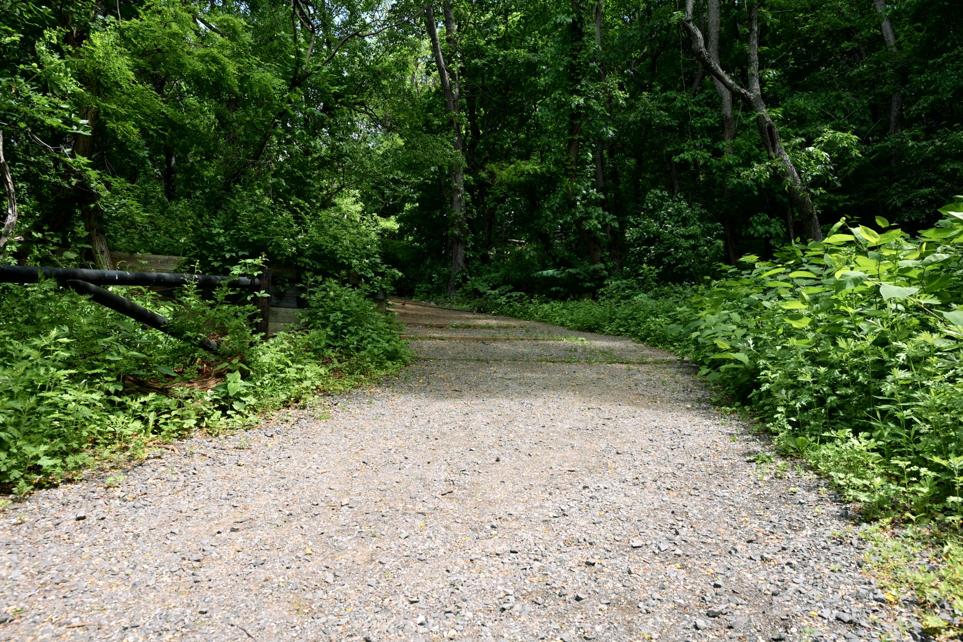

In 1980 the Chicago, Milwaukee, St. Paul and Pacific Railroad, universally called the Milwaukee Road, abandoned its western extension. The company was bankrupt, the line had never made money, and the electrified transcontinental route it had built across Washington was switched off.
Washington State bought the corridor.
What exists now is a state park shaped like a line: the Palouse to Cascades State Park Trail, running 251 miles from Cedar Falls near North Bend east to the Idaho border on the old railway grade. It has been called the Iron Horse Trail and the John Wayne Pioneer Trail at various points, and you will still see both names on signage and maps.
Why a rail trail is different
Railways cannot climb, and that single engineering constraint defines the whole experience. A steam or electric locomotive hauling freight needs a gradient of no more than about two percent, and the Milwaukee Road held to that across the Cascades, using long contouring traverses, deep cuts, high trestles and tunnels to do it.
Walking it, you get a relentlessly gentle grade through terrain that would otherwise involve serious climbing, because you are on a shelf cut into a mountainside going up at a rate you can barely feel, for miles. That makes it excellent for beginners, families, cyclists and anyone who wants distance without vertical, and slightly monotonous for anyone who came for a summit. It also means the views are lateral rather than from above, so you look across valleys at eye level for hours.
The Snoqualmie Tunnel
The centerpiece, and one of the more memorable things you can walk in Washington. The Snoqualmie Tunnel runs 11,894 feet, or 2.25 miles, under Snoqualmie Pass at around 2,600 feet elevation, and it is the longest bike and pedestrian tunnel in the United States.
It is completely dark, straight enough that the far portal is a pinprick of light for most of the way, cold at a steady temperature regardless of the season, wet with water dripping and running down the walls, and loud with the sound of that water. Expect something in the region of 40 to 50°F inside whatever the date, with a noticeable wind through the bore, so on a hot August day the contrast is severe and a jacket matters.
You need a real light rather than a phone, and people underestimate this constantly, because it is unpleasant to be halfway through a two-and-a-quarter-mile tunnel with a dying phone flashlight. A single weak light is not enough either, and the fact that you can see the far portal as a point of light is disorienting rather than helpful, because it gives you no depth information. The surface is compacted gravel with puddles and loose patches, so ride slowly, and expect to get wet and your bike to get filthy.
Other users walk it, cycle it and bring children, so announce yourself and moderate your speed. It takes twenty to thirty minutes on foot and ten or so by bike, and it feels considerably longer. Claustrophobia is a real consideration for some people and there is no exit partway. And the tunnel closes seasonally, typically from around the start of November to the start of May, because of ice fall inside and avalanche danger at the portals, so check before planning around it.
It is one of the more memorable half hours available in Washington, and it costs nothing beyond a Discover Pass and a decent flashlight.
Which sections are worth it
The honest answer is that 251 miles of railway grade is not uniformly interesting, and knowing where to go matters more here than on most trails.
Rattlesnake Lake to the Snoqualmie Tunnel is the best-known section and the one most people do, running roughly twenty miles round trip from the Cedar Falls trailhead to the west portal, which is a long day on foot and an easy half day on a bike, and most people cycle it. The Iron Horse section through the upper Snoqualmie valley gives you trestles, cuts and views across to the peaks, while Hyak to Easton, east of the tunnel, drops through forest on the drier side.
Further east, the Yakima River Canyon section near Thorp is a completely different landscape of basalt, sagebrush and river, and the sections across the Columbia Basin and into the Palouse are open, hot, exposed and often remote, with long stretches between water and services, which is where the trail becomes a genuine expedition rather than a day out. The Beverly Bridge over the Columbia reopened in recent years after decades of closure, restoring a critical link that had forced a long detour.
What makes it hard
Not the gradient, which is the point people miss. Surface is the single most common complaint, because much of the trail is coarse ballast or loose gravel rather than compacted crushed rock, which is slow on foot and demands wide tires on a bike. Water is the next, since long sections east of the mountains have none, and exposure compounds it, because the eastern half is open country with no shade and serious summer heat. Remoteness completes the set, with stretches where the nearest town is a long way off and there is no signal.
Then there is the administrative half, which is unusual for a state park. Some eastern segments crossing private land have historically required a separate permit, and access arrangements have changed over the years, while missing bridges and closed segments force detours in places. A 251-mile park that is thirty feet wide crosses a great many ownerships, and the answer to "am I allowed to be here" varies by milepost and by year. Guidepole Hike carries the ownership and access status along the corridor rather than treating it as one park, which on a trail assembled from a bankrupt railway's right of way is the difference between a planned crossing and a locked gate at mile 180.
What the eastern half is like
Most coverage of this trail stops at the tunnel, which leaves out about 230 miles. East of Snoqualmie Pass the trail drops through Easton and Cle Elum into the Kittitas Valley and the landscape changes fast, with ponderosa pine giving way to sagebrush within a few tens of miles. The Yakima River Canyon and the Thorp area offer basalt walls, river and open sky, scenic in a completely different register from the forested west side.
Across the Columbia at the Beverly Bridge the trail enters the Columbia Basin, with irrigated agriculture, coulees and long straight sections across open country, and the Palouse at the eastern end brings the rolling loess hills and wheat.
What the eastern half demands is water planning, because there is very little, heat management, because there is no shade, navigation, because trestles are missing in places and detours are needed, and tolerance for monotony, because a straight railway grade across a basin is a long way between features. It also delivers something the west side cannot, which is solitude on a scale that is hard to find anywhere in Washington, and you can ride for hours without seeing anyone.
Riding it end to end
A small number of people do the full 251 miles, usually by bike over four to seven days. West to east is the usual direction, taking the long gentle climb to the tunnel first and then a general descent. Tires of at least 2 inches are the common recommendation and many riders go wider, because this is not a road-bike surface.
Water caches or town resupply need planning across the eastern sections, and camping is at trailside sites, in towns, or dispersed where permitted, with the arrangements varying by segment. Permits and access have changed over the years on the eastern segments crossing private ground, so current information matters more than a guidebook.
It is not a famous route in the way the Great Divide or the Katy Trail are, and the people who finish it tend to describe it as harder and emptier than they expected.
The Palouse to Cascades State Park Trail and the Longest Rail Trail Tunnel in the USThe Milwaukee Road, briefly
Worth knowing because the ruins are the scenery. The railway built its Pacific Extension between 1906 and 1909, arriving late to a market already served by three transcontinental lines, and to compete it electrified long sections across the Rockies and Cascades, which was visionary for the time and produced one of the most advanced railway operations in the world.
It never paid. The route was expensive, the traffic was thin, and the company went through repeated bankruptcies before abandoning the western lines in 1980. What remains along the trail is substations, catenary poles, snowsheds, trestles and the tunnel, with several structures visible from the grade and a few interpreted.
The gear
Two hundred and thirty miles of former railroad grade across the state, with a two-and-a-quarter-mile tunnel in the middle of it, produces an unusual gear list.
A proper headlamp or a real bike light, which is the item this trail is famous for needing. The Snoqualmie Tunnel is two and a quarter miles long, unlit, and dark in a way that phone lights do not address. People turn back in there every summer.
A jacket for the tunnel, for the same reason. It runs around forty degrees inside regardless of the season, and riding through it in shorts on an August afternoon is cold by the far end.
Wide tires if you ride, because the surface is crushed rock rather than pavement for almost the whole length, and a road bike is the wrong tool.
More water than the distance suggests, particularly east of the crest where the trail crosses dry country with no services for long stretches.
A Discover Pass for the trailhead lots.
Current segment and access information, which matters more here than on any other trail in this library. Sections are closed, some trestles are out, one long stretch crosses private and tribal land with its own arrangements, and the state has been reopening pieces gradually.
And offline maps, since much of the eastern half has no coverage at all.
Where it connects
The corridor is part of something larger, which is worth knowing if you are thinking about long routes. The Great American Rail-Trail, a developing cross-country route from Washington DC to Washington State, uses the Palouse to Cascades as its western section, and that project has pushed attention and funding toward closing gaps here.
At the western end the trail connects toward the Snoqualmie Valley Trail and the wider network around North Bend and Duvall, which links most of the way toward the Puget Sound lowlands, and at the eastern end it reaches the Idaho line, where the Trail of the Coeur d'Alenes continues across the panhandle on another rail grade for seventy-plus miles of paved surface. Strung together that is a very long continuous off-road route, with section quality varying from smooth pavement to loose ballast.
One local note: Rattlesnake Lake at the western trailhead is also the start of the Rattlesnake Ledge trail, one of the busiest hikes in Washington, so expect the parking area to be shared with a great many people who are not going anywhere near the rail trail.
Biking the Palouse to Cascades Trail from North BendPractical notes
A Discover Pass is required for most trailhead parking. Bikes are the sensible way to see any real distance, and on foot you should treat it as a series of day sections. Horses are permitted on much of it, and dogs are welcome on leash.
Camping exists at intervals and is primitive in the east. The tunnel needs lights and a jacket and is seasonally closed roughly November to May. Rattlesnake Lake is the western trailhead and a busy day-use area in its own right. And signal is patchy in the mountains and absent in much of the east.
What to do
If you have one day, ride or walk from Rattlesnake Lake to the Snoqualmie Tunnel and through it, with a light. If you want quiet, take the Yakima River Canyon section or anything east of the Columbia. And if you want the whole thing, it is a multi-day bikepacking route, and the people who finish it are a small club.
Whichever section you choose, the thing to notice is the grade. Two percent, held across a mountain range, by people with hand tools and dynamite in 1908, for a railway that never turned a profit and was switched off within a lifetime.
More Washington state parks at Deception Pass, Larrabee and Dry Falls. The mountains above the trail are in hiking Mount Si and hiking Seattle, and what a linear state park means is explained in natural area, scenic trail, reserve.
The mountain trailheads at the western end are in Mount Si and Mailbox Peak, and the city it starts from is in hiking Seattle. The dry country it crosses is in Dry Falls and Palouse Falls. The designation that makes a park out of a line is explained in state natural areas explained.