Fish
Fish Fire
Fire Hike
Hike Bird
Bird


In February, on a cold morning on the road below Bear Valley, you can stand in the dark and watch several hundred Bald Eagles leave a roost, in ones and twos and then in a stream, heading out over the basin to hunt.
It is one of the great wildlife spectacles in North America, it happens about forty minutes from Klamath Falls, and it is under more pressure than almost anywhere else in this library.
What the complex is
The Klamath Basin National Wildlife Refuge Complex straddles the Oregon and California border and comprises six refuges: Lower Klamath, Tule Lake, Clear Lake, Bear Valley, Upper Klamath and Klamath Marsh.
Lower Klamath is the historically significant one. President Theodore Roosevelt established it in 1908 as a preserve and breeding ground for native birds, making it the first waterfowl refuge in the United States. That history sits awkwardly beside what happened next: the draining of Tule Lake began in 1912 and Lower Klamath Lake in 1917, both to create farmland, and close to 95 percent of the basin's original wetlands have been lost, most converted to pasture and irrigated agriculture.
What remains is still extraordinary, and it is managed within a water system that no longer has enough water in it for everyone.
Winter at the Klamath Basin National Wildlife RefugesThe eagles
This is the reason to come in winter, and it is world-class. The basin hosts the largest concentration of wintering Bald Eagles in the contiguous United States, with birds present in impressive numbers from early December through mid-March and numbers generally peaking in mid-February.
The mechanism is simple. Enormous waterfowl concentrations provide food, and the surrounding forested ridges provide sheltered communal night roosts. Bear Valley exists specifically to protect one of those roosts, and it is closed to public entry through the roosting season for exactly that reason.
You do not need to enter it. The tradition is the fly-out: park on the public road below the roost before first light and watch the birds leave. It is cold, it is dark, and it is worth it. Bring a scope, keep the engine off, and do not go up the closed road, because a roost that gets disturbed moves and then there is nothing to watch from anywhere.
The auto tours
Both Lower Klamath and Tule Lake have driving routes, and they are the main way to bird the complex. The Lower Klamath auto tour is a 10.2-mile loop, roughly twelve miles from the visitor center, and it works across the seasons in quite different ways: white pelicans, egrets, herons, grebes, avocets, Black-necked Stilt and White-faced Ibis in summer; large flocks of geese and ducks plus Sandhill Cranes and shorebirds in spring and autumn; and Tundra Swans, Bald Eagles and other raptors in winter. The Tule Lake auto tour covers the impoundments and the sump, with refuge headquarters and the visitor center nearby.
As everywhere, the car is the hide. These birds are habituated to vehicles and not to people, and the routes are designed on that assumption.
What the spring migration used to be
It is worth knowing what this basin was, because it sets the scale of what is at stake. The Klamath sits at a pinch point on the Pacific Flyway, where routes from the Arctic breeding grounds converge before the birds continue into the Central Valley and beyond, and historically it supported waterfowl concentrations among the largest anywhere on the continent, with spring and autumn peaks running into the millions of birds.
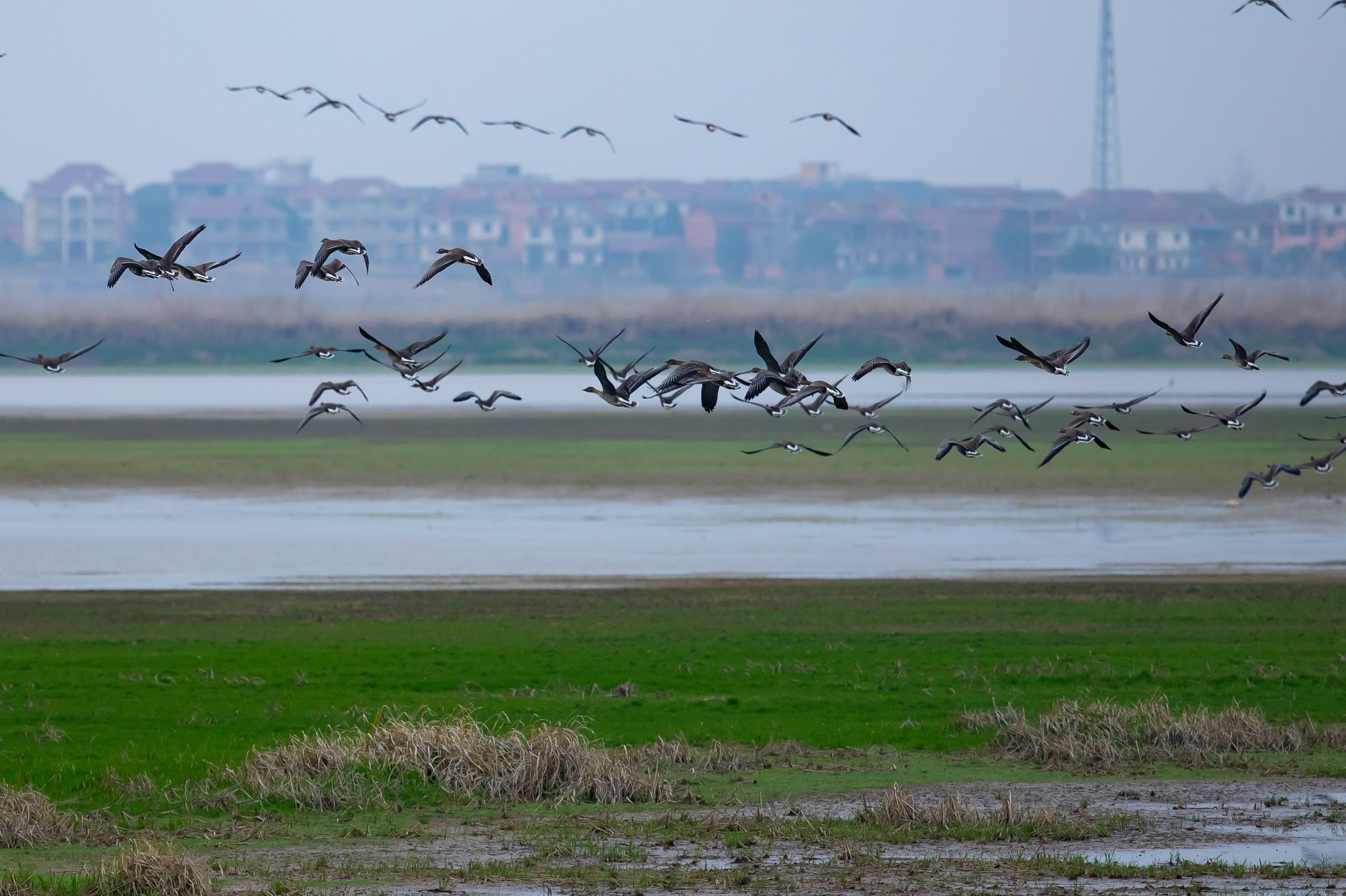
Those numbers are much reduced, but the flyway geography has not changed. In a year with water the basin still produces a spring movement of Northern Pintail, White-fronted Goose, Snow Goose, Ross's Goose, Tundra Swan and a long list of ducks that can fairly be called spectacular. Sandhill Cranes stage here in numbers in both directions. Shorebirds use the drawn-down impoundments in autumn, with Long-billed Dowitcher, Wilson's Phalarope, avocets and stilts among the regulars. And breeding colonial waterbirds in summer include American White Pelican, White-faced Ibis, Black-crowned Night-Heron, Forster's and Caspian Tern and several grebe species.
The honest framing is that this is a place where the ceiling is set by a water allocation, and where the difference between a great year and a poor one is decided in a meeting rather than by the weather alone.
The Water Crisis Facing the Klamath BasinThe water crisis, stated plainly
This is the part a birding guide has an obligation not to skip. The Klamath Project's water is allocated among irrigation, tribal trust obligations, endangered fish in Upper Klamath Lake, flows for salmon in the Klamath River, and the refuges. The refuges sit at the bottom of that list in practice, and in dry years they receive very little.
The consequence is avian botulism. When wetlands are shallow, warm and stagnant rather than deep and circulating, conditions favor the bacterium and waterbirds die in large numbers, and outbreaks in recent years have been severe, with reported losses running into the tens of thousands of birds. As of mid-August 2026 an outbreak is under way at Tule Lake, with reported mortality approaching fourteen thousand birds and refuge staff finding roughly a hundred and fifty dead birds a day. Around fifty thousand acres of Project land were idled this year in response to reduced supplies.
The current response is a flow-through approach, moving water through the refuge wetlands and returning it to the Klamath River, with the aim of improving circulation and water quality and reducing the stagnant conditions that fuel botulism. A coalition of irrigation districts, agencies, tribal nations and conservation organizations has worked to deliver it, and whether it arrives early enough to blunt the seasonal peak is the open question.
What this means for a visitor is straightforward. Check conditions before you plan a trip, understand that a refuge which reads as open water on a map may be dry ground, and know that autumn in particular can be a distressing rather than a joyful visit.
Timing
-
Mid-December to mid-March for eagles, peaking mid-February.
-
March and April for the northbound waterfowl and crane movement, historically one of the largest concentrations on the flyway.
-
May to July for breeding colonial waterbirds, pelicans, ibis, grebes and terns, water permitting.
-
Late summer and early autumn is the botulism risk window and the period most affected by low water.
-
October and November for the southbound push, which in a good water year is still spectacular.
The basin also holds a strong supporting cast, with Rough-legged Hawk, Ferruginous Hawk, Prairie Falcon, Northern Shrike and Snowy Owl in some winters.
The gear
The Klamath Basin in winter is cold, flat, exposed and enormous, and it is birded almost entirely from a vehicle on gravel dikes.
A spotting scope, because the eagle roost counts and the waterfowl rafts are both distant, and because the interesting work in a basin like this is sorting a raft rather than admiring it.
Serious cold-weather layers. This is a high basin at four thousand feet and February mornings run well below freezing with wind across open water and ice.
A window mount, since the auto tours are the refuges and a vehicle is the only hide available.
A full tank and food for the day, because the loop between Lower Klamath and Tule Lake covers a lot of ground with almost no services, and Tulelake is a small town.
Current refuge conditions checked in advance, which matters more here than at any other refuge in this library. Water allocation in the Klamath is contested and variable, units go dry in some years, and a refuge with no water on it is a refuge with no birds on it. The complex posts conditions and they are worth reading before committing to a four-hour drive.
A thermos, for a morning spent stationary at an eagle roost before dawn.
And a raptor reference, because this basin in winter holds one of the densest concentrations of Bald Eagles in the lower forty-eight along with Rough-legged Hawks, Ferruginous Hawks, harriers and Prairie Falcons, and sorting them at distance is most of the day.
Reading the basin as a birder
A few habits make the complex much easier to work. Start at the visitor center, because the staff at Tule Lake know which impoundments have water this week, which is the single most useful piece of information available and which no map will tell you. Then follow the water rather than the boundary, since in a low year the birds concentrate wherever the water is, and that may be a leased agricultural field inside the refuge, a flooded pasture outside it, or a single unit that happened to get an allocation.
Use the county roads, because much of the basin is birdable from public roads running between fields, and in winter those are frequently better for raptors than the refuge units themselves. Watch the sumps, since Tule Lake's hold birds when the shallower units are dry and concentrate everything in a hard year. And check the Oregon side too, because Klamath Marsh and Upper Klamath are a different habitat entirely, with marsh and forest species rather than open-water waterfowl, and they are often overlooked by visitors focused on the California units.
Where to base yourself, and a first visit
The geography rewards planning, because the driving between units is substantial. Klamath Falls, Oregon, is the practical base, with the range of accommodation, restaurants and fuel, within reasonable reach of Bear Valley, Lower Klamath and the Oregon units, and in winter it is also where the roads are cleared first. Tulelake, California, is much smaller and much closer to Tule Lake refuge headquarters and the visitor center, so if your focus is the California units and the auto tours the shorter pre-dawn drive is worth the reduced choice of rooms. Merrill and Malin offer limited options between the two.
For the eagle fly-out specifically, you need to be on the road below the roost in full darkness, which from Klamath Falls means leaving very early on a February morning with the roads potentially icy. Build that into the plan rather than discovering it at five in the morning, and fuel up the night before, because rural service stations in this basin do not keep early hours.
Winter mornings here are severely cold and the fly-out involves standing still in the dark at altitude, so dress for that rather than for the drive. Facilities are limited outside the visitor centers. And do not overlook the history, because the Tule Lake site includes the location of one of the incarceration camps where Japanese Americans were imprisoned during World War II, now a national monument, sitting directly beside the refuge and deserving a visit on its own terms.
Come in February. Sleep in Klamath Falls. Be on the road below Bear Valley in the dark, watch the fly-out, then drive the Lower Klamath auto tour as the light comes up with the whole basin in front of you. Check refuge conditions first and ask at the visitor center what has water this year, because the answer changes and the staff know.
This is also a hard place to read from a standard map: six refuges across two states, a working irrigation project interleaved with them, leased agricultural ground inside refuge boundaries, seasonal closures around a roost, and units whose water status changes year to year. Guidepole Bird carries the ownership and management layer, which here means telling refuge from Project land from private ground from a closed roost unit before you turn down a road. On a landscape where the difference between a wetland and a dry field is a decision made in a meeting, knowing who manages what is not academic.
One more thing while you are there. The eagle fly-out is the headline, but the return in the last half hour of light is quieter, far less attended, and arguably better, because the birds come back low and singly rather than streaming out in a mass, and you can watch individual eagles pick their way up the ridge to the roost trees. Almost nobody stays for it.
And go, rather than waiting for a better year. Places like this are protected by the number of people who care about them, and that number is a function of how many have stood in the cold and watched the eagles leave.
For the wider context, where to see bald eagles in winter covers the other great winter concentrations, and a wildlife refuge is not a park explains the rules that make a refuge different from the national monument next door.
The eagle concentration here is the interior counterpart to the coastal salmon river gatherings described in where to see bald eagles in winter. The southern end of the same flyway is in Central Valley waterfowl and the northern end in Skagit flats snow geese. The nearest comparable Great Basin water is Malheur National Wildlife Refuge, and why a refuge is managed the way this one is comes down to the mandate described in a wildlife refuge is not a park.