Fish
Fish Fire
Fire Hike
Hike Bird
Bird

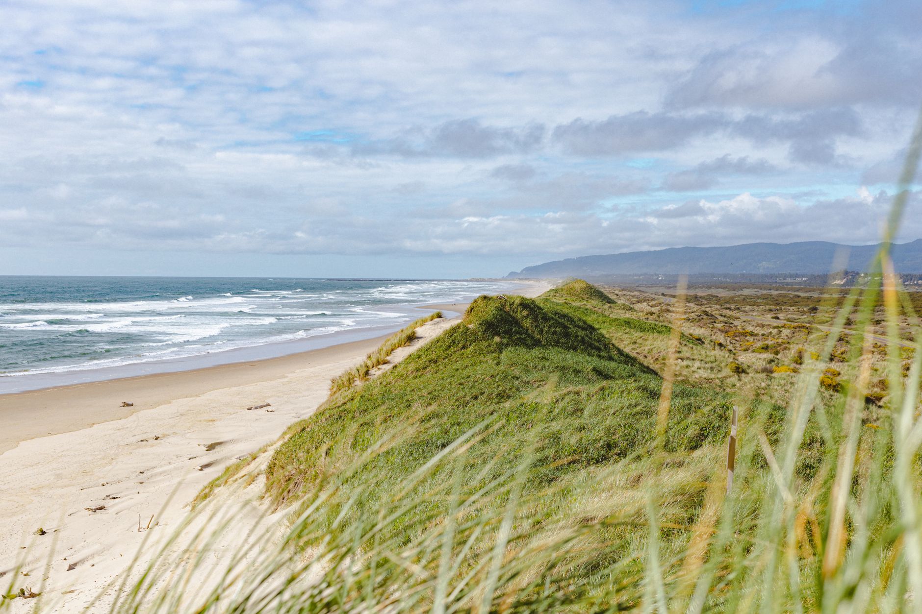

Oregon's razor clam season has a closure that has nothing to do with toxins, and it is the one visitors miss.
Razor clamming on the Clatsop beaches, the eighteen miles of sand running north from Tillamook Head to the Columbia, closes at one minute past midnight on July 15 every year. The last day to dig is July 14. It reopens on October 1, subject to biotoxin results.
That is a conservation closure rather than a safety one, and understanding the difference is most of what you need to know about clamming in Oregon.
Why the closure exists
The Clatsop beaches carry the great majority of Oregon's razor clam harvest, and they carry it because of how the population works there.
Razor clams set in enormous numbers on these beaches in a good year, and the young clams need time to establish and grow before they can sustain harvest. The summer closure takes the pressure off during the period when the year's recruits are becoming established, so they are still there to be dug in future seasons.
It is worth appreciating what that means practically. This is not a biotoxin closure that might lift next week, and it is not a response to a bad survey. It is an annual, calendar-fixed, entirely predictable shutdown of the state's best razor beach through the middle of summer, and no amount of checking will make it open on July 20.
Beaches south of Tillamook Head operate on different rules and are open at times when Clatsop is not, so the season is not simply closed statewide, but the productive ground is.
Where the clams actually are
Clatsop is the fishery, and the reason is geological.
The beaches north of Tillamook Head, running past Seaside and Gearhart to Fort Stevens and the Columbia mouth, are a long, gently sloping, fine-sand surf beach fed by sediment from the Columbia River. That is precisely the habitat razor clams want, and the density here is far higher than anywhere else on the Oregon coast.
South of Tillamook Head the coast is rockier, more broken into pocket beaches and headlands, and razor clams occur in far smaller and less reliable concentrations. There is digging on the central and southern coast, and it is a different and generally thinner proposition.
So an Oregon razor trip is either a Clatsop trip in the open season or a considerably more speculative outing elsewhere.
The gear
Oregon razor clamming needs four things and tolerates no substitutes for two of them.
The digging tool is a clam gun or a clam shovel, and both are legal here with specified opening dimensions. The gun is a tube you push straight down over the show and lift with a thumb over the vent; it is easier to learn and breaks fewer clams, which matters more in Oregon than most places because a broken clam still counts toward your fifteen. The shovel is faster in practiced hands and unforgiving while you learn.
A headlamp with genuine spare batteries is the second non-negotiable. The best winter tides on this coast fall after dark, and cold flattens batteries faster than people expect, so a phone light is not a plan.
Waders or serious waterproof boots come third. You work the waterline in Pacific surf in winter, and being wet and cold ends more Clatsop digs than thin clams do.
Then a separate net or container for every digger, because each person digs and keeps their own and the containers get checked.
Beyond that: an Oregon license for everyone twelve and over, which is not interchangeable with a Washington one; two bookmarks, ODFW for the season and the Department of Agriculture for the closures, because checking one and not the other is the standard Oregon mistake; and somebody in the group whose job is watching the water while the rest of you face the sand.
The rules
Oregon's razor rules are close to Washington's and differ in ways that matter.
The daily limit is the first fifteen dug, with no sorting and no releasing. That is the same principle Washington uses and for the same reason: a dug razor clam has a thin brittle shell and a severable siphon and generally does not survive being returned, so allowing release would produce a large invisible mortality on top of a visible limit.
Oregon extends that logic further. All razor, gaper, piddock and softshell clams must be retained regardless of size or condition, so the mandatory-retention rule covers more species here than it does north of the Columbia.
Permitted methods are hand, shovel, clam gun or tube, with specified dimensions on the openings. A license is required for everyone twelve years and older, which is a lower age threshold than Washington and the detail that most often catches a visiting family.
Each digger digs and keeps their own, and each person's clams are kept separately.
Digging Razor Clams with ODFWThe other closure, which does move
The July closure is fixed. The biotoxin closures are not, and Oregon has had serious ones.
Domoic acid closes razor beaches here on the same basis as in Washington, and the state has experienced extended coastwide razor closures lasting many months. Oregon has also had a significant paralytic shellfish poisoning event, which is less commonly associated with razor clams and was serious enough to prompt a rapid public health response and coastwide closures across multiple shellfish types.
The agency split is the thing to internalize. The Department of Fish and Wildlife sets the seasons and the limits. The Department of Agriculture runs the biotoxin program and issues the closures, with a hotline on 1-800-448-2474.
So a Clatsop trip in November needs two separate checks: that the season is open, which it will be, and that the beach has not been closed for domoic acid, which it might be. Those answers live in different places and change independently, which is why Guidepole carries the current closure status against the specific beach alongside the tide. The general mechanism is in shellfish biotoxin closures.
Digging one
The technique is the same as on the Washington coast, and the beach conditions here are as good as it gets for learning.
Work the waterline as the waves sheet back, because fresh shows appear in the wet sand as the water retreats and the dry beach tells you nothing. A show is a small hole, dimple or doughnut where the clam has withdrawn its siphon. Pounding the sand with a shovel handle or stamping nearby will make a clam withdraw and reveal itself, which is the standard way to prospect an apparently empty stretch.
Then commit. A razor clam digs downward fast, using a muscular foot that it inflates to anchor and then hauls the shell after, and a hesitant dig loses it. With a gun, push straight down over the show and pull with a thumb over the vent. With a shovel, go in vertically on the seaward side and lift a wedge away from the clam rather than through it. Either way your hand goes into the hole at the end.
The gun is easier to learn and breaks fewer shells, which matters more here than usual because a broken clam still counts toward your fifteen.
What a razor clam is doing down there
Understanding the animal explains why the rules are shaped the way they are.
Siliqua patula is built entirely around burrowing. The shell is thin, smooth, elongated and slightly open at both ends, offering almost no resistance moving through wet sand, and the muscular foot works by pushing down, inflating to anchor, then hauling the shell after it. A healthy clam repeats that cycle fast enough to outpace a person with a shovel, which is why a committed dig beats a careful one.
They live a handful of years, grow quickly, and the population on any given beach swings widely between years depending on how well the larvae settled. That variability is why the state surveys each beach and sets seasons against those numbers rather than running a fixed calendar, and it is why the July closure exists: protecting a good set through its first summer is what produces diggable clams two winters later.
They also sit relatively high in the surf zone compared with most clams, which is why razor beaches work on tides that would be useless for geoducks, and why the limiting factor here is surf rather than tidal extremity.
Cleaning and eating
Fifteen clams a person is real work at the end of a cold night, and Oregon beach towns are set up for it in the same way Washington's are.
The method is a brief dip in very hot water to loosen the shell, a cold rinse, then opening the clam and cutting away the gills, the palps and the dark digestive tract, leaving the digger, the mantle and the neck. Doing it at a cleaning station on the way off the beach beats doing it in a motel sink at midnight.
Grit is the enemy and mechanical rinsing is the only answer, because razor clams do not purge in a bucket the way Manila clams do. Rinse more than feels necessary.
Then cook them fast and hot. A razor clam is a two-minute animal, and overcooking it into rubber is the most common way a hard-won limit gets wasted. Dredged in seasoned flour and fried briefly is the regional default, and the necks and anything broken in the digging go into chowder.
Freeze what you cannot eat within a day or two, cleaned rather than whole, and use frozen meat for chowder and fritters rather than anything where texture is the point.
Digging beyond Clatsop
The rest of the Oregon coast has razor clams and the proposition is different, which is worth knowing before driving south expecting Clatsop.
Beaches on the central and southern coast, around Newport, Waldport and down toward Coos Bay, hold razor clams in far lower and less consistent densities, scattered between headlands rather than spread along eighteen continuous miles. Seasons there run on a different schedule from Clatsop and are open at times when the northern beaches are shut, so the July to September window is not a statewide shutdown.
What you get is a more exploratory outing: fewer shows, more walking, and a genuine chance of a poor day. For anyone who wants a reliable limit, Clatsop in the open season is the answer, and for anyone who prefers an empty beach the southern digs have their own appeal.
Clam density surveys are published ahead of the season, and reading them before choosing a beach is the single most useful piece of preparation for a trip outside Clatsop.
How to clean a Razor Clam with ODFW Shellfish BiologistTiming a trip
Three things decide whether a Clatsop dig works, and only one of them is fixed years ahead.
The season is the first, and it is the calendar: October 1 to July 14, closed in between. The tide is the second, and razor clamming wants a low tide, ideally minus, with the best of them falling in the dark in winter on this coast. The tide arithmetic is in minus tides for clamming.
The third is surf. This is an open Pacific beach with no shelter, and a big swell running on a low tide gives you less workable sand than the number promises and considerably more risk. You dig facing away from the ocean, in the dark, in winter, which is exactly the setup sneaker waves exploit. Keep somebody in the group facing the water.
The practical consequence is that the good digging days are fewer than the open season suggests, and they cluster around the minus tide series in autumn and winter.
Where to base
The Clatsop beaches are backed by towns that are set up for this and by one of the better state parks in Oregon.
Seaside and Gearhart sit in the middle of the productive stretch with beach access and full services. Warrenton and Hammond are at the northern end near the Columbia. Fort Stevens State Park covers the mouth of the river with a very large campground, miles of beach access and the wreck of the Peter Iredale on the sand, and it is the obvious base for a multi-day trip.
Astoria is fifteen minutes inland with restaurants, and the Columbia River Maritime Museum, which is good and a reasonable thing to do while the tide is wrong.
Long Beach Peninsula is across the river in Washington, on a different license, a different season and a different set of closures, and it is one of the four Washington razor beaches. The Washington fishery is in razor clamming the Washington coast.
The short version
Clatsop beaches are the Oregon razor fishery, and they close for conservation from 12:01 a.m. on July 15 until October 1. That closure is annual and fixed and has nothing to do with toxins.
The limit is the first fifteen dug, no sorting and no releasing, because a dug razor clam usually dies. Oregon extends mandatory retention to gaper, piddock and softshell clams too.
A license is required from age twelve, lower than Washington, and the two states do not honor each other.
Biotoxin closures are separate, come from the Department of Agriculture rather than ODFW, and Oregon has had extended coastwide razor closures. Check both.
And the best tides are in the dark in winter on an exposed Pacific beach, so bring a headlamp with spare batteries and keep somebody watching the surf.
Washington's razor fishery, with its five beaches and block-announced digs, is in razor clamming the Washington coast. The bay clams on the same trip are in purple varnish clams in Oregon, the crab is in Dungeness crabbing on the Oregon coast, and the state-by-state license picture is in shellfish licenses by state.