Fish
Fish Fire
Fire Hike
Hike Bird
Bird

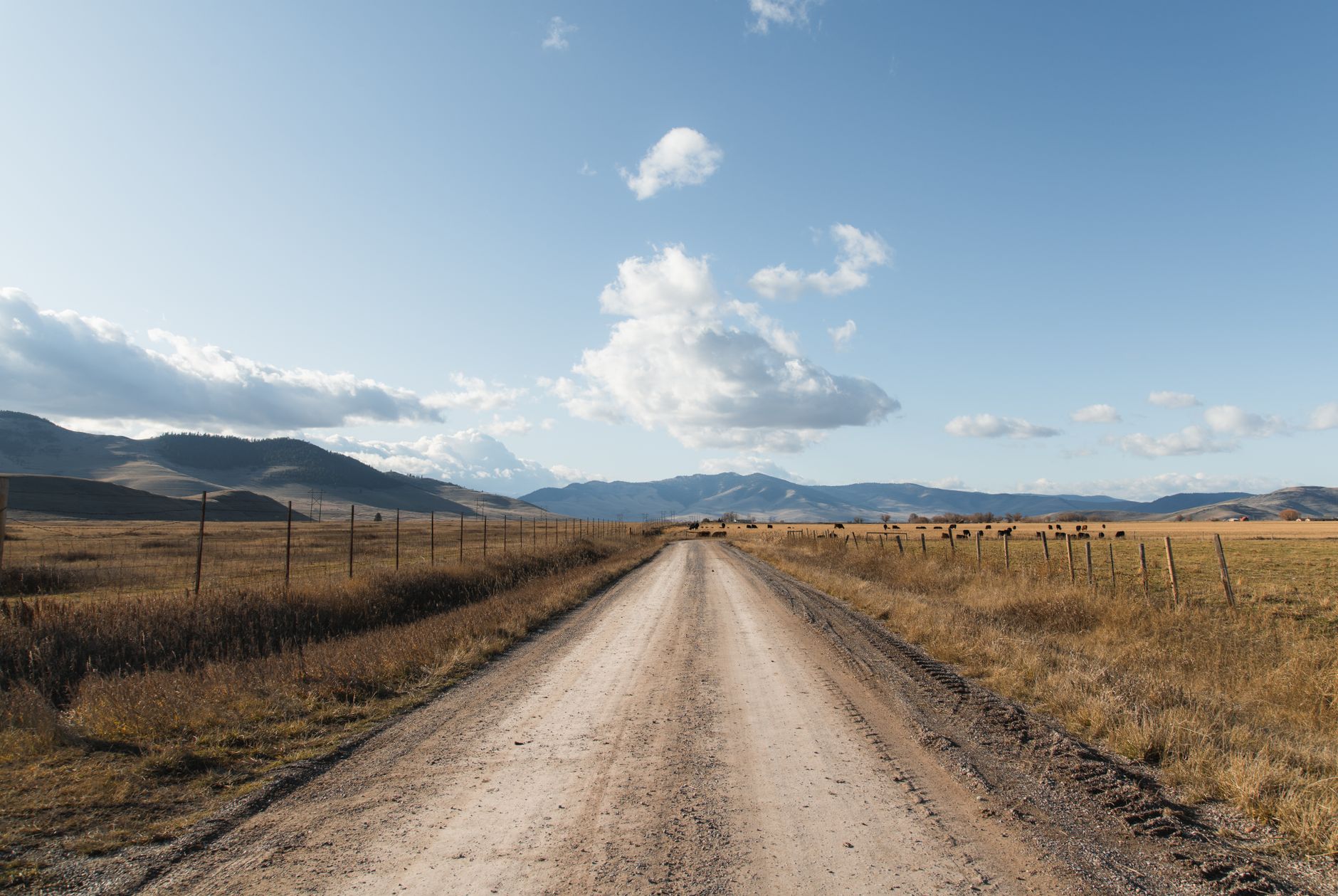

Drive Highway 2 across north-central Montana and the landscape gives you very little to work with. Mixed-grass prairie, a railway line, grain elevators, enormous sky.
Then you turn off seven miles east of Malta and there is a shallow lake with several hundred American White Pelicans on it, Western Grebes running across the water in courtship, and an American Avocet on the shoulder about nine feet from your side mirror.
Bowdoin National Wildlife Refuge is what the northern prairie looks like when it still has its water.
The auto tour
The refuge is organized around a 15-mile driving route, and as at most prairie refuges the vehicle is the correct way to bird it. The route runs around Lake Bowdoin and through the surrounding impoundments and grassland, and the birds along it are habituated to cars in a way they emphatically are not to people on foot. Roll the window down, drive slowly, and stop where you can pull clear.
The useful discipline is to treat the loop as a slow circuit rather than a drive. Two hours is a fast pass and a morning is about right, because the shorebird edges in particular reward stopping and waiting rather than covering ground.
What is here
This is prairie pothole country and the community reflects it.
-
American White Pelican is the signature bird, with a substantial nesting colony visible from the auto tour and startling in scale the first time.
-
Grebes are the highlight. Western Grebes on the open water, with the occasional Clark's, Eared and Pied-billed on the smaller units.
-
Shorebirds are excellent, with American Avocet and Black-necked Stilt breeding in numbers close to the road, plus Willet, Marbled Godwit, Wilson's Phalarope and a good passage of smaller species.
-
Colonial waterbirds include Franklin's Gull, terns, White-faced Ibis and Double-crested Cormorant.
-
Waterfowl across the full northern prairie set: shovelers, gadwall, teal, redhead, canvasback and ruddy duck, with Sandhill Cranes through migration.
-
Grassland birds on the surrounding prairie, which is the other half of the site and the part most visitors skip: Chestnut-collared Longspur, Baird's Sparrow, Sprague's Pipit and Bobolink.
The grebe display, which deserves its own trip
If you go once, go for this. Western and Clark's Grebes perform a courtship display called rushing, in which a pair rises out of the water and runs side by side across the surface, necks arched, for several seconds before diving in unison. It is among the most extraordinary things any North American bird does and it is easy to watch here in late spring.
The two species are worth separating while you are at it. Clark's has the black cap ending above the eye, so the eye sits in white, with a brighter orange-yellow bill. Western has the cap coming down to include the eye, with a duller greenish-yellow bill. They interbreed, so intermediates exist and not every bird is assignable. There is also a second display, the weed ceremony, in which the pair rises breast to breast holding vegetation, which is rarer to catch and arguably better.
Be there early in the morning in late May or early June, on flat water, and be prepared to wait. Rushing happens in bursts, often triggered by one pair setting others off, and a lake that has been quiet for twenty minutes can produce four runs in ninety seconds.
Hours and the rules that differ
The refuge is open sunrise to sunset, with one specific exception: during hunting seasons, hunters may be present two hours before sunrise and two hours after sunset. That is worth reading twice, because it tells you something about how these places work. The extended hours are not for you.
The rules that catch visitors out are seasonal and unit-specific:
-
Foot traffic is prohibited in the East Unit from September 1 to November 30, except on the auto tour route. This is the autumn concentration period and the closure protects it.
-
Dogs must be leashed from April 15 to August 15 throughout the refuge, and from September 1 to November 30 in the East Unit.
-
The East Unit is closed to all migratory bird hunting, which makes it the refuge within the refuge and the reason birds sit there in autumn.
-
Camping is prohibited, with the nearest options in Malta or at Nelson Reservoir.
This pattern, where a single refuge contains units under different rules in different months, is completely standard, and it is the main reason that reading the specific unit rather than the category matters.
Western Grebe versus Clark's Grebe: Bird Identification Made EasyFinding the grassland specialties
Three species bring birders across the country, and all three are found the same way.
Sprague's Pipit sings in a display flight so high that the bird is frequently invisible, giving a descending series of thin tinkling notes that seems to come from nowhere in particular. The technique is to stand still on a road allowance through native prairie at first light, listen until you locate the direction, then find the speck. Baird's Sparrow sings from a low perch or from the ground, a few clear introductory notes followed by a trill, and it is a bird of relatively undisturbed native grass, meaning the sections that have never been plowed rather than the ones that look tidiest from the road. Chestnut-collared Longspur is the easiest of the three, displaying in a fluttering song flight over shorter grass and frequently sitting on fence wires.
The common threads matter more than the individual descriptions. All three are declining sharply as native prairie is converted, all three are found by ear, and all three go quiet as the morning warms, so if you arrive at nine you will hear almost nothing and conclude the site is poor. And stay on the road allowance or on ground you have confirmed is public, because walking out into native prairie during the breeding season is a trespass question and a disturbance question at the same time.
The gear
Bowdoin is a fifteen-mile gravel loop on the Montana Hi-Line, four hours from anywhere, and the gear list assumes you are self-contained.
A vehicle you are happy to drive slowly for hours, since the auto tour is the refuge and it rewards being driven at ten miles an hour with stops rather than as a circuit.
A window mount or beanbag rest, because everything here is watched from the car and the birds know the difference between a vehicle and a person standing next to one.
A spotting scope, for the pelican and grebe colonies out on the lake and for the shorebirds on the alkali flats, which are distant and small and worth resolving properly.
Grassland bird song references, which is the item that changes the trip most. Baird's Sparrow, Sprague's Pipit and Chestnut-collared Longspur are all far easier to find by sound than by sight, they all sing from the air or from cover, and knowing the three songs before you arrive is worth more than any optic.
Serious mosquito protection, since Bowdoin sits in a marsh basin and June here is not gentle.
A land ownership map, because the refuge is surrounded by a mix of private ranch, state and Bureau of Land Management ground, and the good grassland is frequently just outside the boundary.
And full fuel and water from Malta, which is the last town, and which is small.
Timing
May and June are the peak, with breeding colonies active, grebes displaying, avocets and stilts on nests, grassland birds singing on territory and the prairie green rather than brown. Late April brings the waterfowl and crane movement. July and August get hot, the water levels drop and the shorebird passage begins on the exposed mud. September to November is the autumn concentration, with the East Unit foot closure in force and hunting under way elsewhere. And winter is severe, largely frozen, and a different and much emptier proposition.
If you are making one trip, make it in early June and be there at first light for the grassland birds, which stop singing as the day warms.
The wider Hi-Line circuit
Bowdoin is best treated as one stop on a route rather than a destination on its own, because the surrounding country holds a great deal. Nelson Reservoir just east is larger open water with different waterfowl and gulls, plus the nearest camping. Charles M. Russell National Wildlife Refuge to the south along the Missouri Breaks is an enormous and very different landscape of badlands, river bottom and prairie, with Greater Sage-Grouse leks in season and a completely different bird list. Bowdoin's own satellite units, several detached wetland parcels managed as part of the refuge, are worth finding.
The most underused resource in the region is the Waterfowl Production Areas, small federal wetland units scattered across the prairie, usually unstaffed and unsigned beyond a boundary marker, and open to public access. The pattern across all of it is the same: the birding is excellent and the access question is invisible on the ground, so knowing which section of grassland is a Waterfowl Production Area and which is a neighboring ranch is the whole difference.
Conditions, and a first visit
Two things shape what you find. The first is salinity. Lake Bowdoin sits in a closed basin with no natural outlet, so water arrives and leaves mainly by evaporation, concentrating dissolved salts over time, and irrigation delivery into the basin has added to the load. The result is a long-running management challenge that affects invertebrate communities and therefore the birds that eat them, and for a visitor it mostly shows up as variable conditions between years, with some units productive one season and poor the next. It is another argument for asking at the refuge rather than assuming.
The second is weather, because north-central Montana in early summer is not a stable climate and the auto tour is exposed to all of it. Wind is the constant, and twenty to thirty miles an hour is an ordinary afternoon, which makes a scope on a tripod nearly unusable and is another argument for working from the vehicle. Thunderstorms build fast, so a clear morning can produce a serious cell by mid-afternoon with no shelter anywhere on the loop. The gravel goes to gumbo, since prairie clay after heavy rain becomes impassable rather than merely slippery, and a two-wheel-drive car on a wet refuge road is a recovery call. Temperature swings are large, with a June morning at forty degrees and an afternoon at eighty-five entirely unremarkable. And there is no shade anywhere on the entire loop.
So bird the first four hours of daylight, carry water and layers, watch the western sky, and be prepared to leave the gravel early if it starts raining properly.
Stay in Malta. Be on the auto tour at sunrise in early June with the windows down, and drive it slowly, twice. Stop at the pelican colony and give it longer than feels necessary. Watch the grebes properly, because the display is worth the trip on its own. Then drive the gravel roads out into the prairie for the longspurs and pipits, on ground you have checked you are allowed to be on, and listen rather than look.
That last point is where a map earns its keep here, because this country is a mosaic of federal refuge, Bureau of Land Management ground, state trust land, Waterfowl Production Areas and private ranch, and almost none of it is signed in a way that tells you which is which from the road. The good grassland birding is frequently not inside the refuge boundary at all; it is on a section of state or BLM ground three miles down a gravel road, and whether you may legally walk it has an actual answer that is invisible on the ground. Guidepole Bird carries that layer, which is the difference between confidently birding a road allowance and guessing.
And expect to be alone. Bowdoin sees a fraction of the visitors that a comparable refuge within reach of a city would get, which means the auto tour is frequently yours for the morning and the birds have not been pushed around by anybody before you arrived. That is most of the charm.
For the wider prairie picture, western Montana birding covers the mountain half of the state, and birding during hunting season explains the autumn rules that apply here from September.
The other Montana site for the same grebe display, in country that could not look less alike, is in western Montana birding. The refuge rules that make an auto tour behave the way it does are in a wildlife refuge is not a park, and the autumn hunting season on the same ground is in birding during hunting season. Planning a trip to a place this remote is largely an eBird problem, covered in reading eBird hotspots, and the access mosaic around the boundary works like state trust lands and access.
A note on the lake itself, which is changing. Bowdoin has no natural outlet, so the salts that irrigation water carries in have nowhere to go, and salinity in the main lake has been rising for decades. That is why the shorebird flats are as extensive as they are and it is also a long-term problem for the fishery the pelicans and grebes depend on. It is the single biggest management question on the refuge, and it is worth knowing about before you wonder why the water looks the way it does.